
Nursling One Place Study
A Study of the Parish of Nursling in the County of Hampshire, or sometime known as the County of Southamptonshire.
I refer you to the Millbrook One Place Study in the first instance. That has a lot of the background information which would be repetitive if just repeated here.
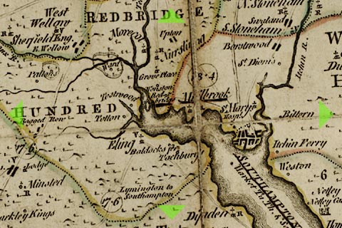
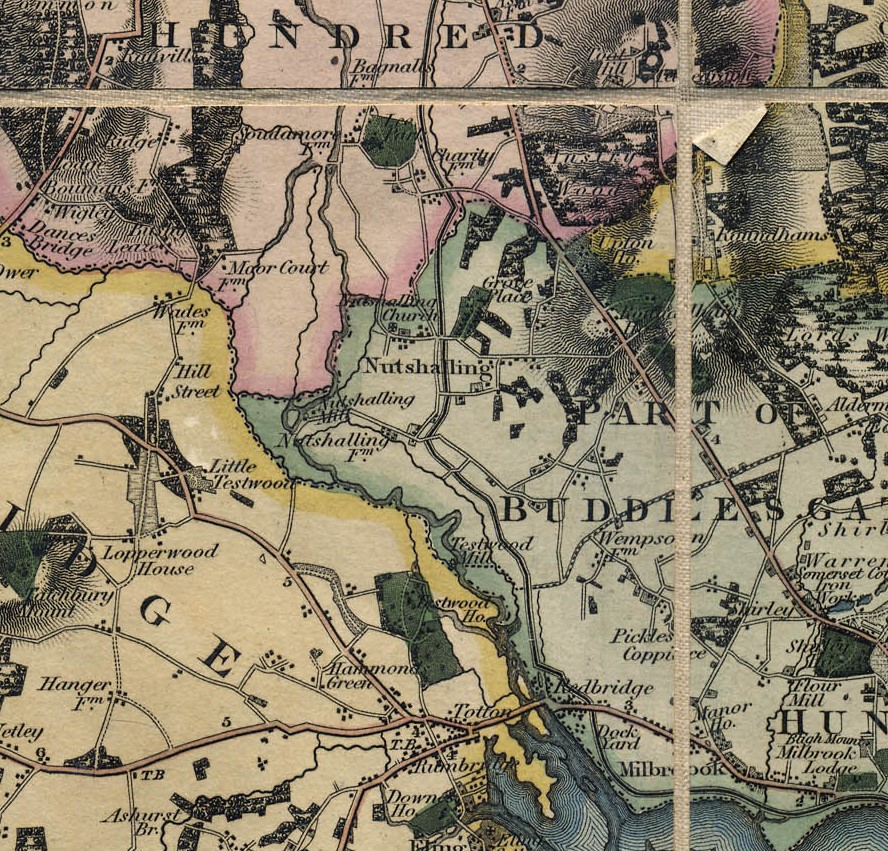
Nursling has also been called Nutshalling as can be seen in the Ordnance Survey drawing held at the British Library. Nutshalling is circled in blue. The nearby Grove Place is circled in green, the seat of Sir Charles Mills. Shirley, in the adjacent parish of Millbrook is circled in orange.
Overview
Overview
The Parish of Nursling
A Study of the Parish of Nursling in the County of Hampshire, or sometime known as the County of Southamptonshire.
I refer you to the Millbrook One Place Study in the first instance. That has a lot of the background information which would be repetitive if just repeated here.
For an extensive description of the parish follow the link to British History Online.
Nursling has also been called Nutshalling as can be seen in the Ordnance Survey drawing held at the British Library. Nutshalling is circled in blue. The nearby Grove Place is circled in green, the seat of Sir Charles Mills. Shirley, in the adjacent parish of Millbrook is circled in orange.
Before delving deeper, some information about the Ordnance Survey drawing held at the British Library. The British Library has also made the drawing available on Wikimedia The surveyor was: Crocker, Edmund - Medium: Pen and ink on paper - Date: 1806.
British Library notes;
This drawing was completed in 1806. The detail with which it records the road network is greater than in previous maps - testimony to the Ordnance Survey's urgency and military intent. The Roman road from Winchester to Old Sarum is marked running from the top left of the map, with smaller sections of the road shown in the Chilworth area. The origin and terminus of these roads are also noted. A line with a circle at each end leads from the margins of the map to Morstead. This line was used to plot locations and landmarks. Several "Ancient Entrenchments" are marked, notably an iron-age hillfort near Winchester called St. Catherine's Hill. The fort is indicated by concentric rings of dark, cross-hatched strokes ('hachures'). Week Turnpike Gate is marked on the road between Week and Winchester.
The recording of a dog kennel above Little Sombourne and bathing houses on the coast between Southampton and Redbridge reveal the meticulousness of the Survey, and perhaps too the interests of the draughtsman.
The map below is an extract of the map referred to in the British Library notes.
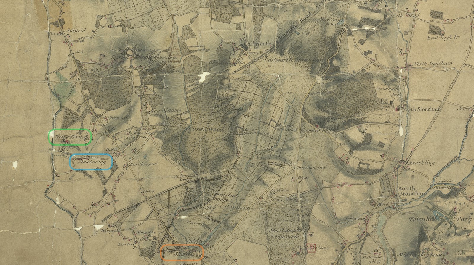
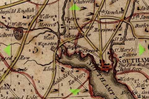
Not circled, but the following can also be seen on this map extract. Lordswood, Roundhams {Rownhams}, and Toothill, with the Telegraph. Together with a few named houses, Springford Cottage, Aldermore Lodge, Roundham House, Upton House, and Chilworth House,
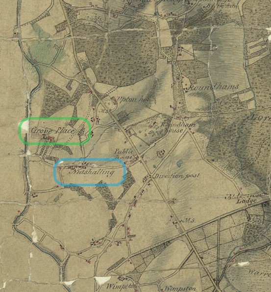
This is the same Drawing referred to above but zooming to Grove Place and Nutshalling.
We are getting ahead of ourselves. Below we jump further back in time, to maps between 1575 and 1788. Nursling, or a variation of spelling of same, is shown on all the maps, despite how very small the village was.
 |
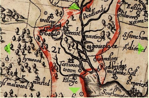 |
| Saxton 1575 | Norden 1595 |
 |
 |
| Norden 1607 | Speed 1611 |
 |
 |
| Morden 1695 | Kitchen 1751 |
 |
|
| Harrison 1788 | |
| The names and dates refer to the originator of the map and date. | |
| Click the link to go to the Old Hampshire Mapped website for more information. | |
| See how much the skill of mapping has changed over time. | |
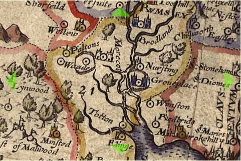
We also need to look at some old large scale maps, also from the Old Hampshire Mapped website.
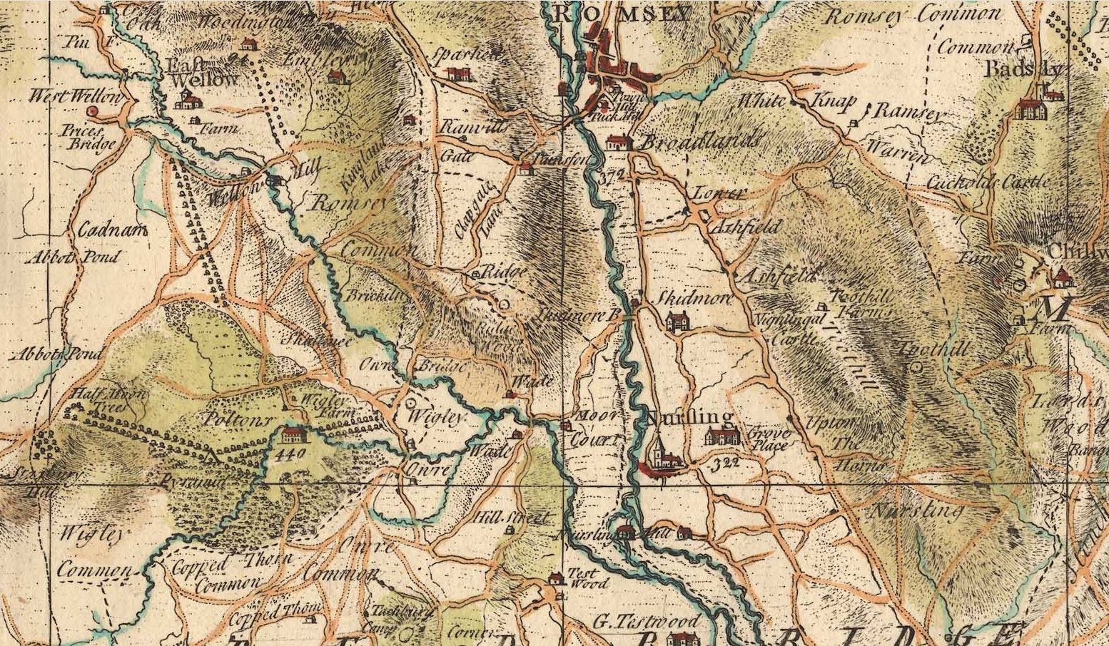
An extract of Taylor's Hampshire 1759. At 1759 this is not dissimilar to the period of interest of the article about John and Mary Mabey of Nursling. Grove Place is annotated 322.

The Mill family were prominent in the area for a long time.
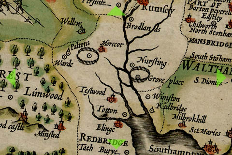
An extract from Milne's Hampshire 1791. This map has names of prominent people added as well as places
| Named people on Map | Residence | Link |
|---|---|---|
| J Jarrett Esq | Freemantle House | http://sotonopedia.wikidot.com/page-browse:freemantle-house |
| W. F. Grenville Esq | Shirley House | http://sotonopedia.wikidot.com/page-browse:shirley-house |
| Sir Charles Mill | Grove House / Place | http://sotonopedia.wikidot.com/page-browse:grove-place |
| Peter Serle Esq | Testwood House | http://sotonopedia.wikidot.com/page-browse:testwood-house |
| Barton Esq | Rownhams House | http://sotonopedia.wikidot.com/page-browse:rownhams-and-rownhams-house |
| Trowbridge Esq | Upton House | https://www.british-history.ac.uk/vch/hants/vol3/pp433-439 |
| Fletcher Esq | Lee House | http://research.hgt.org.uk/item/lee-house/ |
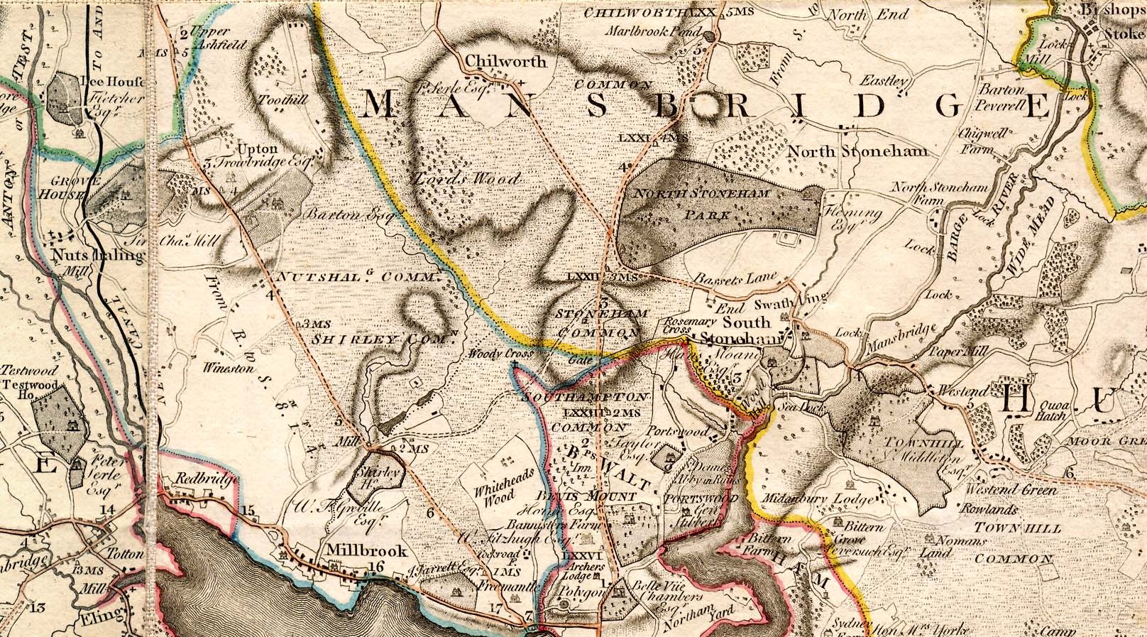
Nutshalling / Nursling Common and Shirley Common is shown on this map. On later maps Shirley Common is much smaller, and in the area of Whiteheads Wood.
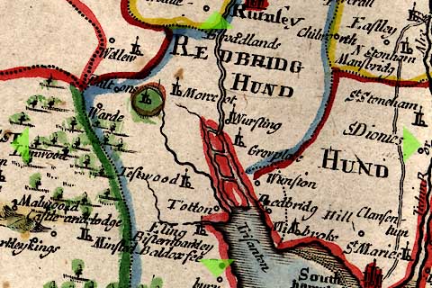
An extract of Greenwood's Hampshire 1826 with Nutshalling and Grove Place clearly shown.
The Parish
The maps so far show the village of Nursling or Nutshalling but not the extent of the parish.
NURSLING, or Nutshalling, a parish, in the union of Romsey, hundred of Buddlesgate, Romsey and S. divisions of the county of Southampton, 5 miles (N. W.) from Southampton. There is a place of worship for Wesleyans.
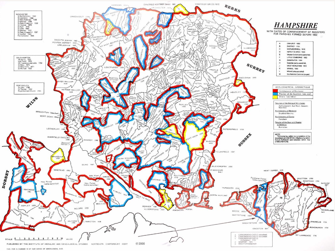
County map of Parishes - Hampshire
Extract from Great Britain, Atlas and Index of Parish Registers, from Ancestry
Same map but in more detail
The same map but zoomed in and split into four parts for ease of use.
There is a vertical overlap on each segment to try to avoid the difficulty of interpreting the information, reading at the joints.
At one time this was done with mouse rollover, but that no longer consistently works on all browsers, so back to static.
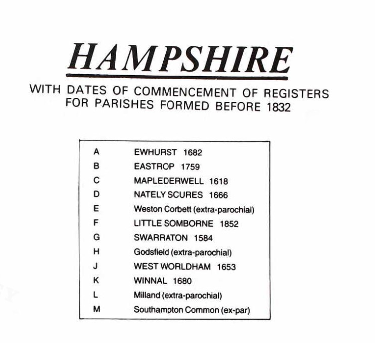
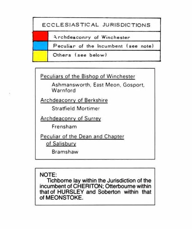
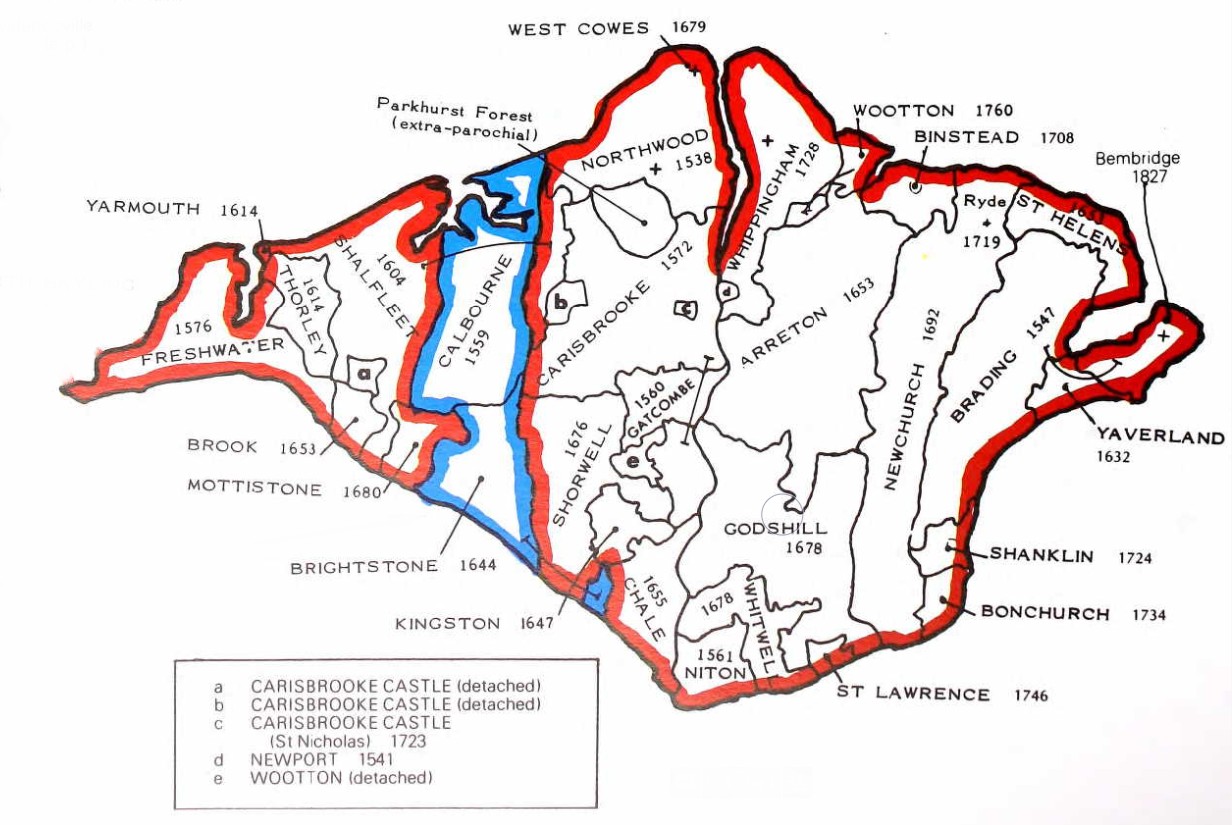
The County of Hampshire Parishes.
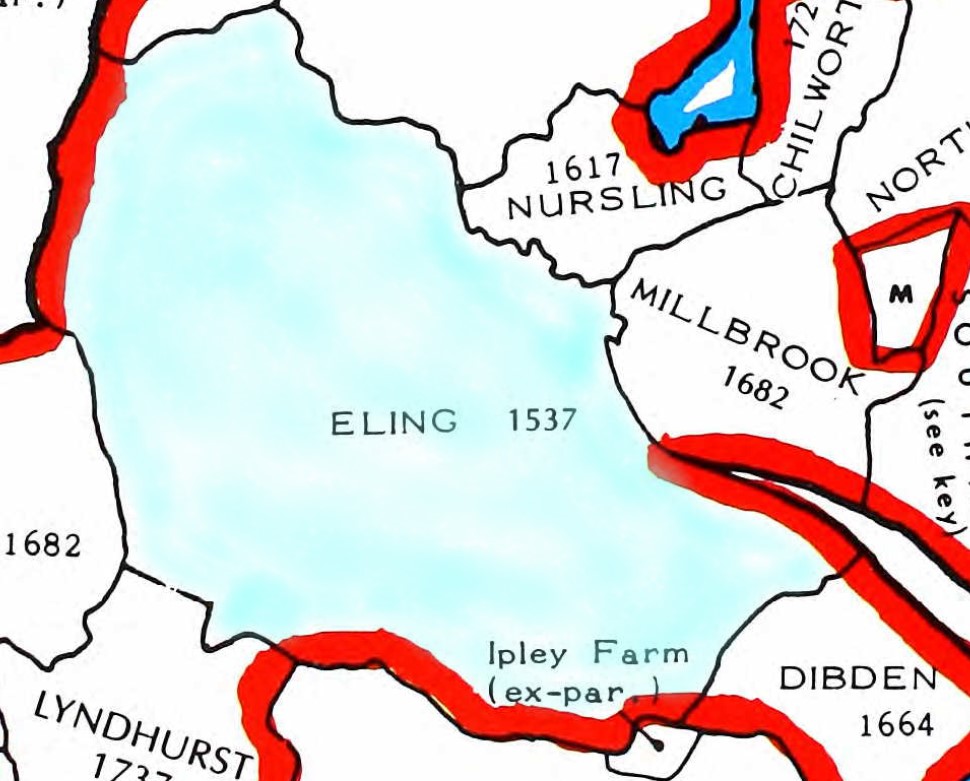
Zooming into the parish of Eling for this map, with a wash of light blue. Adjacent parishes to the North include Millbrook and Nursling. The dates indicate the early parish records.
An extract of Family Search English Jurisdictions 1851. Search for Nursling, to get the map below.
A similar map but for the parish of North Baddesley, which includes Rownhams.
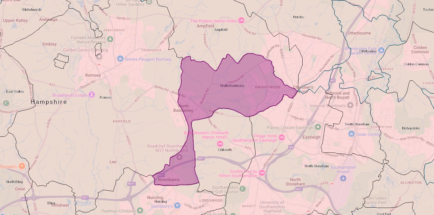
Rownhams was formerly a chapelry in the parishes of Nursling, Romsey and North Baddesley, on 1 October 1897 became a separate civil parish, on 1 April 1932 the parish was abolished to form "Nursling and Rownhams". In 1931 the parish had a population of 540.
St John’s Church in Rownhams was constructed in the 1850’s having been financed by Oliver Colt who lived in Rownhams House.
From Kelly's "Directory of Hampshire and the Isle of Wight (1911)"
ROWNHAMS is an ecclesiastical parish formed in 1856 from the parishes of Romsey Extra, Nursling and North Baddesley, and into a civil parish by Local Government Board Order No 36648, dated Oct 1st, 1897; it is 1½ miles north from Nursling station on the Southampton and Salisbury line of the London and South Western railway, 4 west-by-north-west from Southampton and 3½ south-east from Romsey, in the New Forest division of the county, hundred of Buddlesgate, union of Romsey, county court district of Romsey, rural deanery of Romsey and archdeaconry and diocese of Winchester, overlooking the valley of the Test, and bounded on the side by the road from Southampton to Romsey. The church of St. John the Evangelist is an edifice of stone in the Decorated style, consisting of chancel, nave, transepts, vestry, south porch and a tower with spire containing one bell and tubular chimes, hung in 1889 to the memory of the Rev. Robert Francis Wilson M.A. vicar here 1863-1888: in the chancel is a brass to William Oliver Colt, founder of this church, died April 9th. 1853, and Jane, his widow, by whom the work was completed about 1856, who died September 5th. 1875: the church was consecrated October 25th. 1856: all the windows are stained: the reredos is of alabaster, gilt and colored (sic): there are 220 sittings. The register dates from the year 1856. The living is a vicarage, net yearly value £190, with residence and 3 acres of glebe, in the gift of the Bishop of Winchester, and held since 1891 by the Rev. George Mead M.A. of St. John's College, Oxford. The vicarage house is of red brick in the Elizabethan still, and was erected by the late Mrs. Colt, of Rownhams Park. Rownhams House, the property and residence of Lord Abinger J.P. is a mansion of brick, situated in a park of 40 acres. The chief landowners are Wilfred W. Ashley esq. M.P., J.P. of Broadlands, Romsey, Mrs Vaudry-Barker-Mill, of Langley Manor, Tankerville Chamberlayne esq. of Cranbury Park, who is lord of the manor, and John E.A. Willis Fleming esq. of Chilworth Manor. The chief crops are barley, wheat and oats. The soil is clay, sand and gravel; subsoil, clay. The area is 1985 acres of land and 4 of water; rateable value , £3428; the population in 1901 was 498 in the civil and 481 in the ecclesiastical parish"
An Ordnance Survey, OS 6" Old Map from the National Library Of Scotland. The link will take you to a similar map, with the marker at St Boniface Church Nursling. The Map is made up from the following sheets;-
Hampshire & Isle of Wight Sheet LVII.SW
Revised: 1895, Published: 1897
Hampshire & Isle of Wight Sheet LVI.SE
Revised: 1895, Published: 1897
Hampshire & Isle of Wight Sheet LXV.NW
Revised: 1895 to 1896, Published: 1898
Hampshire & Isle of Wight Sheet LXIV.NE
Revised: 1895 to 1896, Published: 1897
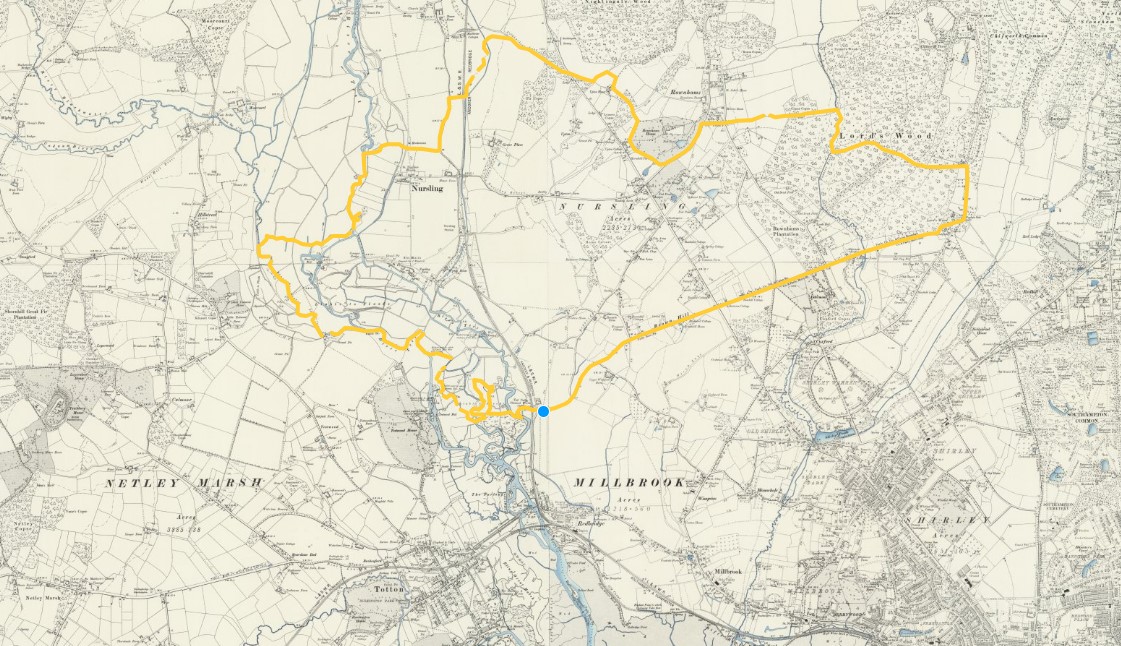
Unfortunately, if you follow the link, the yellow line will not be there. I drew that onto the digital map using one of the tools. Zooming in a long way I followed the boundary markers, hoping they were the parish boundary.
You could also follow the doted line on the map at the link, for the detailed position. It may not be exactly the same boundary as shown on the English Jurisdictions 1851 map, above. Not only is there a time difference but the may be a difference between civil and ecclesiastical boundaries.
To get you a little closer, I have made copies of the above, zoomed in and split North and South.

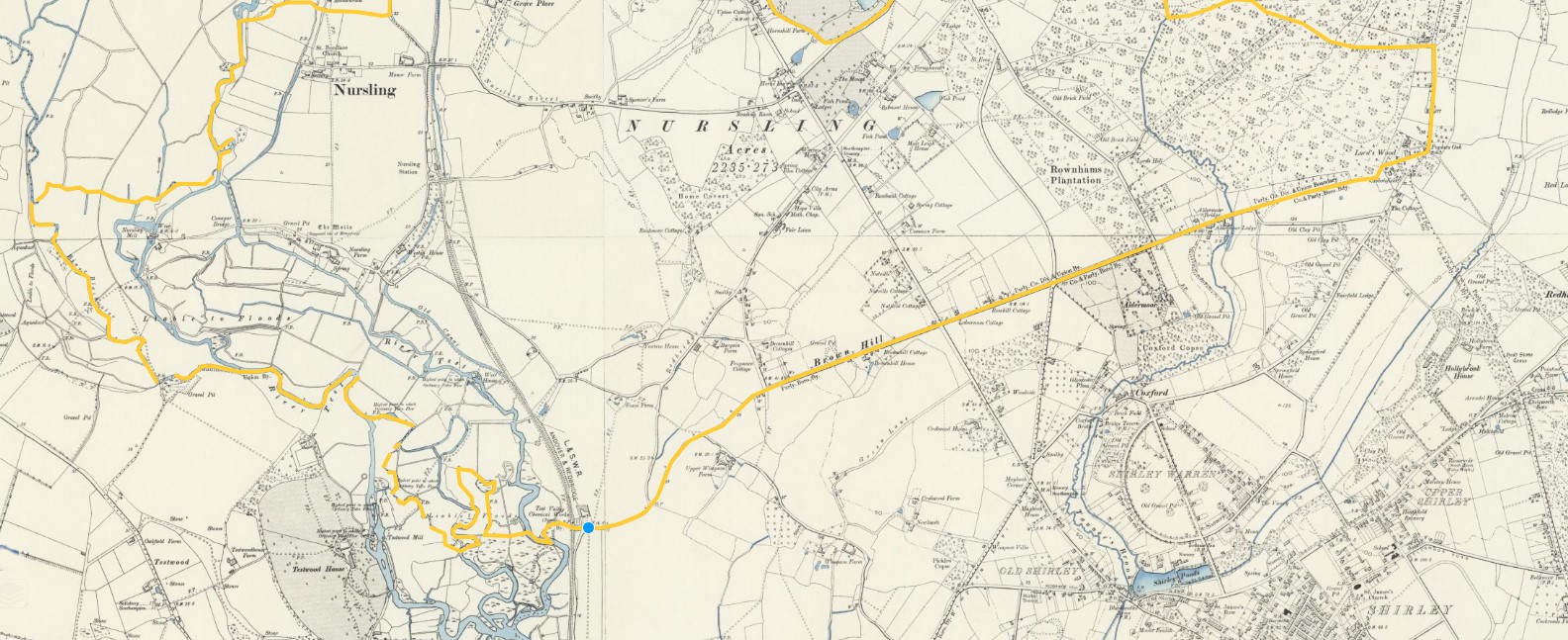
I have not tried to align the two sheets. There are some vary torturous routes for the boundary, especially near the river.
All of the above maps of the Parish are before the separation and creation of a separate Rownhams Parish from lands of Nursling, Romsey, and North Baddesley Parishes, on 1 October 1897.
However, Rownhams House and the village of Rownhams do appear to be outside of the boundary shown. It is possible that the imminent boundary change was know and incorporated onto the maps as part of the revision.
Some of the dotted lines I have followed are Poor Law Union boundaries and others are Civil Parishes. Looking further at the key, I don't think the maps show ecclesiastical boundaries, so at least that is one potential variation resolved.
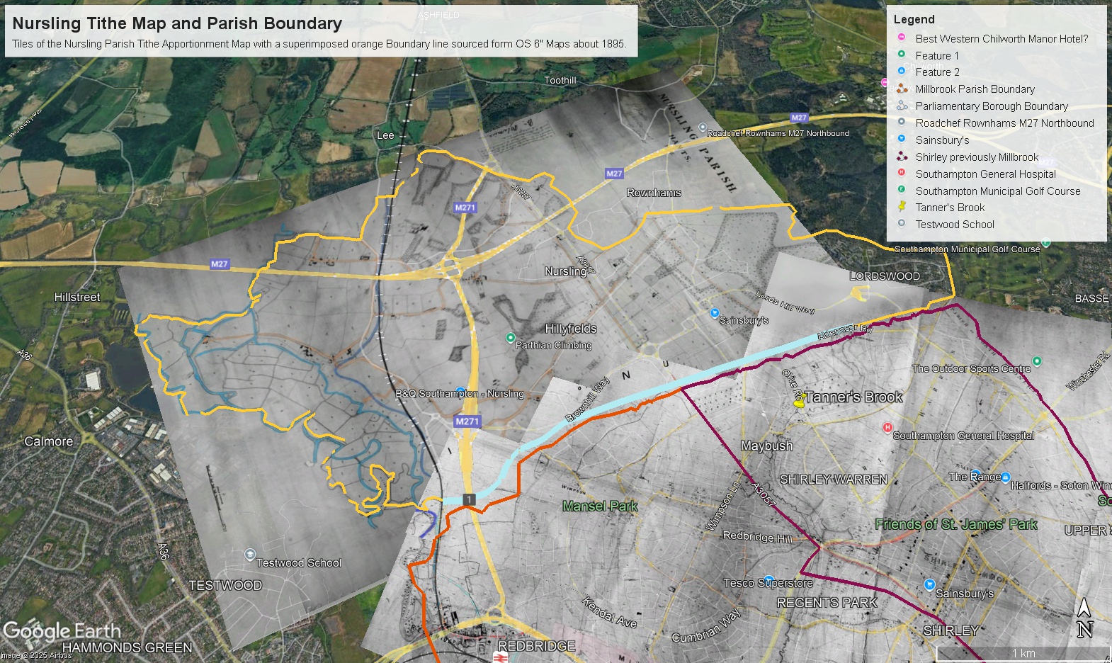
The above is a copy of a Google Earth image created by overlaying tiles of Nursling Parish Tithe Apportionment Map and the Boundary line created on the OS 6" maps above. Also shown is some of Millbrook Parish Tithe Apportionment Map. Although the lines and the edge of the Tithe Map do not align everywhere, there is a reasonable correlation. Apart for part of Lordswood, which appears to be missing. Although, on the original image it does go further into Lordswood, closer to the shape of the boundary. Something to rectify at a later date. The Tithe Apportionment is dated 19th Sept 1846. My conclusion therefore is that the orange line above is before the separation of part of the Parish for the creation of the Parish of Rownhams.
The above ESRI Church of England Parish map brings us up to date. Click on the map in the area of Nursling to bring up the boundary and information about the Parish. It does work here but it is easier to see if you first click on 'View larger map', which opens a new page. The statistics are fascinating. You can also click on one of the dots to bring up information about that. Click in different places to see different parts of the boundary, or adjacent parishes.
ESRI StoryMap Nursling
The Nursling One Place Study StoryMap below can also be seen in a new tab, full size, by following this link.
Before 1066
Your text...
Domesday Book
Nursling in the Domesday Book of 1086
Nursling has also been called Nutshalling
Nursling was mentioned it the Domesday Book of 1086
Nursling was a settlement in Domesday Book, in the hundred of Buddlesgate and the county of Hampshire.
It had a recorded population of 30 households in 1086, putting it in the largest 40% of settlements recorded in Domesday.
Land of Bishop of Winchester (St Peter & St Swithin)
Households
Households: 21 villagers. 8 smallholders. 1 slave.
Land and resources
Ploughland: 6 ploughlands. 1 lord's plough teams. 10 men's plough teams.
Other resources: Meadow 140 acres. Woodland 5 swine render. 1 mill, value 1 pound 2 shillings and 7 pence. 1 church.
Valuation
Annual value to lord: 9 pounds in 1086; 5 pounds when acquired by the 1086 owner; 8 pounds in 1066.
Owners
Tenant-in-chief in 1086: Winchester (St Peter & St Swithin), bishop of.
Lord in 1086: Winchester (St Peter & St Swithin), bishop of.
Lord in 1066: Winchester (St Peter & St Swithin), bishop of.
Other information
Phillimore reference: Hampshire 3,2
Comparison to other nearby settlements.
By comparison, nearby settlements of Millbrook and Shirley. Which later became parishes, which subsequently merged, and then again separated.
Millbrook was a settlement in Domesday Book, in the hundred of Mansbridge and the county of Hampshire.
It had a recorded population of 28 households in 1086, putting it in the largest 40% of settlements recorded in Domesday.
Land of Bishop of Winchester (St Peter & St Swithin)
Interestingly, for Millbrook, the lord in both 1066 and 1086 is stated as being 'villagers'
Shirley was a settlement in Domesday Book, in the hundred of Mansbridge and the county of Hampshire.
It had a recorded population of 12 households in 1086.
Land of Ralph of Mortimer
Mortimer is a surname in my Family Tree. I wonder if there is a connection?
Nearby towns were Southampton, Romsey and Eling, 4.2 miles / 1hr 25 mins walk, 3.7 miles / 1hr 14 mins walk, and 3.6 miles / 1hr 13 mins walk respectively, according to Google Maps
Southampton was a settlement in Domesday Book, in the hundred of Mansbridge and the county of Hampshire.
It had a recorded population of 185.5 households in 1086, putting it in the largest 20% of settlements recorded in Domesday, and is listed under 4 owners in Domesday Book.
Land of Bishop of Winchester (St Peter & St Swithin)
Romsey was a settlement in Domesday Book, in the hundred of Somborne and the county of Hampshire.
It had a recorded population of 127 households in 1086, putting it in the largest 20% of settlements recorded in Domesday.
Land of Romsey (St Mary & St Elfleda), abbey of
Eling was a settlement in Domesday Book, in the hundred of Redbridge and the county of Hampshire.
It had a recorded population of 69 households in 1086, putting it in the largest 20% of settlements recorded in Domesday.
Land of King William
Between Nursling and Eling is Totton.
Totton was a settlement in Domesday Book, in the hundred of Redbridge and the county of Hampshire.
It had a recorded population of 20 households in 1086, and is listed under 2 owners in Domesday Book.
Land of Romsey (St Mary & St Elfleda), abbey of
and
Land of Aghmund, of Wellow
Before 1600
1600 to 1800
Tithe Apportionment and Map
Tithe Apportionment and Map
The Tithe Commutation Act 1836
An Act for the Commutation of Tithes in England and Wales. - 6 & 7 Will 4 c 71. Royal assent; 13 August 1836
Together with several amendments;
Act amended by Tithe Act 1839 (c. 62), Tithe Act 1842 (c. 54), Tithe Act 1860 (c. 93), Tithe Act 1878 (c. 42), Tithe Act 1891 (c. 8) and Tithe Act 1918 (c. 54)
The Tithe Act, 1936 (26 Geo. V and 1 Edw. VIII. C.43) abolished all tithe rent charges. Responsibility for tithe documents created under the tithe acts (1836, 1837, 1839, 1860, 1891) were placed under the charge of the Master of the Rolls, who has the authority to transfer them to an approved place of deposit. This responsibility is exercised by The National Archives: Historical Manuscripts Commission. The Master of the Rolls has issued Tithe (Copies of Instruments of apportionment) Rules 1960 (SI 1960/2440), as amended by the Tithe (Copies of Instruments of Apportionment) (Amendment) Rules 1963 (SI 1963/977)] concerning the care, custody, access to, and definition of tithe documents.
The start and end of Tithes.
Religion, of many faiths, the Established Church, the Pope, the Governments, and Kings of the time shaped the idea and practice of collecting tithes.
From a simple pious concept of the donation one tenth of your crop to the church, for charity, changed over time and created some very rich churches and some very poor people, and a degree of discontent.
Tithes lasted in England for over a thousand years, partly in goods and latterly as money.
All intertwined with a Norman, with Viking Blood, thinking he was the rightful successor to the English Throne, a Pope who wanted to bring Ireland into the European sphere, or should that read his sphere, and Henry VIII wanting to have a male heir to prolong the Tudor epoch. Little did he know Elizabeth I would be so good at being monarch. Power and politics, over centuries of time.
Splits in the Christian Church
There were three major schisms:
- 1) the one in the 5th century that split eastern Christendom in two;
- 2) the one the 11th century that divided the Latin church and the Byzantine church;
- and 3) the Reformation in the 16th century in which Protestantism arose and split from the Roman Catholic church.
2) On July 16, 1054, Patriarch of Constantinople Michael Cerularius was excommunicated, starting the “Great Schism” that created the two largest denominations in Christianity—the Roman Catholic and Eastern Orthodox faiths.
3) The Reformation — more properly called the Protestant Reformation or the European Reformation — was a 16th-century religious and political uprising against the authority of the Pope that led to was a schism in Western Christianity. It was initiated by Martin Luther with the publication of the “Ninety-five Theses” in 1517 and continued by Huldrych Zwingli, John Calvin and other Protestant Reformers. The Reformation triggered the bloody the Counter-Reformation, which sucked in much of Europe, and lasted until the end of the Thirty Years' War in 1648. The Reformation led to the division of Western Christianity into different denominations such Catholic, Lutheran, Reformed, Anglican, Anabaptist and Unitarian. The Eastern Orthodox Christian church had split off in 1054.
The Reformation began as theological debate over real and perceived Church corruption. Early dissenters included John Wycliffe (1320-84) in England, and john Huss (burned as a heretic in 1415) in Bohemia. Martin Luther was from Germany. Other major players in the Reformation were Huldrych Zwingli of Zurich, John Calvin of Geneva and King Henry VIII of England
The Reformation was aided by the invigorated intellectual freedom of the Renaissance and spirit of nationalism in England, France, Germany and Bohemia. In the 16th century the church was corrupt and blemished by greedy clergy and decadent monks, extracting financial burdens from the laity to pay for their indulgences and ambitions. The General Councils of 15th century failed to reform he church. After the Reformation the power of the Catholic Church was greatly weakened
What is the relevance of these splits? The divisions within the Christian Church have in part contributed to the discontent leading to the Tithe Wars and the subsequent Tithe Commutation Act. The Act led to the creation of very useful set of documents for Family Historians, with information about people, places, and land usage.
Feudal system
A copy of some text from the ESRI Story Map of Whiteparish One Place Study
The feudal system and the Domesday Book
The feudal system was a way of organising society into different groups based on their roles. It had the king at the top with all of the control, and the peasants at the bottom doing all of the work.
How did the feudal system start?
The results created what's known as the Domesday Book. It actually described a wide range of ways in which people used the land, but historians suggested that it had a basic structure:
- King – owned all the land.
- Barons – the king gave some land to the barons in return for money and men for the army.
- Knights – the barons gave some of their land to the knights if they promised to fight when needed.
- Peasants – the knights gave a few strips of land to the peasants and the peasants had to share their produce with them. They were not allowed to leave and were not free men
In the Middle Ages, anyone who was higher up in this system than you was a 'lord' and of course the monarch had no one above them. What kept the system working was loyalty. Stay loyal and keep the land and wealth. Fail and your income was taken from you by your lord.
Centuries later the system was not hugely different and Tithes came into play.
Tithes were originally a tax which required one tenth of all agricultural produce to be paid annually to support the local church and clergy. After the Reformation much land passed from the Church to lay owners who inherited entitlement to receive tithes, along with the land.
The Tithe Acts of 1836 and 1936 abolished the old system, but two hundred years ago tithes were engraved upon the lives of the entire population: a source of income, luxury and avarice for the privileged; a tax at 2s
Before Tithes
Fifteenths and tenths, 1334
FIFTEENTHS AND TENTHS: QUOTAS OF 1334
'Fifteenths and tenths, 1334', in A History of the County of Wiltshire: Volume 4, ed. Elizabeth Crittall (London, 1959), pp. 294-303. British History Online http://www.british-history.ac.uk/vch/wilts/vol4/pp294-303 [accessed 24 June 2021].
By the last quarter of the 13th century Englishmen had become familiar with a system of tax assessment which took no account of such old-fashioned assessments of wealth as hides or knight's fees. This new system of assessment was based on a valuation of certain personal property, usually described by the vague word 'movables'. Of this value Parliament had granted the king a fraction: the fraction itself varied from grant to grant but in each grant a greater fraction was levied on cities, towns, and royal demesne than on other areas. Thus in 1332 the townsman found himself contributing a tenth of his assessed movables but the countryman only a fifteenth. In addition there were some categories of goods which the collectors were instructed to ignore, and as a result the statistics from the collections deal only with those Englishmen and women who were wealthy enough to fall under the scrutiny of the local assessors. It is rather like an iceberg the size of whose submerged depths is unknown. In addition there was probably evasion and under-assessment everywhere.
Frustfield Hundred 274s.
- Abbotstone (in Whiteparish);50s 0d
- Alderstone (in Whiteparish);13s 4d
- Cowesfield (in Whiteparish);100s 0d
- Landford; 66s 8d
- Whelpley (in Whiteparish); 44s 0d
Whiteparish does not appear as a separate settlement in 1334, assuming that the (in Whiteparish) is a later addition when the table was constructed from the original data.
Tithe background
Tithe background
From Wikipedia, extracts from articles about Tithes and Tithe Commutation
A tithe (/taɪð/; from Old English: teogoþa "tenth") is a one-tenth part of something, paid as a contribution to a religious organization or compulsory tax to government.
Church collection of religious offerings and taxes - England and Wales
The right to receive tithes was granted to the English churches by King Ethelwulf in 855. The Saladin tithe was a royal tax, but assessed using ecclesiastical boundaries, in 1188. The legal validity of the tithe system was affirmed under the Statute of Westminster of 1285. The Dissolution of the Monasteries led to the transfer of many rights to tithe to secular landowners and the Crown – and tithes could be extinguished until 1577 under an Act of the 37th year of Henry VIII's reign. Adam Smith criticized the system in The Wealth of Nations (1776), arguing that a fixed rent would encourage peasants to work far more efficiently.
The system gradually ended with the Tithe Commutation Act 1836, whose long-lasting Tithe Commission replaced them with a commutation payment, land award and/or rentcharges to those paying the commutation payment and took the opportunity to map out (apportion) residual chancel repair liability where the rectory had been appropriated during the medieval period by a religious house or college. Its records give a snapshot of land ownership in most parishes, the Tithe Files, are a socio-economic history resource. The rolled-up payment of several years' tithe would be divided between the tithe-owners as at the date of their extinction.
This commutation reduced problems to the ultimate payers by effectively folding tithes in with rents however, it could cause transitional money supply problems by raising the transaction demand for money. Later the decline of large landowners led tenants to become freeholders and again have to pay directly; this also led to renewed objections of principle by non-Anglicans.[39] It also kept intact a system of chancel repair liability affecting the minority of parishes where the rectory had been lay-appropriated. The precise land affected in such places hinged on the content of documents such as the content of deeds of merger and apportionment maps.
Tithe redemption
Rent charges in lieu of abolished English tithes paid by landowners were converted by a public outlay of money under the Tithe Act 1936 into annuities paid to the state through the Tithe Redemption Commission. Such payments were transferred in 1960 to the Board of Inland Revenue, and those remaining were terminated by the Finance Act 1977.
The Tithe Act 1951 established the compulsory redemption of English tithes by landowners where the annual amounts payable were less than £1, so abolishing the bureaucracy and costs of collecting small sums of money.
Ireland
From the English Reformation in the 16th century, most Irish people chose to remain Roman Catholic and had by now to pay tithes valued at about 10 per cent of an area's agricultural produce, to maintain and fund the established state church, the Anglican Church of Ireland, to which only a small minority of the population converted. Irish Presbyterians and other minorities like the Quakers and Jews were in the same situation.
The collection of tithes was resisted in the period 1831–36, known as the Tithe War. Thereafter, tithes were reduced and added to rents with the passing of the Tithe Commutation Act in 1836. With the disestablishment of the Church of Ireland by the Irish Church Act 1869, tithes were abolished.
Tithe War
The Tithe War (Irish: Cogadh na nDeachúna) was a campaign of mainly nonviolent civil disobedience, punctuated by sporadic violent episodes, in Ireland between 1830 and 1836 in reaction to the enforcement of tithes on the Roman Catholic majority for the upkeep of the established state church, the Church of Ireland. Tithes were payable in cash or kind and payment was compulsory, irrespective of an individual's religious adherence.
Tithe payment was an obligation on those working the land to pay ten per cent of the value of certain types of agricultural produce for the upkeep of the clergy and maintenance of the assets of the church. After the Reformation in Ireland of the 16th century, the assets of the church were allocated by King Henry VIII to the new established church. The majority in Ireland who remained loyal to the old religion were then obliged to make tithe payments which were directed away from their own church to the reformed one. This increased the financial burden on subsistence farmers, many of whom were at the same time making voluntary contributions to the construction or purchase of new premises to provide Roman Catholic places of worship. The new established church was supported by only a minority of the population, seventy-five percent of whom continued to adhere to Roman Catholicism.
Emancipation for Roman Catholics was promised by Pitt during the campaign in favour of the Act of Union of 1801 which was approved by the Irish Parliament, thus abolishing itself and creating the United Kingdom of Great Britain and Ireland. However, King George III refused to keep Pitt's promises. It was not until 1829 that the Duke of Wellington's government promoted and parliament enacted the Roman Catholic Emancipation Act, in the teeth of defiant royal opposition from King George IV.
But the obligation to pay tithes to the Church of Ireland remained, causing much resentment. Roman Catholic clerical establishments in Ireland had refused government offers of tithe-sharing with the established church, fearing that British government regulation and control would come with acceptance of such money.
(British rule in Ireland began with the Anglo-Norman invasion of Ireland in 1169. Most of Ireland gained independence from Great Britain following the Anglo-Irish War as a Dominion called the Irish Free State in 1922, and became a fully independent republic following the passage of the Republic of Ireland Act in 1949. The papal bull Laudabiliter of Pope Adrian IV was issued in 1155. It granted the Angevin King Henry II of England the title Dominus Hibernae (Latin for "Lord of Ireland"). Laudabiliter authorised the king to invade Ireland, to bring the country into the European sphere. In return, Henry was required to remit a penny per hearth of the tax roll to the Pope. This was reconfirmed by Adrian's successor Pope Alexander III in 1172. When Pope Clement VII excommunicated the king of England, Henry VIII, in 1533, the constitutional position of the lordship in Ireland became uncertain. Henry had broken away from the Holy See and declared himself the head of the Church in England. He had petitioned Rome to procure an annulment of his marriage to Catherine of Aragon. Clement VII refused Henry's request and Henry subsequently refused to recognise the Roman Catholic Church's vestigial sovereignty over Ireland, and was excommunicated again in late 1538 by Pope Paul III. The Treason Act (Ireland) 1537 was passed to counteract this.
The Lordship of Ireland (Irish: Tiarnas na hÉireann), sometimes referred to retroactively as Norman Ireland, was the part of Ireland ruled by the King of England (styled as "Lord of Ireland") and controlled by loyal Anglo-Norman lords between 1177 and 1542. The lordship was created following the Norman invasion of Ireland in 1169–1171. It was a papal fief, granted to the Plantagenet kings of England by the Holy See, via Laudabiliter. As the lord of Ireland was also the king of England, he was represented locally by a governor, variously known as justiciar, lieutenant, or lord deputy.
The kings of England claimed lordship over the whole island, but in reality the king's rule only ever extended to parts of the island. The rest of the island—known as Gaelic Ireland—remained under the control of various Gaelic Irish kingdoms or chiefdoms, who were often at war with the Anglo-Normans.
The area under English rule and law grew and shrank over time, and reached its greatest extent in the late 13th and early 14th centuries. The lordship then went into decline, brought on by its invasion by Scotland in 1315–18, the Great Famine of 1315–17, and the Black Death of the 1340s. The fluid political situation and Norman feudal system allowed a great deal of autonomy for the Anglo-Norman lords in Ireland, who carved out earldoms for themselves and had almost as much authority as some of the native Gaelic kings. Some Anglo-Normans became Gaelicised and rebelled against the English administration. The English attempted to curb this by passing the Statutes of Kilkenny (1366), which forbade English settlers from taking up Irish law, language, custom and dress. The period ended with the creation of the Kingdom of Ireland in 1542.)
The Kingdom of Ireland (Classical Irish: an Ríoghacht Éireann; Modern Irish: an Ríocht Éireann, pronounced [ənˠ ˌɾˠiːxt̪ˠ ˈeːɾʲən̪ˠ]) was a monarchy on the island of Ireland that was a client state of the Kingdom of England and then of Great Britain. It existed from 1542 until 1800. It was ruled by the monarchs of England and then the monarchs of Great Britain. The kingdom was administered from Dublin Castle by a viceroy appointed by the English king — the Lord Deputy of Ireland. A Parliament of Ireland, composed of Anglo-Irish and native nobles, was created. From 1661-1801, the administration controlled an army. A Protestant state church — the Church of Ireland — was established. Although styled a kingdom, for most of its history it was, de facto, an English dependency.
The Protestant Ascendancy, meeting in their Parliament of Ireland, passed the Acts of Union 1800 which abolished both the parliament itself and the kingdom.[5] The act was also passed by the Parliament of Great Britain. On the first day of 1801, a new state — the United Kingdom of Great Britain and Ireland — was established which united the parliaments of Ireland and of Great Britain into a single legislature — the Parliament of the United Kingdom.)
Scotland
In Scotland teinds were the tenths of certain produce of the land appropriated to the maintenance of the Church and clergy. At the Reformation most of the Church property was acquired by the Crown, nobles and landowners. In 1567 the Privy Council of Scotland provided that a third of the revenues of lands should be applied to paying the clergy of the reformed Church of Scotland. In 1925 the system was recast by statute and provision was made for the standardisation of stipends at a fixed value in money. The Court of Session acted as the Teind Court. Teinds were finally abolished by section 56 of the Abolition of Feudal Tenure etc. (Scotland) Act 2000.
Tithe Commutation History
Tithe Commutation History
The extract below is from the The National Library of Wales. The same applied to England.
What Were Tithes?
Tithes were payments made from early times for the support of the parish church and its clergy. Originally these payments were made in kind (crops, wool, milk, young stock, etc.) and usually represented a tenth (tithe) of the yearly production of cultivation or stock rearing.
There were 3 types of tithe:
- Predial tithes were the products of crop husbandry - such as grain, woodland, and vegetables
- Mixed tithes were the products of animal husbandry - such as calves, lambs, wool and milk.
- Personal tithes were the profits of man's labour - such as fishing or milling (and largely insignificant after 1549).
It is more usual to refer to tithes as ‘Great Tithes’ and ‘Small Tithes’. The great tithes, also known as the ’rectorial tithes’, were payable to the rector and generally comprised the predial tithes of corn, grain, hay and wood while the small tithes, also known as the ‘vicarial tithes’, were payable to the vicar and comprised all other tithes
The ownership of the tithe was a property right that could be bought and sold, leased or mortgaged, or assigned to others. This resulted in many of the rectorial tithes passing into lay hands - particularly after the dissolution of the monasteries. These tithes then became the personal property of the new owners, or lay impropriators. After the sale of the tithes forfeited to the Crown in the 1530s, about 22.8% of the net value of tithes in Wales were held by lay impropriatorsat the time of commutation in 1836. A vicar usually continued to have the spiritual care of the parish and to receive the vicarial tithes.
From early times money payments had begun to be substituted for payments in kind. Fixed sums (moduses) were substituted for some categories of production, particularly for livestock and perishable produce; while adjustable payments known as compositions, which were sometimes assessed annually, were increasingly being substituted in local arrangements in latter years.
The National Archives holds a similar text as a guide, however, it was archived in 2015. Below is an extract from the archived version, just in case it disappears. The current version is In The National Archives Research Guides
The history of tithes
Originally, tithes were payments in kind (crops, wool, milk etc.) comprising an agreed proportion of the yearly profits from farming, and made by parishioners for the support of their parish church and its clergy. In theory, tithes were payable on
(i) all things arising from the ground and subject to annual increase - grain, wood, vegetables etc.;
(ii) all things nourished by the ground - the young of cattle, sheep etc., and animal produce such as milk, eggs and wool; and
(iii) the produce of man's labour, particularly the profits from mills and fishing.
Such tithes were termed respectively predial, mixed and personal tithes. Tithes were also divided into great and small tithes; generally speaking, corn, grain, hay and wood were considered great tithes, and all other predial tithes together with all mixed and personal tithes were classed as small tithes. It was common, but by no means universal, for the great tithes to be payable to the rector and the small tithes to the vicar of the parish.
During the dissolution of the monasteries, much church land - and in many cases also the accompanying rectorial tithes - passed into lay ownership. These tithes became the personal property of the new owners or lay impropriators. Usually a vicar continued to have spiritual oversight of the parish and to receive its vicarial tithes.
From early times money payments began to be substituted for payments in kind, a tendency further stimulated by enclosures, particularly the parliamentary enclosures of the late18th century. Enclosures were often made in order to improve the land and its yield, and had they proceeded without some arrangements respecting tithes, the rectors, vicars and lay owners of the tithes would have received an automatically increased income, as indeed they did when cultivation was improved without preliminary enclosure. One object of the Enclosure Acts was to get rid of the obligation to pay tithes. This could be done in one of two ways: by the allotment of land in lieu of tithes, or by the substitution either of a fixed money payment or of one which varied with the price of corn (hence the name corn rents applied to payments in lieu of tithes). The limits of the land allotted, or of the land charged with a money payment, were generally shown on a map attached to the Enclosure Award.
Tithe commutation from 1836
Statutory enclosure was a purely local affair, prompted by local landowners. Although much of the country was covered, in 1836 tithes were still payable in the majority of parishes in England and Wales. Scotland and Ireland have a different history: the Acts cited in this research guide did not apply there. In 1836, the government decided to commute tithes (i.e. to substitute money payments for payments in kind) throughout the country. The Bill received Royal Assent on 13 August 1836; three Tithe Commissioners were appointed, and the process of commutation began. Although the Tithe Act 1836 (6 & 7 Will IV, c.71) is a long and complicated piece of legislation, the underlying principle was the simple one of substituting for the payment of tithes in kind corn rents of the same sort as were already payable in many parishes under the authority of a local Enclosure Act. These new corn rents, known as tithe rentcharges, were not subject to local variation, but varied according to the price of corn calculated on a septennial average for the whole country. Existing corn rents were left unaffected: they continued to be paid according to the varied provisions of the local Acts which created them.
The first task of the Commissioners was to discover to what extent commutation had already taken place. Enquiries were directed to every parish or township listed in the census returns.
The initial process in the commutation of tithes in a parish was an agreement between the tithe-owners and landowners or, in default of agreement, an award by the Tithe Commissioners. Generally the next stage was the apportionment of payments, and the substance of the preceding agreement or award was then recited in the preamble of the instrument of apportionment.
Tithe maps
The Tithe Maps are by no means as uniform as the apportionments (see Section 6), varying greatly in scale, accuracy and size. At the outset, the Tithe Commissioners had attempted to secure a uniform and high standard. However in most cases there was no suitable map already in existence, and while there were many skilled land surveyors available, the expense of any new survey had to be met by the landowners. Insistence upon a fixed standard would have retarded the progress of commutation, so concessions therefore had to be made. When the 1836 Act was amended in the following year, a provision was inserted to the effect that, whilst every tithe map should be signed by the Commissioners, a map or plan should not be deemed evidence of the quantity of the land, or treated as accurate, unless it was sealed as well as signed by the Commissioners (Tithe Act 1837, s.1). Approximately 1,900 only of the tithe maps - about one-sixth of the whole - were sealed by the Tithe Commissioners, and it is these alone - called first-class maps - which can be accepted as accurate. The unsealed (or second-class) maps constitute a very mixed collection - indeed, some are little more than topographical sketches.
In many cases, discrepancies between apportionment and map subsequently created difficulties in the administration of payments and redemptions. At the time of the survey, when all the landowners concerned were well acquainted with the ground, the exact area of a piece of land or its precise delineation on a map might have appeared of little significance. The matter assumed more importance as time went on, particularly when readily-identifiable tithe areas vanished as a result of later developments. It is unnecessary to discuss in detail the problems of interpreting a tithe map; but it is well to bear in mind that reliance cannot be placed upon the area of individual tithe areas stated in an apportionment or computed from the tithe map, unless the map is sealed.
The numbers of the tithe areas on the map correspond to those in the schedules to the apportionment. These numbers are not consecutive.
Back to the The National Library of Wales.
The tithe maps
The accuracy of the maps depended on the skill of the local surveyors employed on the task. More than 200 different surveyors worked in Wales.
The first specification (British Parliamentary Papers, Session 1837, Vol. XLI 405) for the mapping proved to be over-ambitious. This was drawn up by one of the Assistant Commissioners, Lieutenant R K Dawson of the Ordnance Survey, and was intended to be at the scale of 3 chains to the inch (1:2,376) with a standardised set of symbols.
Unfortunately, this was not adopted, because the landowners had to pay the costs of the survey and many were unwilling, especially if they already had estate plans that could do the job.
Amending legislation had to be passed in 1837 permitting the presentation of less accurate maps, often on a smaller scale. Many of these maps were compiled from existing estate maps and involved very little new surveying.
Those maps that met the standard were calledfirst-class plans and received a seal from the Tithe Commissioners. The Tithe Commissioners refused their seal to inferior plans.
In Wales only 50 of 1,091 were sealed as first-class maps, mostly for Districts in Monmouthshire or Breconshire. The remainder were simply certified as being the documents on which the tithe rent-charge apportionment was based.
These second-class maps vary in scale and quality; there are some at the prescribed scale of 3 chains to the inch which for some reason were not sealed as first-class maps; while others are little more than topographical sketches and of no value for information about property boundaries, e.g. Llangeitho, Cardiganshire (1:7,920) and Nantglyn, Denbighshire (1:21,120). Some maps were simply enlargements of the Ordnance Survey One-inch maps.
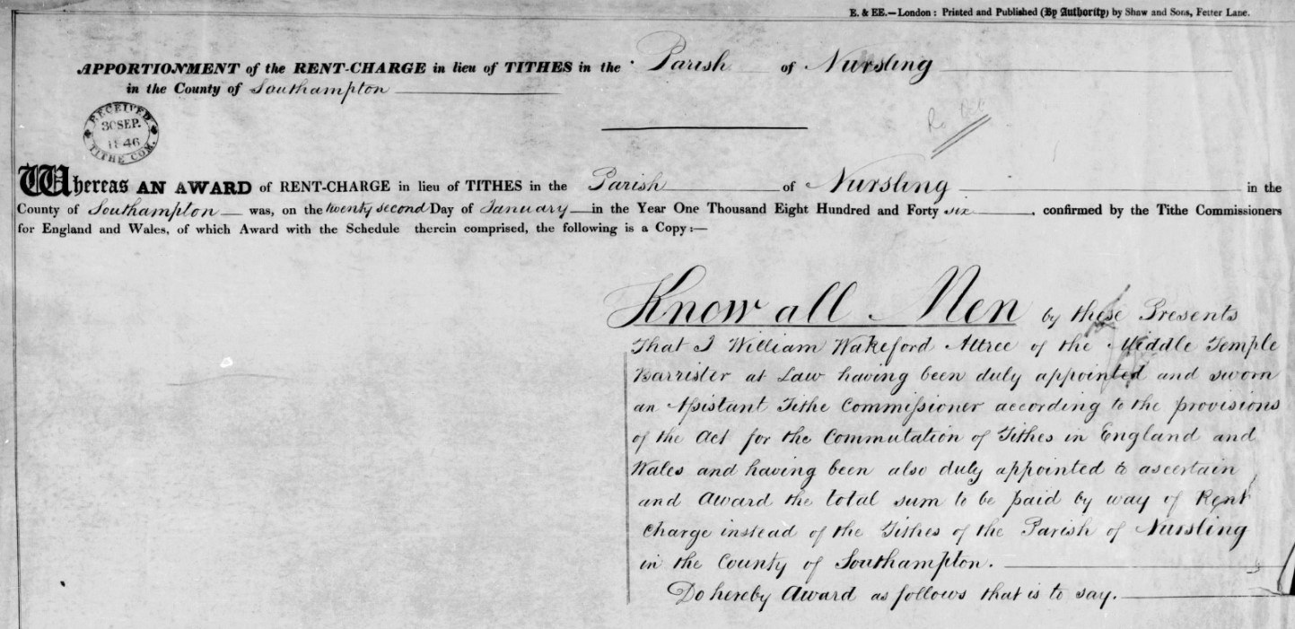
The Award of Rent-charge in lieu of Tithes in the Parish of Nursling in the County of Southampton. Hampshire variously known as the County of Southampton, Southamptonshire, and abbreviated to Hants.
From the 'Know all Men' paragraph, the Assistant Tithe Commissioner responsible for Nursling was William Wakeford Attree of the Middle Temple Barrister at Law. He was also responsible for the Tithe Commutation for the Parish of Freefolk in the County of Southampton, and possibly others.
I found an article in The National Archives which has some information about William Wakeford Attree and his family, extract below. The Atrree family do not live in Nursling but have an involvement by virtue of the Tithe Award.
THE HISTORY OF HOWLETT & CLARKE by Antony Dale
Howlett & Clarke is not only the oldest firm of Solicitors in Brighton but the only one that can be traced back to the eighteenth century. Its first known principal or partner was William Attree. He came of an old established Ditchling family. His grand-father, William Attree, was a brick-layer there. The latter died in 1767 but left a Will, so he must have been a man of some education. This William Attree's son, John Attree, was a prosperous malster. In 1745 John Attree married at Newtimber Susannah, daughter of Henry Scrase of Withdean, Patcham. He died on the 9th June 1772 and is buried in a table-tomb in Ditchling church-yard to the north of the church
John and Susannah Attree had one daughter and four sons
William Attree was the second of these sons and was born in 1749. In 1765 he was articled for 5 years to an attorney in Lewes named Henry Burtenshaw. He was admitted to the roll of solicitors before 1775. But this must have been at least two years earlier, as in 1773, when the Brighton Town Commissioners were first set up to pave and light the streets and to erect groynes in front of the town, he became their first Clerk and also Treasurer. The Commissioners' minutes have not survived from before 1789, but Bishops' "Brighton in the Olden Time" quotes an advertisement by William Attree as Clerk to the Commissioners of 1st August 1773, so he must have held this office since the initiation of the Commission. His salary as such in 1789 was £4-10-0 a year
He was also Clerk to the Brighton Vestry. The date when he was appointed to that office is unknown because again the minutes of the Vestry have not survived from before 1790. He may well have been in office for some time before that date and perhaps was even appointed Clerk to the Commissioners in 1773 because he was already Clerk to the Vestry. His salary as Clerk to the Vestry was £10-10-0 a year in 1790 and £30-0-0 a year in 1804
It is just possible that William Attree's legal connection may extend further back than this. His mother's first cousin, Charles Scrase, was also an attorney. He was born in 1709 and was Town Clerk of Seaford in 1733. In 1771 Scrase purchased a moiety of the manor of Brighton and lived in the Manor House there which was on the site of Royal York Buildings in Old Steine. Scrase was also the solicitor of Dr Johnson's friend, Hester Thrale, later Mrs Piozzi. She stayed with him at the Manor House and subsequently bought a house of her own in Brighton in West Street. William Attree acted as steward of the Manor for Scrase from 1778 onwards. So it is possible that he had been articled to Scrase. The latter died in 1791
When William Attree established his practice in Brighton, he built himself an office and a house where he also lived. In 1775 he bought a site in Ship Street for £50. On this he built No. 8 Ship Street and probably the adjoining house, No. 9. No. 8 was his residence and office combined until his death and after that the residence and office of his son until 1830. William Attree mortgaged the building for £2,000 in 1803, and this loan was not finally paid off by his son until 1824. The house was rebuilt in its present form, but still with a facade of Georgian character, at some time between 1830 and 1863. But continuity has been preserved as the building is still the office of Howlett & Clarke today
In or before 1800 there were few attorneys in Brighton, so William Attree easily acquired a near monopoly of the best legal work in the town. Amongst his fashionable clients was the Prince of Wales. When the Prince was acquiring land to enlarge the grounds of his Brighton house, he employed Attree in the various purchases which this involved. Attree's position will have been of benefit to both parties when, in 1803, the Prince sought the agreement of the Town Commisioners to divert the north end of Great East Street, as East Street was then called, which ran almost directly under his windows, and to give the town instead a piece of land further west which, in 1806, became New Road
The above is not really relevant to the Parish of Nursling but does give some background to the next extract where William Wakeford Attree, the Assistant Tithe Commissioner for Nursling and a number of other Hampshire Parishes.
Thomas Attree married about 1805. His wife's Christian names were Elizabeth Austin. They had a son and a daughter. The son, William Wakeford Attree, was born in 1806. He followed his father into the legal profession, but became a barrister in the Middle Temple. He was Recorder of Rye, Hastings and Seaford. He died in his father's life-time and at his father's Brighton house on the 28th January 1862 aged 56. He was buried in Ditchling church-yard
In his memory his father endowed a scholarship at Brighton College. To provide the money for this he conveyed to the Trustees of the College No 9 Ship Street adjoining his office and, if this Trust was invalidated by his death within 6 months of the date of gift, he substituted in his Will a bequest to the College of £1,000. Thomas Attree's daughter, Elizabeth Wakeford Attree, died when quite young. Stained glass windows in memory of both the son and daughter were inserted in the north wall of the nave of Ditchling Church in 1863.
Census
Your text...
1939 Register
Your text...
Post 1939
Your text...
People
People
People of note in the parish of Nursling, through time.
Your text...
Relatives
Relatives
Some of my relatives with an association to the parish of Nursling.
Your text...
Spare
Your text...