Eling One Place Study
A Study of the Parish of Eling in the County of Hampshire, or sometime known as the County of Southamptonshire.
I refer you to the Millbrook One Place Study in the first instance. That has a lot of the background information which would be repetitive if just repeated here.
Progress;
- Initial StoryMap added to Overview 1/12/2024.
- Parish Records, Baptisms, new spreadsheet template, commenced Sept 2025, with the Register book 1537-1674.
- Researching before 1066 and Prehistory Oct 2025.
- 'The Place' added, and the Article Eling Hampshire incorporated Nov 2025.
- 'How I make use of Tithe Apportionment and Maps' separated from 'Tithe Commutation Act 1836' and incorporated as article in article to provide consistent information. Nov 2025.
- Added a section for 'Related Articles' and inserted 'Biddlecombe families of Eling' Nov 2025.
Overview
Overview
There are a few go to websites when researching a parish, some of which are listed below.
British History Online
A History of the County of Hampshire: Volume 4. Originally published by Victoria County History, London, 1911.
GENUKI
"ELING, a parish in the hundred of Redbridge, Romsey division of county Hants, 3 miles N.W. of Southampton, its post town. The Totton station, on the London and South-Western railway, is about 1; mile to the N.W. of the village. It is situated at the upper end of the Southampton Water, near the river:Test, and is of great extent, including several townships and hamlets, the principal of which are North and South Eling, Marchwood, Netley, and Totton, and the manor of Bury Farm, which last is held of the crown by the tenure of presenting to the king, on his visiting the New Forest, a brace of white greyhounds in silver couples, which ceremony was last performed in 1789, on the event of George III.'s visit to Lindhurst. "
[From The National Gazetteer of Great Britain and Ireland (1868) - transcribed by Colin Hinson ©2003]
A Vision of Britain through Time
Descriptive Gazetteer Entry for ELING
(John Marius Wilson, Imperial Gazetteer of England and Wales (1870-72))
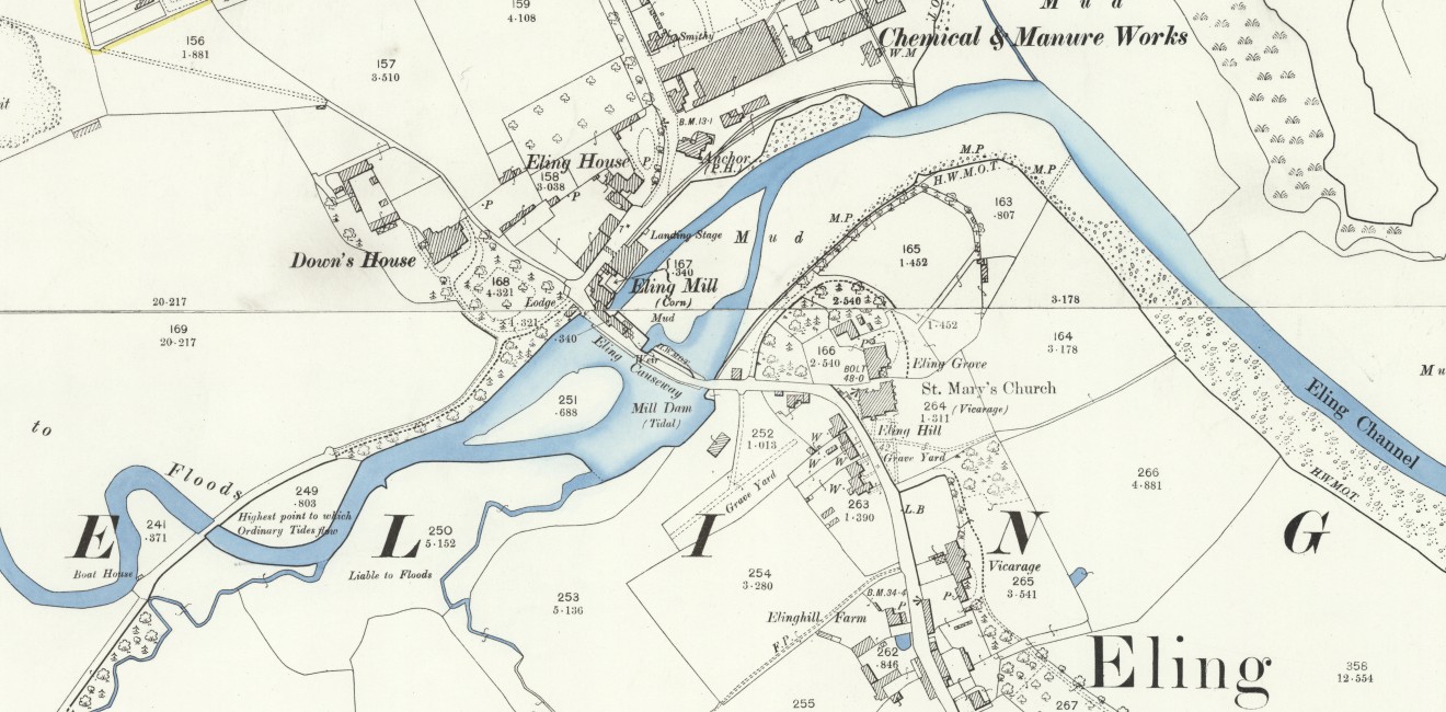
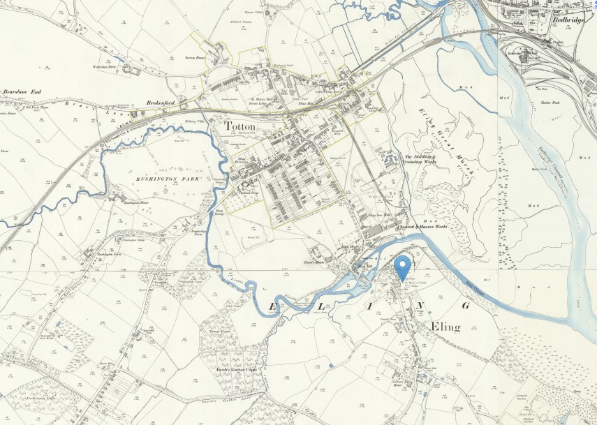
An extract of ArcGIS Church of England Parishes Map focused on the parish of Eling
The Eling One Place Study StoryMap below can also be seen in a new tab, full size, by following this link.
The place
Eling Hampshire
Eling a small village and town, as well as a large parish on the banks of the River Test opposite Southampton, and adjacent to the New Forest, in the county of Hampshire, sometimes known as Southamptonshire, or County of Southampton.
Bronze Age 1500BC
A Bronze Age Settlement to the North of the Town was discovered when the Testwood Lakes were excavated. A jetty, bridge and dagger were all found dating from that period.
The town has a history back to before Bronze Age times. It is thought the name Eling probably derives from Edlas’s people, or Edlingas as it appeared in the Domesday Book.
Domesday Book 1066-1086
Eling was a settlement in Domesday Book, in the hundred of Redbridge and the county of Hampshire.
It had a recorded population of 69 households in 1086, putting it in the largest 20% of settlements recorded in Domesday.
![Domesday_-_Eling.jpeg]() Land of King William
Land of King William
 Land of King William
Households
- Households: 13 villagers. 43 smallholders. 13 slaves.
Land and resources
- Ploughland: 20 ploughlands. 5 lord's plough teams. 7 men's plough teams.
- Other resources: Meadow 125 acres. Woodland 20 swine render;in Forest. 2 mills, value 1 pound 5 shillings. 1 fishery. 1 salthouse. 1 church. 0.5 church lands.
Valuation
- Annual value to lord: 20 pounds in 1086; 38 pounds 8 shillings and 2 pence when acquired by the 1086 owner; 38 pounds 8 shillings and 2 pence in 1066.
Owners
- Tenant-in-chief in 1086: King William.
- Lord in 1086: King William.
- Lord in 1066: King Edward.
Other information
- Partially waste in 1086.
- Phillimore reference: Hampshire 1,27
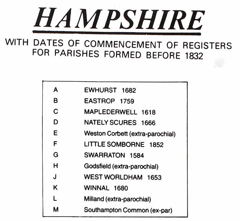
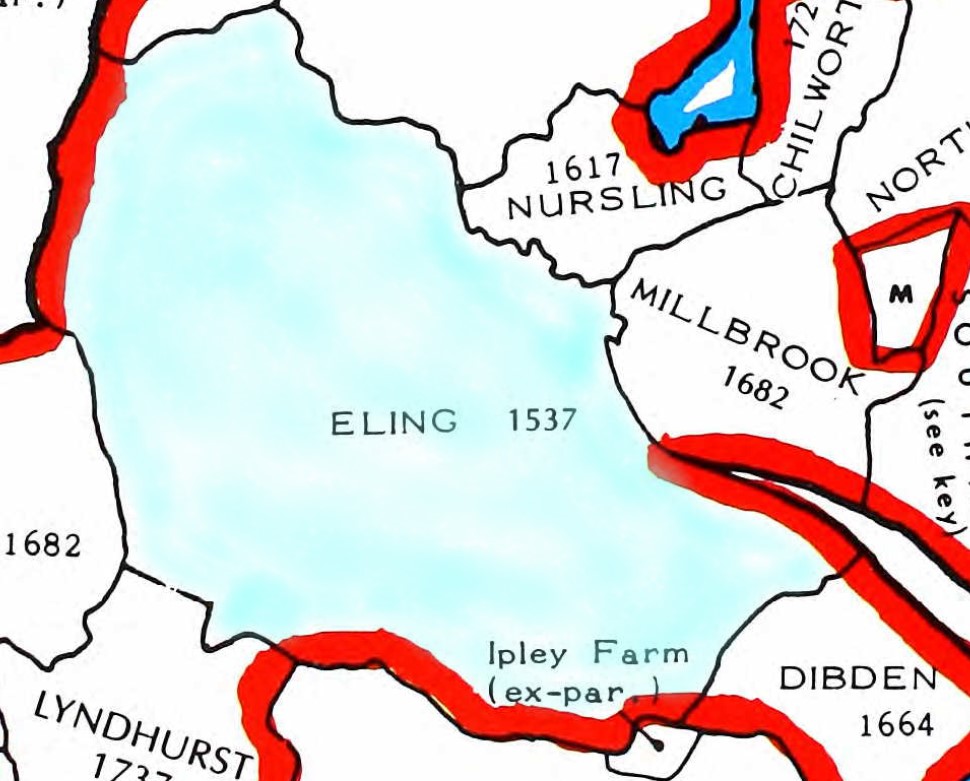
Hampshire Parishes - Eling Parish 1537
Original data;
Smith, Cecil R. Humphery. The Phillimore Atlas and Index of Parish Registers. Digitized images. Institute of Heraldic and Genealogical Studies, Canterbury, Kent, England. From Ancestry
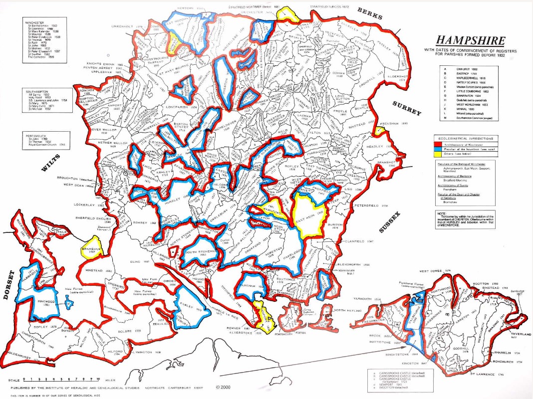
County map of Parishes - Hampshire
Extract from Great Britain, Atlas and Index of Parish Registers, from Ancestry
Same map but in more detail
The same map but zoomed in and split into four parts for ease of use.
There is a vertical overlap on each segment to try to avoid the difficulty of interpreting the information, reading at the joints.
At one time this was done with mouse rollover, but that no longer consistently works on all browsers, so back to static.
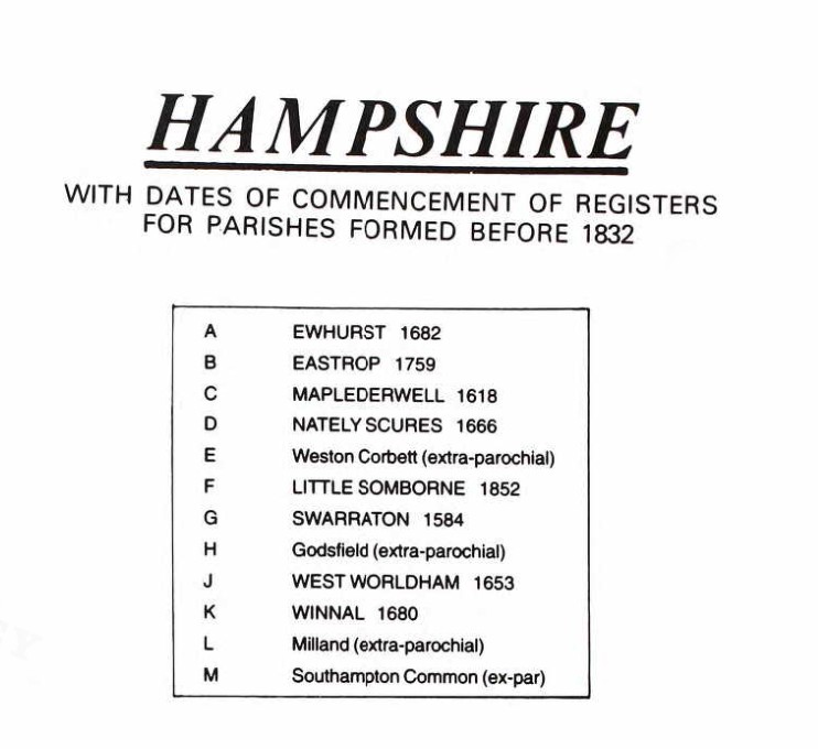
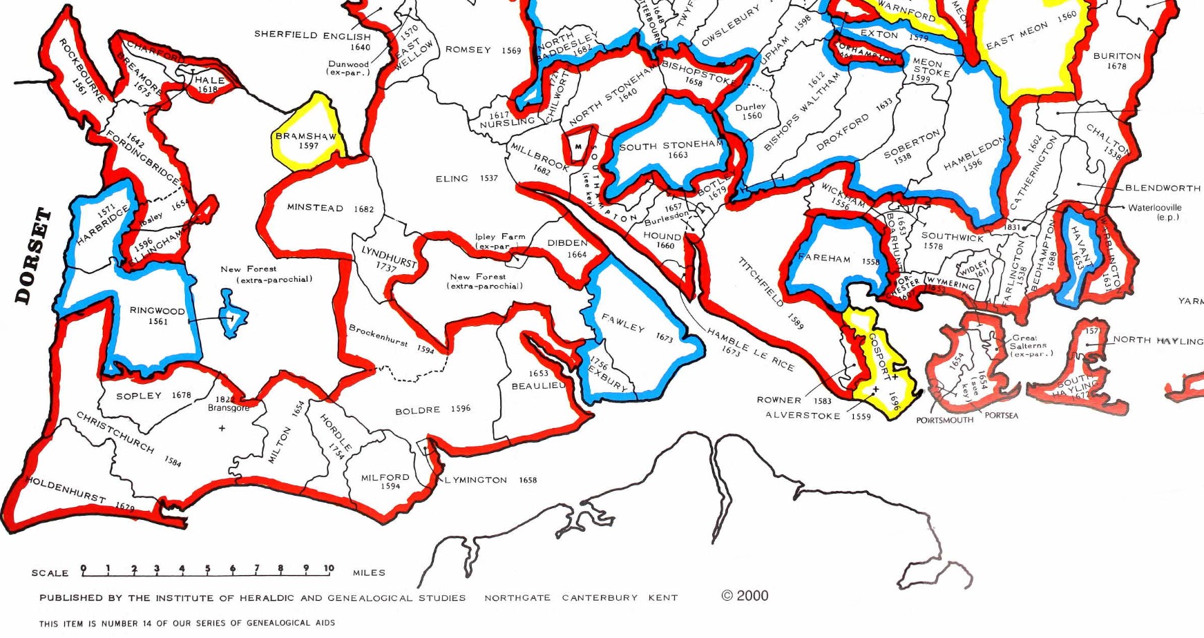

The above map is an extract of the The Phillimore Atlas and Index of Parish Registers for Hampshire. Of particular interest, the Parishes of Eling - 1537, Southampton, Hound 1660, and South Stonham 1663.
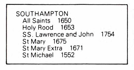
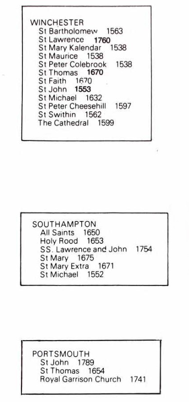
Southampton contains the following parishes;
- All Saints - 1650
- Holy Rood - 1653
- SS, Lawrence and John, sometimes written as St Lawrence and St John - 1754
- St Mary - 1675
- St Mary Extra - 1671 (Other side of the River Itchen)
- St Michael - 1552
- Southampton Common, marked as M, extra-parochial.
The dates are not when the parishes were formed but as it states by the County Title, the dates of the commencement of Registers of Parishes formed before 1832.
I think that may be expanded to dates of registers still in existence.
Old Hampshire Maps
The website for Old Hampshire Maps and Other Historic Resources is a most excellent source of information which I often refer to.
I normally click on the top left icon, Old Hampshire Mapped, but believe that the one next to it on the right is more extensive and gets to the same maps and more.
This section could be called an indulgence to my lifelong fascination with maps and travel. Maps can tell you so much more than just how to get from A to B. Maps over time add to so much more.
Generally, the maps refer to Eling the settlement as opposed to the much larger parish. Something in the history must have given Eling some significance.
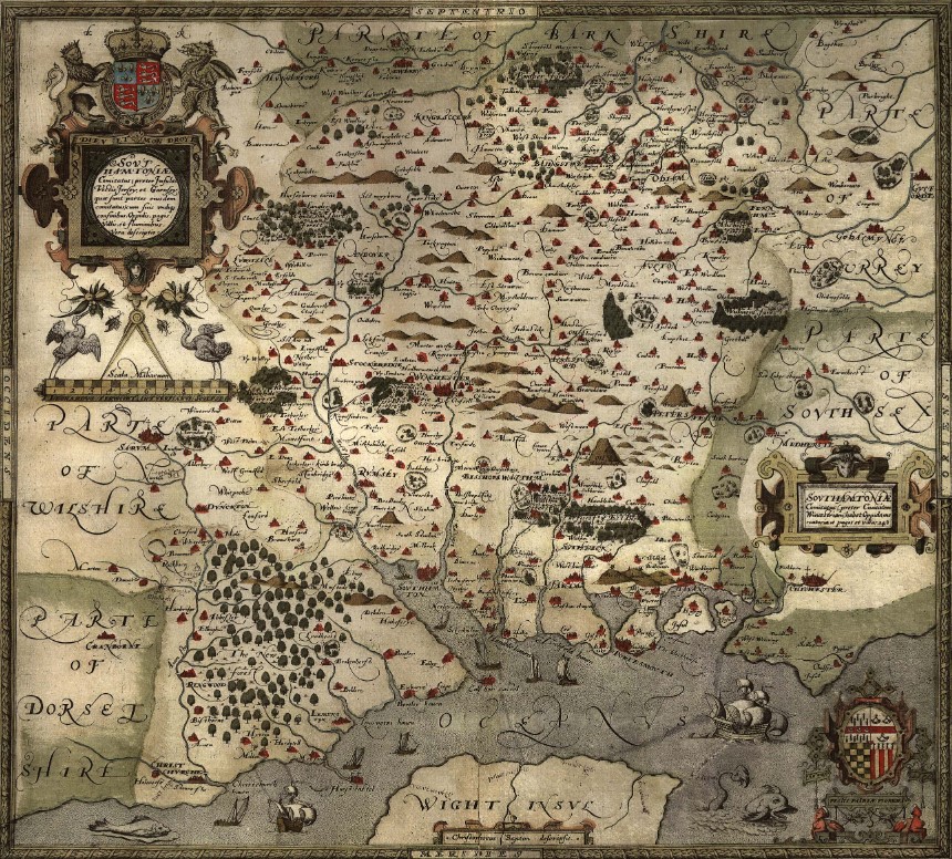
Saxton 1575
Saxton's map of Hampshire 1575
Extract from the Old Hampshire Mapped website about Saxton's map.
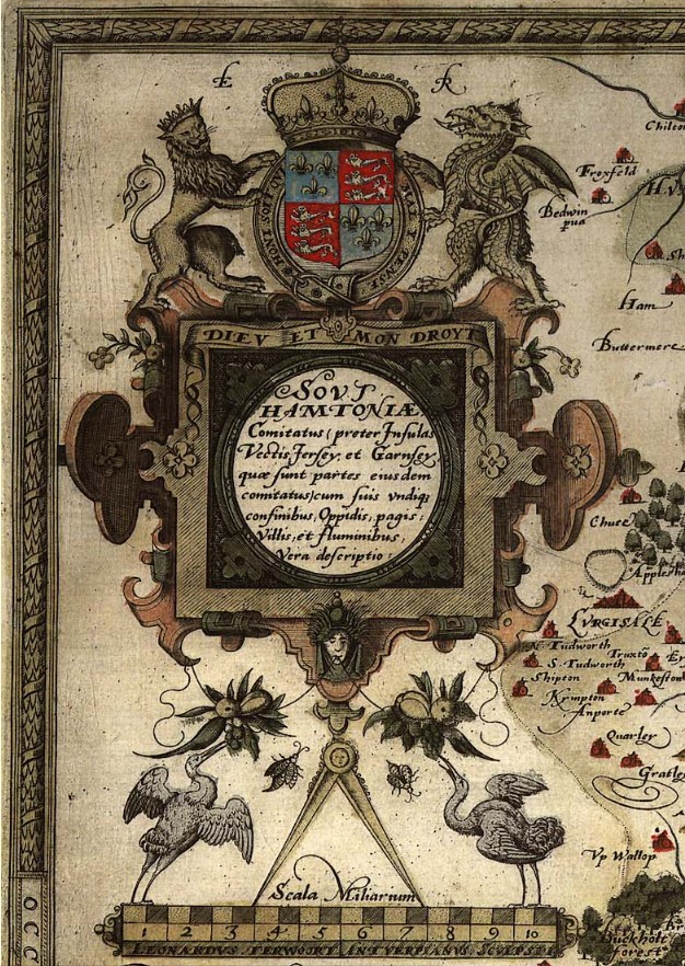
Map, hand coloured copper plate engraving, Southamtoniae, ie Hampshire, scale about 4 miles to 1 inch, engraved by Leonard Terwoort, Antwerp, Netherlands, published by Christopher Saxton, map maker, London? about 1575.
Published in the Atlas of England and Wales; it was usually issued in hand coloured form; measurements and notes made in the field were worked up later, with the help of earlier manuscript maps if available; Saxton almost certainly used the rudimentary triangulation techniques first described by the cartographer Frisius, Belgium, 1533.
Hills are drawn in profile to provide a general impression of the local topography, while named settlements are shown by a variety of symbols including a church with tower; rivers, coastline, some bridges, deer parks and woods are all included; the most obvious omission on Saxton's maps, to our eyes, are roads, which were not included on general county maps until the 1690s.
The map '... provides us with our first english example of accurate cartography': Colonel Close: 1930:: Hampshire Field Club.
Saxton's county maps were engraved by Ryther, Hogenberg, Reynolds, Terwoort and Scatter.
Direct link to Eling.(Settlement)
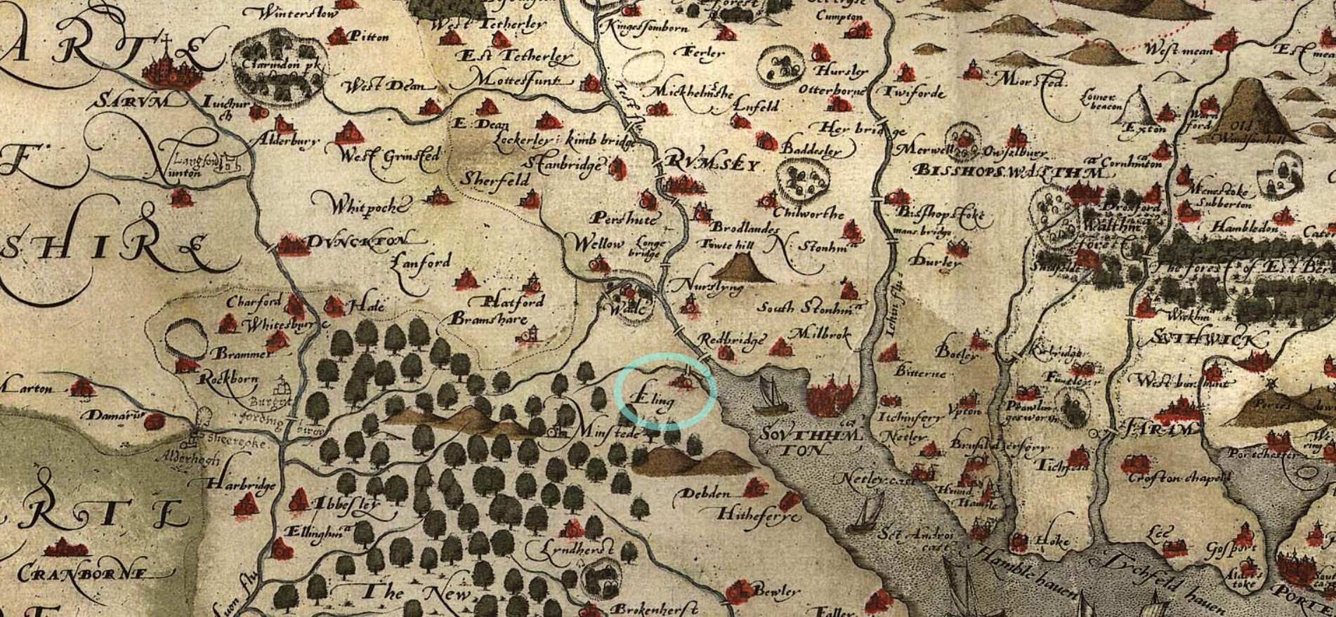
The ancient settlement of Eling circled in blue, to help locate it.
Zoomed in some more on the same map. Showing from the New Forest, Eling, Southampton, across to the Hamble.
Norden 1595
Norden's Hampshire 1595
A map of Hampshire, including the Hundreds of the time. Remembering that a Hundred was an administrative area, part of and smaller than a County, and bigger than, and containing multiple Parishes.
The origin of the division of counties into hundreds is described by the Oxford English Dictionary (OED) as "exceedingly obscure". It may once have referred to an area of 100 hides; in early Anglo-Saxon England a hide was the amount of land farmed by and required to support a peasant family, but by the eleventh century in many areas it supported four families. Alternatively the hundred may have been an area originally settled by one "hundred" men at arms, or the area liable to provide one "hundred" men under arms.
Either way, a huge area of land for such a small population.
![Norden s Hampshire 1595 Hundreds and key]() Details
Details
 Details
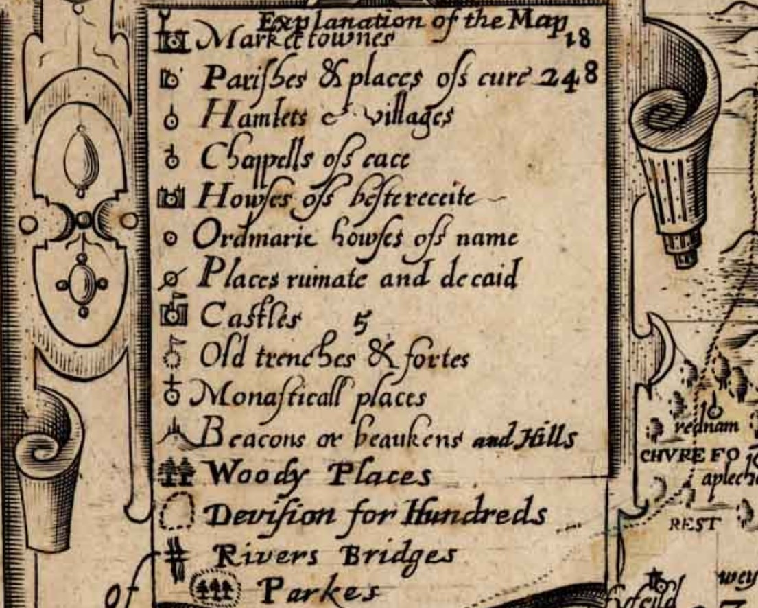
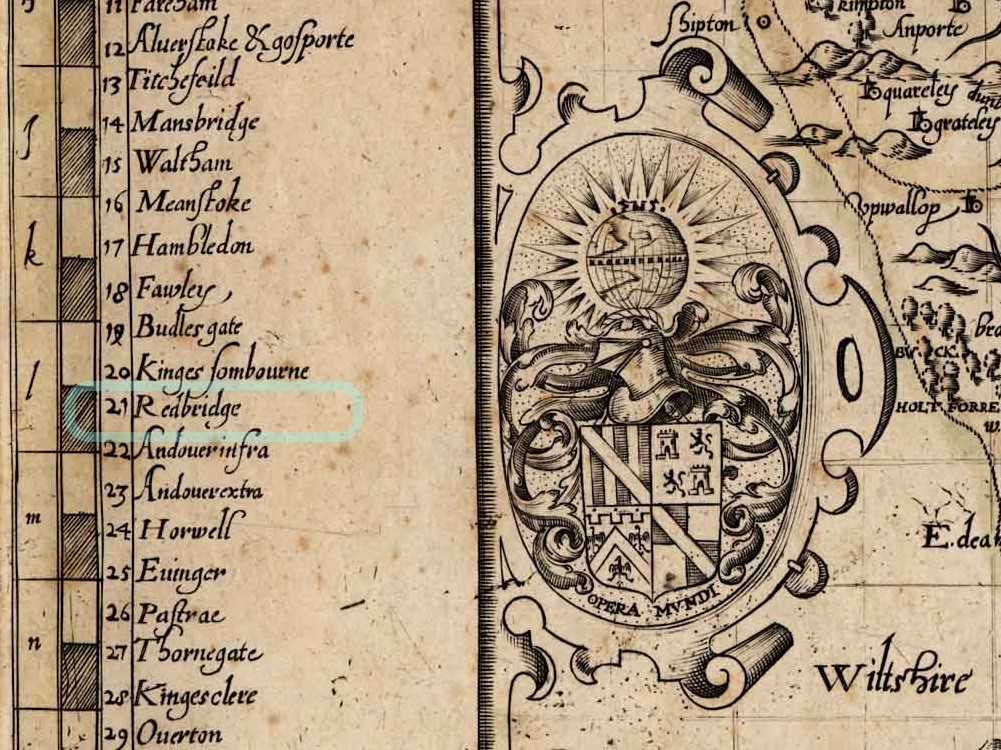
Eling is within the Hundred of Redbridge. Indicated on this map as 21. Fortunately, some of the hundreds have boundaries marked in red on this copy of the map, and 21 is one of them.
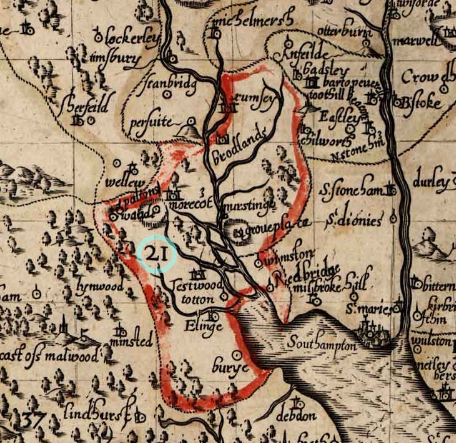
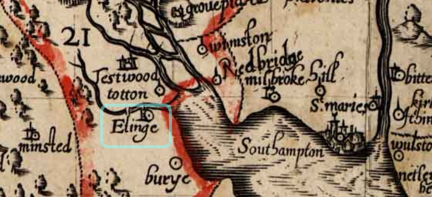
From this map it appears that the Hundred of Redbridge, at the time, extended North as far as Romsey, with its town and Abbey, including the Broadlands Estate, and South just past Elinge, on level with Lyndhurst. Note the spelling of Eling with an e at the end.
According to the Key or 'Explanation of the Map' the icon attributed to Elinge appears to be that of a Parish. This map is dated from 1595 and from elsewhere Parish Records commenced in 1537, which obviously predates the map.
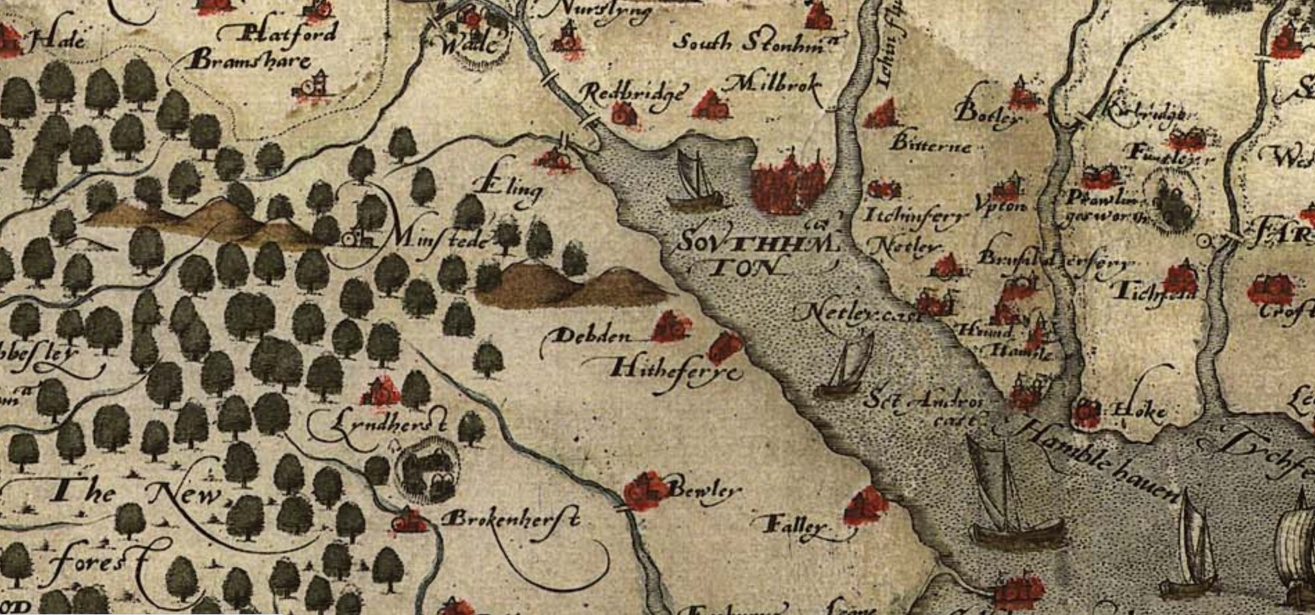
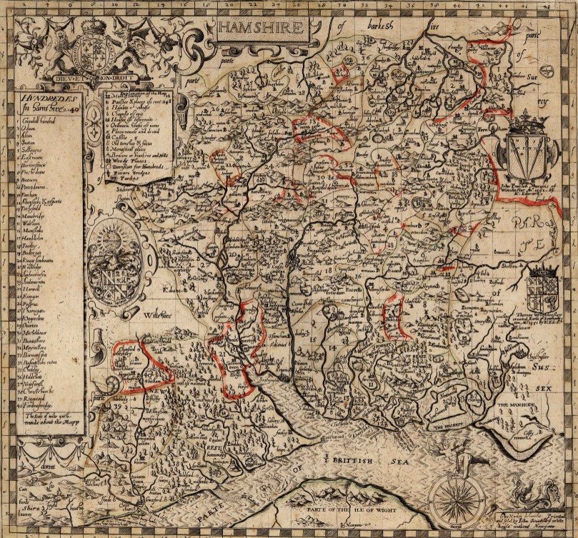
Taylor's Hampshire 1759
Taylor's Hampshire 1759 - Section 33.
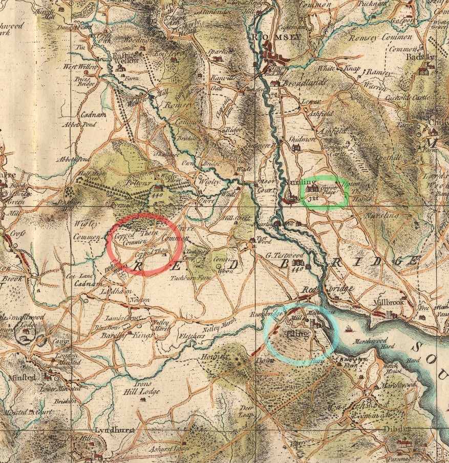
Circled in green, Grove Place, in Nursling, is not part of this story, but does get a mention elsewhere on this site. Eling, the settlement, circled in blue, is the centre of attention. Eling the parish, takes up a large portion of the map, and the Hundred of Redbridge takes up even more. Extending to Romsey
Copped Thorn Common and Copped Thorn are circled in red, and turn up later in our story, under a slightly changed name.
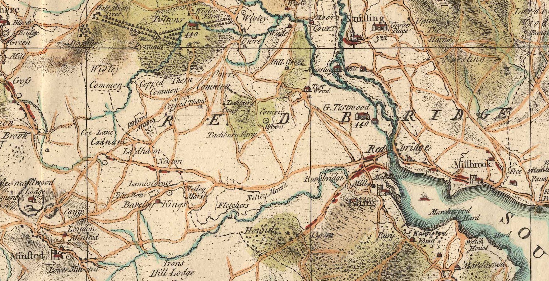
I will have to look up house 440 at Poltons. It is interesting that Great Testwood carries the same number. Poltons is now known as Paultons Park - Home of Peppa Pig World. How things change.
The estate can be traced back to 1086 where the ‘Paulet’ manor was in the possession of Glastonbury Abbey. The house became derelict and burned down in a great fire on 5 November 1963. Click the link to read about the Estate's History.
The above only looks at Section 33 of Taylor's Map of Hampshire. If you want to look at the whole map, which is very decorated, follow the link to the article Taylor's Map of Hampshire 1759 which opens in a new window.
Eling Parish Split in three 1837-1846
Ancient Parish of Eling
The Parish of Eling was divided, which is understandable, as it was a huge area, and would have had a growing population. Initially into, South to North, Marchwood, (1846), Ealing (Ancient) and North Eling (1837), .
The maps are from FamilySearch.
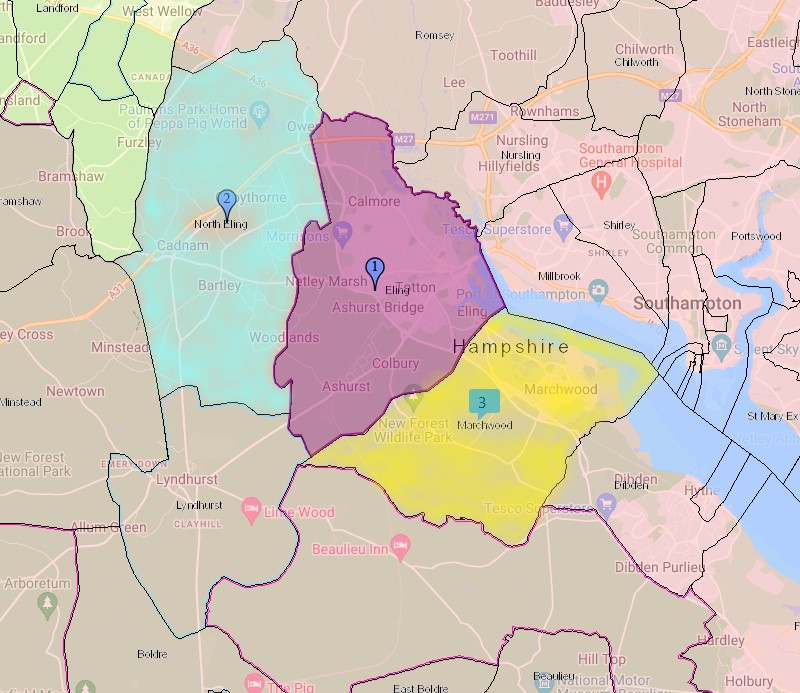
North Eling, blue wash, Eling, mouve, Marchwood, yellow.
Eling - re-sized
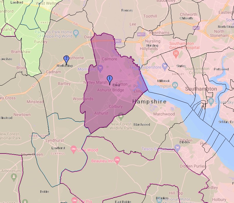
First the map with the revised size Eling parish as 1 and the newly formed North Eling as 2. Marchwood is also formed from the Ancient Parish of Ealing.
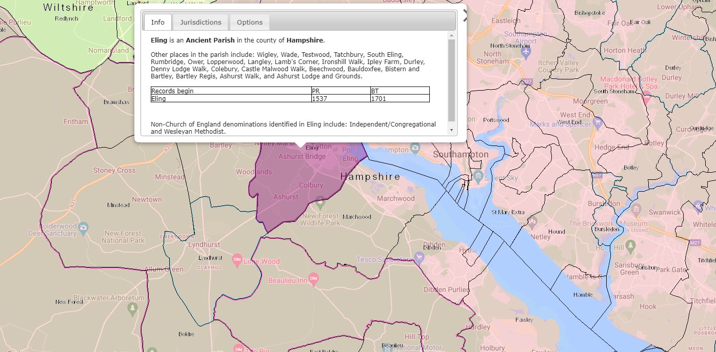
Eling is an Ancient Parish in the county of Hampshire
Other places include: Wigley, Wade, Testwood, Tatchbury, South Eling, Rumbridge, Ower, Lopperwood, Langley, Lamb's Corner, Ironshill Walk, Ipley Farm, Durley, Denny Lodge Walk, Colebury, Castle Malwood Walk, Beechwood, Bauldoxfee, Bistern and Bartley, Bartley Regis, Ashurst Walk, and Ashurst Lodge and Grounds.
Parish records begin in 1537 and Bishops Transcripts 1701.
Non-Church of England denominations identified in Eling include: Independent/Congregational and Wesleyan Methodist.
I have transcribed the image, which is clearly legible sat here, mainly to provide searchable text, but hopefully also to provide the information irrespective of the devise used to view this article.
North Eling
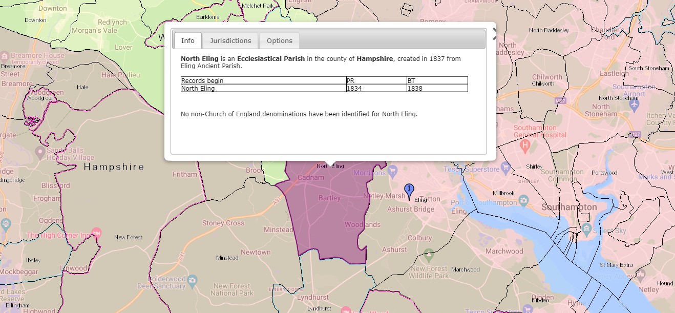
North Eling is an Ecclesiastical Parish in the county of Hampshire, created in 1837 from Eling Ancient Parish.
Parish records begin in 1834 and Bishops Transcripts 1838. Interesting that the Parish records commence before the creation of the parish. No non-Church of England denominations have been identified for North Eling.
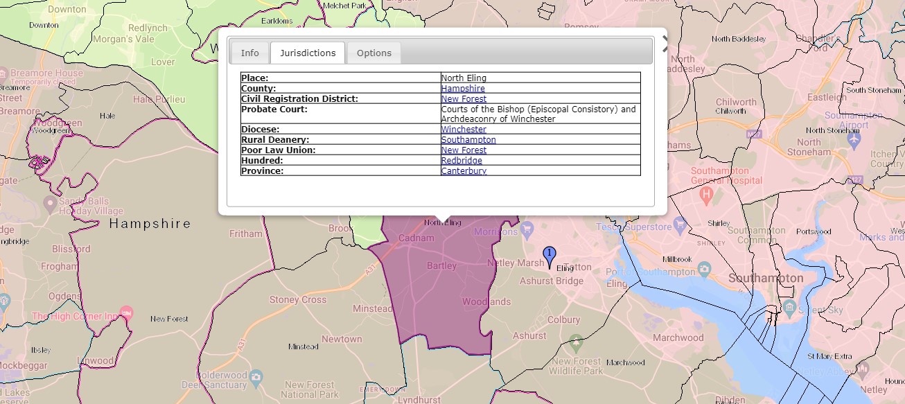
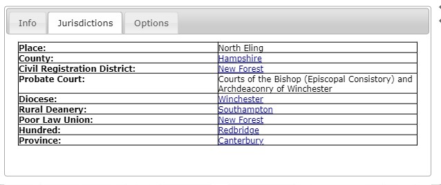
Jurisdictions;
- Place; North Eling
- County; Hampshire
- Civil Registration District; New Forest
- Probate Court; Courts of the Bishop (Episcopal Consistory) and Archdeaconry of Winchester.
- Diocese; Winchester
- Rural Deanery; Southampton
- Poor Law Union; New Forest
- Hundred; Redbridge
- Province; Canterbury
All the Jurisdictions apart from the place are the same for all three parishes.
Marchwood
Nine years after the division of the Ancient Parish of Eling to create North Eling, a further split to create the Parish of Marchwood.
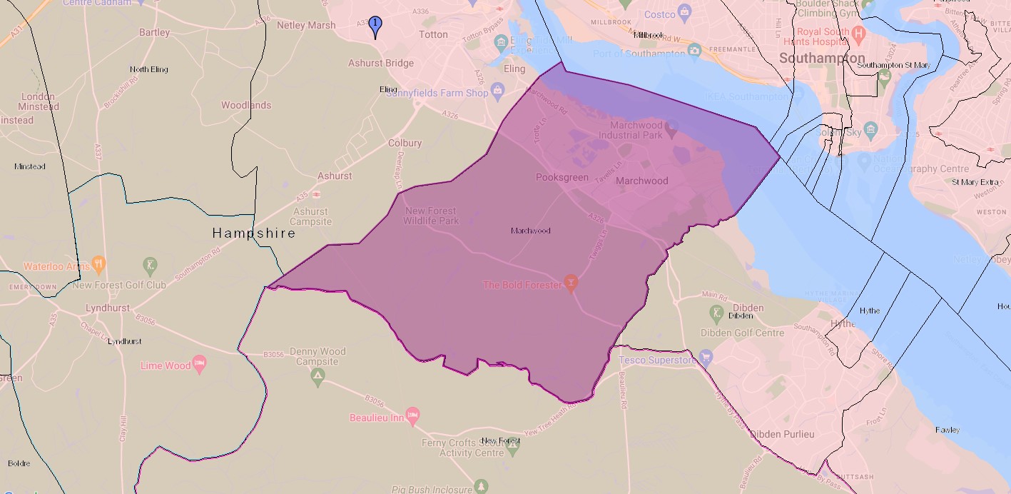
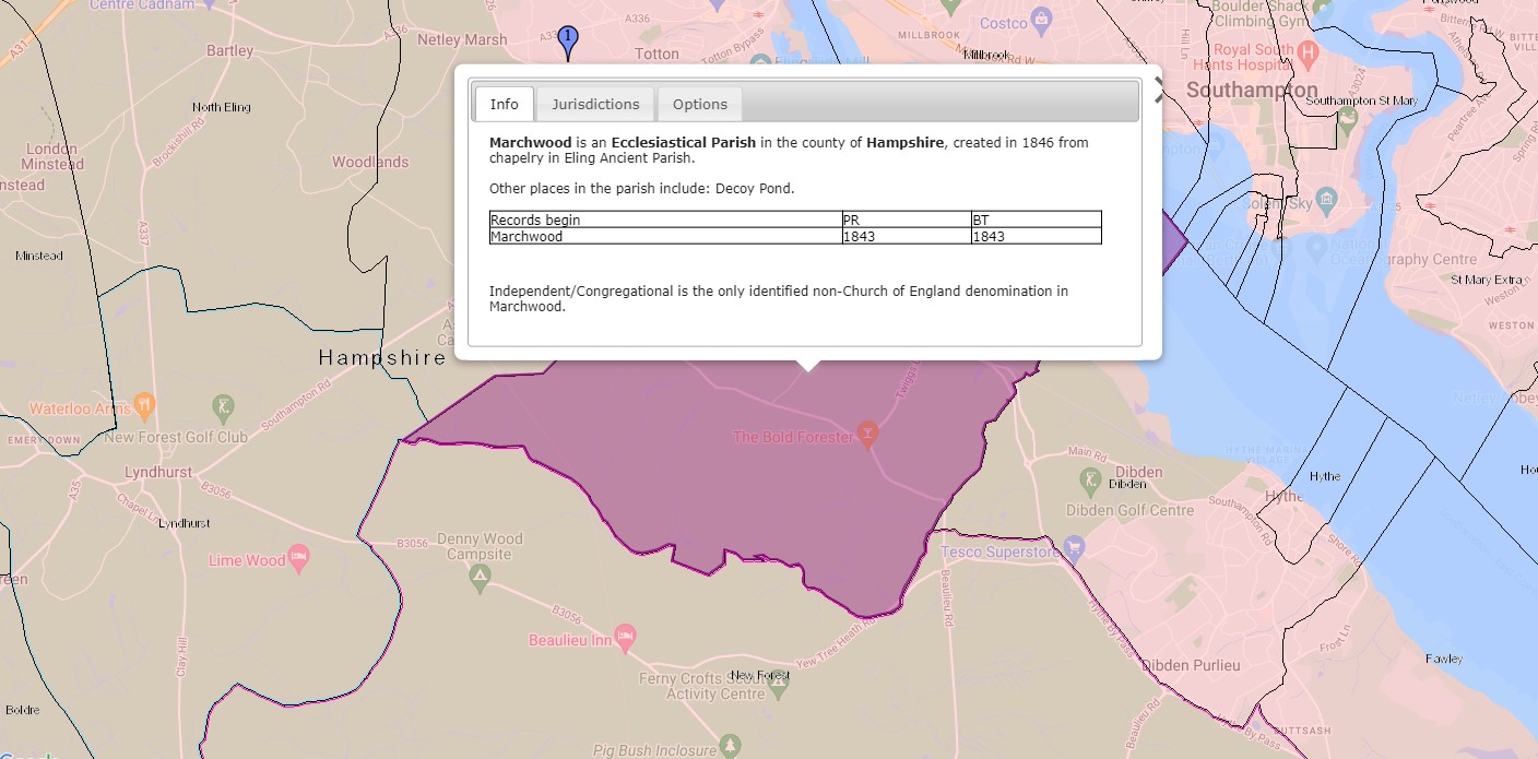
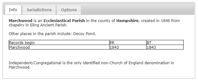
Marchwood is an Ecclesiastical Parish in the county of Hampshire, created in 1846 from chapelry in Ealing Ancient Parish.
Other places in the parish include: Decoy Pond.
Parish records begin in 1843 and Bishops Transcripts 1843. Interesting that the Parish records commence before the creation of the parish.
Independent/Congregational is the only identified non-Church of England denomination in Marchwood.
ArcGIS Church of England Parishes Map
An extract of ArcGIS Church of England Parishes Map focused on the parish of Eling
Ordnance Survey
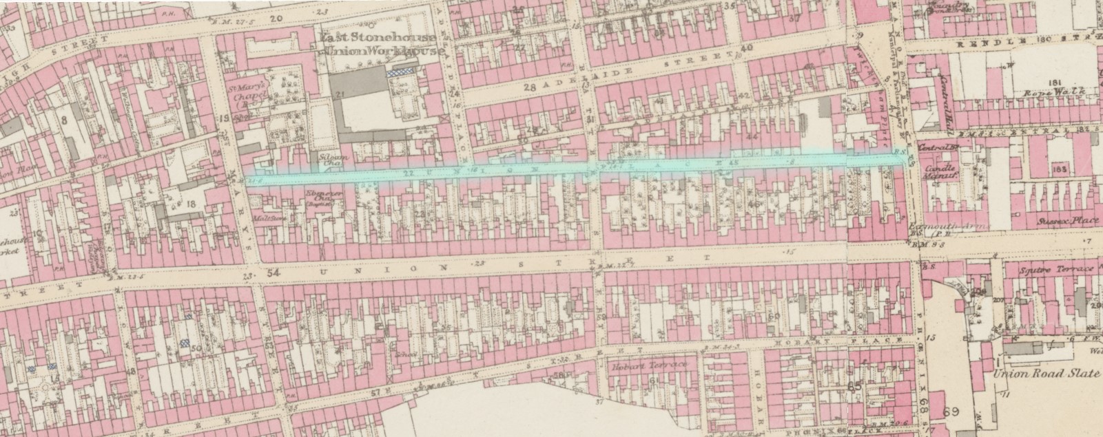
 OS 25 Old Map Eling village - Hampshire and Isle of Wight LXIV.12 Revised: 1895, Published: 1897
 OS 25 Old Map Eling and Totton - Hampshire and Isle of Wight LXIV.8 Revised: 1896, Published: 1897
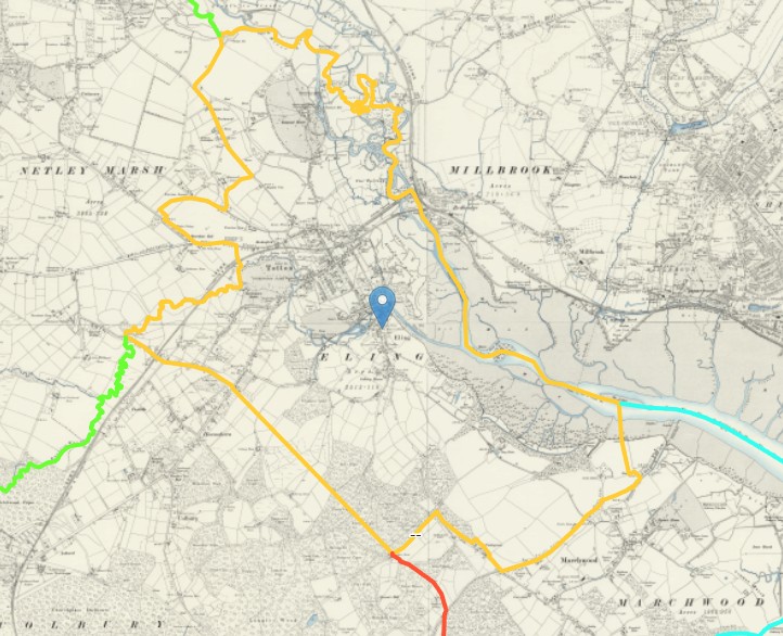
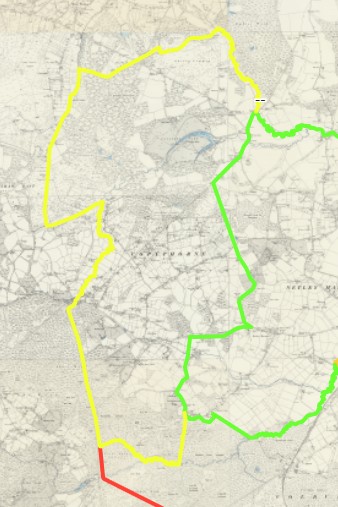
 OS 6 Old Map Ancient Eling 4 parish boundaries plus Eling mark - Hampshire & Isle of Wight Sheet LXIV.NE Revised: 1895 to 1896, Published: 1897
For this rendition of the 6" version of the same Ordnance Survey Map I have slowly traced the boundary makers shown on the map to more easily see the ancient parish of Eling, as well as the now four resultant parishes.
First it was one parish, then three, then four at the time of this map, 1895.
It is made up of several map sheets, one of which is Hampshire & Isle of Wight Sheet LXIV.SE
Revised: 1895, Published: 1898.
The village of Eling is shown by the blue marker.
The 1895 Eling Parish boundary is shown with the orange line.
The Parish of Copythorne has a yellow outer boundary.
The Parish of Netley Marsh has a green outer boundary.
The Parish of Colbury has a red outer boundary.
The Parish of Marchwood has a light blue outer boundary.
With inner boundaries sharing adjacent parishes colours.
I have saved the lines, but unfortunately they will not show when you follow the link, click the map, to the source information.
The following maps are zoomed in to each parish.
The 1895 Eling Parish boundary is shown with the orange line.
The 1895 Parish of Copythorne has a yellow outer boundary.
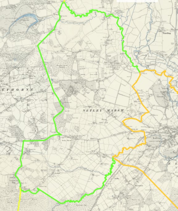
The 1895 Parish of Netley Marsh has a green outer boundary.
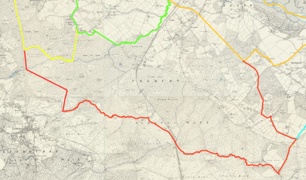
The 1895 Parish of Colbury has a red outer boundary.
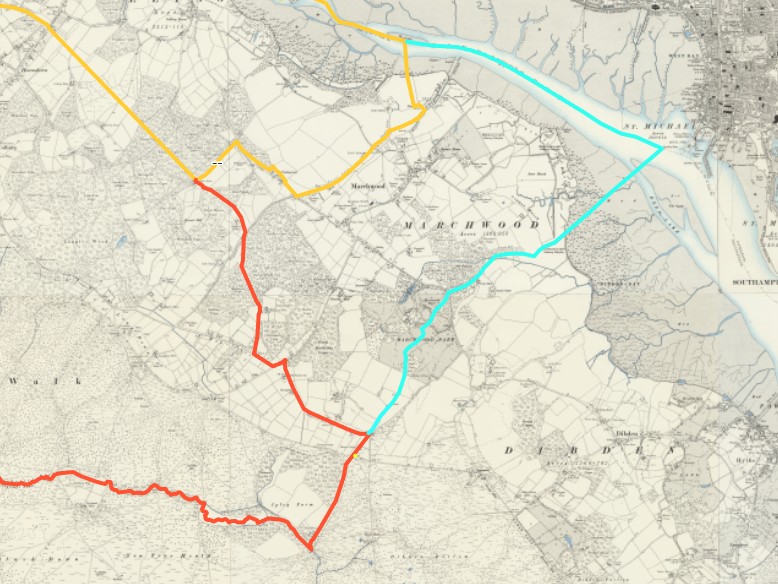
The 1895 Parish of Marchwood has a light blue outer boundary.
Before 1066
Prehistoric
Prehistoric Hampshire
Prehistoric evidence in Hampshire
Prehistoric evidence in Hampshire - Atlas of Hampshire's Archaeology
Extracted from Atlas of Hampshire Archaeology, well worth the read in it's entirety.
The Atlas of Hampshire's Archaeology
The Historic Environment Record (HER) contains around 50,000 entries that describe the known archaeology of Hampshire. Analysing the distributions of this complex data by using GIS allows fascinating insights into the evolution of the Hampshire landscape. The Atlas of Hampshire's Archaeology presents HER data in a graphic and understandable way and provides the opportunity to enjoy and understand the archaeological story of Hampshire. Displaying the HER data alongside other information, such as topography, rivers, geology and landscape allows new insights and the patterns of data to be readily appreciated. The Atlas of Hampshire's Archaeology was developed to support an understanding of the archaeological potential of different landscapes. The maps are equally interesting to a wider audience including those seeking to know what has been found in their area, students and academics undertaking research, and consultants preparing advice for developers. The following pages offer an opportunity to share the emerging story of Hampshire.
This forms a significant part of this section, hence leading with it. The Maps and text are in the various periods without continuously repeating the above introduction.
Prehistoric evidence in Hampshire - Paleolithic
Paleolithic, aka Old Stone Age - c. 3.3 million – c. 11,700 years ago.
Paleolithic - Broom Hill, Braishfield
Although the ecclesiastical parish of Braishfield was only formed in 1855 and the civil parish just under a century later there is evidence of human activity in the area in the Paleolithic era, about 500,000 years ago. At Broom Hill is probably the oldest building in Britain – an 8,500 year old mesolithic hut discovered by Michael O’Malley in 1971 (for further information click on links Hampshire Archaeology). There is evidence of intermittent settlement from the late Paleolithic, Mesolithic, Neolithic, Bronze Age, Iron Age, Roman and late Saxon periods. The site is particularly noted for the range and quality of Mesolithic flint tools, and it would have been visited seasonally by Mesolithic hunter-gatherers. In later periods of settled agricultural activity, from the Neolithic period onwards, the site would have been inhabited for longer periods.
The Romans settled at Fernhill not far from the Mesolithic site. A late third century bath house was excavated in 1976, part of a much older villa complex consisting of at least six substantial buildings which were occupied long before the construction of the bath house. North of Fernhill Farm a trial trench showed chalk blocks laid in mortar, and finds included bricks and roofing tiles. Excavations by Test Valley Archaeological Committee in 1976 revealed a bath house block and C.4 Roman coins
Little is recorded of Braishfield until 1043 when, as part of the manor of Michelmersh, the lands were donated by Queen Emma to the cathedral clergy at Winchester. Later much of this holding was released to secular landowners, including two Oxford colleges, one of which owned land in the village up to the Second World War.
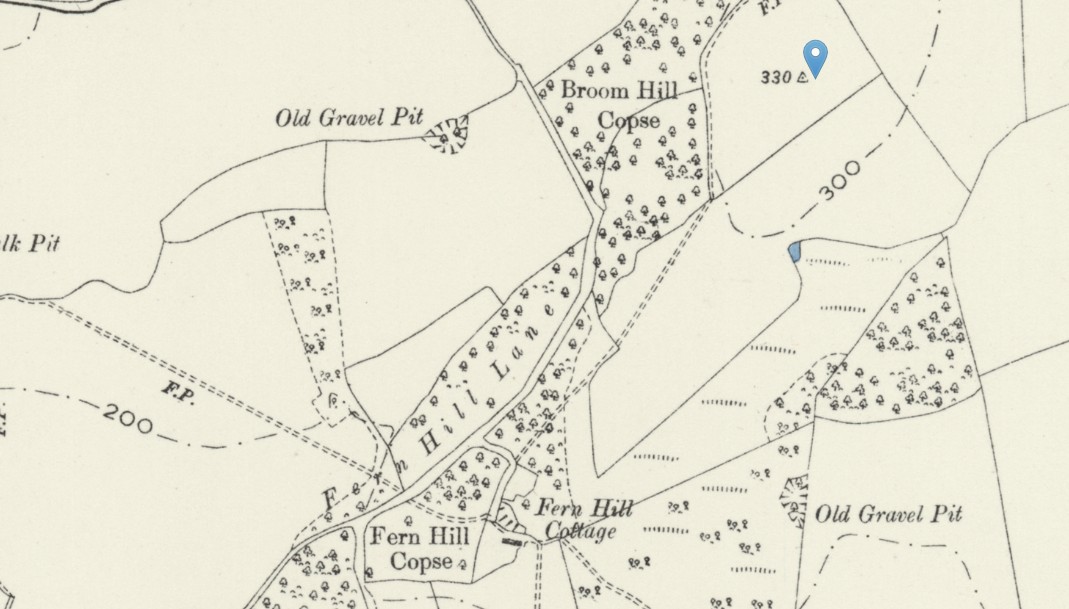 OS 25 Old Map Broom Hill Hampshire - Hampshire & Isle of Wight Sheet XLIX.NW Revised: 1894 to 1895, Published: 1897
Currently, an assumption that Broom Hill is the hill, summit 330 ft, adjacent to Broom Hill Copse.
Open Street Map has the same position annotated as Broom Hill with an elevation of 106m, 348 ft.
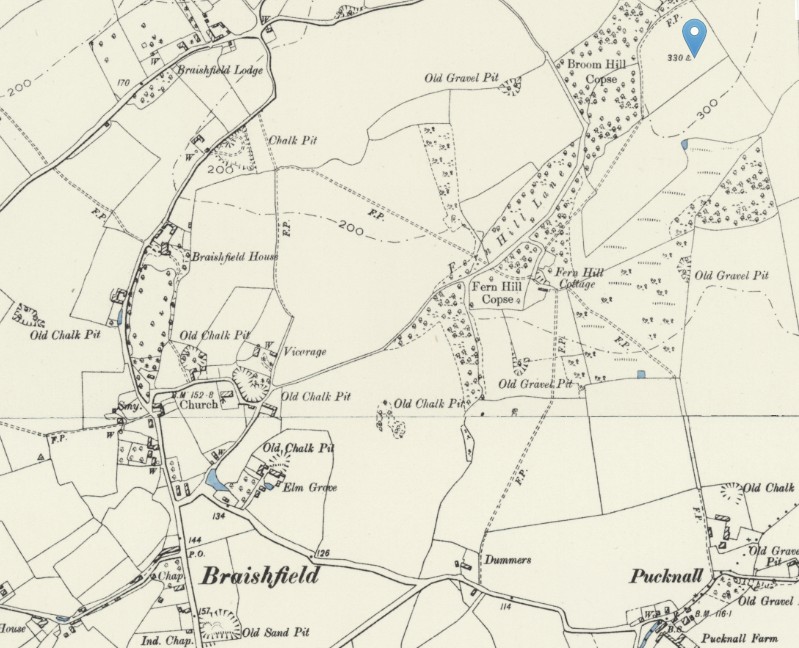
The same map but zoomed out to show Braishfield as well as Broom Hill Copse.
Another article of interest, Buried in time, Broom Hill, Braishfield. How the Broom Hill site was found by an Ordnance Survey, surveyor, and the subsequent excavation and finds.
Radiocarbon dates suggest that it was in use for about two thousand years from 6500 to 4500 BC, making it a Later Mesolithic site.
Prehistoric evidence in Hampshire - Mesolithic
The Hunter Gatherers
Prehistoric evidence in Hampshire - Atlas of Hampshire's Archaeology - Mesolithic
Mesolithic Hampshire 10,000 BC to 4,000 BC
The Mesolithic is characterised by small groups of nomadic hunter gatherers, who moved through the landscape hunting, fishing and gathering wild foods. They would have known their environment and the resources within it intimately and would have moved with the seasons, knowing where to find animals or following the migrating animals, and knowing where different foods were available throughout the year. This way of life leaves little trace in the archaeological record. The Mesolithic sites are frequently identified through the distinctive stone tools, which are generally small, and the small camps and occupation sites that these are associated with.
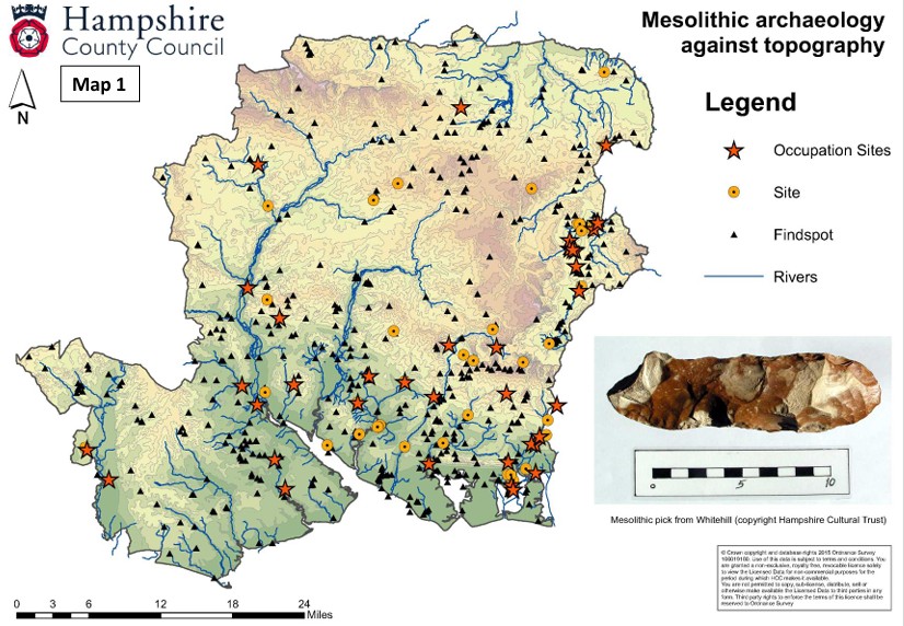
Above and below, Hampshire County Council Map of Mesolithic archaeology extracted from Atlas of Hampshire Archaeology.
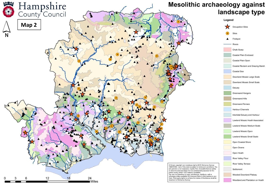
Map 1 and map 2 - These show the distribution of evidence from the Mesolithic, sites and finds, which shows a concentration of activity through the
southern woodland, the central plain, river valleys and the East Hampshire heath. There is a notable spread between the River Wey, the River Loddon and
the top of the River Test. There is a notable lack of evidence across the extensive, arid chalk downs.
An article in Research Gate entitled Resource Assessment The Mesolithic in Hampshire refers mainly to Mesolithic evidence on the grasslands to the East of Hampshire and into Sussex. Also in an article in Hants Filed Club, entitled, MESOLITHIC RESEARCH IN EAST HAMPSHIRE. THE HAMPSHIRE GREENSAND.
Less intensive evidence to the West of Southampton Water. Very sparce in the New Forest and mid and North Hampshire.
Prehistoric evidence in Hampshire - Neolithic
Prehistoric evidence in Hampshire - Atlas of Hampshire's Archaeology - Neolithic
Prehistoric evidence in Hampshire - Bronze Age
Prehistoric evidence in Hampshire - Atlas of Hampshire's Archaeology - Bronze Age
An article in Research Gate entitled Resource Assessment The Mesolithic in Hampshire refers mainly to Mesolithic evidence on the grasslands to the East of Hampshire and into Sussex. Also in an article in Hants Filed Club, entitled, MESOLITHIC RESEARCH IN EAST HAMPSHIRE. THE HAMPSHIRE GREENSAND.
Less intensive evidence to the West of Southampton Water. Very sparce in the New Forest and mid and North Hampshire.
Rural Iron and Roman Age British Village Uncovered
FORDINGBRIDGE, ENGLAND—Cotswold Archaeology announced that a team of their archaeologists uncovered evidence for hundreds of years of intense Iron Age and Roman occupation at a site in Fordingbridge, Hampshire, prior to the construction of a new housing development. The investigation revealed more than 2,000 archaeological features spread across just two acres of a small river terrace, including pits, enclosures, ovens, and trackways. Most notable was the discovery of 15 roundhouses belonging to a previously unknown late Iron Age (first-century a.d.) rural settlement. Each house measured around 40 feet in diameter. Excavations in and around these structures found abundant evidence of domestic activities, including textile production and grain processing. One of the most exciting finds was a complete sandstone quern, or grinding stone, which are rarely, if ever, recovered whole and unbroken. During the later Roman phases, the settlement transformed from a residential site into more of an industrial complex, with evidence of large-scale metalworking and pottery production. To read in-depth about archaeology in southern England, go to "A Dark Age Beacon."
Prehistoric Parish of Eling, Hampshire
Well, approximately where the Parish of Eling would, some considerable time later, become established.
Prehistoric evidence in the Parish of Eling Hampshire
Lets start by establishing the area of Hampshire under consideration. In the South of the County of Hampshire, or Southamptonshire. To the West of the River Test and the town of Southampton. Nearly touching the County of Wiltshire to the North West, in the vicinity of Nomansland and Landford, shown on the map below. The New Forest further West of the parish. Adjoining the upper reaches of Southampton Water. To the South are the villages of Dibden, and Hythe.
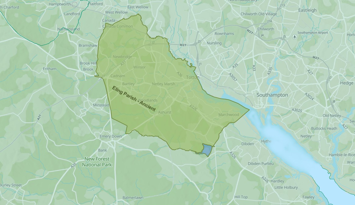
A screenshot of the ESRI map with the superimposed Ancient Parish of Eling from the Story Map in the Overview above. Obviously not Prehistoric, but provides location context.
Prehistoric evidence in the Parish of Eling Hampshire - Mesolithic
Lets start by looking at the information from the Atlas of Hampshire Archaeology, which I have used in the Hampshire section, and zoom in to southern Hampshire. Looking particularly at the area to the left of Southampton and the River Test.
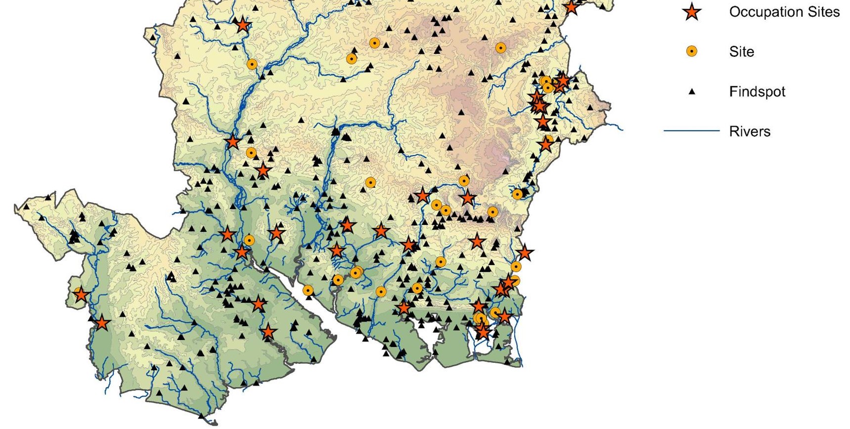
An extract of Hampshire County Council Map of Mesolithic archaeology taken from Atlas of Hampshire Archaeology. Using the previous information about the location of the Parish of Eling, there are three or four occupation sites and approximately 30 findspots.
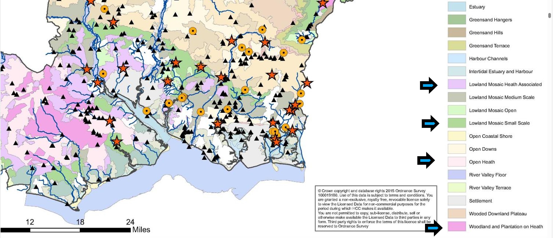
An extract of Hampshire County Council Map of Mesolithic archaeology taken from Atlas of Hampshire Archaeology, with an approximate indication of the later Parish of Eling in blue.
Prehistoric evidence in the Parish of Eling Hampshire - Neolithic
Prehistoric evidence in the Parish of Eling Hampshire - Bronze Age
Money Hills - Barrow Cemetery
Testwood Lakes - Museum
Plaitford Barrow - Round Barrow(s)
Black Bush Plain - Barrow Cemetery
Fritham Butt - Round Barrow(s)
Iron Age - The Celts / Britons
Iron Age - The Celts / Britons
Iron Age evidence in Hampshire - Iron Age
The Iron Age is often considered to be within the Prehistoric otherwise dealt with. However, as this is also the story of The Celts, or Britions as the Romans called them, it deserves separate consideration. The tribes invaded and conquered by the Romans, and also remaining after the Romans left, and went back home.
Iron Age evidence in Hampshire - Atlas of Hampshire's Archaeology - Iron Age
Roman
Roman
From a quick internet search;
Roman evidence in Hampshire
Hampshire is rich in Roman evidence, with several key sites and discoveries that provide insight into the Roman occupation of the region. Here are some notable findings:
- Hamwic: Located near Southampton, this site is no longer intact but is still fascinating for its historical significance.
- Portchester Castle and Silchester: These are two major sites of Roman occupation, with Portchester Castle being particularly notable for its impressive Roman walls.
- Alice Holt and New Forest: Pottery from these areas has been excavated, indicating Roman pottery production.
- Horndean: This site, discovered in 2013, was adjacent to the Portsmouth to London road and revealed Roman ditches and pottery.
- Wickham: Excavations revealed a Roman road, roadside settlement, and wells, indicating a thriving settlement during the later 2nd century AD.
- Fordingbridge: An excavation uncovered a cluster of roundhouses, suggesting a previously unknown settlement of "roundhouses" during the late Iron Age to early Roman period.
These findings highlight the dynamic and significant presence of Romans in Hampshire, with ongoing archaeological research continuing to uncover more about their lives and activities in the region.
Source of some of the above, Tracing connections between Hampshire and our Roman History from Hampshire History
The Wickham reference is from Cotswold Archaeology, and Fordingbridge is both Cotswold Archaeology and Archaeology Magazine
Dark Ages
Darks Ages - Britons / Anglo Saxons / Vikings
Prehistoric
Domesday Book
Pending ...
Before 1600
Pending ...
1600 to 1800
Pending ...
Tithe Apportionment and Map
Tithe Apportionment and Map
Background
The Tithe Commutation Act 1836
An Act for the Commutation of Tithes in England and Wales. - 6 & 7 Will 4 c 71. Royal assent; 13 August 1836
Together with several amendments;
Act amended by Tithe Act 1839 (c. 62), Tithe Act 1842 (c. 54), Tithe Act 1860 (c. 93), Tithe Act 1878 (c. 42), Tithe Act 1891 (c. 8) and Tithe Act 1918 (c. 54)
The Tithe Act, 1936 (26 Geo. V and 1 Edw. VIII. C.43) abolished all tithe rent charges. Responsibility for tithe documents created under the tithe acts (1836, 1837, 1839, 1860, 1891) were placed under the charge of the Master of the Rolls, who has the authority to transfer them to an approved place of deposit. This responsibility is exercised by The National Archives: Historical Manuscripts Commission. The Master of the Rolls has issued Tithe (Copies of Instruments of apportionment) Rules 1960 (SI 1960/2440), as amended by the Tithe (Copies of Instruments of Apportionment) (Amendment) Rules 1963 (SI 1963/977)] concerning the care, custody, access to, and definition of tithe documents.
The start and end of Tithes.
Religion, of many faiths, the Established Church, the Pope, the Governments, and Kings of the time shaped the idea and practice of collecting tithes.
From a simple pious concept of the donation one tenth of your crop to the church, for charity, changed over time and created some very rich churches and some very poor people, and a degree of discontent.
Tithes lasted in England for over a thousand years, partly in goods and latterly as money.
All intertwined with a Norman, with Viking Blood, thinking he was the rightful successor to the English Throne, a Pope who wanted to bring Ireland into the European sphere, or should that read his sphere, and Henry VIII wanting to have a male heir to prolong the Tudor epoch. Little did he know Elizabeth I would be so good at being monarch. Power and politics, over centuries of time.
Splits in the Christian Church
There were three major schisms:
- 1) the one in the 5th century that split eastern Christendom in two;
- 2) the one the 11th century that divided the Latin church and the Byzantine church;
- and 3) the Reformation in the 16th century in which Protestantism arose and split from the Roman Catholic church.
2) On July 16, 1054, Patriarch of Constantinople Michael Cerularius was excommunicated, starting the “Great Schism” that created the two largest denominations in Christianity—the Roman Catholic and Eastern Orthodox faiths.
3) The Reformation — more properly called the Protestant Reformation or the European Reformation — was a 16th-century religious and political uprising against the authority of the Pope that led to was a schism in Western Christianity. It was initiated by Martin Luther with the publication of the “Ninety-five Theses” in 1517 and continued by Huldrych Zwingli, John Calvin and other Protestant Reformers. The Reformation triggered the bloody the Counter-Reformation, which sucked in much of Europe, and lasted until the end of the Thirty Years' War in 1648. The Reformation led to the division of Western Christianity into different denominations such Catholic, Lutheran, Reformed, Anglican, Anabaptist and Unitarian. The Eastern Orthodox Christian church had split off in 1054.
The Reformation began as theological debate over real and perceived Church corruption. Early dissenters included John Wycliffe (1320-84) in England, and john Huss (burned as a heretic in 1415) in Bohemia. Martin Luther was from Germany. Other major players in the Reformation were Huldrych Zwingli of Zurich, John Calvin of Geneva and King Henry VIII of England
The Reformation was aided by the invigorated intellectual freedom of the Renaissance and spirit of nationalism in England, France, Germany and Bohemia. In the 16th century the church was corrupt and blemished by greedy clergy and decadent monks, extracting financial burdens from the laity to pay for their indulgences and ambitions. The General Councils of 15th century failed to reform he church. After the Reformation the power of the Catholic Church was greatly weakened
What is the relevance of these splits? The divisions within the Christian Church have in part contributed to the discontent leading to the Tithe Wars and the subsequent Tithe Commutation Act. The Act led to the creation of very useful set of documents for Family Historians, with information about people, places, and land usage.
Feudal system
A copy of some text from the ESRI Story Map of Whiteparish One Place Study
The feudal system and the Domesday Book
The feudal system was a way of organising society into different groups based on their roles. It had the king at the top with all of the control, and the peasants at the bottom doing all of the work.
How did the feudal system start?
The results created what's known as the Domesday Book. It actually described a wide range of ways in which people used the land, but historians suggested that it had a basic structure:
- King – owned all the land.
- Barons – the king gave some land to the barons in return for money and men for the army.
- Knights – the barons gave some of their land to the knights if they promised to fight when needed.
- Peasants – the knights gave a few strips of land to the peasants and the peasants had to share their produce with them. They were not allowed to leave and were not free men
In the Middle Ages, anyone who was higher up in this system than you was a 'lord' and of course the monarch had no one above them. What kept the system working was loyalty. Stay loyal and keep the land and wealth. Fail and your income was taken from you by your lord.
Centuries later the system was not hugely different and Tithes came into play.
Tithes were originally a tax which required one tenth of all agricultural produce to be paid annually to support the local church and clergy. After the Reformation much land passed from the Church to lay owners who inherited entitlement to receive tithes, along with the land.
The Tithe Acts of 1836 and 1936 abolished the old system, but two hundred years ago tithes were engraved upon the lives of the entire population: a source of income, luxury and avarice for the privileged; a tax at 2s
Before Tithes
Fifteenths and tenths, 1334
FIFTEENTHS AND TENTHS: QUOTAS OF 1334
'Fifteenths and tenths, 1334', in A History of the County of Wiltshire: Volume 4, ed. Elizabeth Crittall (London, 1959), pp. 294-303. British History Online http://www.british-history.ac.uk/vch/wilts/vol4/pp294-303 [accessed 24 June 2021].
By the last quarter of the 13th century Englishmen had become familiar with a system of tax assessment which took no account of such old-fashioned assessments of wealth as hides or knight's fees. This new system of assessment was based on a valuation of certain personal property, usually described by the vague word 'movables'. Of this value Parliament had granted the king a fraction: the fraction itself varied from grant to grant but in each grant a greater fraction was levied on cities, towns, and royal demesne than on other areas. Thus in 1332 the townsman found himself contributing a tenth of his assessed movables but the countryman only a fifteenth. In addition there were some categories of goods which the collectors were instructed to ignore, and as a result the statistics from the collections deal only with those Englishmen and women who were wealthy enough to fall under the scrutiny of the local assessors. It is rather like an iceberg the size of whose submerged depths is unknown. In addition there was probably evasion and under-assessment everywhere.
Frustfield Hundred 274s.
- Abbotstone (in Whiteparish);50s 0d
- Alderstone (in Whiteparish);13s 4d
- Cowesfield (in Whiteparish);100s 0d
- Landford; 66s 8d
- Whelpley (in Whiteparish); 44s 0d
Whiteparish does not appear as a separate settlement in 1334, assuming that the (in Whiteparish) is a later addition when the table was constructed from the original data.
Tithe background
Tithe background
From Wikipedia, extracts from articles about Tithes and Tithe Commutation
A tithe (/taɪð/; from Old English: teogoþa "tenth") is a one-tenth part of something, paid as a contribution to a religious organization or compulsory tax to government.
Church collection of religious offerings and taxes - England and Wales
The right to receive tithes was granted to the English churches by King Ethelwulf in 855. The Saladin tithe was a royal tax, but assessed using ecclesiastical boundaries, in 1188. The legal validity of the tithe system was affirmed under the Statute of Westminster of 1285. The Dissolution of the Monasteries led to the transfer of many rights to tithe to secular landowners and the Crown – and tithes could be extinguished until 1577 under an Act of the 37th year of Henry VIII's reign. Adam Smith criticized the system in The Wealth of Nations (1776), arguing that a fixed rent would encourage peasants to work far more efficiently.
The system gradually ended with the Tithe Commutation Act 1836, whose long-lasting Tithe Commission replaced them with a commutation payment, land award and/or rentcharges to those paying the commutation payment and took the opportunity to map out (apportion) residual chancel repair liability where the rectory had been appropriated during the medieval period by a religious house or college. Its records give a snapshot of land ownership in most parishes, the Tithe Files, are a socio-economic history resource. The rolled-up payment of several years' tithe would be divided between the tithe-owners as at the date of their extinction.
This commutation reduced problems to the ultimate payers by effectively folding tithes in with rents however, it could cause transitional money supply problems by raising the transaction demand for money. Later the decline of large landowners led tenants to become freeholders and again have to pay directly; this also led to renewed objections of principle by non-Anglicans.[39] It also kept intact a system of chancel repair liability affecting the minority of parishes where the rectory had been lay-appropriated. The precise land affected in such places hinged on the content of documents such as the content of deeds of merger and apportionment maps.
Tithe redemption
Rent charges in lieu of abolished English tithes paid by landowners were converted by a public outlay of money under the Tithe Act 1936 into annuities paid to the state through the Tithe Redemption Commission. Such payments were transferred in 1960 to the Board of Inland Revenue, and those remaining were terminated by the Finance Act 1977.
The Tithe Act 1951 established the compulsory redemption of English tithes by landowners where the annual amounts payable were less than £1, so abolishing the bureaucracy and costs of collecting small sums of money.
Ireland
From the English Reformation in the 16th century, most Irish people chose to remain Roman Catholic and had by now to pay tithes valued at about 10 per cent of an area's agricultural produce, to maintain and fund the established state church, the Anglican Church of Ireland, to which only a small minority of the population converted. Irish Presbyterians and other minorities like the Quakers and Jews were in the same situation.
The collection of tithes was resisted in the period 1831–36, known as the Tithe War. Thereafter, tithes were reduced and added to rents with the passing of the Tithe Commutation Act in 1836. With the disestablishment of the Church of Ireland by the Irish Church Act 1869, tithes were abolished.
Tithe War
The Tithe War (Irish: Cogadh na nDeachúna) was a campaign of mainly nonviolent civil disobedience, punctuated by sporadic violent episodes, in Ireland between 1830 and 1836 in reaction to the enforcement of tithes on the Roman Catholic majority for the upkeep of the established state church, the Church of Ireland. Tithes were payable in cash or kind and payment was compulsory, irrespective of an individual's religious adherence.
Tithe payment was an obligation on those working the land to pay ten per cent of the value of certain types of agricultural produce for the upkeep of the clergy and maintenance of the assets of the church. After the Reformation in Ireland of the 16th century, the assets of the church were allocated by King Henry VIII to the new established church. The majority in Ireland who remained loyal to the old religion were then obliged to make tithe payments which were directed away from their own church to the reformed one. This increased the financial burden on subsistence farmers, many of whom were at the same time making voluntary contributions to the construction or purchase of new premises to provide Roman Catholic places of worship. The new established church was supported by only a minority of the population, seventy-five percent of whom continued to adhere to Roman Catholicism.
Emancipation for Roman Catholics was promised by Pitt during the campaign in favour of the Act of Union of 1801 which was approved by the Irish Parliament, thus abolishing itself and creating the United Kingdom of Great Britain and Ireland. However, King George III refused to keep Pitt's promises. It was not until 1829 that the Duke of Wellington's government promoted and parliament enacted the Roman Catholic Emancipation Act, in the teeth of defiant royal opposition from King George IV.
But the obligation to pay tithes to the Church of Ireland remained, causing much resentment. Roman Catholic clerical establishments in Ireland had refused government offers of tithe-sharing with the established church, fearing that British government regulation and control would come with acceptance of such money.
(British rule in Ireland began with the Anglo-Norman invasion of Ireland in 1169. Most of Ireland gained independence from Great Britain following the Anglo-Irish War as a Dominion called the Irish Free State in 1922, and became a fully independent republic following the passage of the Republic of Ireland Act in 1949. The papal bull Laudabiliter of Pope Adrian IV was issued in 1155. It granted the Angevin King Henry II of England the title Dominus Hibernae (Latin for "Lord of Ireland"). Laudabiliter authorised the king to invade Ireland, to bring the country into the European sphere. In return, Henry was required to remit a penny per hearth of the tax roll to the Pope. This was reconfirmed by Adrian's successor Pope Alexander III in 1172. When Pope Clement VII excommunicated the king of England, Henry VIII, in 1533, the constitutional position of the lordship in Ireland became uncertain. Henry had broken away from the Holy See and declared himself the head of the Church in England. He had petitioned Rome to procure an annulment of his marriage to Catherine of Aragon. Clement VII refused Henry's request and Henry subsequently refused to recognise the Roman Catholic Church's vestigial sovereignty over Ireland, and was excommunicated again in late 1538 by Pope Paul III. The Treason Act (Ireland) 1537 was passed to counteract this.
The Lordship of Ireland (Irish: Tiarnas na hÉireann), sometimes referred to retroactively as Norman Ireland, was the part of Ireland ruled by the King of England (styled as "Lord of Ireland") and controlled by loyal Anglo-Norman lords between 1177 and 1542. The lordship was created following the Norman invasion of Ireland in 1169–1171. It was a papal fief, granted to the Plantagenet kings of England by the Holy See, via Laudabiliter. As the lord of Ireland was also the king of England, he was represented locally by a governor, variously known as justiciar, lieutenant, or lord deputy.
The kings of England claimed lordship over the whole island, but in reality the king's rule only ever extended to parts of the island. The rest of the island—known as Gaelic Ireland—remained under the control of various Gaelic Irish kingdoms or chiefdoms, who were often at war with the Anglo-Normans.
The area under English rule and law grew and shrank over time, and reached its greatest extent in the late 13th and early 14th centuries. The lordship then went into decline, brought on by its invasion by Scotland in 1315–18, the Great Famine of 1315–17, and the Black Death of the 1340s. The fluid political situation and Norman feudal system allowed a great deal of autonomy for the Anglo-Norman lords in Ireland, who carved out earldoms for themselves and had almost as much authority as some of the native Gaelic kings. Some Anglo-Normans became Gaelicised and rebelled against the English administration. The English attempted to curb this by passing the Statutes of Kilkenny (1366), which forbade English settlers from taking up Irish law, language, custom and dress. The period ended with the creation of the Kingdom of Ireland in 1542.)
The Kingdom of Ireland (Classical Irish: an Ríoghacht Éireann; Modern Irish: an Ríocht Éireann, pronounced [ənˠ ˌɾˠiːxt̪ˠ ˈeːɾʲən̪ˠ]) was a monarchy on the island of Ireland that was a client state of the Kingdom of England and then of Great Britain. It existed from 1542 until 1800. It was ruled by the monarchs of England and then the monarchs of Great Britain. The kingdom was administered from Dublin Castle by a viceroy appointed by the English king — the Lord Deputy of Ireland. A Parliament of Ireland, composed of Anglo-Irish and native nobles, was created. From 1661-1801, the administration controlled an army. A Protestant state church — the Church of Ireland — was established. Although styled a kingdom, for most of its history it was, de facto, an English dependency.
The Protestant Ascendancy, meeting in their Parliament of Ireland, passed the Acts of Union 1800 which abolished both the parliament itself and the kingdom.[5] The act was also passed by the Parliament of Great Britain. On the first day of 1801, a new state — the United Kingdom of Great Britain and Ireland — was established which united the parliaments of Ireland and of Great Britain into a single legislature — the Parliament of the United Kingdom.)
Scotland
In Scotland teinds were the tenths of certain produce of the land appropriated to the maintenance of the Church and clergy. At the Reformation most of the Church property was acquired by the Crown, nobles and landowners. In 1567 the Privy Council of Scotland provided that a third of the revenues of lands should be applied to paying the clergy of the reformed Church of Scotland. In 1925 the system was recast by statute and provision was made for the standardisation of stipends at a fixed value in money. The Court of Session acted as the Teind Court. Teinds were finally abolished by section 56 of the Abolition of Feudal Tenure etc. (Scotland) Act 2000.
Tithe Commutation History
Tithe Commutation History
The extract below is from the The National Library of Wales. The same applied to England.
What Were Tithes?
Tithes were payments made from early times for the support of the parish church and its clergy. Originally these payments were made in kind (crops, wool, milk, young stock, etc.) and usually represented a tenth (tithe) of the yearly production of cultivation or stock rearing.
There were 3 types of tithe:
- Predial tithes were the products of crop husbandry - such as grain, woodland, and vegetables
- Mixed tithes were the products of animal husbandry - such as calves, lambs, wool and milk.
- Personal tithes were the profits of man's labour - such as fishing or milling (and largely insignificant after 1549).
It is more usual to refer to tithes as ‘Great Tithes’ and ‘Small Tithes’. The great tithes, also known as the ’rectorial tithes’, were payable to the rector and generally comprised the predial tithes of corn, grain, hay and wood while the small tithes, also known as the ‘vicarial tithes’, were payable to the vicar and comprised all other tithes
The ownership of the tithe was a property right that could be bought and sold, leased or mortgaged, or assigned to others. This resulted in many of the rectorial tithes passing into lay hands - particularly after the dissolution of the monasteries. These tithes then became the personal property of the new owners, or lay impropriators. After the sale of the tithes forfeited to the Crown in the 1530s, about 22.8% of the net value of tithes in Wales were held by lay impropriatorsat the time of commutation in 1836. A vicar usually continued to have the spiritual care of the parish and to receive the vicarial tithes.
From early times money payments had begun to be substituted for payments in kind. Fixed sums (moduses) were substituted for some categories of production, particularly for livestock and perishable produce; while adjustable payments known as compositions, which were sometimes assessed annually, were increasingly being substituted in local arrangements in latter years.
The National Archives holds a similar text as a guide, however, it was archived in 2015. Below is an extract from the archived version, just in case it disappears. The current version is In The National Archives Research Guides
The history of tithes
Originally, tithes were payments in kind (crops, wool, milk etc.) comprising an agreed proportion of the yearly profits from farming, and made by parishioners for the support of their parish church and its clergy. In theory, tithes were payable on
(i) all things arising from the ground and subject to annual increase - grain, wood, vegetables etc.;
(ii) all things nourished by the ground - the young of cattle, sheep etc., and animal produce such as milk, eggs and wool; and
(iii) the produce of man's labour, particularly the profits from mills and fishing.
Such tithes were termed respectively predial, mixed and personal tithes. Tithes were also divided into great and small tithes; generally speaking, corn, grain, hay and wood were considered great tithes, and all other predial tithes together with all mixed and personal tithes were classed as small tithes. It was common, but by no means universal, for the great tithes to be payable to the rector and the small tithes to the vicar of the parish.
During the dissolution of the monasteries, much church land - and in many cases also the accompanying rectorial tithes - passed into lay ownership. These tithes became the personal property of the new owners or lay impropriators. Usually a vicar continued to have spiritual oversight of the parish and to receive its vicarial tithes.
From early times money payments began to be substituted for payments in kind, a tendency further stimulated by enclosures, particularly the parliamentary enclosures of the late18th century. Enclosures were often made in order to improve the land and its yield, and had they proceeded without some arrangements respecting tithes, the rectors, vicars and lay owners of the tithes would have received an automatically increased income, as indeed they did when cultivation was improved without preliminary enclosure. One object of the Enclosure Acts was to get rid of the obligation to pay tithes. This could be done in one of two ways: by the allotment of land in lieu of tithes, or by the substitution either of a fixed money payment or of one which varied with the price of corn (hence the name corn rents applied to payments in lieu of tithes). The limits of the land allotted, or of the land charged with a money payment, were generally shown on a map attached to the Enclosure Award.
Tithe commutation from 1836
Statutory enclosure was a purely local affair, prompted by local landowners. Although much of the country was covered, in 1836 tithes were still payable in the majority of parishes in England and Wales. Scotland and Ireland have a different history: the Acts cited in this research guide did not apply there. In 1836, the government decided to commute tithes (i.e. to substitute money payments for payments in kind) throughout the country. The Bill received Royal Assent on 13 August 1836; three Tithe Commissioners were appointed, and the process of commutation began. Although the Tithe Act 1836 (6 & 7 Will IV, c.71) is a long and complicated piece of legislation, the underlying principle was the simple one of substituting for the payment of tithes in kind corn rents of the same sort as were already payable in many parishes under the authority of a local Enclosure Act. These new corn rents, known as tithe rentcharges, were not subject to local variation, but varied according to the price of corn calculated on a septennial average for the whole country. Existing corn rents were left unaffected: they continued to be paid according to the varied provisions of the local Acts which created them.
The first task of the Commissioners was to discover to what extent commutation had already taken place. Enquiries were directed to every parish or township listed in the census returns.
The initial process in the commutation of tithes in a parish was an agreement between the tithe-owners and landowners or, in default of agreement, an award by the Tithe Commissioners. Generally the next stage was the apportionment of payments, and the substance of the preceding agreement or award was then recited in the preamble of the instrument of apportionment.
Tithe maps
The Tithe Maps are by no means as uniform as the apportionments (see Section 6), varying greatly in scale, accuracy and size. At the outset, the Tithe Commissioners had attempted to secure a uniform and high standard. However in most cases there was no suitable map already in existence, and while there were many skilled land surveyors available, the expense of any new survey had to be met by the landowners. Insistence upon a fixed standard would have retarded the progress of commutation, so concessions therefore had to be made. When the 1836 Act was amended in the following year, a provision was inserted to the effect that, whilst every tithe map should be signed by the Commissioners, a map or plan should not be deemed evidence of the quantity of the land, or treated as accurate, unless it was sealed as well as signed by the Commissioners (Tithe Act 1837, s.1). Approximately 1,900 only of the tithe maps - about one-sixth of the whole - were sealed by the Tithe Commissioners, and it is these alone - called first-class maps - which can be accepted as accurate. The unsealed (or second-class) maps constitute a very mixed collection - indeed, some are little more than topographical sketches.
In many cases, discrepancies between apportionment and map subsequently created difficulties in the administration of payments and redemptions. At the time of the survey, when all the landowners concerned were well acquainted with the ground, the exact area of a piece of land or its precise delineation on a map might have appeared of little significance. The matter assumed more importance as time went on, particularly when readily-identifiable tithe areas vanished as a result of later developments. It is unnecessary to discuss in detail the problems of interpreting a tithe map; but it is well to bear in mind that reliance cannot be placed upon the area of individual tithe areas stated in an apportionment or computed from the tithe map, unless the map is sealed.
The numbers of the tithe areas on the map correspond to those in the schedules to the apportionment. These numbers are not consecutive.
Back to the The National Library of Wales.
The tithe maps
The accuracy of the maps depended on the skill of the local surveyors employed on the task. More than 200 different surveyors worked in Wales.
The first specification (British Parliamentary Papers, Session 1837, Vol. XLI 405) for the mapping proved to be over-ambitious. This was drawn up by one of the Assistant Commissioners, Lieutenant R K Dawson of the Ordnance Survey, and was intended to be at the scale of 3 chains to the inch (1:2,376) with a standardised set of symbols.
Unfortunately, this was not adopted, because the landowners had to pay the costs of the survey and many were unwilling, especially if they already had estate plans that could do the job.
Amending legislation had to be passed in 1837 permitting the presentation of less accurate maps, often on a smaller scale. Many of these maps were compiled from existing estate maps and involved very little new surveying.
Those maps that met the standard were calledfirst-class plans and received a seal from the Tithe Commissioners. The Tithe Commissioners refused their seal to inferior plans.
In Wales only 50 of 1,091 were sealed as first-class maps, mostly for Districts in Monmouthshire or Breconshire. The remainder were simply certified as being the documents on which the tithe rent-charge apportionment was based.
These second-class maps vary in scale and quality; there are some at the prescribed scale of 3 chains to the inch which for some reason were not sealed as first-class maps; while others are little more than topographical sketches and of no value for information about property boundaries, e.g. Llangeitho, Cardiganshire (1:7,920) and Nantglyn, Denbighshire (1:21,120). Some maps were simply enlargements of the Ordnance Survey One-inch maps.
How I make use of Tithe Apportionment and Maps
How I make use of Tithe Apportionment and Maps
This is both sharing with you the reader and helping me with some notes regarding the process for Tithe Apportionment articles, dataset, and ESRI Story Maps.
This hopes to provide a useful and consistent layout and content, which I suspect would be most beneficial in the collection of Tithe Apportionment articles.
Guide to Tithe Apportionment and Maps transcription and use
Guide to Tithe Apportionment and Maps transcription and use
The first part of this is to record the process of how I create information out of the historic data, followed by what I subsequently do with that information.
The end goal is to create sharable information for Family Historians and for myself. My choice of Parishes is reflective of my own Family Tree and the location of key ancestors in the period that the Surveys and Agreements were undertaken, about the 1840's
Introduction
Introduction
This element is fundamentally a guide for the transcription of the Tithe Allocation document and to the use of the associated spreadsheet.
The sections equate to the different tabs in the spreadsheet and the subsequent results in the associated webpage.
The sections also follow the process of creating the dataset.
Spreadsheet tables have a mix of direct entry, calculated fields, looked up data, and checking fields. Sometimes there is a colour bar above the titles to aid identifying the type of cells or fields in the column.
Generally the;-
- Direct entry are shown in a shade of blue, with light blue being the first pass of data entry.
- Calculating fields are headed with a yellow bar.
- Looked up data, i.e. information from other tables linked to this data, are headed with a brown bar.
- Checking fields, primarily to check data consistency, are headed with a red bar.
Creating the Dataset
Creating the Dataset
The original schedule is hand written on paper. Scans of those paper pages have been made. Fortunately, most of the handwriting is a lot easier to read that mine.
The images from those scans are available form the Hampshire Record Office and The Genealogist. The former also holds the original documents which can also be viewed by arrangement.
Analog images are very interesting but the data needs to be digitised to allow it to be readily accessed and interrogated.
Transcription from the scans is not very difficult, the handwriting is generally very legible, but is time consuming.
Key to creating the dataset is to have somewhere to put it, in an organised structured nature, which can subsequently be easily interrogated and analysed, producing reliable, meaningful, consistent, and repeatably results.
Primary Data
Creating the Dataset - Primary Data
Spreadsheet tab - Prime Data.
A form cell entry, not a table.
Most of the Primary Date will be found within or near the Agreement at the front of the Tithe Apportionment. There are also some checks back to the other parts of the spreadsheet but obviously these will not be correct until all of the other data is input and all the links refreshed.
There is a possibility that the total area stated in the Agreement is not the same as the sum of the parts elsewhere in the Agreement. The spreadsheet checks if the two match, however, if it shows a variance all that can be done is to check the input and transcription, and if they are correct, accept the historic variance.
Find the data and fill in the form accordingly.
Summary
Creating the Dataset - Summary
Spreadsheet tab - Names of L and O.
A table where each row is a record, and each cell in that row is a field, or element of that record.
Find the Summary on the Tithe Apportionment, sometimes after the Schedule. It has a list of all the names and the total quantity of land and total rentcharge for each combination of Land owner and Occupier, and occasionally with an addition of Lessor, with Lessee as Land owner.
The first pass is only to capture the names of those people found in the Summary, ignoring the quantity and rentcharge columns.
Go to the tab 'Names of L and O' which is for Names of Landowner and Occupier. From the Summary enter, in the first three columns, the persons' name, normalised if necessary to given names followed by Surname. Suffix such as Esquire or & another, or & others are inserted in the second column, named appropriately. Part of the tab's calculation area finds the surname form the name and another part strips out any remaining underscores, "_". The third column is to indicate the category, such as Land owner or Occupier, or both, using the dropdown.
Entries such as Herself and Himself are transcribed as the persons name to facilitate separate record analysis.
Also Biddlecomb Widow and the like are transcribed Widow Biddlecome for consistent interpretation. Sad to think that there was a time that a woman was so much the wife of a man, that even on official documentation, they did not have a name, just that they were the Widow of that man.
On a paper copy it is implied that a list continues with the landowner, with multiple occupiers until the next landowner is written in. We are creating a dataset as well as a transcription so each record, or row, needs all of the information, not just a blank, ditto, or ". The name therefore needs to be copied down to all appropriate rows. The same applies to the Lessor if there is one.
Other columns in the tab are not relevant at this time and include data for cross-referencing between the Tithe listed people and my TNG database and the Census data.
Spreadsheet tab - Summary.
A table where each row is a record, and each cell in that row is a field, or element of that record.
The next step is to repeat the process on the tab 'Summary' but including the total quantity of land and total rentcharge this time. Yes, this is duplication of effort, but it is done to improve accuracy by double typing, The totals are also used to check the entries of the Schedule.
In the numerical fields, blanks can be left or leading zeros, up to the first number. However intermediate blanks must be replaced with a zero. I.e. ¦ " ¦ " ¦ 2 can be ¦ ¦ ¦ 2 ¦ but ¦ 4 ¦ " ¦ 8 ¦ has to be ¦ 4 ¦ 0 ¦ 8 ¦ .
At the end of the first page there is probably a total. In a column to the right headed page, input the page or image number and drag it down to cover all the entries for that page. Going back to the values input columns, and then curser down to the bottom. Use the page number to select the relevant information, or use the filter to select the page if that does not work. If all the selections are working, the total written in the Summary and that calculated on the spreadsheet should be correct. If they are not, check and recheck the transcription.
It is easier to do checks progressively, one page at a time, instead of waiting to do the check at the end and then trying to find what page the error is on followed by doing the same check as above for the page.
If it does tally correctly, proceed to the next page and continue. The checks would not highlight compensatory errors, but further checks happen latter.
At the end of the Summary there are totals for area and monies. The spreadsheet should correlate with the historic document.
Return to the Primary Data tab and add the Area Total, Acres, R, P after the names of the Tithe Commissioners.
Repeat with the Monetary Values for both Rent Charges.
The checks inspect the input against the same information on the historical documents.
There are some tabs on the spreadsheet that use the Summary as source. PT is for Pivot Table in these instances. The tabs are 'PT Summary Area Rent', 'PT Summary V Rent', 'PT Summary IM Rent', and 'PT Summary Area'.
Schedule
Creating the Dataset - Schedule
Spreadsheet tab - Plot registry.
A table where each row is a record, and each cell in that row is a field, or element of that record.
The Schedule has all the detailed data at the all important plot level.
Landowners and Occupiers and Numbers referring to the Plan
The plot number is the first entry, that is simple enough.
The next field only applies to some Schedules, where there is a Leasor at the top of the page. Which in turn renders what would normally be Landowner to become Leasee Landowner.
(Leasee Landowner) Landowner and Occupier are the next fields, which can either be by direct typing or by using the dropdowns which are fuelled by the data filled in 'Names of L and O' tab.
Name and Description of Lands and Premises and State of Cultivation
Lands and premises field is a copy of the schedule column Name and Description of Lands and Premises. This is a typing field. Sometimes there is very useful information in this field with names that can still be found on current or older maps. Other times it is a little sparse.
The State of Cultivation on the schedule is interested in land use to establish the Tithe. For those elements it is just typing into the column of the same name. However, I am also interested in other land use. Using the Description of Lands and Premises I make and assessment of the alternative usages, generally into one or more of the following usages.
| Name and Description of Land and Premises | State of Cultivation |
|---|---|
| House and Garden | {Residence} |
| Cottage and Garden | {Residence} |
| Yard and Buildings | {Premises} |
| Farm Yard and Buildings | {Premises} |
| Blacksmiths Shop | {Retail} |
| Willow Bed and Water | {Water} |
| Roadway | {Road} |
| Waste | {Waste} |
| Chapel | {Church} |
| Common | {Common} |
| Pleasure Gardens | {Pleasure Gardens} |
| Orchard | {Orchard} |
| Plantation | {Plantation} |
| House, Blacksmith's Shop, and Garden | {{Residence}{Retail}} |
| ??? Inn and Garden | {{Residence}{Retail}} |
| House, Blacksmith's Shop, Buildings, Garden, and Yard | {{Residence}{Retail}{Premises}} |
| House and Pleasure Garden | {{Residence}{Pleasure Gardens}} |
| Mansion House, and Pleasure Gardens | {{Residence}{Pleasure Gardens}} |
| Mansion House, Buildings, and Pleasure Gardens | {{Residence}{Pleasure Gardens}{Premises}} |
The new categories of use are enclosed in braces { } to distinguish the entry apart form the transcription. Multiple uses are allocated any combination of the new categories, enclosed in a further set of braces {{ }{ }}, although avoid {{ a }{ b }} and {{ b }{ a }} as this will just collate as two entries when it is only one.
I should point out at this point that in my opinion the description 'Garden' is not how we would construe the term today. Today we might think of a front or back garden with perhaps flowers and a lawn, laid out to look good. With some of the front gardens converted as somewhere to park cars. I suspect that in 1800's 'Garden' was more akin to market garden or vegetable patch.
| Aside |
Following the end of the war in the 1940's, 50's and 60's the UK went on something of a building spree, with thousands of council houses being built. Part replacing bombed out buildings and part slum clearance. I was brought up in my early years in one such house. I recall reading somewhere that a lot of council houses built then had relatively large gardens to facilitate home production, farming on a small scale. These micro farms may have included animals, a pig, or some chickens, but mainly fruit and vegetables. A continuation of the wartime make do and carry on, self reliance. Times have changed, and as a society we moved away from grow your own, so the gardens have become more about flowers and lawns. We could be at the beginning of a move towards a return to grow your own. See Also Historic England on Post War council housing estates
|
Quantities in Statute Measure
In the numerical fields, blanks can be left or leading zeros, up to the first number. However intermediate blanks must be replaced with a zero. I.e. ¦ " ¦ " ¦ 2 can be ¦ ¦ ¦ 2 ¦ but ¦ 4 ¦ " ¦ 8 ¦ has to be ¦ 4 ¦ 0 ¦ 8 ¦ .
The area of the plot numbers are ¦ A. ¦ R. ¦ P. ¦ meaning Acre, Rood (Rod), and Perch. With 40 perch to a rood and 4 rood to the acre.
| Aside |
One Acre is the area that could be ploughed by a team of eight oxen in one day. Measuring land for ownership (and taxation) is a very ancient concept, as is the word ‘acre’, which occurs in many old languages and translates as ‘open field’. The area thus described was originally a strip of land (a long furrow, which gave rise to the word furlong, an old measurement of length) that a ploughman and his yoke of two oxen could turn over in an average day’s work – a strip being easier to plough than a square, as there were fewer turning points required. Acres. Later an acre was more accurately measured as an area which is equivalent to 10 chains by one chain. A chain is now standardised as 66 feet (20.18 m), so the actual area covered by an acre is 660 feet by 66 feet, which (to save you the maths) converts to near enough 4,048 square metres. To visualise this, a professional football (soccer) field covers an area of two acres, so one team’s half is an acre. Thus a hectare, which is approximately 2 1⁄2 acres, takes up both halves of the playing area, plus the land around it between players and spectators. Roods & perches. These are subdivisions of an acre. There are four roods in an acre, and in turn a rood contains 40 perches. As a rood is a quarter of an acre, it contains 1.012 square metres – about the size of two tennis courts. Each of the 40 perches in a rood thus consists of just over 25 square metres – the size of one of the net-side playing areas of the tennis court. One chain is also the distance between wickets on a cricket pitch. The chain (abbreviated ch) is a unit of length equal to 66 feet (22 yards), used in both the US customary and Imperial unit systems. It is subdivided into 100 links. There are 10 chains in a furlong, and 80 chains in one statute mile. In metric terms, it is 20.1168 m long.
|
Each plot has an area measurement and therefore an entry under Quantities in Statute Measure. However, not every plot has an entry under rent-charge.
Amount of Rent-Charge apportioned upon the several Lands, and Payable to the Vicar / Rector / Impropriator
There are now two groups of columns, one group regarding the rent-charge payable to the vicar, and the other to the Impropriator.
Each group separated into ¦ £. ¦ s. ¦ d. ¦. £ s d being Pounds, shillings, and pence. With 12 pence to the shilling and 20 shillings to the pound. If you are of a certain age you will be able to add up the values easily.
Sometimes the Tithe Apportionment pro-forma only has one group of rent-charge, as is the case with Nursling, with the charge payable to the Rector. I don't think it makes much difference but I have decided to record the entries for the Rector under the columns for Impropriator. I will hide the columns for the vicar for the time being to aid filling in the data.
Applies to both Quantities in Statute Measure and Rent-Charge
Where there is one Landowner and one occupier for a single plot there is a single entry for each such set.
Where a Landowner has a number of occupiers across numerous plots, there might be a subtitle for that landowner. In such a case add a sub-subtitle into the column headed Sub title info. The numbers entered adjacent to such annotations are treated differently in the totals calculations to avoid double counting. Adding the sub totals in this way should allow the entered data to look similar to the original document. Which should allow better visual checking of data entry.
At the end of the each page there may be a total. This would be annotated sub-total.
If there is a total at the end of the page set the filters to that page and filter out the sub-subtotals and the subtotal annotations in the column headed Sub title info,and the totals displayed should equal those shown on the original document. If not firstly check for the correct page designations, and filter settings. Then check the entries. Then check the entries again. If after all these checks there is still a variance, check the arithmetic on the original document.
Whatever the outcome of the checks, transcribe the document as it is, and make a note in the notes column of the variance and suspected cause. So if the Tithe Apportionment has the rent-charge sub-total of £ 3 5s 10p but it should have totaled £ 3 6s 10p write the original £ 3 5s 10p and note the 1s variance. Expect that variance to show up again in the totals.
Obviously, if the error is found to be an incorrect transcription/data entry then that is corrected. A 3 looks like and 8, but the totals confirm that it was a 3, go back and change it from a 8 to a 3.
The same applies to the sub-subtotals as you work your way down the page. You can either use the filtering method or hone your arithmetic skills other than decimal, with 40, 4, and 12, and 20, being the shift to the next column.
If you do use the filtering method, there is a yellow box under the data input area of the table which does the arithmetic for you. But don't forget to either filter out the sub-subtotals or do it before entering the data, otherwise you will get incorrect totals. A reminder, this procedure is to check your data entry, not the Tithe Apportionment arithmetic.
In some instances the occupier or landowner may be split across more than one page with the use of 'carry forward' and 'brought forward'. I have not created a mechanism for dealing with this as it is not required in a continuous record set. It is very much a paper based way of doing things. A very good way, I might add, for paper. So although the record set should look similar to the original, this is left out, both the 'carry forward' at the bottom of the page, and 'brought forward' at the top of the following page. However, I do consider it prudent to think of it as a sub-total and check if my input thus far equals the stated 'carry forward' figure by using the filters as above. As long as that is the case, I just move on and discard them. If not, I find the cause of the variance.
Additional information
Creating the Dataset - Additional information
Spreadsheet tab - Plot registry.
Still working on the Plot Registry and data from the The Schedule.
Name and Description of Lands and Premises and State of Cultivation
| Number of dwellings | Sub total info |
Where the information from the original document implies a residence, such as House and Garden or Cottage and Garden add a 1 to the column headed 'Number of dwellings'. If is states Two Cottages, add a 2, etc.
Ultimately, that will provide the total number of dwellings covered by the Tithe Apportionment survey, which can be compared to the appropriate Census.
Sub total info has been dealt with above.
| Include in Landowners report | Include in Occupiers report | Owner Occupier | Probable Residence |
Include in Landowners report / Include in Occupiers report
Are both part of data checking.
Owner Occupier
Owner Occupier is actually a calculated field not a direct entry. It reports true if the entered Landowners and Occupiers Names are the same.
Probable Residence
Probable Residence is a simple drop down 'True' statement where the description suggests that there is one or more dwellings on the plot. It could have been a calculated field based on the 'Number of dwellings' column but this gives a degree of data checking.
Place named
I have recently added a column headed 'Place named', which is intended as a 'TRUE' or blank. With reference to the Description on the Schedule the are several named fields which could be useful, but they don't qualify for a 'TRUE' in this column. A named inn, a church, or named mansion are all examples which would be 'TRUE'. The idea being that when the data is filtered to 'TRUE' the named places can be searched for on old maps. Once a particular named place is located on both the Tithe Map and an old map it is easier to start matching plots on the Tithe Map to fields and places on an old map, which can then be used to create the associated latitude and longitude.
Page and notes are further into the 'Engine' as shown below.
The page is just the page number of the Tithe Apportionment for this particular Parish. The Page number can also be used to create page totals and to check the data entry of the figures where the Tithe Apportionment has page totals. A change of page number generates a broken underline at the first six fields of data entry.
Notes are just that, either notes on the Tithe Apportionment document or your own notes. I do not normally add the coded / accounting annotations found at the edge of some rows on the Tithe Apportionment.
I use the notes to record variations in arithmetic (errors on the original Tithe Apportionment) - rare, but do occasionally show up.
Checks
As well as the double entry typing as part of the checks there are both overall and detailed checks.
The basic overall checks are included in the Primary Data tab. Rudimentary TRUE or FALSE statements which combine to either a sad or happy face.
Following completion of Names of L and O, Summary, and Plot registry, we need to check for consistency of names and the presentation of those names. In a dataset John Smith is different to Smith, John, so all the answers about that person will be incorrect. John Smith and John Smith and others is similarly a problem if they are meant to be the same but OK if they a meant to be different.
Go to PT LO Check or PT OW Check, yellow tabs. Refresh the Pivot tables.
There are two collection Pivot tables, one from the detail, Plot registry, and another from the Summary. The two adjacent columns, Compare and Correct, checks for a match of the area quantities for each person in the detail against the summary. However, if the names mis-match by as much as a trailing space, the calculation returns N/A. Filter all of the N/A and find the variances in the names. Then amend the name in the Names of L and O and Summary, to match the detail, where it is appropriate to do so. It is natural to create a summery from the detail, which is why I have given preference to the detail being correct. The variance could have been created by me or on the original documents. Either way, a correction is needed for subsequent calculations. I do not tend to make notes about these changes. If however, the problem is caused by two people having exactly the same name, then add something to differentiate them, such as a 2 at the end of one of the names.
Once all for the names inconsistencies have been resolved in both PT LO Check and PT OW Check it is time to look at the values. Variances are shown highlighted FALSE. Check and resolve the differences, often by checking the original scans, and the consistent use of suffixes such as '& Others' or '& another'. Sometimes there will be an annoying small variance that just does not want to be found. It can be something as simple as 1 3 "" instead of 1 3 0.
In the unlikely even that there is a demonstrable error in the original documents, there is a facility to record that in the Primary Data tab, in the compare section. Then you can still get an OK for the spreadsheet data whilst still keeping its integrity.
Spreadsheet Engine
Creating the Dataset - Spreadsheet Engine
Spreadsheet tab - Plot registry.
Still working on the Plot Registry and data from the The Schedule.
This section is all about the backroom stuff. The calculations that help verify the input data and aid analysis and data interrogation.
The stuff that goes on in the background without direct input.
Generally with yellow or brown column headers.
| Landowners Initial | Landowners Family Name | Landowners Given Names | Occupiers Family Name | Occupiers Given Names | Page | Quantities in Statute Measure | Rent charge payable to Vicar | Rent charge payable to Impropriator | Landowners names included in TNG | Landowners names included in TNG ref | Occupiers names included in TNG | Occupiers names included in TNG ref | Notes |
| Parish | Latitude | Longitude | Landowners Area | Landowners V Rent | Landowners IM Rent | From Summary Landowners Area | From Summary Landowners V Rent | From Summary Landowners IM Rent | Check | Is Plot ID a number |
In hindsight, Page and Notes would be at the end of the other direct entries, not mixed within the calculated and lookup fields. Parish is looked up from the Prime Data, and the Latitude and Longitude is looked up from another data entry table specifically for location.
Output
Creating the Dataset - Output
Your text...
Geolocation
Geolocation
Matching the Tithe Map to current Mapping
As stated above, It is unnecessary to discuss in detail the problems of interpreting a tithe map; but it is well to bear in mind that reliance cannot be placed upon the area of individual tithe areas stated in an apportionment or computed from the tithe map, unless the map is scaled.
I therefore resort to comparing the Tithe Maps to the Ordnance Survey 25" maps held by The National Library of Scotland and prefer the Georeferenced Mapping.
It is not that easy to see the correlation with the OS Map with it's Northerly orientation compared to a Tithe Map which is normally arranged to best fit the paper.
Sometimes I can rotate a digital copy of the Tithe Map 90o or more, to approximate the Compass Rose northerly direction. It is then more discernible as to whether it is the same location as indicated on the 25" OS Maps as being the same as the Tithe Map.
Unfortunately Tithe Maps are frequently without place name annotations. So it is generally down to shapes to enable identification of the places by comparison to both old and current maps.
The shapes of the rivers, roads, and fields as well as the plot numbers confirm that it is the same hand drawn map. Fields are amazingly often the same shape now and then.
Another point of help can sometimes be the Apportionment Schedule, if the plots have named places which can be identified and found on the comparison map.
The first Tithe Map I used was from the Hampshire Record Office. Latterly I use the Tithe Apportionment and Maps held at The Genealogist, under the Landowner & Occupier Record Collection. Some of their Tithe Maps are now geolocated, which makes matching a lot easier.
Spreadsheet tab - Lookups A
Working on the tab Lookups A and from the Tithe Apportionment Maps, OS Maps held at the The National Library of Scotland, and the Esri COE Pariah Map. Referring to the Parish itself, what are the significant settlements of the time. The Esri COE Parish Map give the current extent of the parish, which is probably not the same as the time of the Tithe Apportionment, but will assist in interpreting the other, older maps.
Click on the map both for details about the parish and to show the current boundary.
Compare settlements to the relevant old OS map.
Another source of information is British History Online. The link is a description of the Parish of Nursling, Hampshire.
I currently have a subscription to The Genealogist which with their recent enhancement, of geolocated maps, allows me to check which settlements I have identified are actually within the Tithe Map.
Then it is just a case of entering those settlements into the table headed 'Valid_Settlement' on the tab 'Lookups A', and selecting from the dropdown if they are a hamlet, or village, etc.
Refresh All on the spreadsheet and that information is now available in the 'Location' tab of the spreadsheet.
Spreadsheet tab - PT Plot number.
Working on the tab 'PT Plot number' and data from the The Schedule.
The first elements are two simple Pivot Tables. The first gives the total number of Plots recorded in the dataset in the 'Plot Registry', and the second checks for duplicate plot number entries. If found to have more that one entry for a particular plot number, check if it is a transcription error, and correct accordingly. If it is an error on the original Tithe Apportionment or Map, add a non-numeric suffix to one of the numbers, perhaps a special character such as a # or a *. All plot numbers it the spreadsheet engine must be unique for the cross referencing to work. Make a note of the change and why in the associated note column.
It next part is jiggery-pokery. It is all about the complexities of sorting a list of both numbers and numbers with an alpha suffix. One way is to use the pivot table sorted list. This however, has the numbers first followed by the numbers with the suffix. These are all text entries, so 7a comes after 429b. It is manageable, but not elegant.
The column headed 'Plot number numeric sort' is the resultant info following a little jiggery-pokery, where the 7a comes after the 6, so is more intuitive to use.
Once all the plots have been added to the 'Plot Registry', move to the 'PT Plot number' and check that the formulas extend to all the rows necessary to capture the whole of the 'Plot Registry' dataset, including the ranges on the formula, in the 'Plot number numeric sort'.
Do some cross checks to see if the results are as expected.
There will be a string of zeros at the start of the column as the sub-subtotal, and subtotal lines do not have a plot number but are still part of the dataset.
Move to the end of the zeros, and copy the contents of the column, from the first non-zero cell, to the last non-zero cell, and paste as values only into the column headed 'Plot' in the table on the tab 'Location'
That should instantly fill in the relevant data from the 'Plot Registry' tab.
Check that the data is as expected for a few sample plot numbers, both numeric and alpha-numeric.
If all is well, move to the next step, which is populating the 'Location' tab, as described below.
Spreadsheet tab - Location
Working on the 'Location' tab and data from the The Schedule and the Tithe Map
The first column is populated as above described in Spreadsheet tab - PT Plot number.
The next eight columns fill in before your eyes based on the plot number entered in the 'Plot' column.
Do not be tempted to mix up the data entry tasks by starting this table before completing the transcription of the The Schedule into the 'Plot Registry'. The plot list is not designed to be dynamic, on purpose. If new plots are added, the list will have to be generated again. This will result in some, if not all, of the Latitude and Longitude data becoming disassociated from the plot number and the eight other pieces of information. This will result in either starting the 'Location' work again from scratch, or a lot of copy and paste work to try and remedy the error of judgement.
How to find and add the Latitude and Longitude.
Starting with the plots that have named places, find the same places on the OS 25" map. Then look at all the surrounding information. Are there enough similarities to fairly robustly identify the place as being one and the same.
For instance, on the Nursling Title Apportionment, in the Description column of the Schedule, there is and entry of 'Horns Inn & Garden' against plot 278. There is a Horns Inn marked on the old OS 25" Map and there are similarities in plot shape and size, together with similarities with road layout and adjacent fields and premises. All in all, enough to make a preliminary assessment that they are one in the same place. The Latitude and Longitude of the cursors position are shown in the bottom right hand corner of the map image. One way would be to write that number on a scrap of paper and manually type it in. However, I prefer to add a marker pin to the relevant point on the map. Then look to the website address, and the last few characters, after 'marker=' are the Latitude and Longitude of the marker and therefore the plot. Copy that data and place it into the appropriate line in the column headed Lat Long. The spreadsheet is set up for that format and extracts the relevant Latitude and Longitude.
Before moving on to the next, copy the full website address, of the map and marker, paste it into the 'Map Link' column. Excel normally automatically turns this into a hyperlink. This allows you and others to look at the source of your data, so it can be reviewed, checked, and validated. The repetition of work does not take long and is well worth it, especially from a data integrity point of view.
Repeat for the other identified named places, and then consider the comparison for the whole of the tithe map to the OS map and ascertain if there is a reasonable correlation, including reference to the Compose Rose.
If so, work along roads and rivers, to establish plot Lat Long and then start the infill areas. It is surprising how may fields still have either the same basic shape, or there are discernible similarities between joined fields or woodlands, and their constituent parts.
I tend to go for the approximate centre of mass, as it were, for the placing of the mark, but for the purposes of this exercise it does not have to be exact. As long as it is in the right field, it is good enough. Some plots are so small that there is little option for maneuver.
Eventually, after a significant amount of time you will find that all of the plots have been geolocated.
A quick note regarding the use of Inns as a place name. Sometimes they change name, and it will take some time and research to trace back to the time of the Tithe Apportionment to establish the names then and now. It may therefore be expeditious to discount it as and initial plot to be correlated, and just work it the same as the other plots in the area.
Google Earth
Google Earth
ESRI Story Maps
ESRI Story Maps
Your text...
Creating the Website
Creating the Website
My website articles with regard to Tithe Apportionment has been amended due to Mr Gerry Dutton of Basingstoke whose work on the The North Hampshire Tithe Map Project and the resultant website gave me the inspiration to consider my work on Tithe Apportionment and Maps as a collective as well as the previous thought of only including the work within the relevant One Place Studies or articles.
At the time of writing I am building my fourth Tithe Apportionment dataset and the associated articles within my Genealogy website. Unsurprisingly it has evolved and improved on each draft. For the forth iteration I am creating a template to structure both the information and the resultant articles, based on past experience and The North Hampshire Tithe Map Project.
I will use the new template, which is not a copy of The North Hampshire Tithe Map Project website, but a re-imagining of mine, to rework my previous articles on the subject. They will be separated form the original articles and used as both standalone article together with articles in articles for the original work and the collective Tithe work.
The format will be;
Introduction
The first paragraph will be;
Introduction
For details about what Tithes where, how they came about, and the Tithe Computation Act that gave us all this wonderful information read the article titled Tithe Commutation Act 1836.
This link points to this article but avoids repeating the same text every time there is a Parish Specific Tithe Apportionment Article.
Having said that, including it as an article within article, does make the overarching article a standalone document. It can be skipped if already read in another article.
Notes
Notes and Stories
Your text...
Transcription
I transcribe the text of the Tithe Agreement directly into the article for the Tithe Apportionment for the Parish. I use additional script fonts the help maintain the emphasis of the original document, but without attempting to make it a facsimile of that document.
Once I have completed and checked the transcription, I make a copy of it lower down the article, convert it all the Arial 12, select the plain text transcription, and print the selection to pdf. I then upload the file and place a pdf link just beneath the first transcription section, and delete the plain text transcription from which it was formed. Nobody wants to read the same dry text twice. This gives the ability for those that want or need to, read the plain text version as a pdf in a new window.
Primary Data
The Primary Data element of the website is by en-large from the tab of the same name. The spreadsheet page is embedded into the website, with the grid showing. It is interactive, so a change in the spreadsheet is reflected in the website upon refresh.
Detailed Data - Summary
The Detailed Data - Summary element of the website is from the tab called 'Names of L and O'. The spreadsheet page is embedded into the website, with the grid showing. It is interactive, so a change in the spreadsheet is reflected in the website upon refresh. Your text...
Detailed Data - Summary Landowners and Occupiers
The Detailed Data - Summary element of the website is from the tab called 'Names of L and O'. The spreadsheet page is embedded into the website, with the grid showing. It is interactive, so a change in the spreadsheet is reflected in the website upon refresh. Your text...
spare 3
Your text...
spare 4
Your text...
spare 5
Your text...
Conclusion
Conclusion
Your text...
Apportionment
Tithe Apportionment - Parish of Eling, Hampshire
Part of a Study of the Parish of Eling in the County of Hampshire, or sometime known as the County of Southamptonshire.
Do not read beyond here as it is currently only a copy of the Nursling Article
The details are behind the dropdowns.
Introduction & Conclusion
Introduction
For details about what Tithes where, how they came about, and the Tithe Commutation Act that gave us all this wonderful information read the article titled Tithe Commutation Act 1836.
The Award of Rent-charge in lieu of Tithes in the Parish of Eling in the County of Southampton. Hampshire variously known as the County of Southampton, Southamptonshire, and abbreviated to Hants.
This is the fifth iteration of Tithe Apportionment articles, and the second of the new templated concept. Others are slowly being converted to this template.
Details of the Parish of Eling are included in the One Place Study about Eling
StoryMap and Graphical Display of Data
Pending population
Notes
Notes and Stories
William Wakeford Attree
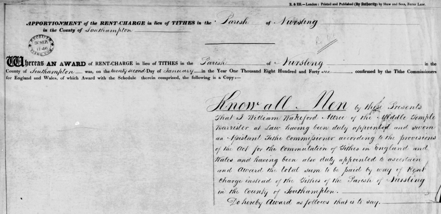
From the 'Know all Men' paragraph, the Assistant Tithe Commissioner responsible for Nursling was William Wakeford Attree of the Middle Temple Barrister at Law. He was also responsible for the Tithe Commutation for the Parish of Freefolk in the County of Southampton, and possibly others.
I found an article in The National Archives which has some information about William Wakeford Attree and his family, extract below. The Atrree family do not live in Nursling but have an involvement by virtue of the Tithe Award.
THE HISTORY OF HOWLETT & CLARKE by Antony Dale
Howlett & Clarke is not only the oldest firm of Solicitors in Brighton but the only one that can be traced back to the eighteenth century. Its first known principal or partner was William Attree. He came of an old established Ditchling family. His grand-father, William Attree, was a brick-layer there. The latter died in 1767 but left a Will, so he must have been a man of some education. This William Attree's son, John Attree, was a prosperous malster. In 1745 John Attree married at Newtimber Susannah, daughter of Henry Scrase of Withdean, Patcham. He died on the 9th June 1772 and is buried in a table-tomb in Ditchling church-yard to the north of the church
John and Susannah Attree had one daughter and four sons
William Attree was the second of these sons and was born in 1749. In 1765 he was articled for 5 years to an attorney in Lewes named Henry Burtenshaw. He was admitted to the roll of solicitors before 1775. But this must have been at least two years earlier, as in 1773, when the Brighton Town Commissioners were first set up to pave and light the streets and to erect groynes in front of the town, he became their first Clerk and also Treasurer. The Commissioners' minutes have not survived from before 1789, but Bishops' "Brighton in the Olden Time" quotes an advertisement by William Attree as Clerk to the Commissioners of 1st August 1773, so he must have held this office since the initiation of the Commission. His salary as such in 1789 was £4-10-0 a year
He was also Clerk to the Brighton Vestry. The date when he was appointed to that office is unknown because again the minutes of the Vestry have not survived from before 1790. He may well have been in office for some time before that date and perhaps was even appointed Clerk to the Commissioners in 1773 because he was already Clerk to the Vestry. His salary as Clerk to the Vestry was £10-10-0 a year in 1790 and £30-0-0 a year in 1804
It is just possible that William Attree's legal connection may extend further back than this. His mother's first cousin, Charles Scrase, was also an attorney. He was born in 1709 and was Town Clerk of Seaford in 1733. In 1771 Scrase purchased a moiety of the manor of Brighton and lived in the Manor House there which was on the site of Royal York Buildings in Old Steine. Scrase was also the solicitor of Dr Johnson's friend, Hester Thrale, later Mrs Piozzi. She stayed with him at the Manor House and subsequently bought a house of her own in Brighton in West Street. William Attree acted as steward of the Manor for Scrase from 1778 onwards. So it is possible that he had been articled to Scrase. The latter died in 1791
When William Attree established his practice in Brighton, he built himself an office and a house where he also lived. In 1775 he bought a site in Ship Street for £50. On this he built No. 8 Ship Street and probably the adjoining house, No. 9. No. 8 was his residence and office combined until his death and after that the residence and office of his son until 1830. William Attree mortgaged the building for £2,000 in 1803, and this loan was not finally paid off by his son until 1824. The house was rebuilt in its present form, but still with a facade of Georgian character, at some time between 1830 and 1863. But continuity has been preserved as the building is still the office of Howlett & Clarke today
In or before 1800 there were few attorneys in Brighton, so William Attree easily acquired a near monopoly of the best legal work in the town. Amongst his fashionable clients was the Prince of Wales. When the Prince was acquiring land to enlarge the grounds of his Brighton house, he employed Attree in the various purchases which this involved. Attree's position will have been of benefit to both parties when, in 1803, the Prince sought the agreement of the Town Commisioners to divert the north end of Great East Street, as East Street was then called, which ran almost directly under his windows, and to give the town instead a piece of land further west which, in 1806, became New Road
The above is not really relevant to the Parish of Nursling but does give some background to the next extract where William Wakeford Attree, the Assistant Tithe Commissioner for Nursling and a number of other Hampshire Parishes.
Thomas Attree married about 1805. His wife's Christian names were Elizabeth Austin. They had a son and a daughter. The son, William Wakeford Attree, was born in 1806. He followed his father into the legal profession, but became a barrister in the Middle Temple. He was Recorder of Rye, Hastings and Seaford. He died in his father's life-time and at his father's Brighton house on the 28th January 1862 aged 56. He was buried in Ditchling church-yard
In his memory his father endowed a scholarship at Brighton College. To provide the money for this he conveyed to the Trustees of the College No 9 Ship Street adjoining his office and, if this Trust was invalidated by his death within 6 months of the date of gift, he substituted in his Will a bequest to the College of £1,000. Thomas Attree's daughter, Elizabeth Wakeford Attree, died when quite young. Stained glass windows in memory of both the son and daughter were inserted in the north wall of the nave of Ditchling Church in 1863.
Transcription
Transcription of Agreement
APPORTIONMENT; of the RENT-CHARGE in lieu of TITHES in the Parish of Eling in the County of Southampton
Whereas AN AWARD of RENT-CHARGE in lieu of TITHES in the Parish of Eling in the County of Southampton was, on the twelfth Day of June in the Year One Thousand Eight Hundred and Forty three, confirmed by the Tithe Commissioners for England and Wales, of which Award with the Schedule therein comprised, the following is a Copy :---
Know All Men by these Presents That I Thomas James Tatham of Bedford Place Russell Square London Land Agent having been duly appointed and sworn an Assistant Tithe Commissioner according to the provisions of the Act for the Commutation of Tithes in England and Wales and having been also duly appointed to ascertain and award the sums to be paid by way of Rent charges instead of the tithes of the parish of Eling in the County of Southampton.
Do hereby award as follows that is to say.
Whereas I have held divers meetings in the said parish touching the matter aforesaid of which meetings due notice was given for the information of the Land Owners and Tithe Owners of the said Parish.
And Whereas I have duly considered all the allegations and proofs tendered to me by all parties interested and have myself made all inquiries touching the premised subject which appeared to me to be necessary.
And Whereas I find that certain enclosed lands of the said parish containing by estimation in Statute measure Thirty seven acres two roods and twenty perches of which lands Her Most Gracious Majesty Queen Victoria in right of the Crown is owner and the present Occupier are by prescription or other lawful means absolutely exempt from payment of all tithes both great and small.
And Whereas I find that all the Lands of the said Parish which are now cultivated as wood land are also by prescription or other lawful means absolutely exempt from payment of all tithes which said lands contain by estimation in Statute Measure Three thousand and ninety seven acres and fourteen perches.
subject to payment of Tithes amounts to one thousand nine hundred and ninety acres three roods and twenty one perches which are cultivated as follows that is to say.
One thousand and forty seven acres and sixteen perches as Arable Land
Four hundred and six acres three roods and thirty perches as Meadow or Pasture.
One hundred and thirty six acres three roods and five perches as Water Meadow
Three hundred and eighty three acres three roods and eighteen perches as Woodland.
And Four acres and thirty two perches are Homesteads and the Sites of Buildings.
And Whereas I find that the Glebe Lands belonging to the Rector of the said Parish amounting by estimation to Twelve acres statute measure is by prescription absolutely exempt from the render of all Tithes.
And Whereas I find that all the Lands of the said Parish are save as aforesaid subject to payment of all manner of Tithes in Kind.
And Whereas in estimating the clear annual value of the said Tithes I have taken into account the rates and assessments paid in respect of such Tithes during the seven years of average prescribed by the said Act.
And Whereas due Notice was was given to me in the manner prescribed by the said Act that the clear average value of the Rectoral Tithes of the said Parish during the said seven years of average would not fairly represent the sum which ought to be the basis of a permanent commutation of the said Tithes.
And Whereas I have taken into consideration all the allegations and proofs tendered to me touching the matter of the said Notice before awarding the Rent charge hereinafter mentioned.
And Whereas I find that the Rector of the said Parish for the time being is entitled to all the Tithes thereof.
Now Know Ye that I the said William Wakeford Attree do hereby Award that the Annual sum of Five hundred and fifty Pounds by way of Rent Charge subject to the provisions of the said Act shall from the first day of October next preceding the confirmation of the Apportionment of the said Rent Charge be paid to the Rector of the said Parish for the time being instead of all the Tithes arising from all the Lands of the said Parish except the Glebe Lands.
And I do hereby Award and direct that no part of the said Rent Charge shall be apportioned on any Holdings of less extent than thirty five perches.
In Testimony whereof I have hereunto set my hand this second day of January in the year One thousand eight hundred and forty six.
Signed
Wm Wakeford Attree
Now I Charles Fielder
of the Parish of Sparsholt near Winchester in the County of Southampton
having been duly appointed Valuer to apportion the total Sum awarded to be paid by way of Rent Charge in lieu of Tithes, amongst the several Lands of the said Parish of Nursling
Do HEREBY apportion the Rent Charge as follows:--
GROSS RENT CHARGE payable to the Titheowner in lieu of tithes for the Parish of Nursling in the County of Southampton
Five Hundred and Fifty Pounds
| Price per Bushel. | Bushels and Decimal Parts. | |||
| s. | d. | |||
| Wheat | 7 | 01/4 | 522, 25519 | |
| Barley | 3 | 111/2 | 926, 31579 | |
| Oats | 2 | 0 | 1333, 33333 | |
The above Transcription can be seen in plain text on the pdf file linked below, which opens in a new window.
![]() Transcription Tithe Agreement - Nursling.pdf94.57 KB07/03/2022
Transcription Tithe Agreement - Nursling.pdf94.57 KB07/03/2022
Transcription of the Schedule
The schedule is transcribed directly into the Dataset by double entry typing, and is therefore not repeated here.
Transcription of the Summary
The Summary is transcribed directly into the Dataset by double entry typing, and is therefore not repeated here.
Transcription of the Ratification
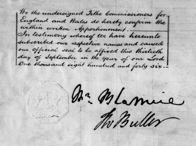
We the undersigned Tithe Commissioners for England and Wales do hereby confirm the within written Apportionment.
In testimony whereof we have hereunto subscribed our respective names and caused out official seal to be affixed this thirteenth day of September in the year of our Lord One thousand eight hundred and forty six.
The Tithe Commissioners whose signatures appear on the ratification are;-
William Blamire (chairman)
Thomas Wentworth Buller
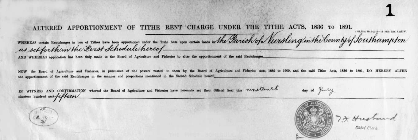
At a later time than the original Tithe Commutation, the Apportionment was altered and attached.
Transcription of the Later Alteration
ALTERED APPORTIONMENT OF TITHE RENT CHARGE UNDER THE TITHE ACTS, 1836 TO 1891
WHEREAS certain Rentcharges in lieu of Tithes have been apportioned under the Tithe Acts upon certain lands in the Parish of Nursling in the County of Southampton as set forth in the First Schedule hereof
AND WHEREAS application has been duly made to the Board of Agriculture and Fisheries to alter the apportionment of the said Rentcharges.
NOW the Board of Agriculture and Fisheries, in pursuance of the powers vested in them by the Board of Agriculture and Fisheries Acts, 1889 to 1909, and the said Tithe Acts, 1836 to 1891, DO HEREBY ALTER the apportionment of the said Rentcharges in the manner and proportions mentioned in the Second Schedule hereof.
IN WITNESS AND CONFIRMATION whereof the Board of Agriculture and Fisheries have hereunto set their Official Seal this nineteenth day of July nineteen hundred and fifteen.
Transcription of the Amended First Schedule
The amended first schedule is transcribed directly into the Dataset by double entry typing, and is therefore not repeated here.
Transcription of the Amended Second Schedule
The amended second schedule is transcribed directly into the Dataset by double entry typing, and is therefore not repeated here.
Dataset
The Dataset
The dataset comprises all of the transcribed information from the Tithe Apportionment and Maps together with additional information, including, inter alia, geolocation and census data. All held in an Excel Spreadsheet. The data is both analysed within the spreadsheet and formed into reports for export as csv files to populate the StoryMap data.
Primary Data
Primary Data
Below is the first page of the spreadsheet containing the Nursling Tithe Dataset. It shows the Primary or key facts pertaining to the Parish of Nursling.
It is a live document, so if the dataset changes, so does this.
Detailed Data - Summary
Detailed Data - Summary
The Summary in the Tithe Apportionment paperwork often appears after the Schedule, and of which it is, as the title suggests, the summary, by landowner and occupier. It includes details of the area together with both the small and great Tithe.
The transcription is below as an extract of the spreadsheet containing the dataset.
Out of this first pass of information, with the addition of gender based on the names of the people, I have generated some graphs within the spreadsheet. They are live and interactive on the spreadsheet, but here they are screenshots.
As well as the addition of gender, there are some which are general neutral, such as Assignees, which includes Executors, Trustees and the like, Corporate, including the Church, and Public etc, which also includes roads, where measured.
Land Area - Acres
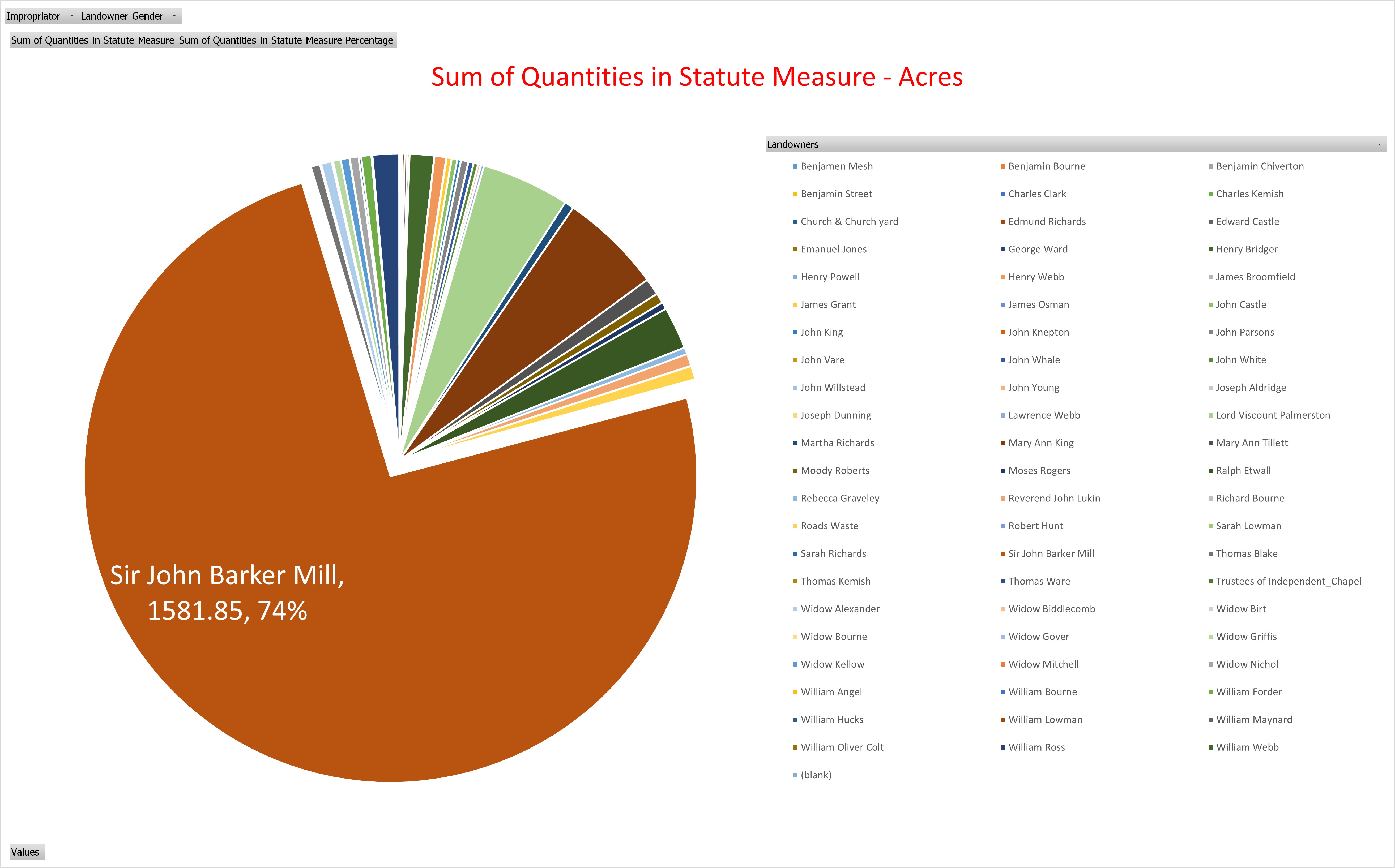
You can see from the Pie chart that Sir John Barker Mill is by far the largest single landowner with 74%. However, the graph does not show much other land he owns but leases to others, with the lessees recorded in the landowners column.
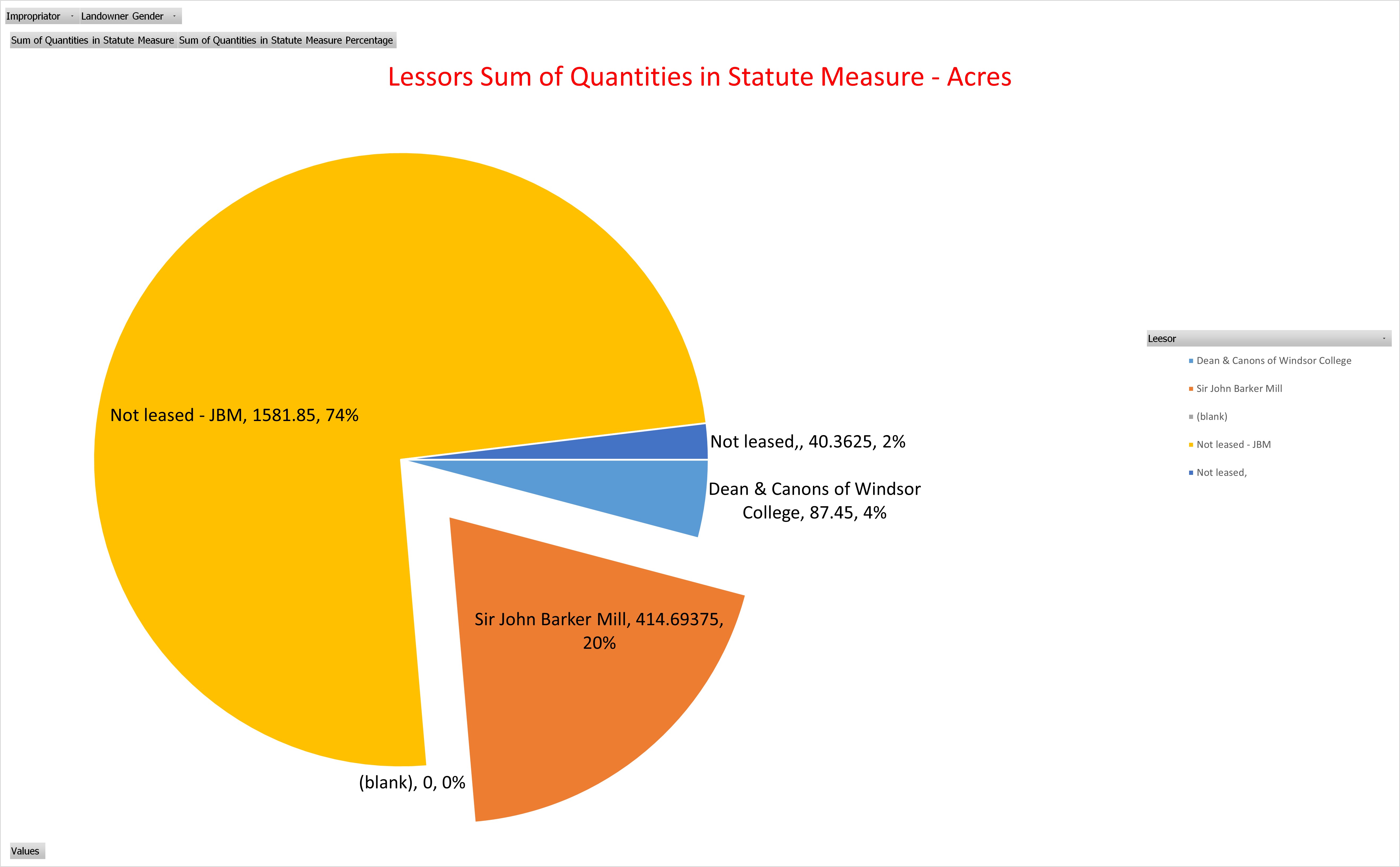
The Pie chart above shows the 1581.85 acres not leased out but owned by Sir John Barker Mill together with a further 141.69 acres, approximately 20%.. 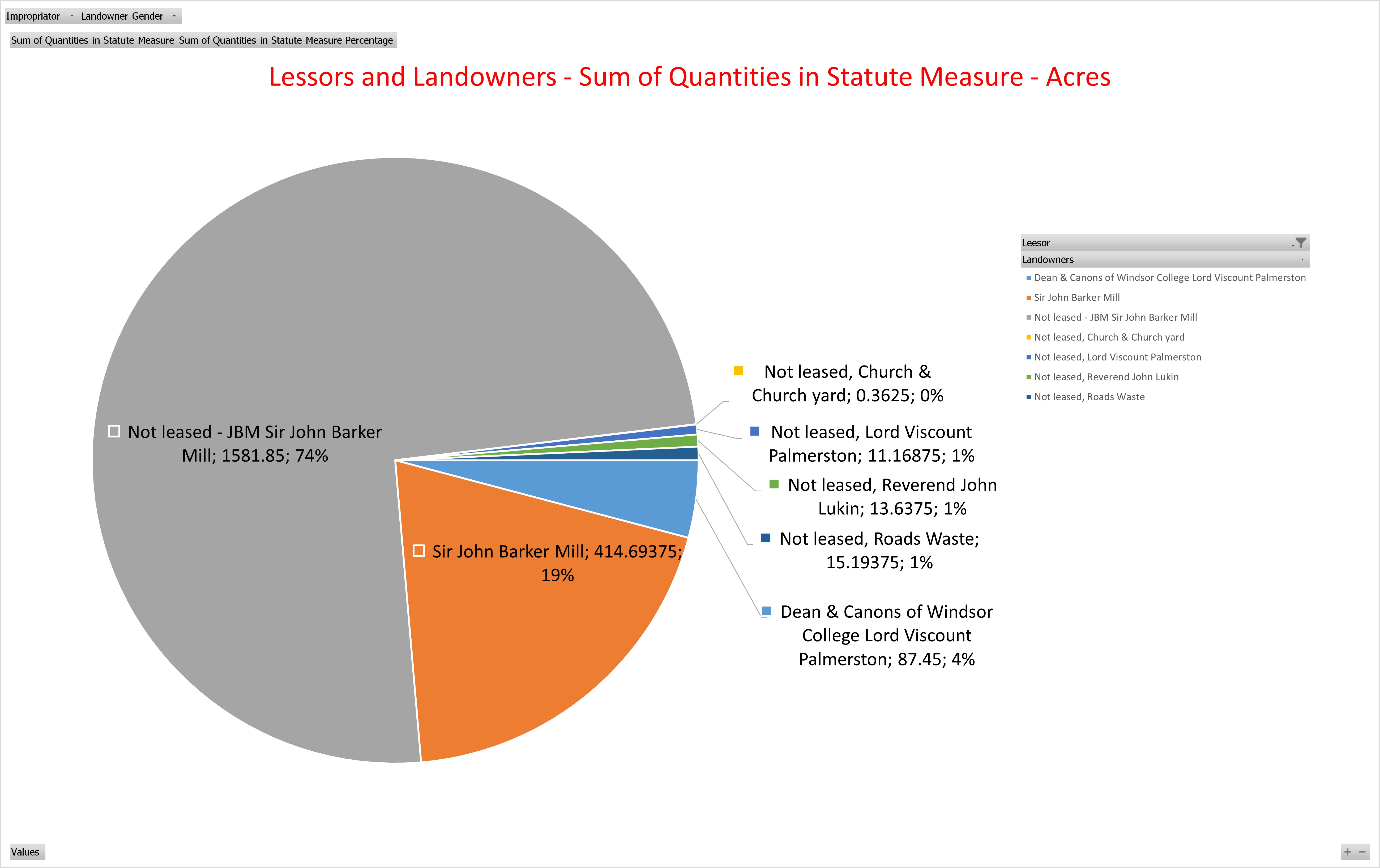
Altogether he therefore owns about 94% of the parish. The 19% of land where Sir John Barker Mill is lessor on the lower pie chart but 20% on the one above is just the way the numbers round.
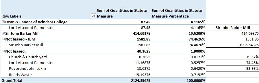
Lord Viscount Palmerston, the owner of The Broadlands Estate between Nursling and Romsey, is the only other Landowner, but even that, as both Landowner and Lessee, only equates to less than 5% of the total area.
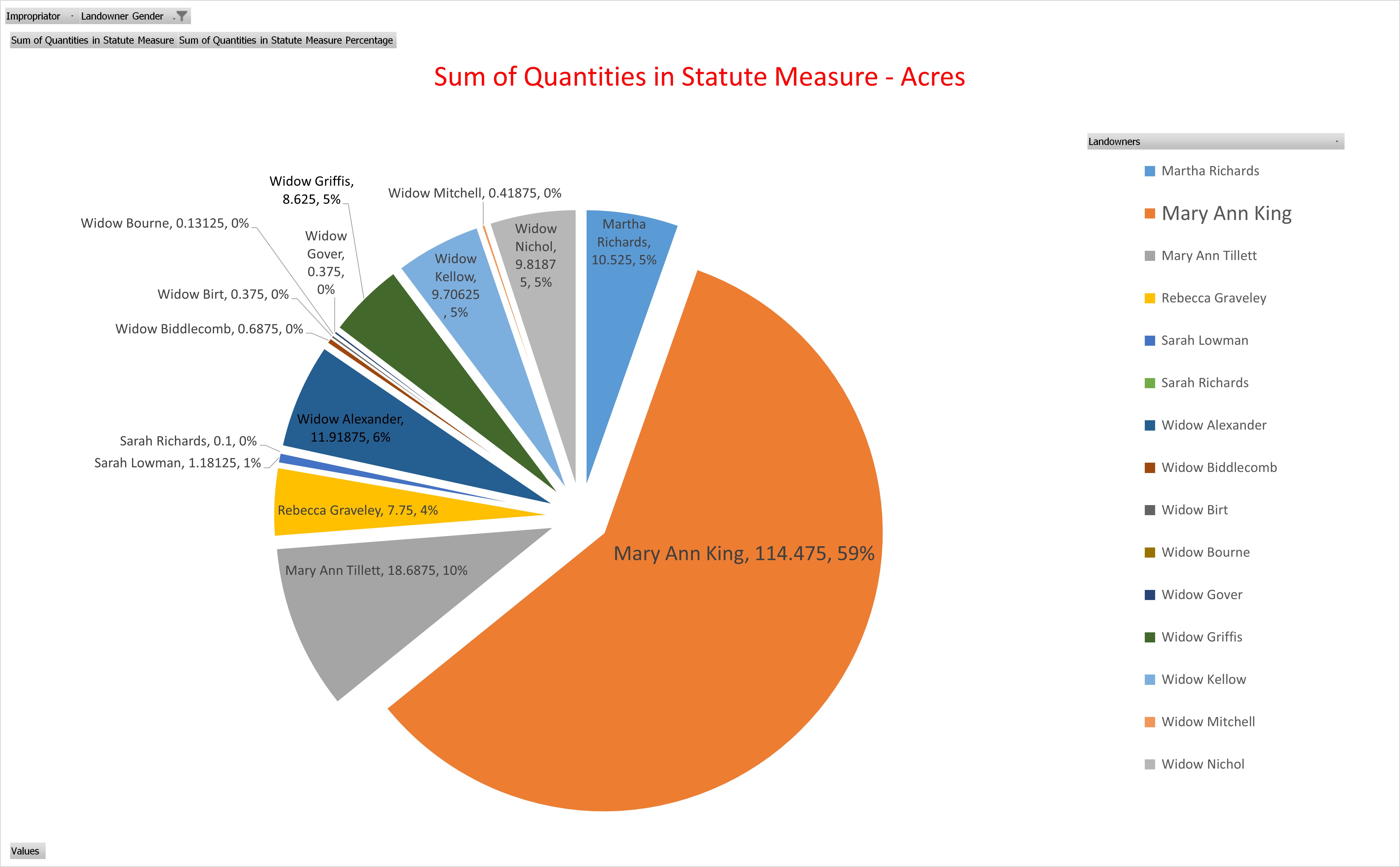
Looking at the gender split, 89% of the land is attributed to males as Landowners / Lessees with just 9% attributed to females. The pie chart above represents that 9%, with Mary Ann King clearly the leader with 114 acres, 59%. There are 9 Widows amongst the 15 women listed as Landowners / Lessees. Just known as widow of husband.
I recognise that in terms of gender 89% plus 9% does not equate to 100%. That is therefore 2% other.
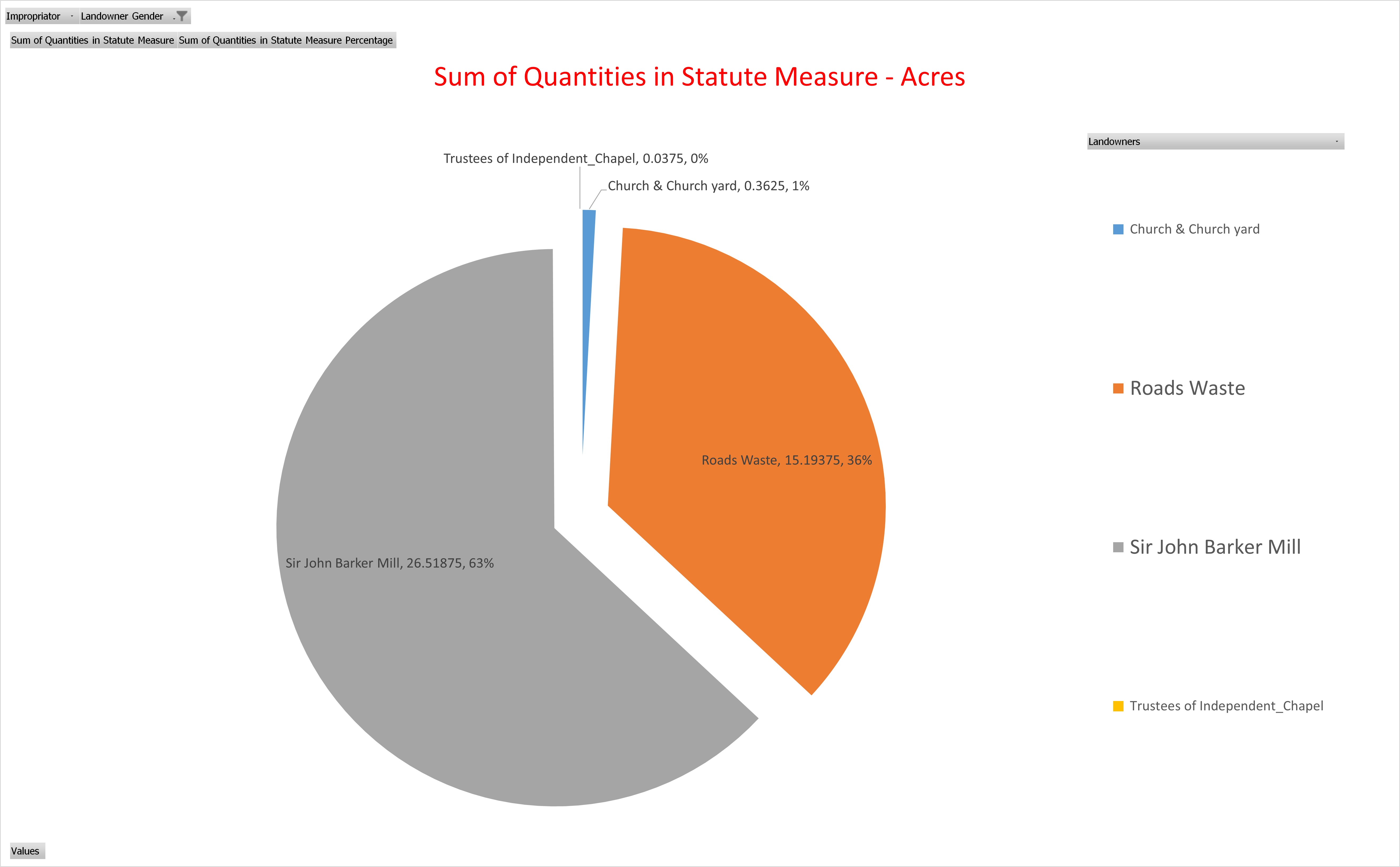
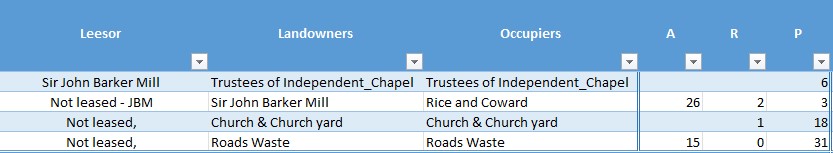
Strictly speaking, this is not consistent with the other graphs as a large proportion of the other 2% is Landowner Sir John Barker Mill, so that would add another 1% of the whole to the male camp above. However, that land is occupied by Rice and Coward, who I have attributed to Corporate. It could be Mr Rice and Mr Coward, but that would normally be John Rice and another, if Mr Rice was a John. Having attributed Rice and Coward to corporate It thought it better to bring it out here for clarity.
Rentcharge - Vicar
The is no value to the Vicar in the Tithe Apportionment for the Parish of Nursling
Rentcharge - Rector
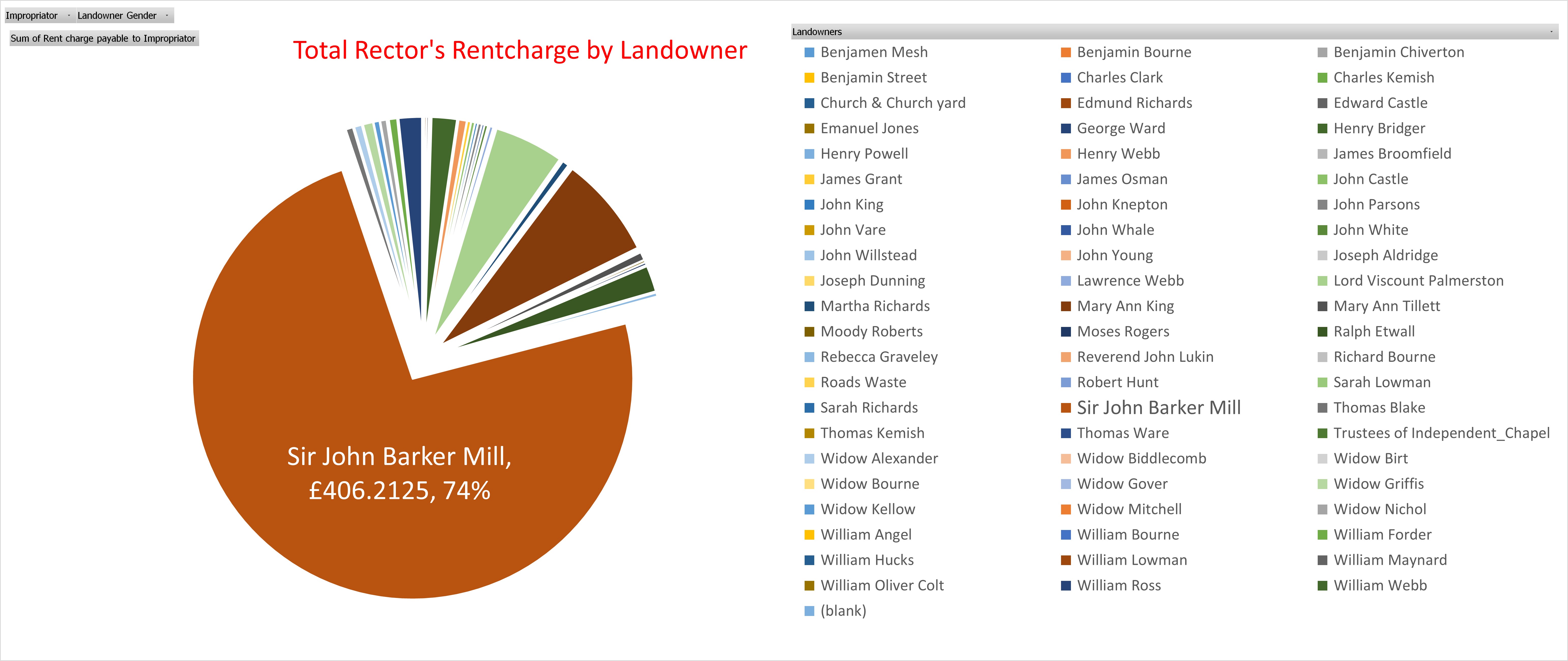
Not surprisingly, Sir John Barker Mill, being the biggest landowner, results in having the biggest proportion of Rentcharge. He also has further lands where most of the list are his lessees. Of the total rentcharge for the Parish of Nursling of £550 Sir John Barker Mill is directly responsible for approximately £406. In 2020, the relative value of £406 4s 3d from 1846 ranges from £40,220.00 to £1,467,000.00. With a relative income value of that income or wealth is £464,600.00.
We know from the Tithe Apportionment for the Parish of Millbrook that Sir John Barker Mill has substantial holdings in that parish as well as almost the whole of Nursling. In The Genealogist website, searching for Landowner and Occupier (mainly Tithe) records, for John Barker (surname) Mill in the Parish of (keyword) Nursling resulted in 497 records. Remove the keyword Nursling and replace it with Landowner, that number goes up to 2,684 results. Some of both these numbers could still be double entries, being in some instances both Landowner and Occupier. Of those results 2,113 were in Hampshire
Other Parishes it that list include, in the County of Hampshire; Broughton (6), East Dean (59), Mottisfont (530), Longstock (174), Kingsomborne and Little Sombourne (King's Somborne) (87), Stockbridge (2), Eling (537), Millbrook (255) and Nursling (461), and Whiteparish (10) in the County of Wiltshire. The total of the Hampshire identified parishes is 2111 results, so either 2 in another parish or just an anomaly.
| Parish | Count of search results | Quantity | Rentcharge V | Rentcharge R | ||||||
|---|---|---|---|---|---|---|---|---|---|---|
| A | R | P | £ | s | d | £ | s | d | ||
| Broughton | 6 | 9 | 0 | 4 | 1 | 0 | 9 | |||
| East Dean | 59 | 601 | 1 | 5 | 101 | 14 | 3 | |||
| Eling | 537 | 2355 | 1 | 33 | 86 | 7 | 06 | 179 | 19 | 0 |
| Kingsomborne and Little Sombourne (King's Somborne) | 87 | 732 | 1 | 24 | 62 | 16 | 5 | 16 | 19 | 10 |
| Longstock | 174 | 820 | 3 | 2 | 100 | 12 | 2 | 136 | 15 | 1 |
| Millbrook | 255 | 820 | 1 | 37 | 303 | 12 | 4 | 7 | 14 | 9 |
| Mottisfont | 530 | 1737 | 3 | 15 | 295 | 5 | 0 | |||
| Nursling | 461 | 2076 | 2 | 7 | 522 | 1 | 8 | |||
| Stockbridge | 2 | 2 | 2 | 9 | 1 | 11 | ||||
| Whiteparish | 10 | 33 | 2 | 29 | 0 | 5 | 8 | 2 | 5 | 8 |
| Total (10) | 2121 | 9187 | 3 | 38 | 553 | 14 | 10 | 1263 | 17 | 10 |
| 3718 Hectares | £ 553.74 | £ 1263.90 | ||||||||
This is just a quick collection with none of the checks for accuracy that are done for specific parishes. Even so, it does show Sir John Barker Mill to be a very significant land owner with about 9000 acres spread over 9 parishes in Hampshire and one parish in Wiltshire. Eling is complicated as it has multiple Impropriators and therefore multiple entries for Sir John Barker Mill in both the Schedule and in the Summary.
Detailed Data - Landowner and Occupier Summary
Detailed Data - Summary
Detailed Summary - Schedule
Detailed Data - Schedule
Your text...
Land Usage
Graph of Land Usage in Whiteparish in 1842 from the Tithe Apportionment information.
Analysis of the land usage based on the Tithe Apportionment information, showing the primary use as arable at 61%, and secondary usages of woodland 18% and pasture 16%. Common and Furze land has been reduced to about 1%, presumably as a result of the Inclosure Acts, (Enclosure).
Land Ownership
Graph of Land Ownership in Whiteparish in 1842 from the Tithe Apportionment information.
Land Ownership is more widely distributed than in some parishes that I have looked at.
Scroll right to see the list of landowners associated to the graph.
Plot register
The Table with all the data of the Detailed Plot register.
This table has the Landowners and Occupiers of all the Plots in the Parish, including the Description or Names of the plots together with the State of Cultivation. It instances where there is no entry, but it is evident what the Land Usage is I have added the category surrounded with { Brace Brackets }. Not relative to the Tithe Apportionment as some of the Land Usage is not part of the charge regime, however {Residence), {Premises} and {Retail} etc are useful additions. There are approximately 220 Mansions, Houses, or Cottages etc, across the Parish.
The areas of each plot together with the Rentcharge amount in respect of both the Small and Great Tithe, for the Vicar and Impropriator.
Top Ten Landowners
Top Ten Landowners in Whiteparish from the Tithe Apportionment information
From this analysis of the plot level detail for the Parish of Whiteparish the Top Ten Landowners own 91% of the whole recorded area of the parish. Two of the Landowners were relations to the Nelson of The Battle of Trafalgar fame.
Horatio Nelson, 3rd Earl Nelson, (7 August 1823 – 25 February 1913), was 16 years 9 months 7 days at the recorded data of the survey, 14th May 1840, a Minor, hence the Guardians of ...
He was the son of Thomas Bolton (a nephew of Vice Admiral The 1st Viscount Nelson) by his wife Frances Elizabeth Eyre. On 28 February 1835 his father inherited the title Earl Nelson from William Nelson, 1st Earl Nelson and adopted the surname of Nelson. He died on 1 November that year, and his son Horatio succeeded to the title and the estate, Trafalgar House in Wiltshire, in the nearby parish of Downton. The Eyre Family were the owners of Brickworth Park according to the Turnpike Acts for the Whiteparish Romsey Southampton Road. The Dowager Countess Frances Elizabeth Nelson was recorded as being the Landowner as Brickworth Park.
The remainder are either titled or referred to as Esquire. Although not all of the Esquires are in the top ten.
Spare
Your text...
Spare
Your text...
Parish Records
Eling Parish Records
Parish and Bishop Transcripts for the parish of Eling in Hampshire, including the parishes split out of the Ancient Parish of Eling.
The process I used starts with creating a dataset of the records, preferably by reference to images of the original parish record book.
The dataset is then used to create the information listed below.
Ancient Eling
Ancient Parish of Eling, called Eling.
ELING (St. Mary), a parish, in the union of New Forest, hundred of Redbridge, Romsey and S. divisions of the county of Southampton, 5 miles (W. by N.) from Southampton with the tythings of Bartley-Regis, Bauldoxfee, Bistern with Bartley, Colebury, Durley, Langley, Lopperwood, Marchwood, Rumbridge, Tatchbury, Testwood, Wade with Over, and Wigley.
For our purposes, Ancient Eling runs up until the Parish of Eling started to be split up.
First with North Eling / Copythorne, and latterly with Marchwood, becoming separate Parishes carved out of Eling.
North Eling / Copythorne
Originally, Copythorne and neighbouring villages were part of the parish of St Mary, Eling, at a time when the population was around 2,000. As the population grew to around 5,000 it began to put pressure on the Church's ministry. The people of Cadnam, Windsor, Bartley, Newbridge. Ower, and Copythorne petitioning for changes, and against this background the Rev. W.G. Phillips and his wardens arranged for their parishioners to have their own church.
Separate Parish records for North Eling commence in 1834.
Under the Local Government Act of 1888, North Ealing was constituted a civil parish by order of the Hampshire County Council and was named Copythorne.
The walk from one of those villages, in this case Cadnam, was over 5 miles, and would take about two hours, each way. Most people would have to walk with only a few having horses and even less, carriages. That is four hours walking, plus the service, out of probably the only day off in the week. After the opening of the new church at Copythorne, the distance was cut to 1 mile, and the time to just 21 minutes, each way. I can understand why the parishioners petitioned for a local chapel.
Marchwood
The parish of Marchwood became a separate ecclesiastical parish in 1843 and a civil parish in 1894.
The Ancient Parish of Eling therefore ceased to be the whole parish in 1834 in respect of Register Records.
Information regarding the transition period and the subsequent reduced size Parish of Eling are both under Eling.
The Parish of Eling before the re-sizing.
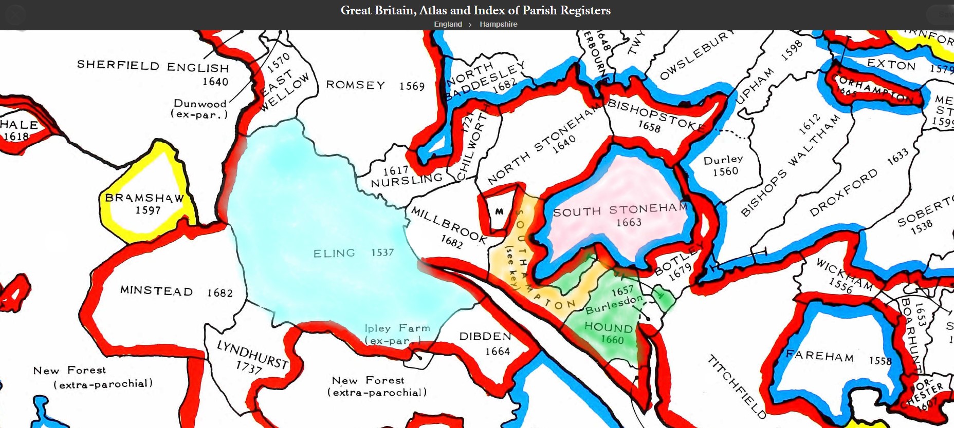
English Jurisdictions Map and data showing the three parishes, of North Eling, Eling, and Marchwood.
England Jurisdictions 1851 - North Eling
Extract from FamilySearch England Jurisdictions 1851. This link may not work if you don't have a subscription to FamilySearch
Then search for North Eling. Use the Key to select which boundaries you wish to see.
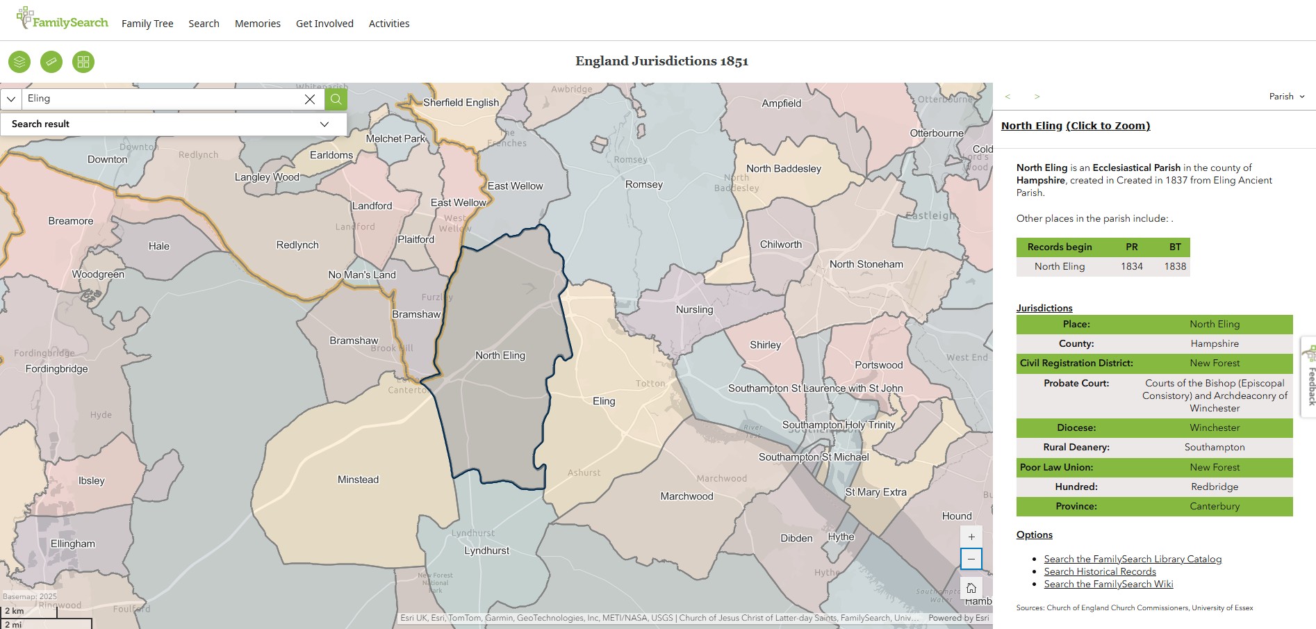
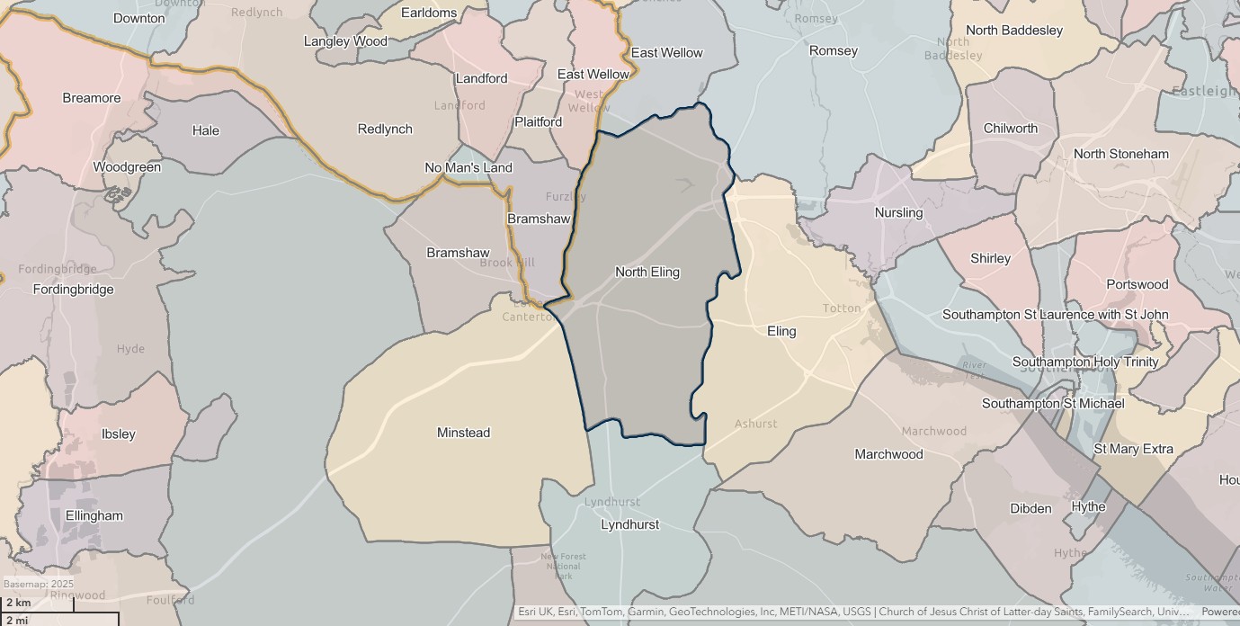
England Jurisdictions 1851 - Eling
Extract from FamilySearch England Jurisdictions 1851. This link may not work if you don't have a subscription to FamilySearch
Then search for Eling. Use the Key to select which boundaries you wish to see.
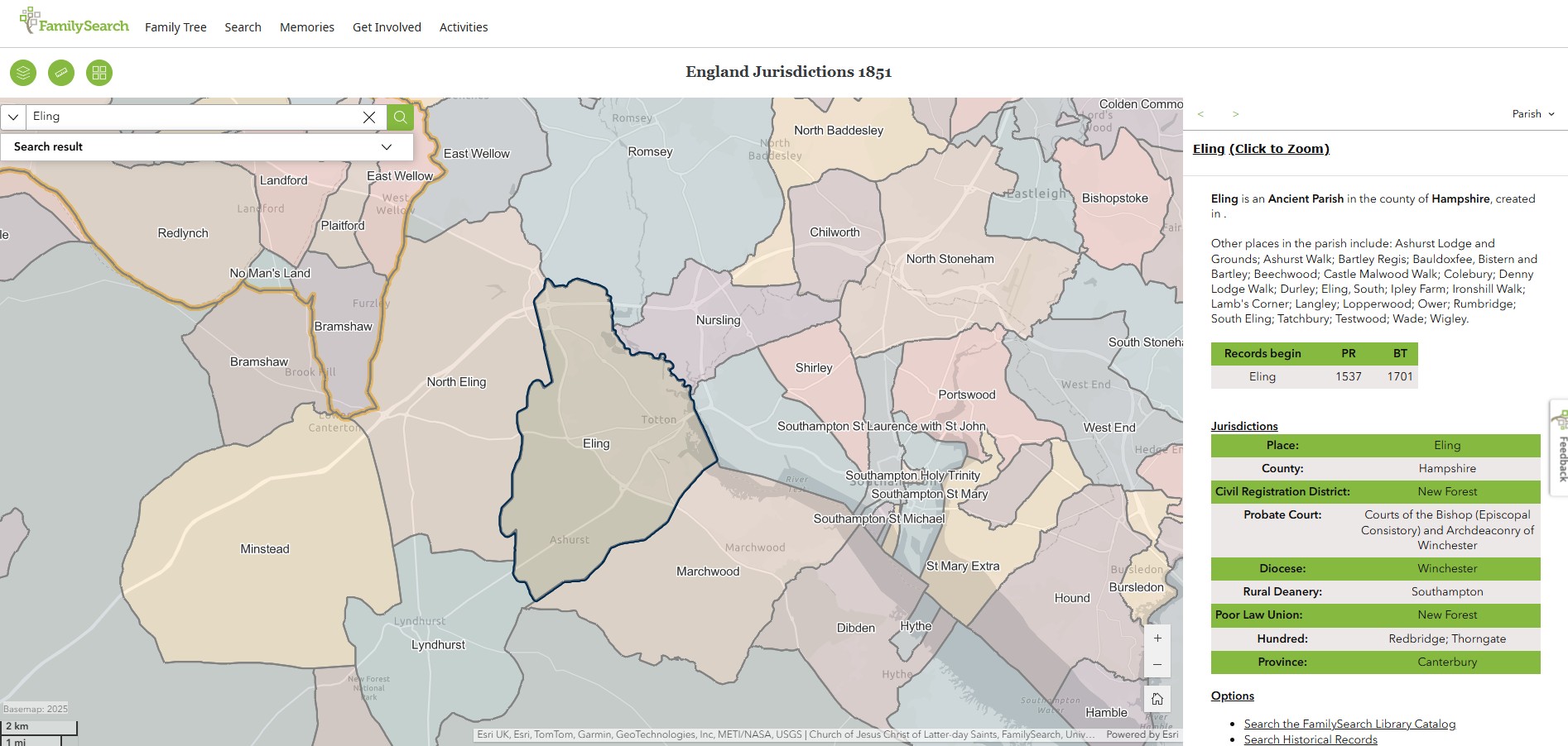
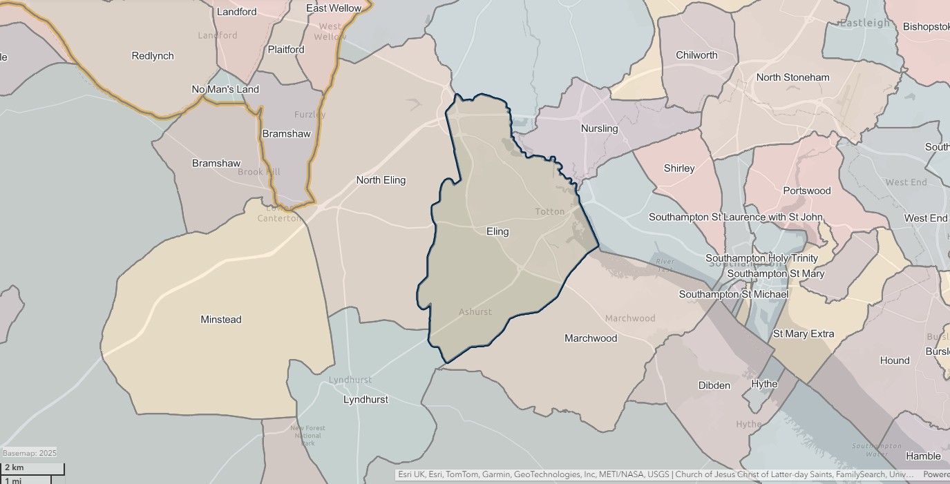
England Jurisdictions 1851 - Marchwood
Extract from FamilySearch England Jurisdictions 1851. This link may not work if you don't have a subscription to FamilySearch
Then search for Marchwood. Use the Key to select which boundaries you wish to see.
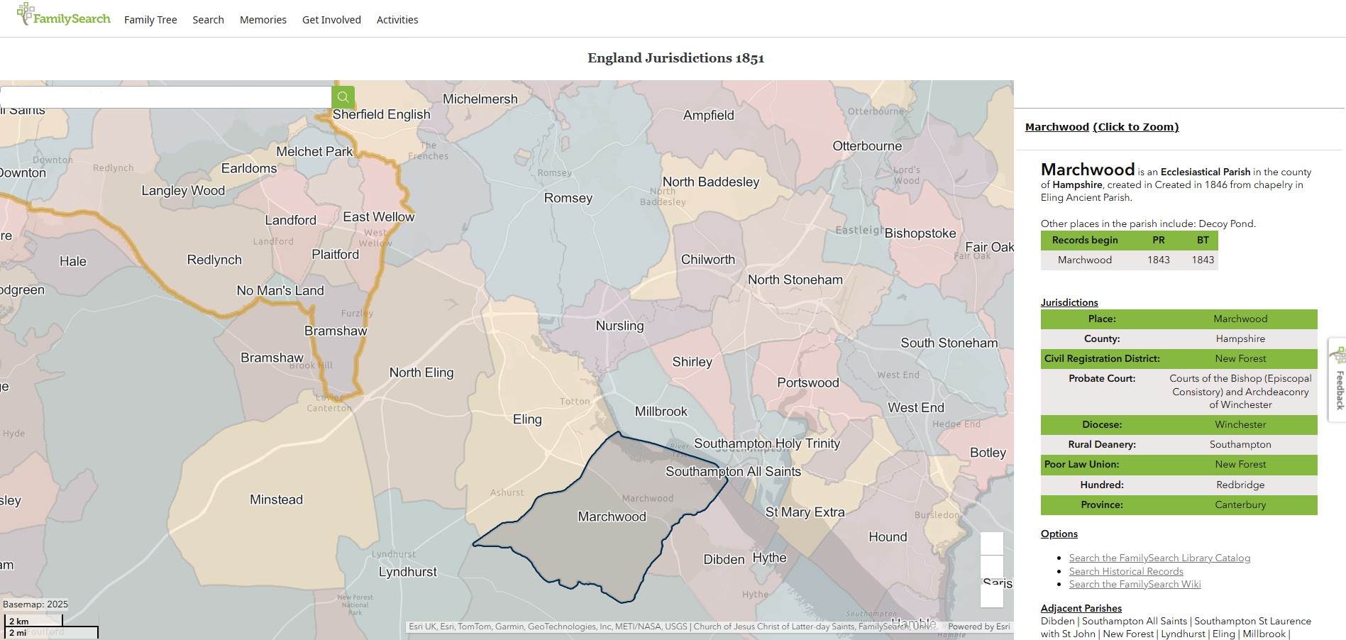
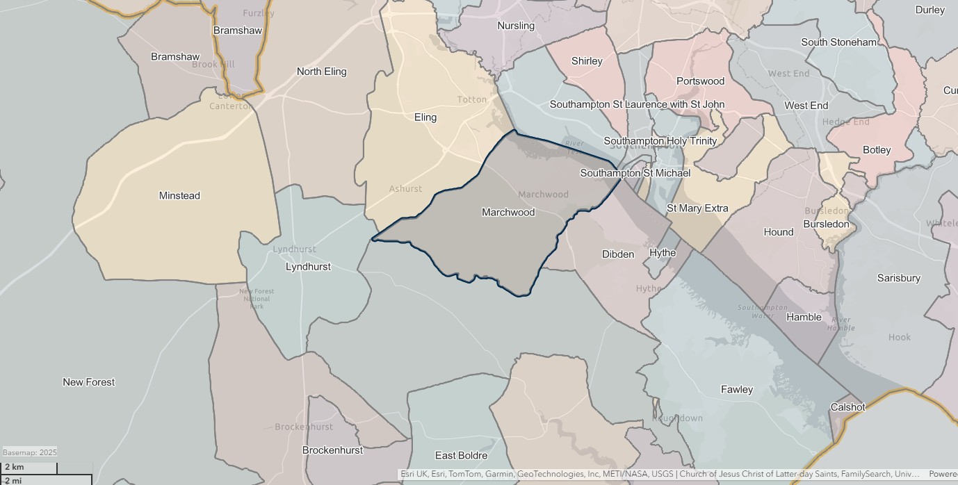
Parish Records Front Pages - Baptisms - Eling 1537-1674 -- Book 1
The Rectors of Eling during the currency of this Book
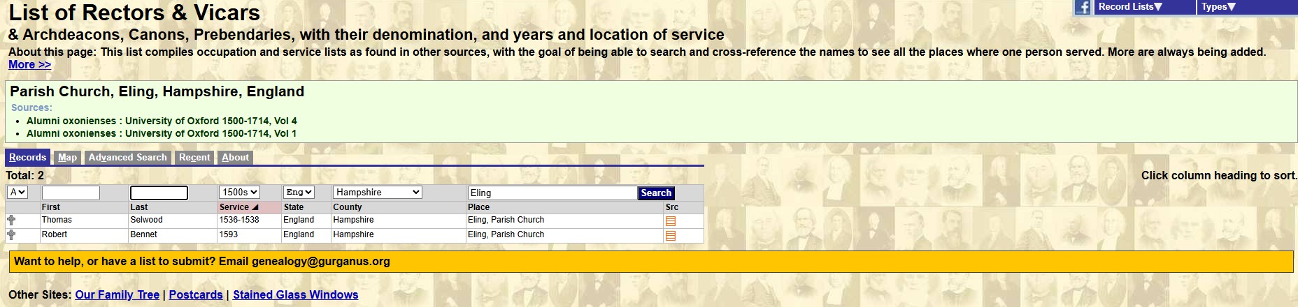

Page 2
I suspect that this register started originally on page 2. The book appears to have been re-covered.
Below is page 2, with the contents of the Register Book No 1 -
Although, it all seems to be in the same hand, and with end dates, it was probably written at the end of the Book's period, not at the start.
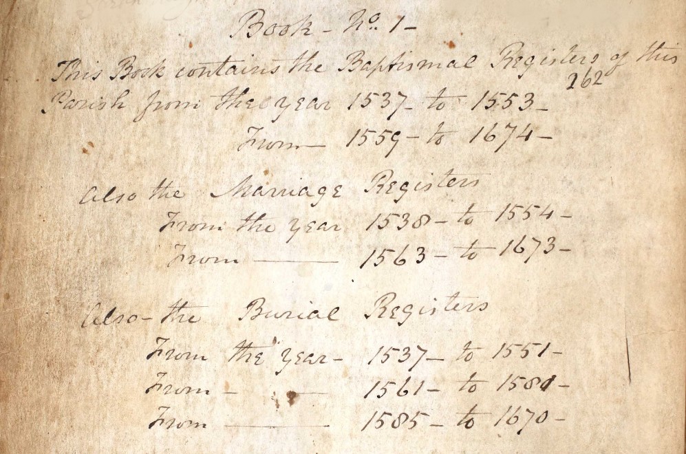
| Book No 1 - | ||||
| This Book contains the Baptismal Registers of this | ||||
| 262 | ||||
| Parish from the Parish | year | 1537 | to | 1554 |
| From | 1563 | to | 1674 | |
| Also the Marriage Registers | ||||
| From the year | 1538 | to | 1554 | |
| From | 1563 | to | 1673 | |
| Also the Burial Registers | From the year | 1537 | to | 15551 |
| From | 1561 | to | 1581 | |
| From | 1585 | to | 1670 | |
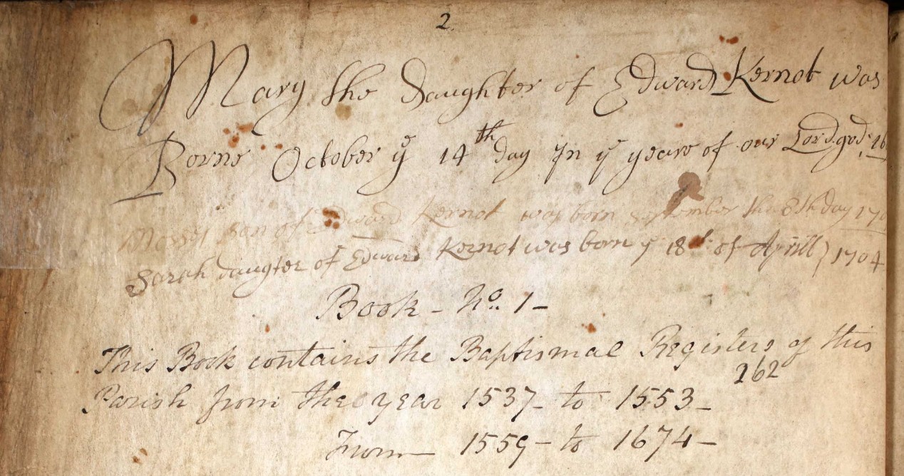
Above the contents on page two there appears be some family notes, all relating to Edward Kernot. Was he the Lord of the Manor or the Rector perhaps.
It appears to be an after note, both it the positioning of the note on the page and that the apparent dates are outside the scope of this register. I have looked at the next register, in the year 1704 for Sarah, but without result.
Mary the Daughter of Edward Kernot was Born October ye 14th day in ye year of our Lord god 169?
Mosses Son of Edward Kernot was born september the 8th day 170?
Sarah daugtor of Edward Kosnot was born ye 18th of April 1704
Page 1
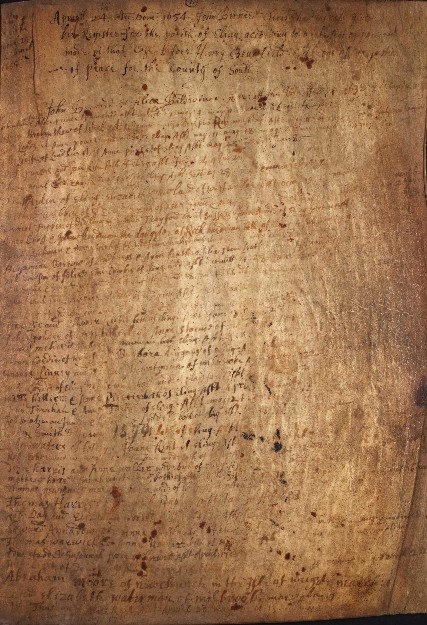
Preceding Page 2 in the register is this page.
Even zoomed in, as in the image below it is still difficult to read.
The record on this page appears to be;-
John Bernard & Alice Baldwinne ?? ?? the ??? 1638. Is it a baptism or some other sort of record or note. Either way 1638 is not at the beginning of the period of this book.
However, none of the page has been transcribed in Ancestry.
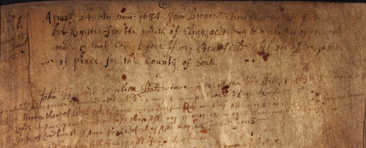
The note at the top of the page appears to be something like;-
Apristt 24th ?? ??? 1654 John Bernard
??? Register for the Parish of Eling according to
made in that Case ? fore Henry Brumfield Esq one of ??? justices
for the County of Southampton
However, this is not a reliable, accurate, nor complete transcription.
A John Bernard was Rector at the Parish of Eling in 1638. Another record has him at Eling from 2 Sep 1638 to 25 Mar 1667, with his death on the latter stated date.
Alumni cantabrigienses; a biographical list of all known students, graduates and holders of office at the University of Cambridge has an entry for John Bernard.
On page 3 of the book there is a clear start to the register of Baptisms. Entitled Anno Dni 1538,an abbreviation for Anno Domini perhaps, Latin for In the year of our Lord.
Only 13 baptisms in the whole year, but the register only started in November, and the year ended in March, on Ladies day, in 1538, so, not a full half year.
Found a good site for Latin phrases which might be found whilst researching, under Manuscripts and Special Collections.
Eling
North Eling / Copythorne
...
North Eling / Copythorne - Baptism
Baptisms at St Mary's Church, Copythorne in the Parish of North Eling / Copythorne from the Parish Register Book 1834 to 1847.
Currently only about half way through entering the data from this book into the dataset in Nov 2024.
The first output from the Baptism part of the dataset is;-
Family Groups
Baptisms in North Eling / Copythorne sorted by Father's Surname and grouped by family, with child's name, date of Baptism, date of birth, and place of residence.
This pivot table did have the functionality to select a smaller group, or filter, by the Father's surname initial. Unfortunately this function is not supported in the embedded form, so it is just scroll down to find the family you are looking for.
Family Groups by Year
The total number of baptisms in the Parish Book totaled for each year.
Baptisms in North Eling / Copythorne sorted by Father's Surname and grouped by family, with child's name, date of Baptism, date of birth, and place of residence, shown in year of Baptism
Number of children
Baptisms in North Eling / Copythorne sorted by Father's Surname and grouped by family, with a count of the children baptised.
Private Baptisms
About half way through the first Baptism Book and Private Baptisms equate to about 12.6%.
Baseborn
About half way through the first Baptism Book and Baseborn / illegitimate equate to about 3.5%.
Officient
Location
The entry for Abode collated into locations and geolocated where possible.
The first table below is for the family abode, or Father's if different from Mother's abode, which is shown in the following table.
Table for Mother's abode.
The main conurbation, by reference to the number of Baptisms is Bartley, followed by Winsor, a close second, and then in third place, Cadnam. Copped Thorn, later known as Copythorne, which became the Parish name, and the location of the Church, has a surprisingly low number of Baptisms recorded at the church.
North Eling / Copythorne - Mariage
Pending population
North Eling / Copythorne - Death
Pending population
Marchwood
...
Census
UK Census dates
UK Census dates from 1911Census.org.
The Census Act 1800 – also known as the Population Act 1800 – (41 Geo. 3. (G.B.) c. 15)
- 1801 First Census Tuesday 10th March 1801
- 1811 Second Census Monday 27th May 1811
- 1821 Third Census Monday 28th May 1821
- 1831 Fourth Census Sunday 29th May 1831
Population Act 1840
- 1841 Fifth Census Sunday 6th June 1841
- 1851 Sixth Census Sunday 30th March 1851
- 1861 Seventh Census Sunday 7th April 1861
- 1871 Eighth Census Sunday 2nd April 1871
- 1881 Ninth Census Sunday 3rd April 1881
- 1891 Tenth Census Sunday 5th April 1891
- 1901 Eleventh Census Sunday 31st March 1901
- 1911 Twelfth Census Sunday 2nd April 1911
- 1921 Thirteenth Census Sunday 19th June 1921
- 1931 Census Sunday 26th April 1931
- 1941 Census -- Not held - WWII --
- 1951 Census Sunday 8th April 1951
- 1961 Census Sunday 23rd April 1961
- 1971 Census Sunday 25th April 1971
- 1981 Census Sunday 5th April 1981
- 1991 Census Sunday 21st April 1991
- 2001 Census Sunday 29th April 2001
- 2011 Census Sunday 27th March 2011
- 2021 Census Sunday 21st March 2021
Distribution of Census months. In March, 5; April, 12; May, 3; and in June, 2.
- <1939 Register Friday 29th September 1939>
Below, a short history of the Census from The National Archhives
UK Census data
Early Census data was very rudimentary.
An example above from the Register of Prior's Dean, Hampshire. For the 1811 census, 17 Uninhabited Houses, 23 Families, 78 Males, 56 Females, 134 Total Persons.
1801
1801 First census
UK Census data - Hampshire - 1801
Population by Parish
| Eling | 2,889 |
| Prior's Dean |
Total Population 1801 to 1971: Population grew from 2,889 in 1801 to 20,006 in 1971. Occupational Structure in 1831: Out of 1,171 males aged 20 and over, 406 were Agricultural …
1811
1811 Second census.
UK Census data - Hampshire - 1811
Population by Parish
| Eling | 6,462 |
| Prior's Dean | 134 |
1821
1821 Third census.
1831
1831 Fourth census.
1841
1841 Fifth census.
1851
1851 Sixth census.
1861
1861 Seventh census.
1871
1871 Eighth census.
1881
1881 Ninth census.
1891
1891 Tenth census.
1901
1901 Eleventh census.
1911
1911 Twelfth census.
1921
1921 Thirteenth census.
1939 Register
Your text...
Post 1939
Your text...
People
People
People of note in the parish of Nursling, through time.
Your text...
Relatives
Relatives
Some of my relatives with an association to the parish of Nursling.
Your text...
Consolidated Records
This is the clever part. There is no easy way to explain this or to show it.
The first is the 1841 Census and Baptisms conducted at St Mary's Chapel / Church, Copythorne, aka Copped Thorn.
The part with the green title row is data from the 1841 Census and blue titles are from Baptisms conducted at St Mary's Chapel / Church, Copythorne. Both datasets are merged where the data appears to relate to the same person, with the same parents. There is a lot more information from both datasets not sown in this view, but hopefully sufficient to give enough to be able to look for the rest.
Biddlecombe families of Eling
Some of the information in this article is repeated it the Article 'Biddlecombe families of Eling' so that it is a standalone Article. It is included here as it is about the Parish of Eling, and does have information not included elsewhere in this Article.
Biddlecombe families of the Parish of Eling, Hampshire
Including the later Parishes of North Eling / Copythorne and Marchwood, all in or adjacent to the New Forest
The parish of Eling, in the County of Hampshire, which was sometimes known as Southampton.
This is part of a series of articles about the Families of Biddlecombe and variations of that name. The introduction to the series is Families of Biddlecombe and variations of that name - START. If you have not visited the introduction yet might I suggest that you do so.
Location
If you have already read the article 'Eling Hampshire, you may want to skip this part, if not it is included here for you convienence
Eling Hampshire
Eling a small village and town, as well as a large parish on the banks of the River Test opposite Southampton, and adjacent to the New Forest, in the county of Hampshire, sometimes known as Southamptonshire, or County of Southampton.
Bronze Age 1500BC
A Bronze Age Settlement to the North of the Town was discovered when the Testwood Lakes were excavated. A jetty, bridge and dagger were all found dating from that period.
The town has a history back to before Bronze Age times. It is thought the name Eling probably derives from Edlas’s people, or Edlingas as it appeared in the Domesday Book.
Domesday Book 1066-1086
Eling was a settlement in Domesday Book, in the hundred of Redbridge and the county of Hampshire.
It had a recorded population of 69 households in 1086, putting it in the largest 20% of settlements recorded in Domesday.
![Domesday_-_Eling.jpeg]() Land of King William
Land of King William
Households
- Households: 13 villagers. 43 smallholders. 13 slaves.
Land and resources
- Ploughland: 20 ploughlands. 5 lord's plough teams. 7 men's plough teams.
- Other resources: Meadow 125 acres. Woodland 20 swine render;in Forest. 2 mills, value 1 pound 5 shillings. 1 fishery. 1 salthouse. 1 church. 0.5 church lands.
Valuation
- Annual value to lord: 20 pounds in 1086; 38 pounds 8 shillings and 2 pence when acquired by the 1086 owner; 38 pounds 8 shillings and 2 pence in 1066.
Owners
- Tenant-in-chief in 1086: King William.
- Lord in 1086: King William.
- Lord in 1066: King Edward.
Other information
- Partially waste in 1086.
- Phillimore reference: Hampshire 1,27
Hampshire Parishes - Eling Parish 1537
Original data;
Smith, Cecil R. Humphery. The Phillimore Atlas and Index of Parish Registers. Digitized images. Institute of Heraldic and Genealogical Studies, Canterbury, Kent, England. From Ancestry
County map of Parishes - Hampshire
Extract from Great Britain, Atlas and Index of Parish Registers, from Ancestry
Same map but in more detail
The same map but zoomed in and split into four parts for ease of use.
There is a vertical overlap on each segment to try to avoid the difficulty of interpreting the information, reading at the joints.
At one time this was done with mouse rollover, but that no longer consistently works on all browsers, so back to static.
The above map is an extract of the The Phillimore Atlas and Index of Parish Registers for Hampshire. Of particular interest, the Parishes of Eling - 1537, Southampton, Hound 1660, and South Stonham 1663.
Southampton contains the following parishes;
- All Saints - 1650
- Holy Rood - 1653
- SS, Lawrence and John, sometimes written as St Lawrence and St John - 1754
- St Mary - 1675
- St Mary Extra - 1671 (Other side of the River Itchen)
- St Michael - 1552
- Southampton Common, marked as M, extra-parochial.
The dates are not when the parishes were formed but as it states by the County Title, the dates of the commencement of Registers of Parishes formed before 1832.
I think that may be expanded to dates of registers still in existence.
Old Hampshire Maps
The website for Old Hampshire Maps and Other Historic Resources is a most excellent source of information which I often refer to.
I normally click on the top left icon, Old Hampshire Mapped, but believe that the one next to it on the right is more extensive and gets to the same maps and more.
This section could be called an indulgence to my lifelong fascination with maps and travel. Maps can tell you so much more than just how to get from A to B. Maps over time add to so much more.
Generally, the maps refer to Eling the settlement as opposed to the much larger parish. Something in the history must have given Eling some significance.
Saxton 1575
Saxton's map of Hampshire 1575
Extract from the Old Hampshire Mapped website about Saxton's map.
Map, hand coloured copper plate engraving, Southamtoniae, ie Hampshire, scale about 4 miles to 1 inch, engraved by Leonard Terwoort, Antwerp, Netherlands, published by Christopher Saxton, map maker, London? about 1575.
Published in the Atlas of England and Wales; it was usually issued in hand coloured form; measurements and notes made in the field were worked up later, with the help of earlier manuscript maps if available; Saxton almost certainly used the rudimentary triangulation techniques first described by the cartographer Frisius, Belgium, 1533.
Hills are drawn in profile to provide a general impression of the local topography, while named settlements are shown by a variety of symbols including a church with tower; rivers, coastline, some bridges, deer parks and woods are all included; the most obvious omission on Saxton's maps, to our eyes, are roads, which were not included on general county maps until the 1690s.
The map '... provides us with our first english example of accurate cartography': Colonel Close: 1930:: Hampshire Field Club.
Saxton's county maps were engraved by Ryther, Hogenberg, Reynolds, Terwoort and Scatter.
Direct link to Eling.(Settlement)
The ancient settlement of Eling circled in blue, to help locate it.
Zoomed in some more on the same map. Showing from the New Forest, Eling, Southampton, across to the Hamble.
Norden 1595
Norden's Hampshire 1595
A map of Hampshire, including the Hundreds of the time. Remembering that a Hundred was an administrative area, part of and smaller than a County, and bigger than, and containing multiple Parishes.
The origin of the division of counties into hundreds is described by the Oxford English Dictionary (OED) as "exceedingly obscure". It may once have referred to an area of 100 hides; in early Anglo-Saxon England a hide was the amount of land farmed by and required to support a peasant family, but by the eleventh century in many areas it supported four families. Alternatively the hundred may have been an area originally settled by one "hundred" men at arms, or the area liable to provide one "hundred" men under arms.
Either way, a huge area of land for such a small population.
![Norden s Hampshire 1595 Hundreds and key]() Details
Details
Eling is within the Hundred of Redbridge. Indicated on this map as 21. Fortunately, some of the hundreds have boundaries marked in red on this copy of the map, and 21 is one of them.
From this map it appears that the Hundred of Redbridge, at the time, extended North as far as Romsey, with its town and Abbey, including the Broadlands Estate, and South just past Elinge, on level with Lyndhurst. Note the spelling of Eling with an e at the end.
According to the Key or 'Explanation of the Map' the icon attributed to Elinge appears to be that of a Parish. This map is dated from 1595 and from elsewhere Parish Records commenced in 1537, which obviously predates the map.
Taylor's Hampshire 1759
Taylor's Hampshire 1759 - Section 33.
Circled in green, Grove Place, in Nursling, is not part of this story, but does get a mention elsewhere on this site. Eling, the settlement, circled in blue, is the centre of attention. Eling the parish, takes up a large portion of the map, and the Hundred of Redbridge takes up even more. Extending to Romsey
Copped Thorn Common and Copped Thorn are circled in red, and turn up later in our story, under a slightly changed name.
I will have to look up house 440 at Poltons. It is interesting that Great Testwood carries the same number. Poltons is now known as Paultons Park - Home of Peppa Pig World. How things change.
The estate can be traced back to 1086 where the ‘Paulet’ manor was in the possession of Glastonbury Abbey. The house became derelict and burned down in a great fire on 5 November 1963. Click the link to read about the Estate's History.
The above only looks at Section 33 of Taylor's Map of Hampshire. If you want to look at the whole map, which is very decorated, follow the link to the article Taylor's Map of Hampshire 1759 which opens in a new window.
Eling Parish Split in three 1837-1846
Ancient Parish of Eling
The Parish of Eling was divided, which is understandable, as it was a huge area, and would have had a growing population. Initially into, South to North, Marchwood, (1846), Ealing (Ancient) and North Eling (1837), .
The maps are from FamilySearch.
North Eling, blue wash, Eling, mouve, Marchwood, yellow.
Eling - re-sized
First the map with the revised size Eling parish as 1 and the newly formed North Eling as 2. Marchwood is also formed from the Ancient Parish of Ealing.
Eling is an Ancient Parish in the county of Hampshire
Other places include: Wigley, Wade, Testwood, Tatchbury, South Eling, Rumbridge, Ower, Lopperwood, Langley, Lamb's Corner, Ironshill Walk, Ipley Farm, Durley, Denny Lodge Walk, Colebury, Castle Malwood Walk, Beechwood, Bauldoxfee, Bistern and Bartley, Bartley Regis, Ashurst Walk, and Ashurst Lodge and Grounds.
Parish records begin in 1537 and Bishops Transcripts 1701.
Non-Church of England denominations identified in Eling include: Independent/Congregational and Wesleyan Methodist.
I have transcribed the image, which is clearly legible sat here, mainly to provide searchable text, but hopefully also to provide the information irrespective of the devise used to view this article.
North Eling
North Eling is an Ecclesiastical Parish in the county of Hampshire, created in 1837 from Eling Ancient Parish.
Parish records begin in 1834 and Bishops Transcripts 1838. Interesting that the Parish records commence before the creation of the parish. No non-Church of England denominations have been identified for North Eling.
Jurisdictions;
- Place; North Eling
- County; Hampshire
- Civil Registration District; New Forest
- Probate Court; Courts of the Bishop (Episcopal Consistory) and Archdeaconry of Winchester.
- Diocese; Winchester
- Rural Deanery; Southampton
- Poor Law Union; New Forest
- Hundred; Redbridge
- Province; Canterbury
All the Jurisdictions apart from the place are the same for all three parishes.
Marchwood
Nine years after the division of the Ancient Parish of Eling to create North Eling, a further split to create the Parish of Marchwood.
Marchwood is an Ecclesiastical Parish in the county of Hampshire, created in 1846 from chapelry in Ealing Ancient Parish.
Other places in the parish include: Decoy Pond.
Parish records begin in 1843 and Bishops Transcripts 1843. Interesting that the Parish records commence before the creation of the parish.
Independent/Congregational is the only identified non-Church of England denomination in Marchwood.
ArcGIS Church of England Parishes Map
An extract of ArcGIS Church of England Parishes Map focused on the parish of Eling
Ordnance Survey
OS 25 Old Map Eling village - Hampshire and Isle of Wight LXIV.12 Revised: 1895, Published: 1897
OS 25 Old Map Eling and Totton - Hampshire and Isle of Wight LXIV.8 Revised: 1896, Published: 1897
OS 6 Old Map Ancient Eling 4 parish boundaries plus Eling mark - Hampshire & Isle of Wight Sheet LXIV.NE Revised: 1895 to 1896, Published: 1897
For this rendition of the 6" version of the same Ordnance Survey Map I have slowly traced the boundary makers shown on the map to more easily see the ancient parish of Eling, as well as the now four resultant parishes.
First it was one parish, then three, then four at the time of this map, 1895.
It is made up of several map sheets, one of which is Hampshire & Isle of Wight Sheet LXIV.SE
Revised: 1895, Published: 1898.
The village of Eling is shown by the blue marker.
The 1895 Eling Parish boundary is shown with the orange line.
The Parish of Copythorne has a yellow outer boundary.
The Parish of Netley Marsh has a green outer boundary.
The Parish of Colbury has a red outer boundary.
The Parish of Marchwood has a light blue outer boundary.
With inner boundaries sharing adjacent parishes colours.
I have saved the lines, but unfortunately they will not show when you follow the link, click the map, to the source information.
The following maps are zoomed in to each parish.
The 1895 Eling Parish boundary is shown with the orange line.
The 1895 Parish of Copythorne has a yellow outer boundary.
The 1895 Parish of Netley Marsh has a green outer boundary.
The 1895 Parish of Colbury has a red outer boundary.
The 1895 Parish of Marchwood has a light blue outer boundary.
Extent of Biddlecombe Surname
Extent of Biddlecombe Surname, and variations.
This is part of the process of trying to establish if there are other Biddlecome families in the area, which could confuse matters, and their number and distribution. By seeing families in the Baptism Register can help eliminate alternative options for residents in Hampshire, of the Church of England. Obliviously this method excludes families without children. It also does not take into account other variables such as change of location. Similar for Marriage Register, except, if I understand correctly, even non-Conformists had to be married in Church of England churches.
It is just indicative, but helpful.
Baptism Index 1537-1659
Extract of HGS Baptism Index 1537 - 1659 - Biddle??? for the Parish of Eling
To include Biddlecomb, Biddlecombe, Biddlecob, and other variations.
HGS Baptisms 1537 to 1659

Sorry, the buttons don't work here. If you find this information useful you can find more about the registers at the Hampshire Genealogical Society shop.
Hampshire Genealogical Society (HGS) Baptism Index 1537 - 1659
Filtered for the Parish of, Eling
Filtered for Surname, Biddle???
These settings only produced a list of 4 baptisms, in the list below. Apparently to two or three families, depending upon if Frances is a female, a different person to Francis, or a spelling mistake. Perhaps a widow of Francis or Morris.
The dates of baptisms are all over an eight year period, near the end of the Index period.
It should be noted that for a lot of Parishes, the end date of 1659, is before or close to the first date of Parish records still in existence. So, the absence of a return for a parish, does not necessarily mean that there were no families of that name in that Parish, just none in the register.

| 04 Apr 1643 | S | John | Francis | Biddlecome | Eling | |
| 10 Jun 1644 | S | Morris | Morris | Biddlecome | Eling | |
| 14 Jan 1645/6 | S | Richard | Francis | Biddlecome | Eling | |
| 20 Oct 1650 | D | Bridget | Frances | Biddlecome | Eling | |
From the Parent Forename, none of the parents were married in the Parish of Eling before the dates of the Baptisms, therefore probably married elsewhere and moved to the Parish of Eling after marriage.
I have searched the images of the Eling Parish Register for this period and found the records for each of the four baptisms above. I have added the baptised, assumed children with approximately the same year of birth as the year of baptism, to my Hurst Family Tree. I have also added the parents as, Francis, Morris, and Frances. Three families across four baptisms. In those records, there was no further information regarding the place other that the Parish of Eling.
Filtered for the Parish of, All
Filtered for Surname, Biddle??? with Parent Forenames cycling through the above found names.
This is to try to establish if there were other Baptisms to the same parent, in any other Hampshire Parish.

![]()
![]()
Extract of HGS Baptism Index 1537 - 1659 - Biddle??? for the County of Hampshire, all Parishes
To include Biddlecomb, Biddlecombe, Biddlecob, and other variations.
Filtered for the Parish of, All
Filtered for Surname, Biddle??? with Parent Forenames blank
This is to try to establish the extent and distribution where Biddle??? Baptisms were taking place, by parish.
The Parishes of residence are Ringwood (29), Heckfield (12), Broughton (7), Eling (4), Yateley (3), Lockerly (2), Headley (2), Durley (2), Ellingham (1), and Bramshott (1).
The resorting to my trusty Excel.
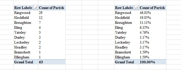
Ringwood is the clear centre of population of Biddlecombe in this period.
Below, a grouping of the data by Parish and then Parent Surname, Forename to approximate family groups.
It would appear that some are the same family, but with varying spelling or abbreviations.
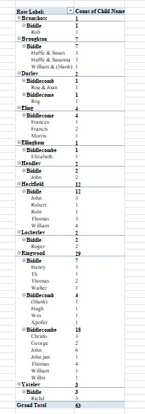
Apologies that this is slightly out of focus, it has had to be shrunk and re-expanded to get on this page.
Variations of surnames.

Biddle returns with a search of Biddle??? or more precisely, Biddle*, but is not likely to be significant as a variation of Biddlecombe. I chose Biddle* as the search to ensure capturing as many relevant variations as possible including misspellings from 'c' onwards.
Baptism Index 1660-1751
Extract of HGS Baptism Index 1660 - 1751 - Biddle??? for the Parish of Eling
To include Biddlecomb, Biddlecombe, Biddlecob, and other variations.
HGS Baptisms 1537 to 1659

Sorry, the buttons don't work here. If you find this information useful you can find more about the registers at the Hampshire Genealogical Society shop.
Hampshire Genealogical Society (HGS) Baptism Index 1660 - 1751
Filtered for the Parish of, Eling
Filtered for Surname, Biddle???
These settings only produced a list of 8 baptisms, in the list below. Apparently to five families.
The dates of baptisms are throughout the Index period.

| 21 Jun 1663 | S | Arthur | John | Biddlecome | Eling | |
| 29 Jan 1692/3 | S | John | Arthur | Biddlecomb | Eling | |
| 10 Dec 1697 | S | John | Arthur | Biddlecomb | Eling | bn 29 Sep |
| 23 Oct 1723 | D | Mary | Richard | Biddlecombe | Eling | |
| 01 May 1723 | S | Arthur | Arthur & Mary | Biddlecombe | Eling | |
| 12 Mar 1742/3 | D | Elizabeth | Arthur & Elizabeth | Biddlecome | Eling | |
| 28 Jul 1745 | S | Arthur | Arthur & Elizabeth | Biddlecomb | Eling | |
| 07 Mar 1747/8 | D | Ann | Arthur & Elizabeth | Biddlecomb | Eling | |
By reference to the Marriage Register for the Parish of Eling, in the period 1660 to 1753.
06 May 1722 Eling - Arthur Biddlecomb and Mary Batchelor
06 Jun 1742 Eling - Arthur Biddlecombe and Elizabeth Blake
I consider that these correlate with the above baptisms from 1723 onward.
Extract of HGS Baptism Index 1660 - 1751 - Biddle??? for the County of Hampshire, all Parishes
To include Biddlecomb, Biddlecombe, Biddlecob, and other variations.
Filtered for the Parish of, All
Filtered for Surname, Biddle??? with Parent Forenames blank
This is to try to establish the extent and distribution where Biddle??? Baptisms were taking place, by parish.
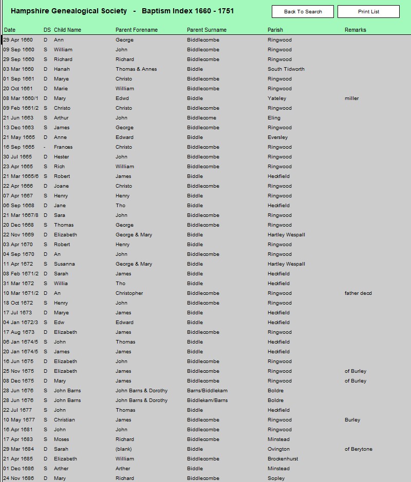
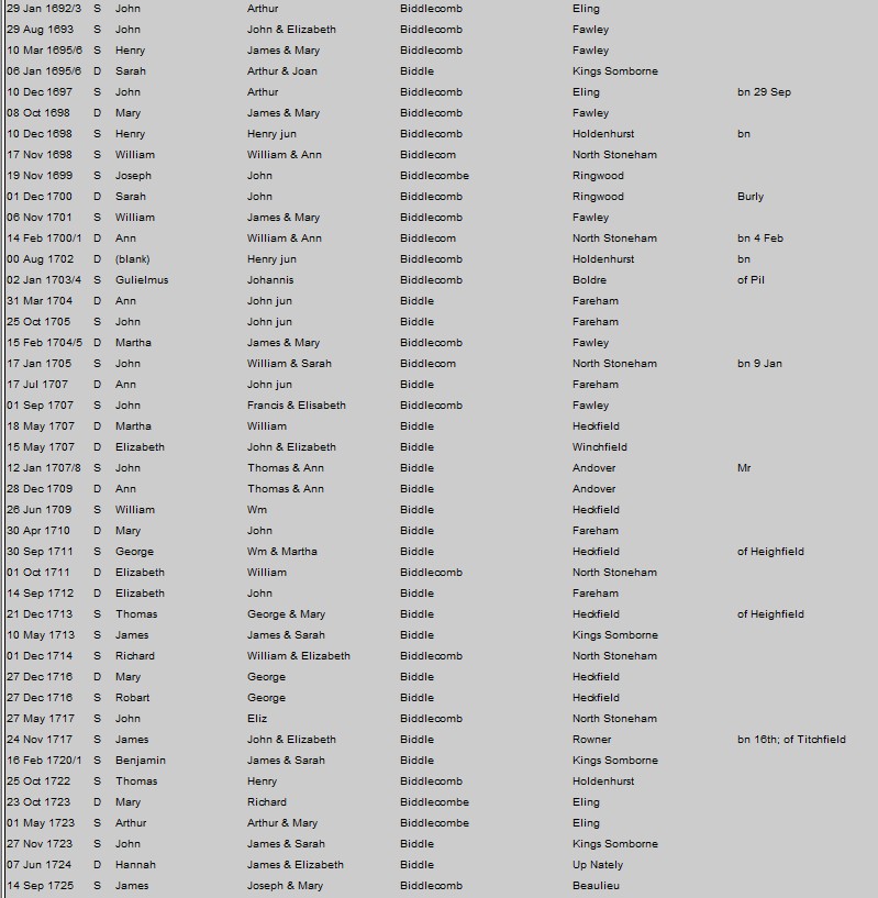
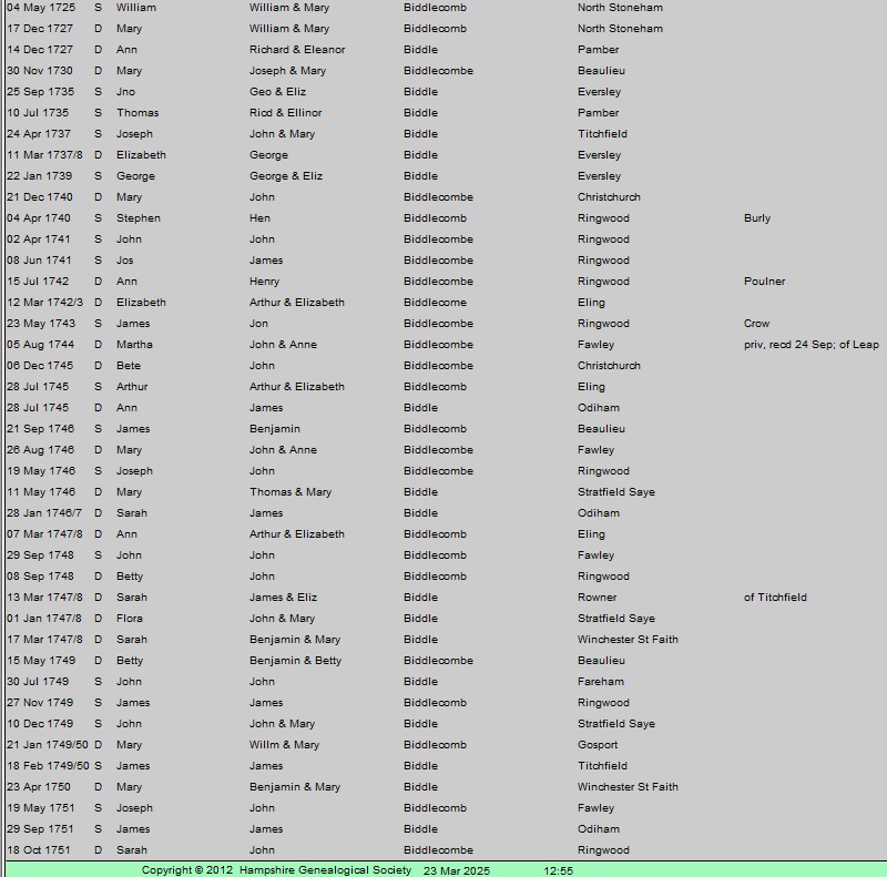
The Parishes of residence are;-
Resorting to my trusty Excel.
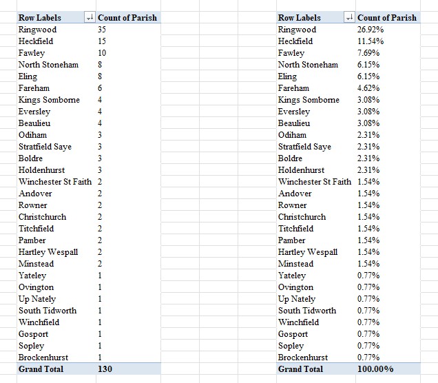
Ringwood is still the clear centre of population of Biddlecombe in this period, but the spread from Ringwood is significantly greater than the previous period.
Below, a grouping of the data by Parish and then Parent Surname, Forename to approximate family groups.
It would appear that some are the same family, but with varying spelling or abbreviations.
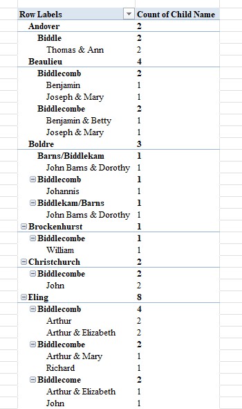 |
 |
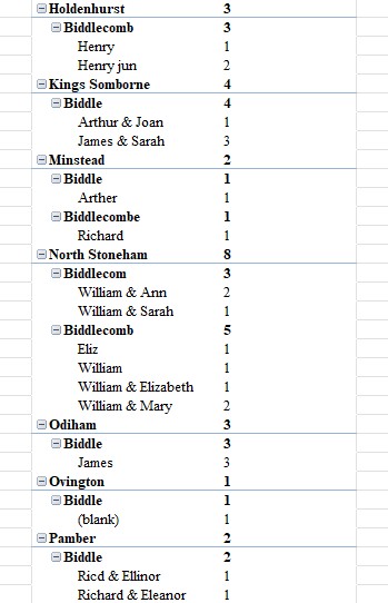 |
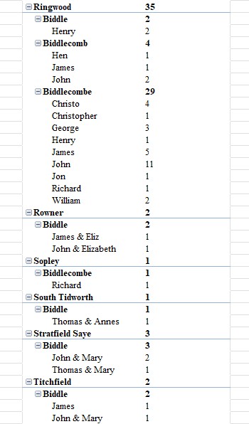 |
 |
Variations of surnames.
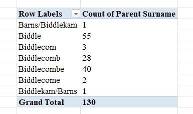
Biddle returns with a search of Biddle??? or more precisely, Biddle*, but is not likely to be significant as a variation of Biddlecombe. I chose Biddle* as the search to ensure capturing as many relevant variations as possible including misspellings from 'c' onwards.
Baptism Index 1752-1812
Extract of HGS Baptism Index 1752 - 1812 - Biddle??? for the Parish of Eling
To include Biddlecomb, Biddlecombe, Biddlecob, and other variations.
HGS Baptisms 1752 to 1812

Sorry, the buttons don't work here. If you find this information useful you can find more about the registers at the Hampshire Genealogical Society shop.
Hampshire Genealogical Society (HGS) Baptism Index 1752 - 1812
Filtered for the Parish of, Eling
Filtered for Surname, Biddle???
These settings produced a list of 25 baptisms, in the list below. Apparently to more than half a dozen families.
The dates of baptisms are all over an 14 year period, near the end of the Index period.


| Biddlecomb | Ann | 03 Mar 1799 | Daniel & Ann |
| Biddlecomb | Ann | 03 Jan 1808 | John & Sarah |
| Biddlecomb | Charles | 25 Aug 1811 | Daniel & Anne |
| Biddlecomb | Elizabeth | 08 Jul 1770 | Edward |
| Biddlecomb | George | 02 Dec 1810 | Leonard & Mary |
| Biddlecomb | Hannah | 25 May 1804 | Leonard & Ann |
| Biddlecomb | Isaac | 25 May 1800 | John & Hannah |
| Biddlecomb | James | 18 Feb 1798 | John & Hannah |
| Biddlecomb | John | 18 Jun 1786 | John & Hannah |
| Biddlecomb | John | 25 May 1800 | Leonard & Mary |
| Biddlecomb | Martha | 16 May 1784 | John & Hannah |
| Biddlecomb | Mary | 24 Mar 1761 | Edward & Mary |
| Biddlecomb | Mary | 29 Mar 1801 | Daniel & Ann |
| Biddlecomb | Mary Ann | 06 Feb 1803 | Leonard & Mary |
| Biddlecomb | Robert | 14 Sep 1788 | John & Hannah |
| Biddlecomb | Sarah | 21 Dec 1794 | Daniel |
| Biddlecomb | Sarah | 30 Apr 1809 | Edward & Sarah |
| Biddlecomb | Stephen | 23 Jan 1791 | John & Hannah |
| Biddlecomb | Susannah | 06 Nov 1785 | Edwd & Elizth |
| Biddlecomb | Thos | 07 Aug 1803 | Daniel & Ann |
| Biddlecombe | Harriot | 10 May 1808 | Leonard & Mary |
| Biddlecombe | Jane | 05 Feb 1809 | Daniel & Anne |
| Biddlecombe | Joseph | 28 May 1797 | Daniell & Anne |
| Biddlecombe | Maria | 25 Oct 1809 | Leonard & Mary |
| Biddlecombe | Maria | 10 May 1812 | John & Sarah |
Potential family groups;
There is more data in this period, 1752 to 1812 so I have used excel to help sort and present the data. Still only 25 people, but more than a previous period, where plain old observation would do.
Firstly, the potential families by the parents' first names.
Then, the same information, but including the children baptised by those parents.
Timeline
The baptism date calculated to a year, and then an annual timeline of baptisms produced.
Marriage Index 1538-1659
Extract of HGS Marriage Index 1538 - 1659 - Biddle??? for the Parish of Eling
To include Biddlecomb, Biddlecombe, Biddlecob, and other variations.
HGS Marriages 1538 - 1660

Sorry, the buttons don't work here. If you find this information useful you can find more about the registers at the Hampshire Genealogical Society shop.
Hampshire Genealogical Society (HGS) Marriage Index 1538 - 1660
Filtered for the Parish of, Eling
Filtered for Surname, Biddle??? - Bride and Groom
These settings only produced a list of zero marriages, with the brides name being Biddle or variations thereof. For the groom there was only one named Biddle???
That is only one marriage for Biddle and variations, both bride and groom in 123 years. About 1 weddings per century on average across the period. Not an auspicious start. At least it was a date at the end of the period.
It should be noted that for a lot of Parishes, the end date of 1660, is before or close to the first date of Parish records still in existence. So, the absence of a return for a parish, does not necessarily mean that there were no families of that name in that Parish, just none in the register.

23 Oct 1654 Eling -- John Biddlecombe and Susannah Thomas
Perhaps the first family to set up camp in the parish of Eling, or maybe John's parents were.
By reference to the Baptism Index of a similar period, John and Susannah do not have any children Baptised in the Parish of Eling before 1659.
Marriage Index 1660-1753
Extract of HGS Marriage Index 1660 - 1753 - Biddle??? for the Parish of Eling
To include Biddlecomb, Biddlecombe, Biddlecob, and other variations.
HGS Marriages 1660 - 1753
Sorry, the buttons don't work here. If you find this information useful you can find more about the registers at the Hampshire Genealogical Society shop.
Hampshire Genealogical Society (HGS) Marriage Index 1660 - 1753
Filtered for the Parish of, Eling
Filtered for Surname, Biddle??? - Bride and Groom
These settings only produced a list of three marriages, with the brides name being Biddle or variations thereof. For the groom there was only two named Biddle???
That is only five marriages for Biddle and variations, both bride and groom in 93 years, and one of those could be a widow. About 4 weddings per century on average across the period. Not a large population of Biddlecombes in the parish of Eling in this period.
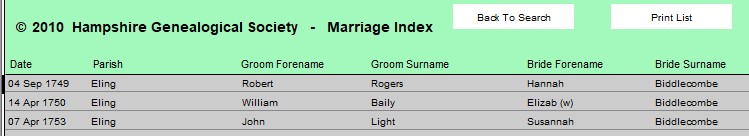
04 Sep 1749 Eling - Robert Rogers and Hannah Biddlecombe
14 Apr 1750 Eling - William Baily and Elizab (w) Biddlecombe
07 Apr 1753 Eling - John Light and Susannah Biddlecombe
The (w) after Elizabeth indicates she is a widow, and therefore Biddlecombe is unlikely to be her maiden name.
In the previous index 23 Oct 1654 Eling -- John Biddlecombe and Susannah Thomas. Susannah Thomas would have become Susannah Biddlecombe. The interval between the two Susannah marriages is nearly a century, so it is reasonable to assume it is not the same person.
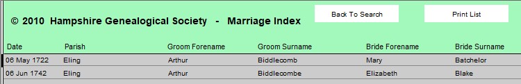
06 May 1722 Eling - Arthur Biddlecomb and Mary Batchelor
06 Jun 1742 Eling - Arthur Biddlecombe and Elizabeth Blake
Marriage Index 1754-1837
Extract of HGS Marriage Index 1754 - 1837 - Biddle??? for the Parish of Eling
To include Biddlecomb, Biddlecombe, Biddlecob, and other variations.
HGS Marriages 1754 - 1837
Sorry, the buttons don't work here. If you find this information useful you can find more about the registers at the Hampshire Genealogical Society shop.
Hampshire Genealogical Society (HGS) Marriage Index 1754 - 1837
Filtered for the Parish of, Eling
Filtered for Surname, Biddle??? - Bride and Groom
These settings only produced a list of thirteen marriages, with the brides name being Biddle or variations thereof. For the groom there was nineteen named Biddle???
That is thirty-two marriages for Biddle and variations, both bride and groom in 83 years, and one of those is repeated, i.e. in both Bride and Groom, so thirty-one in total. About 4 weddings per decade on average across the period. Not a large population of Biddlecombes in the parish of Eling in this period, but a veritable population explosion compared to previous indexes.
Bride
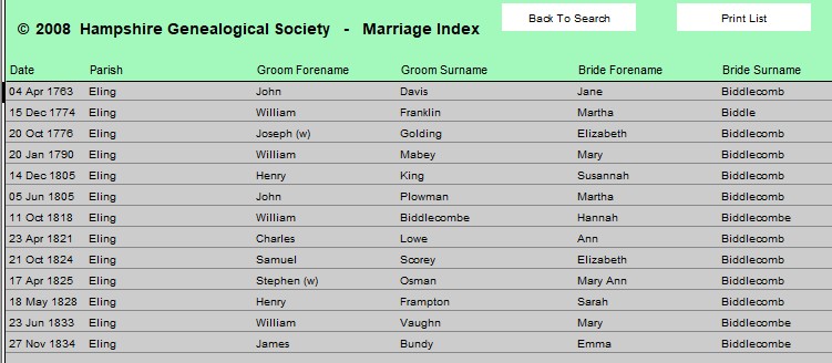
| 04 Apr 1763 | Eling | John Davis | and | Jane Biddlecomb |
| 15 Dec 1774 | Eling | William Franklin | and | Martha Biddle |
| 20 Oct 1776 | Eling | Joseph Golding (w) | and | Elizabeth Biddlecomb |
| 20 Jan 1790 | Eling | William Mabey | and | Mary Biddlecomb |
| 14 Dec 1805 | Eling | Henry King | and | Susannah Biddlecomb |
| 05 Jun 1805 | Eling | John Plowman | and | Martha Biddlecomb |
| 11 Oct 1818 | Eling | William Biddlecombe | and | Hannah Biddlecombe |
| 23 Apr 1821 | Eling | Charles Lowe | and | Ann Biddlecomb |
| 21 Oct 1824 | Eling | Samuel Scorey | and | Elizabeth Biddlecomb |
| 17 Apr 1825 | Eling | Stephen Osman | and | Mary Ann Biddlecomb |
| 18 May 1828 | Eling | Henry Frampton | and | Sarah Biddlecomb |
| 23 Jun 1833 | Eling | William Vaughn | and | Mary Biddlecombe |
| 27 Nov 1834 | Eling | James Bundy | and | Emma Biddlecombe |
Groom
| 01 Jun 1759 | Eling | Edward Biddlecomb | and | Mary Plaskett |
| 13 Jun 1762 | Eling | William Biddlecomb | and | Honour Curtis |
| 30 Mar 1770 | Eling | Edward Biddlecomb | and | Elizabeth Scorey |
| 17 Jul 1782 | Eling | John Biddlecomb | and | Hannah Hatch |
| 14 Apr 1788 | Eling | Daniel Biddlecomb | and | Mary Fabian |
| 19 Feb 1797 | Eling | Daniel Biddlecomb | and | Ann Davies |
| 24 Mar 1799 | Eling | Leaonnard Biddlecomb | and | Mary Harris |
| 25 Aug 1807 | Eling | John Biddlecomb | and | Sarah Lowman |
| 19 Jan 1811 | Eling | Joseph Biddlecomb | and | Charlotte Lancaster |
| 20 Mar 1813 | Eling | Robert Biddlecomb | and | Mary Morris |
| 25 Oct 1814 | Eling | John Biddlecomb | and | Elizabeth Oliver |
| 11 Oct 1818 | Eling | William Biddlecombe | and | Hannah Biddlecombe |
| 27 Dec 1819 | Eling | Thomas Biddlecomb | and | Elizabeth Luke |
| 27 Sep 1821 | Eling | James Biddlecomb | and | Elizabeth Hendy |
| 19 Jul 1821 | Eling | Isaac Biddlecomb | and | Ann Hurle |
| 05 Jan 1821 | Eling | Dewrin Biddlecombe | and | Mary Pierce |
| 27 Oct 1822 | Eling | Charles Biddlecomb | and | Ann Jerram |
| 18 Mar 1832 | Eling | George Biddlecomb | and | Elizabeth Longland |
| 29 Jun 1837 | Eling | William Biddlecomb | and | Susannah Bundy |
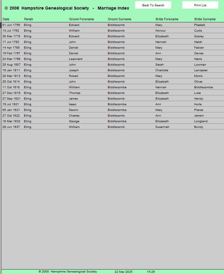
Records
Parish Registers
Moving on from an overview of the Register to a detailed look at the contents, on a journey of discovery for Baptisms, Marriages, and Burials, and perhaps a few other things on the way. Hoping to find validation regarding people in my Ancestry Family Tree, and perhaps some additional information / people.
We are very lucky to have Parish Registers going so far back in time. It gives us a starter to building ancient relationships. There are however intrinsic difficulties with the information gained. Early baptisms only contain the name of the person being baptised. Then later, the person, generally a child, together with a parent name. Later, the addition of father and mother. With the latter there is a reasonable chance of being able to create a family group, especially if you can find an associated marriage for the mother and father, if the location remains constant and the dates make sense.
Names are another problem. Repeatedly using the same Christian names through generations is problematic. Even reusing a name where a child has died in infancy, in the same family! There are not many Fifi Trixibelle names in the mix but there are a lot of four or more generations of the same common name. Often, without any middle names, to help separate one John from another.
Then there is the inconsistent spelling to take into count, as well as the sometimes poor handwriting. Was ink so expensive that an early dip in the inkwell would be unconscionable. No, better that it is so faint that it is barely visible. Then suddenly, a few lines on, and it is legible again. Transcribing all that can be difficult, I appreciate that. However, just using search function on the records database does not always find all the required, or expected results. Sometimes even the first letter of a name is mis-transcribed. Totally understandably in some instances. It is easier to read through the images of the Parish Records when you are looking for a specific Surname. Pattern matching starts to play, which can give better results than just sequential transcriptions.
However, it is still difficult to join one generation to another outside of the situation where both parents are recorded on the Baptism Record. It all comes down to probabilities in the end. How many facts of convergence can you find to give you enough confidence to make that leap of faith, and make the assumption that John and Arthur are related, and to create that link on Ancestry, or any other tree. There is no way from the records that you can definitively conclude if it was the 1817 Arthur or the 1823 Arthur who married Elizabeth. Even DNA will just pass through that node between the match and the common ancestor. The name attached to that node, is not conclusive.
With the various Acts which improved the record keeping requirements, so the ability to create accurate links improves. Having Fathers on Marriage certificates helps in this respect. Places of abode on Baptism Records also help. For instance the Parish of Eling, before the split in three, was over 20 square miles, about 5700 hectares. A rural place of abode may cover 2 square miles, about 500 hectares. Proximity of location at abode level gives rise to greater confidence than at Parish level.
List of Rectors & Vicars
A spectacular find. Click on image to go to source.
Eling
These lists are so helpful. In the past I would look through the Parish Register for information to create a list, or go to some of the sources at the top of the image. This is so much easier, just look the parish up, and there is the list. I recognise some of the names from the Marriage Certificates.
Lists generated within Extent above - Baptisms
Baptism Index 1537-1659
Baptism Index 1537-1659
| Baptism date | D/S | Child name | Parent forename | Surname | Parish | |
| 04 Apr 1643 | S | John | Francis | Biddlecome | Eling | |
| 10 Jun 1644 | S | Morris | Morris | Biddlecome | Eling | |
| 14 Jan 1645/6 | S | Richard | Francis | Biddlecome | Eling | |
| 20 Oct 1650 | D | Bridget | Frances | Biddlecome | Eling |
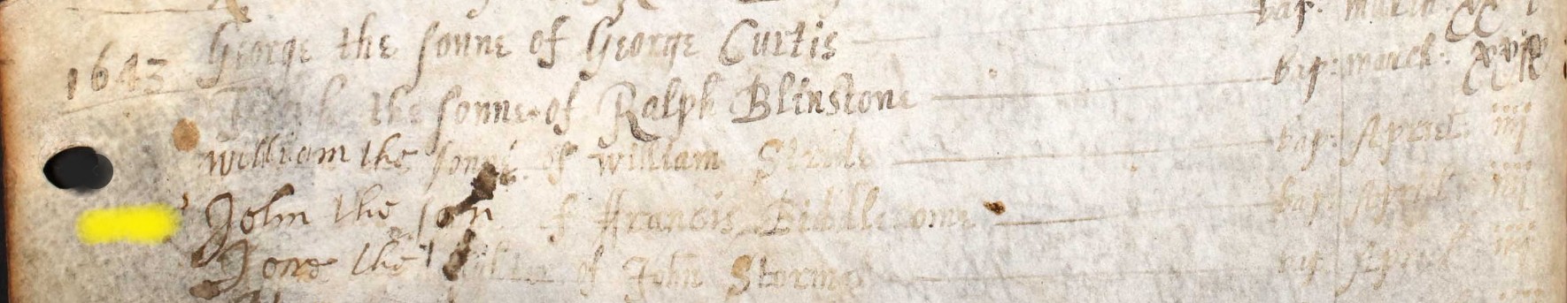
John the Son of Francis Biddlecome -- Bap April iiii
4 April 1643.
No mother or place information other than parish.
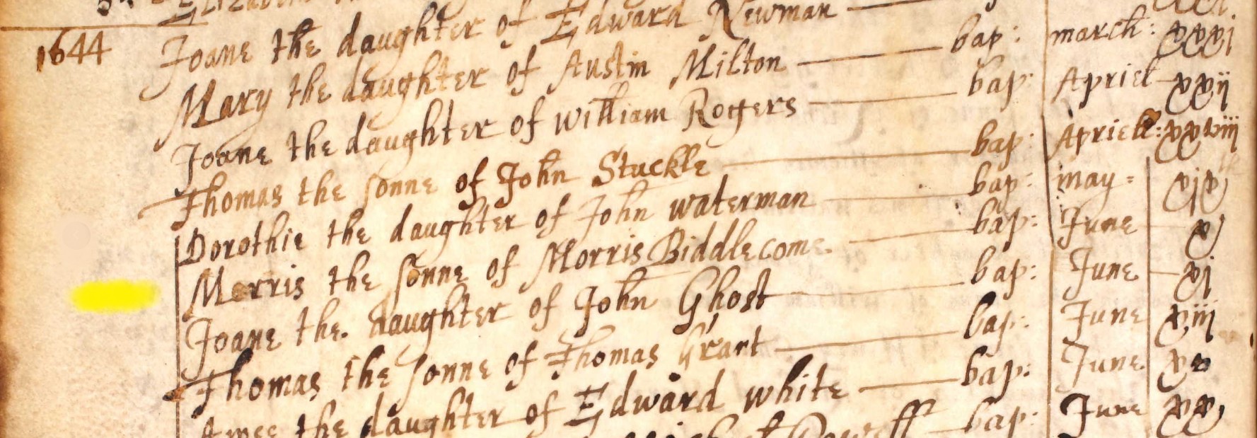
Morris the Sonne of Morris Biddlecome - bap: Jun 10
10 Jun 1644
No mother or place information other than parish.

Richard the sonne of Frances Biddlecome - bap: Jan xi
11 Jan 1645
No place information other than parish.
Uncertain if Frances Biddlecome is Mother or Father, with the spelling of Frances with an 'e' suggesting the possibility it maybe a female. No other note confirming that the person is not the standard father.
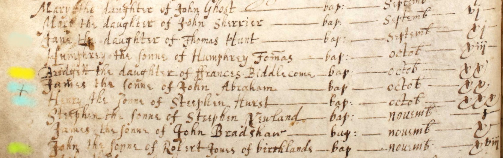
Bridgett the daughter of Francess Biddlecome - bap: octob XX
20 Oct
No place information other than parish.
Uncertain if Frances Biddlecome is Mother or Father, with the spelling of Frances with an 'e' suggesting the possibility it maybe a female. No other note confirming that the person is not the standard father.
Note other familiar surnames, (blue) of Abrahams and Hurst.
Note also (green) Robert Jones of birthlands, presumably indicating his abode being outside the Parish, or the name of a house or farm. Note particularly relevant here, but altough at first pass I read birthlands it could be Ci??hlands.
Baptism Index 1660-1751
Baptism Index 1660-1751
| Baptism Date | D/S | Child Name | Parent Name | Surname | Parish | |
| 21 Jun 1663 | S | Arthur | John | Biddlecome | Eling | |
| 29 Jan 1692/3 | S | John | Arthur | Biddlecomb | Eling | |
| 10 Dec 1697 | S | John | Arthur | Biddlecomb | Eling | bn 29 Sep |
| 23 Oct 1723 | D | Mary | Richard | Biddlecombe | Eling | |
| 01 May 1723 | S | Arthur | Arthur & Mary | Biddlecombe | Eling | |
| 12 Mar 1742/3 | D | Elizabeth | Arthur & Elizabeth | Biddlecome | Eling | |
| 28 Jul 1745 | S | Arthur | Arthur & Elizabeth | Biddlecomb | Eling | |
| 07 Mar 1747/8 | D | Ann | Arthur & Elizabeth | Biddlecomb | Eling |
I will attempt to group these people into family groups, and create tabs accordingly. The allocation may change over time.
Arthur of John and John of Arthur
Arthur of John and John of Arthur x 2
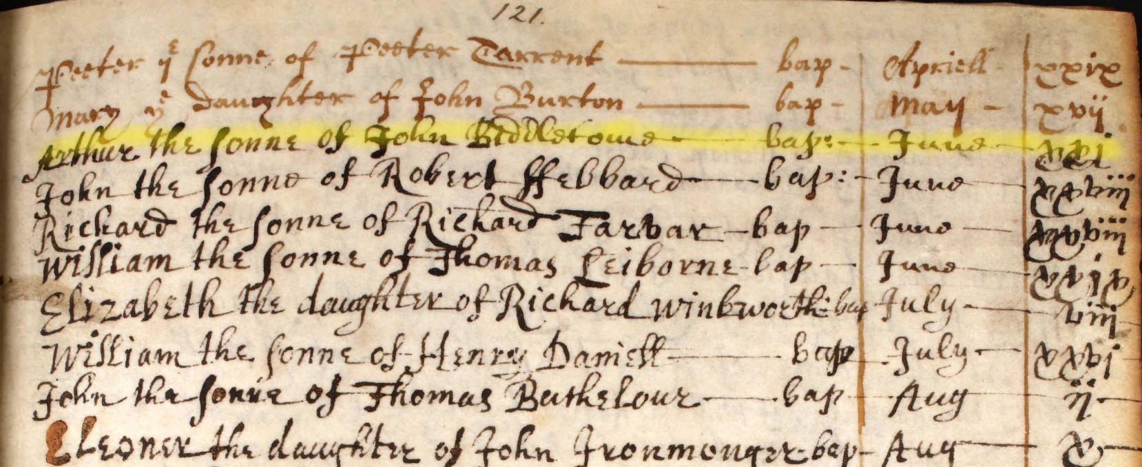
Arthur the sonne of John Biddlecome Bap: June xxi
Baptised 21 June 1663
Could the above Arthur reappear within other records. For instance, marriage might be between 20-25 years for early marriage, and maybe 40-50 years for a late marriage. Assuming Baptism year to be the same as birth year, 1663 plus 20-25 is 1683 to 1685, and plus 40-50 is 1703-1713. Parenthood might therefore be expected to be between, 1683 to 1713, but not restricted to those dates only.
On 29 Jan 1692 John was baptised to a father called Arthur Biddlecomb. The above Arthur would have been approximately 29 years of age in 1692. So names, location and timescales all work for this being the same person.
On 06 May 1722 an Arthur was married. The above Arthur would have been 59 on this date. Not an inconceivable date but equally not so probable to call it as the same person at this stage.
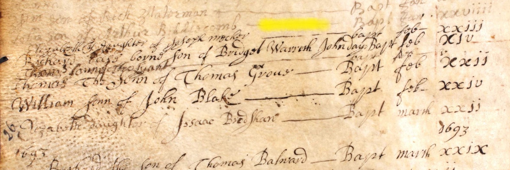
John son of Arthur Biddlecomb Bapt Jan xxviiii
Baptised 29 Jan 1692
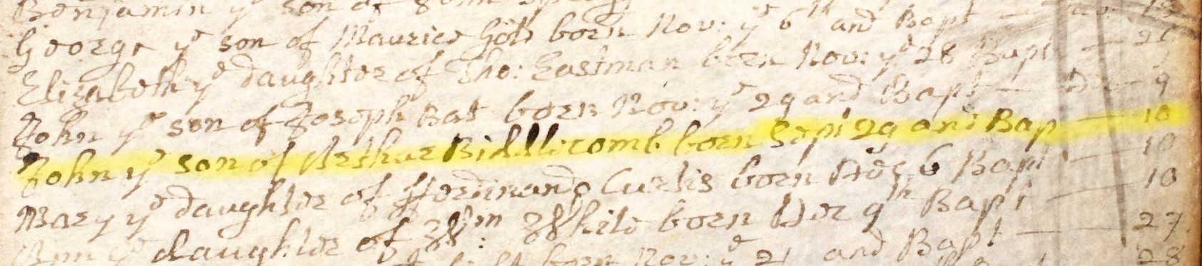
John ye son of Arthur Biddlecomb born Sept 29 and Bap Dec 10.
Baptised 10 Dec 1697.
On first view this John and Arthur combination should indicate a separate family to the previous one in 1692. There is only five/six years of separation between baptisms. However, currently there appears to be only one Arthur Biddlecomb active in the Parish of Eling at the relevant time, according to the records. An alternative consideration is that it is the same family, but sadly, the 1692 John died. Searches have not demonstrated this to be so. I will therefore page turn the Burial records.
...
Unfortunately, the page turn did not reveal anything useful. At least in the Parish of Eling.
I will consider this a hypothesis for the time being.
Going back to the first record here, Arthur of John, baptised 21 June 1663.
Is it conceivable that the below information from FindMyPast is relevant re Arthur's parents. Could they have been the John and Susan who married in Eling in 1654
First name(s) John
Last name Biddlecomb
Year 1654
Spouse's first name(s) Susan
Spouse's last name Tomas
Place Eling
County Hampshire
Country England
Source Boyd's 1st miscellaneous marriage index, 1415-1808
Record set England, Boyd's Marriage Indexes, 1538-1850
Category Birth, Marriage, Death & Parish Records
Subcategory Parish Marriages
Collections from England, Great Britain
Arthur & Mary
Arthur of Arthur and Mary
Then there is a 26 year gap to the next baptism. Unlikely to be the same family group / generation as the last or previous baptisms.
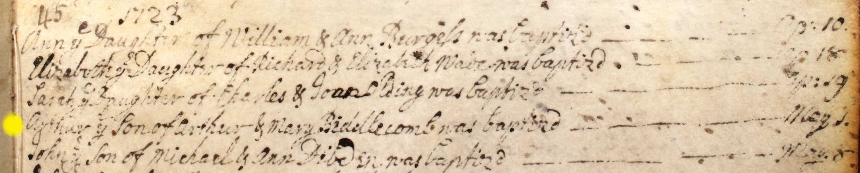
Aurtur y Son of Arthur & Mary Biddlecomb was baptisd May 1
1 May 1723
Mary of Richard
Mary of Richard
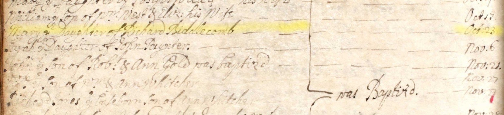
Mary ye Daughter of Richard Biddlecomb was Baptised Oct : 23
Baptised 23 Oct 1723
Arthur & Elizabeth
Arthur & Elizabeth
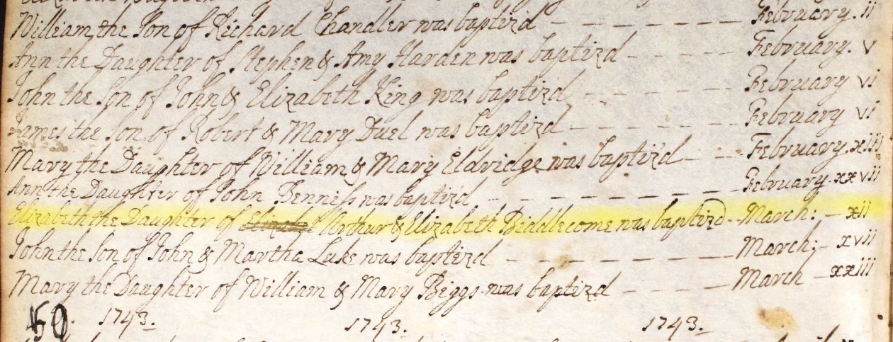
Elizabeth the Daughter of Arthur & Elizabeth Biddlecome was baptised March xii.
Baptised 12 March 1742.
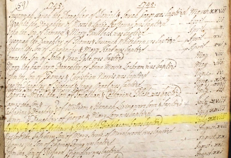
Arthur ye Son of Arthur & Elizabeth Biddlecomb was Baptized July xxviii
Baptised 28 July 1745
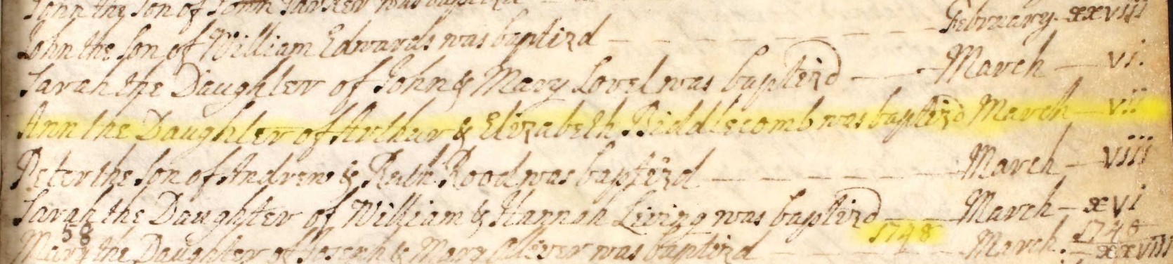
Ann the Daughter of Arthur & Elizabeth Biddlecomb was baptised March vii
Baptised 7 March 1747.
Given the interval between baptisms, and therefore probably births, and the same parents names, as well as location, I consider these to be three children to be siblings of the same parents, Arthur and Ellizabeth Biddlecomb. Three is a low number of children for the period. I will look for potential reasons.
I think below is the marriage details of the parents, brought forward from marriages.
| 06 Jun 1742 | Eling | Arthur Biddlecombe | and | Elizabeth Blake |
Extract of the Register for the Parish of Eling image.
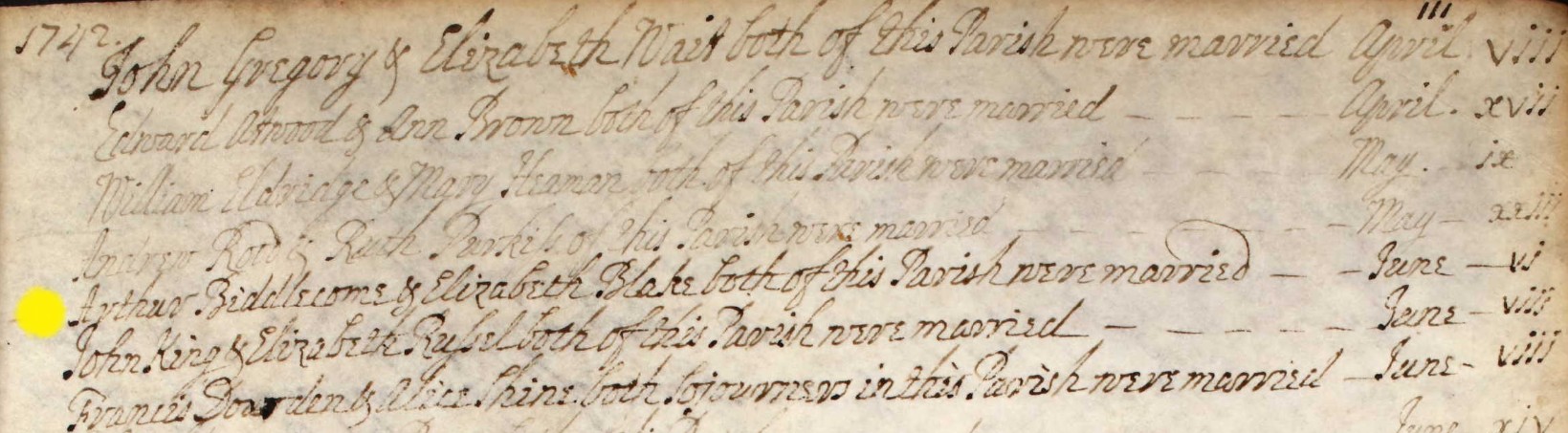
Arthur Biddlecome & Elizabeth Blake both of this Parish were married June vi.
Marriage 6 June 1742
However, there is an inconsistency here.
Elizabeth, Baptised 12 March 1742.
Arthur, Baptised 28 July 1745.
Ann, Baptised 7 March 1747.
Elizabeth was baptised before they were married on 6 June 1742, but there is no reference to that on the Baptism record, as would normally be the case.
Other
Other
A possible link to the centre of Biddlecome population in Hampshire, Ringwood.
Pulling this forward from the Marriages section;-
| 23 Oct 1654 | Eling | John Biddlecombe | and | Susannah Thomas |
Extract of the Register for the Parish of Eling image.
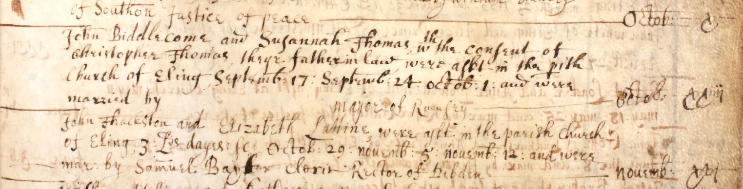
John Biddlecome and Susannah Thomas with the consent of Christopher Thomas theyr {their} father in law were a??? in the parish Church of Eling {banns} Septemb: 17 : Septemb: 24 : octob: 1 and were married by mayor of Romsey Octob xxiii. --
Marriage 23 Oct 1654.
So on 23 Oct 1654 Susannah Thomas, and possibly John Biddlecome, were aged under 21 years. Giving an approximate year of birth as after 1634.
No marriage of a person under the age of 21 was valid without the consent of parents or guardians. Clergymen who disobeyed the law were liable for 14 years transportation.
Although Jews and Quakers were exempt from the 1753 Act, it required religious non-conformists and Catholics to be married in Anglican churches.
Again looking at the baptism index.
| 04 Apr 1643 | S | John | Francis | Biddlecome | Eling |
If this is the same John, as was married on 23 Oct 1654, he would have been 11 years, 6 months, 20 days including the end date.
The legal age for marriage from 29 September 1653 was fixed at 16 for a man and 14 for a woman. In 1660 the pre-interregnum laws were reinstated and the ages of marriage reverted to 14 for the groom and 12 for the bride.
Therefore I am currently discounting the idea that the two Johns are one in the same person.
However, allowing the search to look outside the Parish of Eling
Extract of the Register for the Parish of Ringwood image.
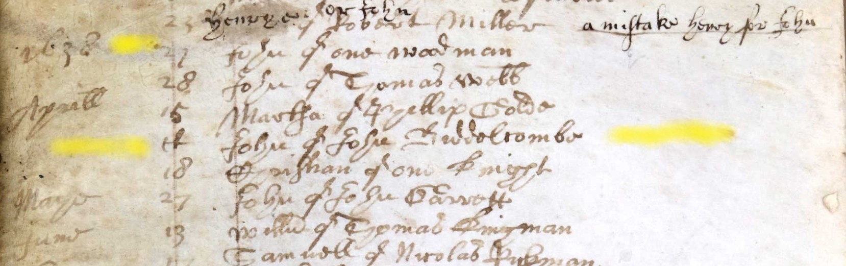
April ?? John of John Biddelcombe
The ?? could be an indecipherable number between 15 and 18 or it could be some form of ditto, d, or ''. The record has been transcribed as 15 April, so I will use that.
Baptised 15 April 1638, in the Parish of Ringwood.
If this is the same John, as was married on 23 Oct 1654, he would have been 16 years, 6 months, 9 days including the end date. Unlike the previous calculation, this is a possibility, and if correct provides the link back to the centre of Biddlecome population in Hampshire, Ringwood.
John being baptised in 1638, and therefore assuming that was his year of birth, his father could have been born about 1618, allowing a 20 year generation gap.
If the following is the record of John's father's baptism, also named John, then the interval between baptisms is 38 years, 10 months, 27 days including the end date, which is also a possibility.
Another consideration is whether John (1599) is a brother of Christopher (1571). See another article regarding Christopher Biddlcomb of Ringwood
Extract of the Register for the Parish of Ringwood image.
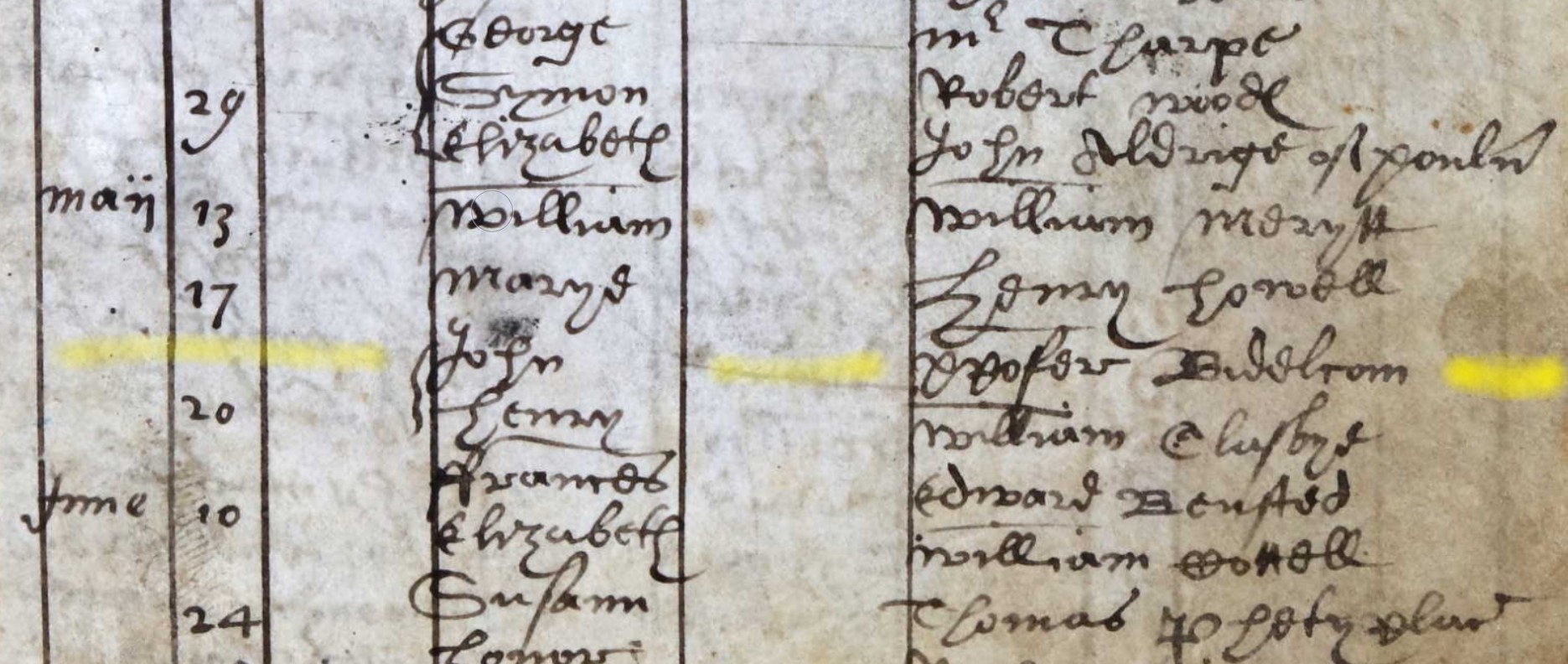
May 20 John ????? Biddlcom
Baptised 20 May 1599 John Biddlcom of Xpofer Biddlcom in the Parish of Ringwood.
I am not sure that the father's name was Xpofer, but I can't make it out either. I would like to try to see it as Arthur, but I have looked at other capital letters on the page. It appears not to be an A.
Another thought, if X is an abbreviation for Christ, the name could be Christpofer, not too distant from Christofer, or Christopher.
However, the Christopher Biddlcomb of Ringwood is not necessarily this Christopher as there is already a John in that family with a baptism year of 1596.
I think I may have just talked myself into a future Biddlecombe families of Ringwood!!
Baptism Index 1752-1812
Baptism Index 1752-1812
xxxxxxxxxxxxxxxxxxxxxxxxxxxxxxxxxxxxxxxxxxxxxx
There are a lot more people that fit the criteria in this third Parish Register book than in previous books. This is evident from the list below.
Due to the extra people I have decided that it might help if I change the format slightly to accommodate the list. Hope it helps.
List of Baptisms brought forward from the HGS Extent exercise.
| Biddlecomb | Ann | 03 Mar 1799 | Daniel & Ann |
| Biddlecomb | Ann | 03 Jan 1808 | John & Sarah |
| Biddlecomb | Charles | 25 Aug 1811 | Daniel & Anne |
| Biddlecomb | Elizabeth | 08 Jul 1770 | Edward |
| Biddlecomb | George | 02 Dec 1810 | Leonard & Mary |
| Biddlecomb | Hannah | 25 May 1804 | Leonard & Ann |
| Biddlecomb | Isaac | 25 May 1800 | John & Hannah |
| Biddlecomb | James | 18 Feb 1798 | John & Hannah |
| Biddlecomb | John | 18 Jun 1786 | John & Hannah |
| Biddlecomb | John | 25 May 1800 | Leonard & Mary |
| Biddlecomb | Martha | 16 May 1784 | John & Hannah |
| Biddlecomb | Mary | 24 Mar 1761 | Edward & Mary |
| Biddlecomb | Mary | 29 Mar 1801 | Daniel & Ann |
| Biddlecomb | Mary Ann | 06 Feb 1803 | Leonard & Mary |
| Biddlecomb | Robert | 14 Sep 1788 | John & Hannah |
| Biddlecomb | Sarah | 21 Dec 1794 | Daniel |
| Biddlecomb | Sarah | 30 Apr 1809 | Edward & Sarah |
| Biddlecomb | Stephen | 23 Jan 1791 | John & Hannah |
| Biddlecomb | Susannah | 06 Nov 1785 | Edwd & Elizth |
| Biddlecomb | Thos | 07 Aug 1803 | Daniel & Ann |
| Biddlecombe | Harriot | 10 May 1808 | Leonard & Mary |
| Biddlecombe | Jane | 05 Feb 1809 | Daniel & Anne |
| Biddlecombe | Joseph | 28 May 1797 | Daniell & Anne |
| Biddlecombe | Maria | 25 Oct 1809 | Leonard & Mary |
| Biddlecombe | Maria | 10 May 1812 | John & Sarah |
There are two surnames in the list above, so I will split the list accordingly. Also, I have found another surname whilst page turning the Parish Register images which was outwith the search criteria, Biddelcome, 'el' instead of 'le'. Another tab for this surname as I consider it just to be another variation. As 'el' comes before 'le', the unlisted names come first.
Biddelcome
Whilst I found Frances first, and the other sections are ordered alphabetically, I will order these chronologically by date of baptism.
Joseph 19 Feb 1772
Joseph 19 Feb 1772
This record was not included in the above extent list.
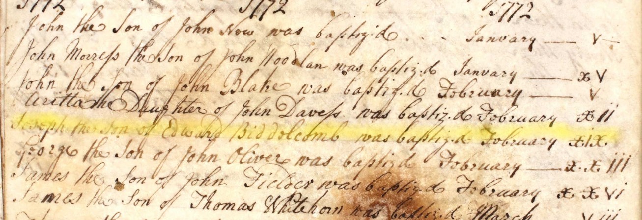
Joseph the Son of Edward Biddelcomb was baptized February xix
Baptised 19 February 1772
Lydard 13 Apr 1774
Lydard 13 Apr 1774
This record was not included in the above extent list.
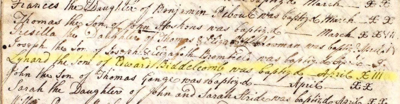
Lynard the Son of Edward Biddelcomb was baptized April xiii
Baptised 13 April 1774
Daniel 9 Oct 1776
Daniel 9 October 1776
This record was not included in the above extent list.
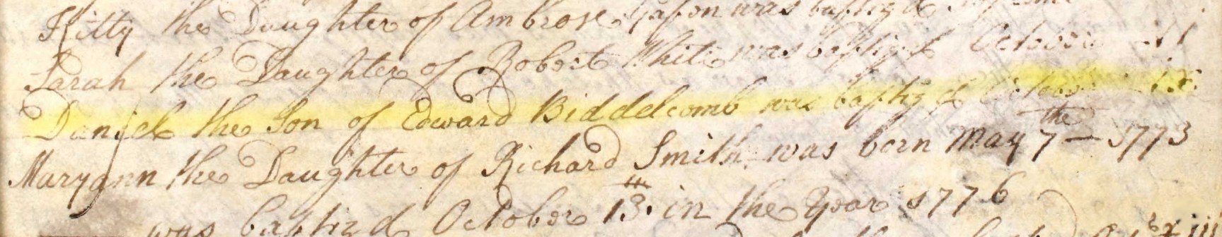
Daniel the Son of Edward Biddelcomb was baptised October ix
Baptised 9 October 1776
Note, the reference to 1773 in the next record is pertaining to Maryann's date of birth, with her baptism being 13th October 1776, four days after Daniel.
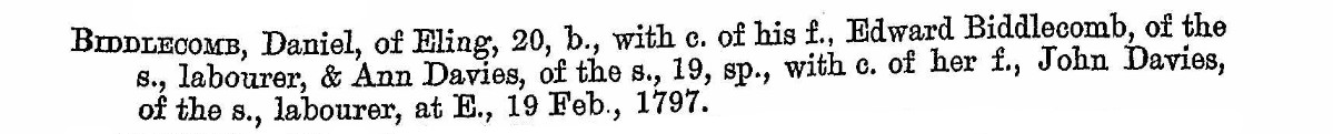
In his Allegations for Marriage Licences entry the spelling changes.
Biddlecomb, Daniel, of Eling, 20 years of age, bachelor with consent of his father Edward Biddlecomb, of the same parish, labourer, & Ann Davies, of the same parish, 19 years of age, spinster, with consent of her father, John Davies, of the same parish, labourer, at Eling, 19 Feb, 1797.
Note, I have note coloured this in green to indicate a transcription as I though it was more useful to put my attempt at resolving all the abbreviations / code.
From the date of baptism 9 October 1776 to 19 Feb 1797, the duration calculates to 20 years, 4 months, 10 days excluding the end date. This matches with his declared age. His age, and that of his proposed wife requires the consent of their respective parents to marry.
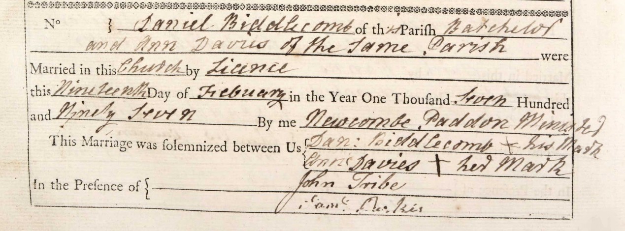
Frances 10 Jun 1778
Frances 10 June 1778
This record was not included in the above extent list.
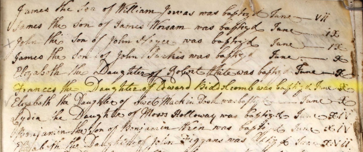
Frances the Daughter of Edward Biddelcomb was baptised June x.
Baptised 10 June 1778.
The record was transcribed as Bibbelcomb, which is understandable. The search criteria for the initial list was Biddle* which accounts for this being missed from the list.
Robert 24 Apr 1782
Robert 24 Apr 1782
This record was not included in the above extent list.
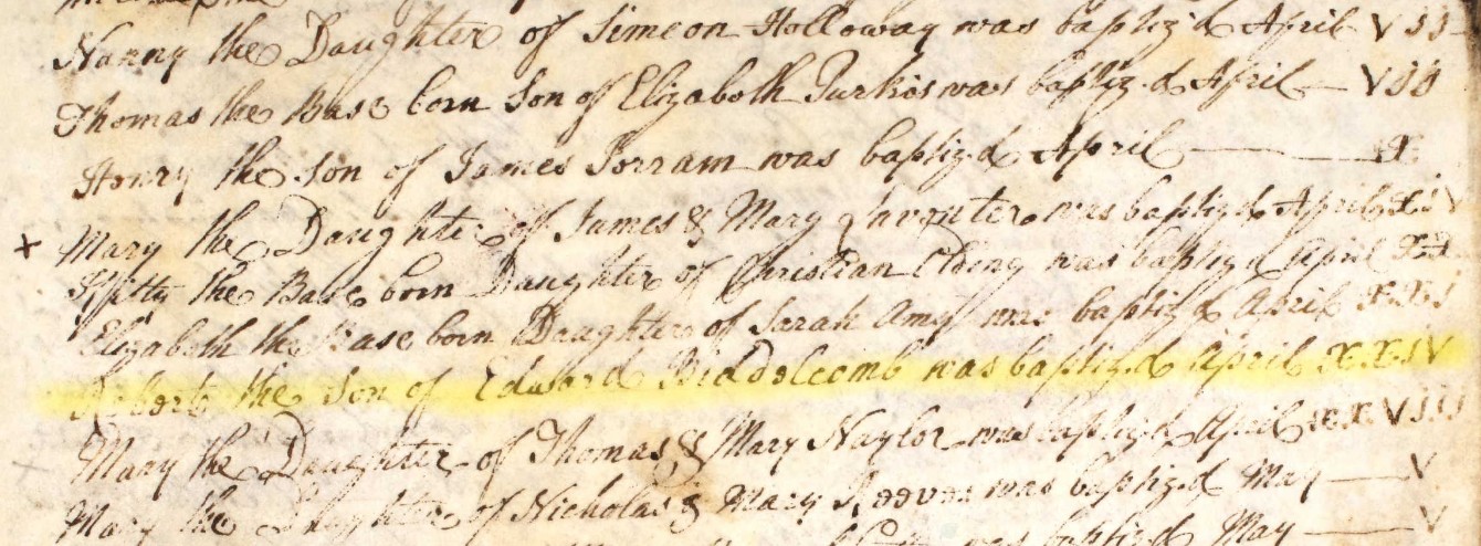
Robert the Son of Edward Biddelcomb was baptized April xxiv
Baptised 24 April 1782.
Possible parents
Creating a list based on the foregoing record finds.
All with a parent, father Edward Biddelcomb
| 19 February 1772 | Joseph | |
| 13 April 1774 | Lynard | |
| 9 October 1776 | Daniel | |
| 10 June 1778. | Frances | |
| 24 April 1782. | Robert |
Assuming births in the same year as baptism, the approximate frequency is a child every second year, apart from 1780. This is easily one family, starting in 1772. Therefore a possible year of marriage could be about 1770-71.
From the HGS indexes in the Extent section, Groom marriages list for this period,
| 01 Jun 1759 | Eling | Edward Biddlecomb | and | Mary Plaskett |
| 13 Jun 1762 | Eling | William Biddlecomb | and | Honour Curtis |
| 30 Mar 1770 | Eling | Edward Biddlecomb | and | Elizabeth Scorey |
The probable parents are Edward Bibblecomb and Elizabeth Biddlecomb nee Scorey.
Re-running the HGS Baptism Index with the filters set to Biddel* and the parish of Eling.
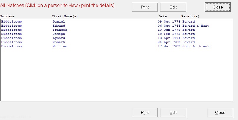
The Edward of Edward and Mary maybe referring to the parents married 01 Jun 1759, Edward Biddlecomb and Mary Plaskett.
The list has the same names as those found with the father being Edward.
William with a parent called John, baptised in the same year as Robert, 1782.
Biddlecomb
Ann 03 Mar 1799
| Biddlecomb | Ann | 03 Mar 1799 | Daniel & Ann |
Ann 03 Jan 1808
| Biddlecomb | Ann | 03 Jan 1808 | John & Sarah |
Charles 25 Aug 1811
| Biddlecomb | Charles | 25 Aug 1811 | Daniel & Anne |
Elizabeth 08 Jul 1770
| Biddlecomb | Elizabeth | 08 Jul 1770 | Edward |
George 02 Dec 1810
| Biddlecomb | George | 02 Dec 1810 | Leonard & Mary |
Hannah 25 May 1804
| Biddlecomb | Hannah | 25 May 1804 | Leonard & Ann |
Isaac 25 May 1800
| Biddlecomb | Isaac | 25 May 1800 | John & Hannah |
James 18 Feb 1798
| Biddlecomb | James | 18 Feb 1798 | John & Hannah |
John 18 Jun 1786
| Biddlecomb | John | 18 Jun 1786 | John & Hannah |
John 25 May 1800
| Biddlecomb | John | 25 May 1800 | Leonard & Mary |
Martha 16 May 1784
| Biddlecomb | Martha | 16 May 1784 | John & Hannah |
Mary 24 Mar 1761
| Biddlecomb | Mary | 24 Mar 1761 | Edward & Mary |
Mary 29 Mar 1801
| Biddlecomb | Mary | 29 Mar 1801 | Daniel & Ann |
Mary Ann 06 Feb 1803
| Biddlecomb | Mary Ann | 06 Feb 1803 | Leonard & Mary |
Robert 14 Sep 1788
| Biddlecomb | Robert | 14 Sep 1788 | John & Hannah |
Sarah 21 Dec 1794
| Biddlecomb | Sarah | 21 Dec 1794 | Daniel |
Sarah 30 Apr 1809
| Biddlecomb | Sarah | 30 Apr 1809 | Edward & Sarah |
Stephen 23 Jan 1791
| Biddlecomb | Stephen | 23 Jan 1791 | John & Hannah |
Susannah 06 Nov 1785
| Biddlecomb | Susannah | 06 Nov 1785 | Edwd & Elizth |
Thos 07 Aug 1803
| Biddlecomb | Thos | 07 Aug 1803 | Daniel & Ann |
Biddelcombe
Harriot 10 May 1808
| Biddlecombe | Harriot | 10 May 1808 | Leonard & Mary |
Jane 05 Feb 1809
| Biddlecombe | Jane | 05 Feb 1809 | Daniel & Anne |
Joseph 28 May 1797
| Biddlecombe | Joseph | 28 May 1797 | Daniell & Anne |
Maria 25 Oct 1809
| Biddlecombe | Maria | 25 Oct 1809 | Leonard & Mary |
Maria 10 May 1812
| Biddlecombe | Maria | 10 May 1812 | John & Sarah |
Lists generated within Extent above - Marriages
In this section we take the lists for the Parish of Eling that were generated in the Extent section above, pertaining to marriages.
To keep a degree of consistency the marriages tabs reflect the dates used above, and within the Parish Registers.
Marriage Index 1538-1659
The filters were applied in the Extent section above based on the bride having a Biddle* surname and the the groom having a Biddle* surname, producing two lists. (Generally, at least one case of zero results)
1538-1659 - Bride List
Zero returns for the filters for brides with a surname Biddle* in the Parish Register of Eling 1538 to 1659.
1538-1659 - Groom List
| 23 Oct 1654 | Eling | John Biddlecombe | and | Susannah Thomas |
Extract of the Register for the Parish of Eling image.
John Biddlecome and Susannah Thomas with the consent of Christopher Thomas theyr {their} father in law were a??? in the parish Church of Eling {banns} Septemb: 17 : Septemb: 24 : octob: 1 and were married by mayor of Romsey Octob xxiii. --
Marriage 23 Oct 1654.
So on 23 Oct 1654 Susannah Thomas, and possibly John Biddlecome, were aged under 21 years. Giving an approximate year of birth as after 1634.
No marriage of a person under the age of 21 was valid without the consent of parents or guardians. Clergymen who disobeyed the law were liable for 14 years transportation.
Although Jews and Quakers were exempt from the 1753 Act, it required religious non-conformists and Catholics to be married in Anglican churches.
Again looking at the baptism index.
| 04 Apr 1643 | S | John | Francis | Biddlecome | Eling |
If this is the same John, as was married on 23 Oct 1654, he would have been 11 years, 6 months, 20 days including the end date.
The legal age for marriage from 29 September 1653 was fixed at 16 for a man and 14 for a woman. In 1660 the pre-interregnum laws were reinstated and the ages of marriage reverted to 14 for the groom and 12 for the bride.
Therefore I am currently discounting the idea that the two Johns are one in the same person.
Marriage Index 1660-1753
The filters were applied in the Extent section above based on the bride having a Biddle* surname and the the groom having a Biddle* surname, producing two lists. (Generally, at least one case of zero results)
1660-1753 - Bride List
| 04 Sep 1749 | Eling | Robert Rogers | and | Hannah Biddlecombe |
Extract of the Register for the Parish of Eling image.
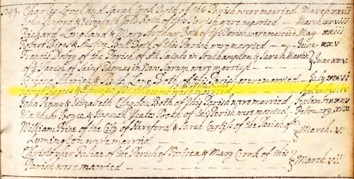
Robert Rogers & Hannah Biddlecomb both of this were married -- September iv
Marriage 04 Sept 1749
No additional place information other that the parish of Eling.
| 14 Apr 1750 | Eling | William Baily | and | Elizab (w) Biddlecombe |
Extract of the Register for the Parish of Eling image.
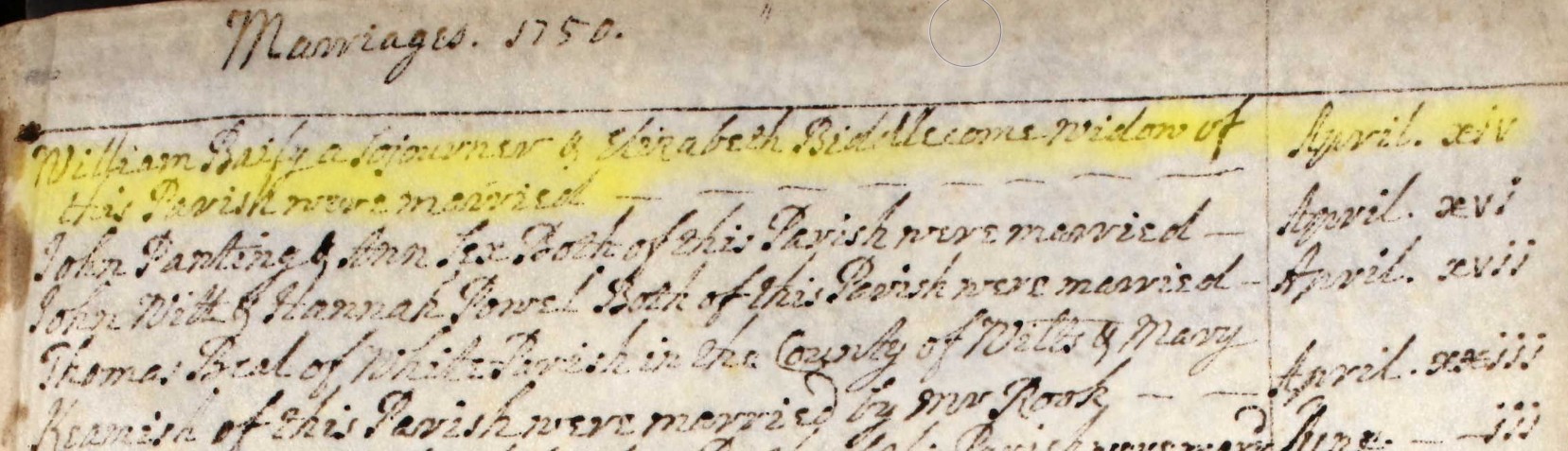
William Baily a Sojourner & Elizabeth Biddlecome widow of this Parish were married April xiv
Marriage 14 April 1750
('sojourn' as 'to stay as a temporary resident.')
No additional place information other that the parish of Eling and temporary resident.
| 07 Apr 1753 | Eling | John Light | and | Susannah Biddlecombe |
Extract of the Register for the Parish of Eling image.
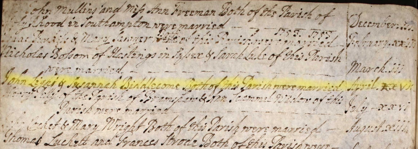
John Light & Susannah Biddlecome Both of this Parish were married April xxvii
27 April 1753
Note that the HGS Index has a date of 07 April 1753.
No additional place information other that the parish of Eling.
1660-1753 - Groom List
| 06 May 1722 | Eling | Arthur Biddlecomb | and | Mary Batchelor |
Extract of the Register for the Parish of Eling image.
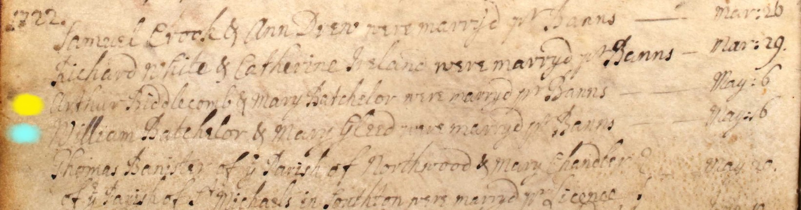
Arthur Biddlecomb & Mary Batchelor were marryd pr Banns May 6
Marriage 6 May 1722
On the next line, on the same date, (blue) is that the bride's brother?
William Batchelor & Mary Gleed were marryd pr Banns May 6
Note that the last entry in the image were both of parishes other than Eling, and was by Licence.
Below, not a marriage, but a baptism.
Arthur y Son of Arthur & Mary Biddlecomb was baptisd May 1
Baptism 1 May 1723
I think this may be the Baptism of Arthur Biddlecomb & Mary Biddlecomb nee Batchelor first born, about a year after they were married.
The reason for including a baptism amongst the marriages, is not just to associate a child to the marriage, but also to explore any connection to the next marriage on our list, in 1742. Nineteen years after Arthur the Son of Arthur & Mary Biddlecomb was baptised.
So it is not inconceivable that this is the same Arthur who married Elizabeth Blake, as recorded below. Accordingly, that is how I have added them all to my Ancestry, work in progress, Hurst Family Tree.
| 06 Jun 1742 | Eling | Arthur Biddlecombe | and | Elizabeth Blake |
Extract of the Register for the Parish of Eling image.
Arthur Biddlecome & Elizabeth Blake both of this Parish were married June vi.
Marriage 6 June 1742
Marriage Index 1754-1837
The filters were applied in the Extent section above based on the bride having a Biddle* surname and the the groom having a Biddle* surname, producing two lists. (Generally, at least one case of zero results)
1754-1837 - Bride List
Parish Records, Marriage Index, Eling List - Bride
The bride list returned 13 results, which is represented here with 13 tabs, plus one spare.
John Davis and Jane Biddlecomb
| 04 Apr 1763 | Eling | John Davis | and | Jane Biddlecomb |
COPY / TEMPLATE -- NOT YET COMPLETE
Banns
Banns not found, Marriage by License.
Place for image
| 1760 | |||||
| No 9 | |||||
| Banns of Marriage between | |||||
| and | |||||
| were published on the three Sundays underwritten: | |||||
| That is to say, | On Sunday, | the | ) | ||
| On Sunday, | the | } | ??????? | by ??????? Rector | |
| On Sunday, | the | ) |
Marriage
Place for image
| 1759 | ||||||
| No. 64 | ||||||
| Edward Biddlecomb of this Parish Batchelor | ||||||
| and | ||||||
| Mary Plaskett Spinster of this parish | ||||||
| were Married in this Church by | License this | First Day of June in the Year One Thousand seven Hundred and fifty nine | by me | Jos Scott | Curate | |
| This Marriage was solemnized between us | Edward Biddlecomb his Mark | |||||
| x the Mark of Mary Plaskett | ||||||
| In the Presence of | x the Mark of Arthur Plaskett. | |||||
| x the mark of Elizabeth Puskis | ||||||
| 1 Jun 1759 |
William Franklin and Martha Biddle
| 15 Dec 1774 | Eling | William Franklin | and | Martha Biddle |
COPY / TEMPLATE -- NOT YET COMPLETE
Banns
Banns not found, Marriage by License.
Place for image
| 1760 | |||||
| No 9 | |||||
| Banns of Marriage between | |||||
| and | |||||
| were published on the three Sundays underwritten: | |||||
| That is to say, | On Sunday, | the | ) | ||
| On Sunday, | the | } | ??????? | by ??????? Rector | |
| On Sunday, | the | ) |
Marriage
Place for image
| 1759 | ||||||
| No. 64 | ||||||
| Edward Biddlecomb of this Parish Batchelor | ||||||
| and | ||||||
| Mary Plaskett Spinster of this parish | ||||||
| were Married in this Church by | License this | First Day of June in the Year One Thousand seven Hundred and fifty nine | by me | Jos Scott | Curate | |
| This Marriage was solemnized between us | Edward Biddlecomb his Mark | |||||
| x the Mark of Mary Plaskett | ||||||
| In the Presence of | x the Mark of Arthur Plaskett. | |||||
| x the mark of Elizabeth Puskis | ||||||
| 1 Jun 1759 |
Joseph Golding (w) and Elizabeth Biddlecomb
| 20 Oct 1776 | Eling | Joseph Golding (w) | and | Elizabeth Biddlecomb |
COPY / TEMPLATE -- NOT YET COMPLETE
Banns
Banns not found, Marriage by License.
Place for image
| 1760 | |||||
| No 9 | |||||
| Banns of Marriage between | |||||
| and | |||||
| were published on the three Sundays underwritten: | |||||
| That is to say, | On Sunday, | the | ) | ||
| On Sunday, | the | } | ??????? | by ??????? Rector | |
| On Sunday, | the | ) |
Marriage
Place for image
| 1759 | ||||||
| No. 64 | ||||||
| Edward Biddlecomb of this Parish Batchelor | ||||||
| and | ||||||
| Mary Plaskett Spinster of this parish | ||||||
| were Married in this Church by | License this | First Day of June in the Year One Thousand seven Hundred and fifty nine | by me | Jos Scott | Curate | |
| This Marriage was solemnized between us | Edward Biddlecomb his Mark | |||||
| x the Mark of Mary Plaskett | ||||||
| In the Presence of | x the Mark of Arthur Plaskett. | |||||
| x the mark of Elizabeth Puskis | ||||||
| 1 Jun 1759 |
William Mabey and Mary Biddlecomb
| 20 Jan 1790 | Eling | William Mabey | and | Mary Biddlecomb |
COPY / TEMPLATE -- NOT YET COMPLETE
Banns
Banns not found, Marriage by License.
Place for image
| 1760 | |||||
| No 9 | |||||
| Banns of Marriage between | |||||
| and | |||||
| were published on the three Sundays underwritten: | |||||
| That is to say, | On Sunday, | the | ) | ||
| On Sunday, | the | } | ??????? | by ??????? Rector | |
| On Sunday, | the | ) |
Marriage
Place for image
| 1759 | ||||||
| No. 64 | ||||||
| Edward Biddlecomb of this Parish Batchelor | ||||||
| and | ||||||
| Mary Plaskett Spinster of this parish | ||||||
| were Married in this Church by | License this | First Day of June in the Year One Thousand seven Hundred and fifty nine | by me | Jos Scott | Curate | |
| This Marriage was solemnized between us | Edward Biddlecomb his Mark | |||||
| x the Mark of Mary Plaskett | ||||||
| In the Presence of | x the Mark of Arthur Plaskett. | |||||
| x the mark of Elizabeth Puskis | ||||||
| 1 Jun 1759 |
Henry King and Susannah Biddlecomb
| 14 Dec 1805 | Eling | Henry King | and | Susannah Biddlecomb |
COPY / TEMPLATE -- NOT YET COMPLETE
Banns
Banns not found, Marriage by License.
Place for image
| 1760 | |||||
| No 9 | |||||
| Banns of Marriage between | |||||
| and | |||||
| were published on the three Sundays underwritten: | |||||
| That is to say, | On Sunday, | the | ) | ||
| On Sunday, | the | } | ??????? | by ??????? Rector | |
| On Sunday, | the | ) |
Marriage
Place for image
| 1759 | ||||||
| No. 64 | ||||||
| Edward Biddlecomb of this Parish Batchelor | ||||||
| and | ||||||
| Mary Plaskett Spinster of this parish | ||||||
| were Married in this Church by | License this | First Day of June in the Year One Thousand seven Hundred and fifty nine | by me | Jos Scott | Curate | |
| This Marriage was solemnized between us | Edward Biddlecomb his Mark | |||||
| x the Mark of Mary Plaskett | ||||||
| In the Presence of | x the Mark of Arthur Plaskett. | |||||
| x the mark of Elizabeth Puskis | ||||||
| 1 Jun 1759 |
John Plowman and Martha Biddlecomb
| 05 Jun 1805 | Eling | John Plowman | and | Martha Biddlecomb |
COPY / TEMPLATE -- NOT YET COMPLETE
Banns
Banns not found, Marriage by License.
Place for image
| 1760 | |||||
| No 9 | |||||
| Banns of Marriage between | |||||
| and | |||||
| were published on the three Sundays underwritten: | |||||
| That is to say, | On Sunday, | the | ) | ||
| On Sunday, | the | } | ??????? | by ??????? Rector | |
| On Sunday, | the | ) |
Marriage
Place for image
| 1759 | ||||||
| No. 64 | ||||||
| Edward Biddlecomb of this Parish Batchelor | ||||||
| and | ||||||
| Mary Plaskett Spinster of this parish | ||||||
| were Married in this Church by | License this | First Day of June in the Year One Thousand seven Hundred and fifty nine | by me | Jos Scott | Curate | |
| This Marriage was solemnized between us | Edward Biddlecomb his Mark | |||||
| x the Mark of Mary Plaskett | ||||||
| In the Presence of | x the Mark of Arthur Plaskett. | |||||
| x the mark of Elizabeth Puskis | ||||||
| 1 Jun 1759 |
William Biddlecombe and Hannah Biddlecombe
| 11 Oct 1818 | Eling | William Biddlecombe | and | Hannah Biddlecombe |
COPY / TEMPLATE -- NOT YET COMPLETE
Banns
Banns not found, Marriage by License.
Place for image
| 1760 | |||||
| No 9 | |||||
| Banns of Marriage between | |||||
| and | |||||
| were published on the three Sundays underwritten: | |||||
| That is to say, | On Sunday, | the | ) | ||
| On Sunday, | the | } | ??????? | by ??????? Rector | |
| On Sunday, | the | ) |
Marriage
Place for image
| 1759 | ||||||
| No. 64 | ||||||
| Edward Biddlecomb of this Parish Batchelor | ||||||
| and | ||||||
| Mary Plaskett Spinster of this parish | ||||||
| were Married in this Church by | License this | First Day of June in the Year One Thousand seven Hundred and fifty nine | by me | Jos Scott | Curate | |
| This Marriage was solemnized between us | Edward Biddlecomb his Mark | |||||
| x the Mark of Mary Plaskett | ||||||
| In the Presence of | x the Mark of Arthur Plaskett. | |||||
| x the mark of Elizabeth Puskis | ||||||
| 1 Jun 1759 |
Charles Lowe and Ann Biddlecomb
| 23 Apr 1821 | Eling | Charles Lowe | and | Ann Biddlecomb |
COPY / TEMPLATE -- NOT YET COMPLETE
Banns
Banns not found, Marriage by License.
Place for image
| 1760 | |||||
| No 9 | |||||
| Banns of Marriage between | |||||
| and | |||||
| were published on the three Sundays underwritten: | |||||
| That is to say, | On Sunday, | the | ) | ||
| On Sunday, | the | } | ??????? | by ??????? Rector | |
| On Sunday, | the | ) |
Marriage
Place for image
| 1759 | ||||||
| No. 64 | ||||||
| Edward Biddlecomb of this Parish Batchelor | ||||||
| and | ||||||
| Mary Plaskett Spinster of this parish | ||||||
| were Married in this Church by | License this | First Day of June in the Year One Thousand seven Hundred and fifty nine | by me | Jos Scott | Curate | |
| This Marriage was solemnized between us | Edward Biddlecomb his Mark | |||||
| x the Mark of Mary Plaskett | ||||||
| In the Presence of | x the Mark of Arthur Plaskett. | |||||
| x the mark of Elizabeth Puskis | ||||||
| 1 Jun 1759 |
Samuel Scorey and Elizabeth Biddlecomb
| 21 Oct 1824 | Eling | Samuel Scorey | and | Elizabeth Biddlecomb |
COPY / TEMPLATE -- NOT YET COMPLETE
Banns
Banns not found, Marriage by License.
Place for image
| 1760 | |||||
| No 9 | |||||
| Banns of Marriage between | |||||
| and | |||||
| were published on the three Sundays underwritten: | |||||
| That is to say, | On Sunday, | the | ) | ||
| On Sunday, | the | } | ??????? | by ??????? Rector | |
| On Sunday, | the | ) |
Marriage
Place for image
| 1759 | ||||||
| No. 64 | ||||||
| Edward Biddlecomb of this Parish Batchelor | ||||||
| and | ||||||
| Mary Plaskett Spinster of this parish | ||||||
| were Married in this Church by | License this | First Day of June in the Year One Thousand seven Hundred and fifty nine | by me | Jos Scott | Curate | |
| This Marriage was solemnized between us | Edward Biddlecomb his Mark | |||||
| x the Mark of Mary Plaskett | ||||||
| In the Presence of | x the Mark of Arthur Plaskett. | |||||
| x the mark of Elizabeth Puskis | ||||||
| 1 Jun 1759 |
Stephen Osman and Mary Ann Biddlecomb
| 17 Apr 1825 | Eling | Stephen Osman | and | Mary Ann Biddlecomb |
COPY / TEMPLATE -- NOT YET COMPLETE
Banns
Banns not found, Marriage by License.
Place for image
| 1760 | |||||
| No 9 | |||||
| Banns of Marriage between | |||||
| and | |||||
| were published on the three Sundays underwritten: | |||||
| That is to say, | On Sunday, | the | ) | ||
| On Sunday, | the | } | ??????? | by ??????? Rector | |
| On Sunday, | the | ) |
Marriage
Place for image
| 1759 | ||||||
| No. 64 | ||||||
| Edward Biddlecomb of this Parish Batchelor | ||||||
| and | ||||||
| Mary Plaskett Spinster of this parish | ||||||
| were Married in this Church by | License this | First Day of June in the Year One Thousand seven Hundred and fifty nine | by me | Jos Scott | Curate | |
| This Marriage was solemnized between us | Edward Biddlecomb his Mark | |||||
| x the Mark of Mary Plaskett | ||||||
| In the Presence of | x the Mark of Arthur Plaskett. | |||||
| x the mark of Elizabeth Puskis | ||||||
| 1 Jun 1759 |
Henry Frampton and Sarah Biddlecomb
| 18 May 1828 | Eling | Henry Frampton | and | Sarah Biddlecomb |
COPY / TEMPLATE -- NOT YET COMPLETE
Banns
Banns not found, Marriage by License.
Place for image
| 1760 | |||||
| No 9 | |||||
| Banns of Marriage between | |||||
| and | |||||
| were published on the three Sundays underwritten: | |||||
| That is to say, | On Sunday, | the | ) | ||
| On Sunday, | the | } | ??????? | by ??????? Rector | |
| On Sunday, | the | ) |
Marriage
Place for image
| 1759 | ||||||
| No. 64 | ||||||
| Edward Biddlecomb of this Parish Batchelor | ||||||
| and | ||||||
| Mary Plaskett Spinster of this parish | ||||||
| were Married in this Church by | License this | First Day of June in the Year One Thousand seven Hundred and fifty nine | by me | Jos Scott | Curate | |
| This Marriage was solemnized between us | Edward Biddlecomb his Mark | |||||
| x the Mark of Mary Plaskett | ||||||
| In the Presence of | x the Mark of Arthur Plaskett. | |||||
| x the mark of Elizabeth Puskis | ||||||
| 1 Jun 1759 |
William Vaughn and Mary Biddlecombe
| 23 Jun 1833 | Eling | William Vaughn | and | Mary Biddlecombe |
COPY / TEMPLATE -- NOT YET COMPLETE
Banns
Banns not found, Marriage by License.
Place for image
| 1760 | |||||
| No 9 | |||||
| Banns of Marriage between | |||||
| and | |||||
| were published on the three Sundays underwritten: | |||||
| That is to say, | On Sunday, | the | ) | ||
| On Sunday, | the | } | ??????? | by ??????? Rector | |
| On Sunday, | the | ) |
Marriage
Place for image
| 1759 | ||||||
| No. 64 | ||||||
| Edward Biddlecomb of this Parish Batchelor | ||||||
| and | ||||||
| Mary Plaskett Spinster of this parish | ||||||
| were Married in this Church by | License this | First Day of June in the Year One Thousand seven Hundred and fifty nine | by me | Jos Scott | Curate | |
| This Marriage was solemnized between us | Edward Biddlecomb his Mark | |||||
| x the Mark of Mary Plaskett | ||||||
| In the Presence of | x the Mark of Arthur Plaskett. | |||||
| x the mark of Elizabeth Puskis | ||||||
| 1 Jun 1759 |
James Bundy and Emma Biddlecombe
| 27 Nov 1834 | Eling | James Bundy | and | Emma Biddlecombe |
COPY / TEMPLATE -- NOT YET COMPLETE
Banns
Banns not found, Marriage by License.
Place for image
| 1760 | |||||
| No 9 | |||||
| Banns of Marriage between | |||||
| and | |||||
| were published on the three Sundays underwritten: | |||||
| That is to say, | On Sunday, | the | ) | ||
| On Sunday, | the | } | ??????? | by ??????? Rector | |
| On Sunday, | the | ) |
Marriage
Place for image
| 1759 | ||||||
| No. 64 | ||||||
| Edward Biddlecomb of this Parish Batchelor | ||||||
| and | ||||||
| Mary Plaskett Spinster of this parish | ||||||
| were Married in this Church by | License this | First Day of June in the Year One Thousand seven Hundred and fifty nine | by me | Jos Scott | Curate | |
| This Marriage was solemnized between us | Edward Biddlecomb his Mark | |||||
| x the Mark of Mary Plaskett | ||||||
| In the Presence of | x the Mark of Arthur Plaskett. | |||||
| x the mark of Elizabeth Puskis | ||||||
| 1 Jun 1759 |
and
COPY / TEMPLATE -- NOT YET COMPLETE
Banns
Banns not found, Marriage by License.
Place for image
| 1760 | |||||
| No 9 | |||||
| Banns of Marriage between | |||||
| and | |||||
| were published on the three Sundays underwritten: | |||||
| That is to say, | On Sunday, | the | ) | ||
| On Sunday, | the | } | ??????? | by ??????? Rector | |
| On Sunday, | the | ) |
Marriage
Place for image
| 1759 | ||||||
| No. 64 | ||||||
| Edward Biddlecomb of this Parish Batchelor | ||||||
| and | ||||||
| Mary Plaskett Spinster of this parish | ||||||
| were Married in this Church by | License this | First Day of June in the Year One Thousand seven Hundred and fifty nine | by me | Jos Scott | Curate | |
| This Marriage was solemnized between us | Edward Biddlecomb his Mark | |||||
| x the Mark of Mary Plaskett | ||||||
| In the Presence of | x the Mark of Arthur Plaskett. | |||||
| x the mark of Elizabeth Puskis | ||||||
| 1 Jun 1759 |
1754-1837 - Groom List
Parish Records, Marriage Index, Eling List - Groom
For the groom there was nineteen listed named Biddle*.
Edward Biddlecomb and Mary Plaskett
| 01 Jun 1759 | Eling | Edward Biddlecomb | and | Mary Plaskett |
Banns
Banns not found, Marriage by License.
| 1760 | |||||
| No 9 | |||||
| Banns of Marriage between | |||||
| and | |||||
| were published on the three Sundays underwritten: | |||||
| That is to say, | On Sunday, | the | ) | ||
| On Sunday, | the | } | ??????? | by ??????? Rector | |
| On Sunday, | the | ) |
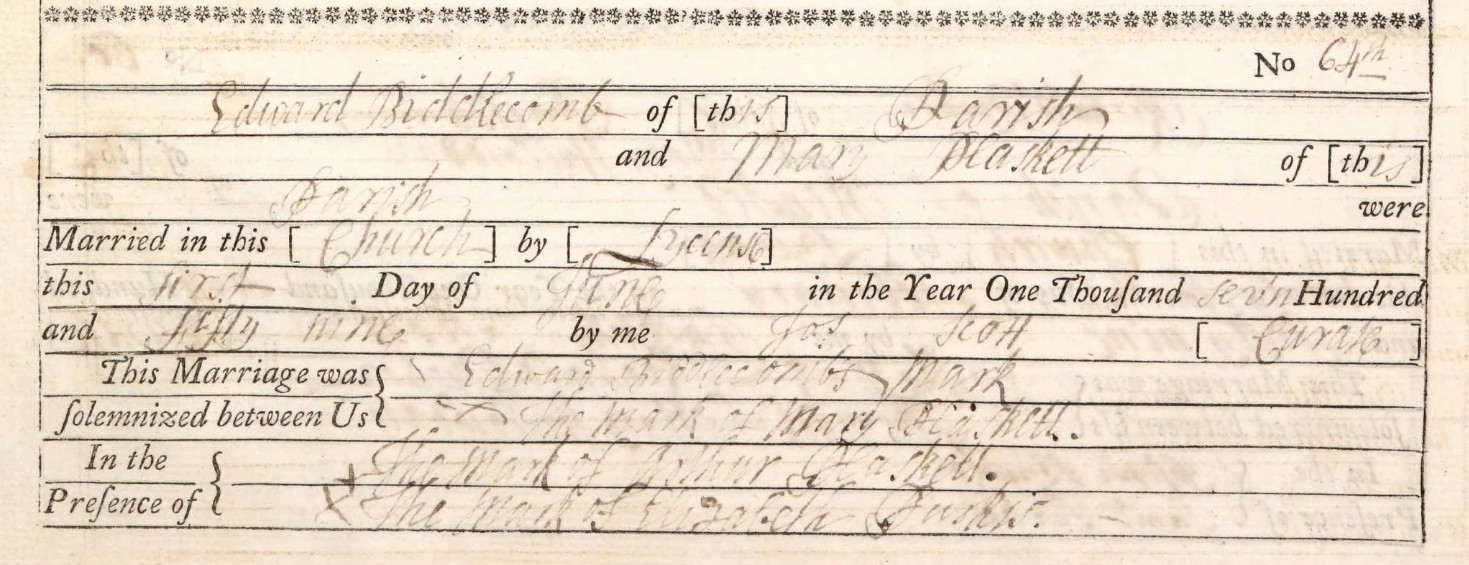
Marriage
| 1759 | ||||||
| No. 64 | ||||||
| Edward Biddlecomb of this Parish Batchelor | ||||||
| and | ||||||
| Mary Plaskett Spinster of this parish | ||||||
| were Married in this Church by | License this | First Day of June in the Year One Thousand seven Hundred and fifty nine | by me | Jos Scott | Curate | |
| This Marriage was solemnized between us | Edward Biddlecomb his Mark | |||||
| x the Mark of Mary Plaskett | ||||||
| In the Presence of | x the Mark of Arthur Plaskett. | |||||
| x the mark of Elizabeth Puskis | ||||||
| 1 Jun 1759 |
This marriage is recorded in my tree, and Edward is my 6th great-granduncle.
William Biddlecomb and Honour Curtis
| 13 Jun 1762 | Eling | William Biddlecomb | and | Honour Curtis |
COPY / TEMPLATE -- NOT YET COMPLETE
Banns
Banns not found, Marriage by License.
Place for image
| 1760 | |||||
| No 9 | |||||
| Banns of Marriage between | |||||
| and | |||||
| were published on the three Sundays underwritten: | |||||
| That is to say, | On Sunday, | the | ) | ||
| On Sunday, | the | } | ??????? | by ??????? Rector | |
| On Sunday, | the | ) |
Marriage
Place for image
| 1759 | ||||||
| No. 64 | ||||||
| Edward Biddlecomb of this Parish Batchelor | ||||||
| and | ||||||
| Mary Plaskett Spinster of this parish | ||||||
| were Married in this Church by | License this | First Day of June in the Year One Thousand seven Hundred and fifty nine | by me | Jos Scott | Curate | |
| This Marriage was solemnized between us | Edward Biddlecomb his Mark | |||||
| x the Mark of Mary Plaskett | ||||||
| In the Presence of | x the Mark of Arthur Plaskett. | |||||
| x the mark of Elizabeth Puskis | ||||||
| 1 Jun 1759 |
Edward Biddlecomb and Elizabeth Scorey
| 30 Mar 1770 | Eling | Edward Biddlecomb | and | Elizabeth Scorey |
Banns
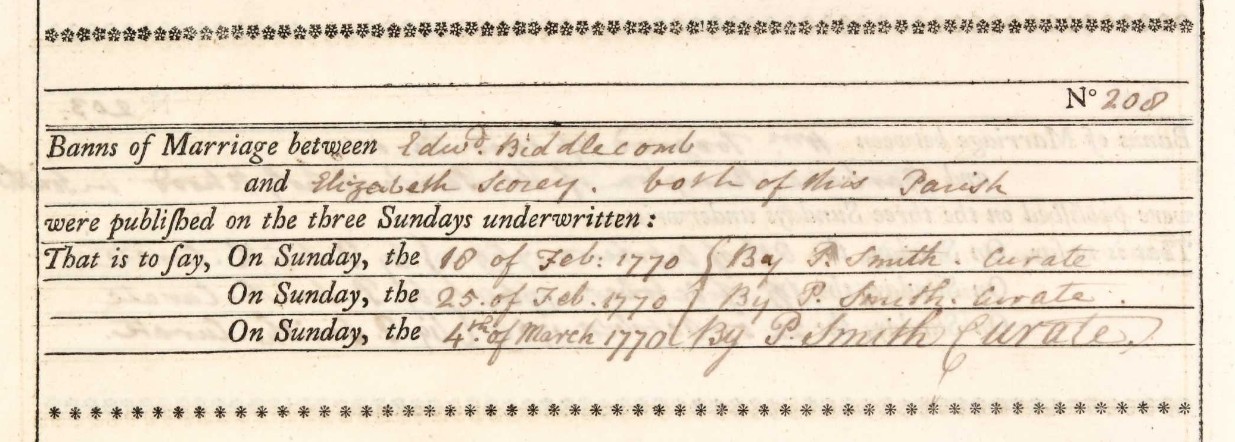
| 1770 | |||||
| No 208 | |||||
| Banns of Marriage between | |||||
| Edwd Biddlecomb | and | Elizabeth Scorey | both of this Parish | ||
| were published on the three Sundays underwritten: | |||||
| That is to say, | On Sunday, | the 18 of Feb: 1770 | ) | ||
| On Sunday, | the 25 of Feb . 1770 | } | by P. Smith | Curate | |
| On Sunday, | the 4th of March 1770 | ) |
Banns read in the Parish of Eling, Hampshire
Marriage
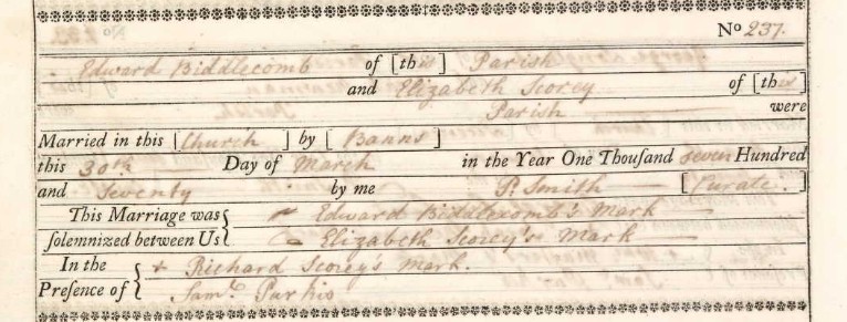
| 1770 | ||||||
| No. 237 | ||||||
| Edward Biddlecomb of this Parish | ||||||
| and | ||||||
| Elizabeth Scorey Spinster of this parish | ||||||
| were Married in this Church by | Banns this | 30th Day of March in the Year One Thousand seven Hundred and Seventy | by me | P. Smith | Curate | |
| This Marriage was solemnized between us | / Edward Biddlecomb's Mark | |||||
| - of Elizabeth Scorey's Mark | ||||||
| In the Presence of | x Richard Scorey's Mark | |||||
| Saml Purkis | ||||||
| 30 March 1770 |
Marriage in the Parish of Eling, Hampshire
John Biddlecomb and Hannah Hatch
| 17 Jul 1782 | Eling | John Biddlecomb | and | Hannah Hatch |
COPY / TEMPLATE -- NOT YET COMPLETE
Banns
Banns not found, Marriage by License.
Place for image
| 1760 | |||||
| No 9 | |||||
| Banns of Marriage between | |||||
| and | |||||
| were published on the three Sundays underwritten: | |||||
| That is to say, | On Sunday, | the | ) | ||
| On Sunday, | the | } | ??????? | by ??????? Rector | |
| On Sunday, | the | ) |
Marriage
Place for image
| 1759 | ||||||
| No. 64 | ||||||
| Edward Biddlecomb of this Parish Batchelor | ||||||
| and | ||||||
| Mary Plaskett Spinster of this parish | ||||||
| were Married in this Church by | License this | First Day of June in the Year One Thousand seven Hundred and fifty nine | by me | Jos Scott | Curate | |
| This Marriage was solemnized between us | Edward Biddlecomb his Mark | |||||
| x the Mark of Mary Plaskett | ||||||
| In the Presence of | x the Mark of Arthur Plaskett. | |||||
| x the mark of Elizabeth Puskis | ||||||
| 1 Jun 1759 |
Daniel Biddlecomb and Mary Fabian
| 14 Apr 1788 | Eling | Daniel Biddlecomb | and | Mary Fabian |
COPY / TEMPLATE -- NOT YET COMPLETE
Banns
Banns not found, Marriage by License.
Place for image
| 1760 | |||||
| No 9 | |||||
| Banns of Marriage between | |||||
| and | |||||
| were published on the three Sundays underwritten: | |||||
| That is to say, | On Sunday, | the | ) | ||
| On Sunday, | the | } | ??????? | by ??????? Rector | |
| On Sunday, | the | ) |
Marriage
Place for image
| 1759 | ||||||
| No. 64 | ||||||
| Edward Biddlecomb of this Parish Batchelor | ||||||
| and | ||||||
| Mary Plaskett Spinster of this parish | ||||||
| were Married in this Church by | License this | First Day of June in the Year One Thousand seven Hundred and fifty nine | by me | Jos Scott | Curate | |
| This Marriage was solemnized between us | Edward Biddlecomb his Mark | |||||
| x the Mark of Mary Plaskett | ||||||
| In the Presence of | x the Mark of Arthur Plaskett. | |||||
| x the mark of Elizabeth Puskis | ||||||
| 1 Jun 1759 |
Daniel Biddlecomb and Ann Davies
| 19 Feb 1797 | Eling | Daniel Biddlecomb | and | Ann Davies |
Banns
Banns not found, Marriage by License.
Marriage
| 1797 | ||||||
| No. | ||||||
| Daniel Biddlecomb of this Parish Batchelor | ||||||
| and | ||||||
| Ann Davies Spinster of the same parish | ||||||
| were Married in this Church by | License this | Nineteenth Day of February in the Year One Thousand seven Hundred and ninety seven | by me | Newcombe Paddon | Minister | |
| This Marriage was solemnized between us | Dan Biddlecomb X his Mark | |||||
| Ann Davies X her Mark | ||||||
| In the Presence of | John Tribe | |||||
| Samuel Purkins ??? | ||||||
| 19 Feb 1797 |
Leaonnard Biddlecomb and Mary Harris
| 24 Mar 1799 | Eling | Leaonnard Biddlecomb | and | Mary Harris |
COPY / TEMPLATE -- NOT YET COMPLETE
Banns
Banns not found, Marriage by License.
Place for image
| 1760 | |||||
| No 9 | |||||
| Banns of Marriage between | |||||
| and | |||||
| were published on the three Sundays underwritten: | |||||
| That is to say, | On Sunday, | the | ) | ||
| On Sunday, | the | } | ??????? | by ??????? Rector | |
| On Sunday, | the | ) |
Marriage
Place for image
| 1759 | ||||||
| No. 64 | ||||||
| Edward Biddlecomb of this Parish Batchelor | ||||||
| and | ||||||
| Mary Plaskett Spinster of this parish | ||||||
| were Married in this Church by | License this | First Day of June in the Year One Thousand seven Hundred and fifty nine | by me | Jos Scott | Curate | |
| This Marriage was solemnized between us | Edward Biddlecomb his Mark | |||||
| x the Mark of Mary Plaskett | ||||||
| In the Presence of | x the Mark of Arthur Plaskett. | |||||
| x the mark of Elizabeth Puskis | ||||||
| 1 Jun 1759 |
John Biddlecomb and Sarah Lowman
| 25 Aug 1807 | Eling | John Biddlecomb | and | Sarah Lowman |
COPY / TEMPLATE -- NOT YET COMPLETE
Banns
Banns not found, Marriage by License.
Place for image
| 1760 | |||||
| No 9 | |||||
| Banns of Marriage between | |||||
| and | |||||
| were published on the three Sundays underwritten: | |||||
| That is to say, | On Sunday, | the | ) | ||
| On Sunday, | the | } | ??????? | by ??????? Rector | |
| On Sunday, | the | ) |
Marriage
Place for image
| 1759 | ||||||
| No. 64 | ||||||
| Edward Biddlecomb of this Parish Batchelor | ||||||
| and | ||||||
| Mary Plaskett Spinster of this parish | ||||||
| were Married in this Church by | License this | First Day of June in the Year One Thousand seven Hundred and fifty nine | by me | Jos Scott | Curate | |
| This Marriage was solemnized between us | Edward Biddlecomb his Mark | |||||
| x the Mark of Mary Plaskett | ||||||
| In the Presence of | x the Mark of Arthur Plaskett. | |||||
| x the mark of Elizabeth Puskis | ||||||
| 1 Jun 1759 |
Joseph Biddlecomb and Charlotte Lancaster
| 19 Jan 1811 | Eling | Joseph Biddlecomb | and | Charlotte Lancaster |
COPY / TEMPLATE -- NOT YET COMPLETE
Banns
Banns not found, Marriage by License.
Place for image
| 1760 | |||||
| No 9 | |||||
| Banns of Marriage between | |||||
| and | |||||
| were published on the three Sundays underwritten: | |||||
| That is to say, | On Sunday, | the | ) | ||
| On Sunday, | the | } | ??????? | by ??????? Rector | |
| On Sunday, | the | ) |
Marriage
Place for image
| 1759 | ||||||
| No. 64 | ||||||
| Edward Biddlecomb of this Parish Batchelor | ||||||
| and | ||||||
| Mary Plaskett Spinster of this parish | ||||||
| were Married in this Church by | License this | First Day of June in the Year One Thousand seven Hundred and fifty nine | by me | Jos Scott | Curate | |
| This Marriage was solemnized between us | Edward Biddlecomb his Mark | |||||
| x the Mark of Mary Plaskett | ||||||
| In the Presence of | x the Mark of Arthur Plaskett. | |||||
| x the mark of Elizabeth Puskis | ||||||
| 1 Jun 1759 |
Robert Biddlecomb and Mary Morris
| 20 Mar 1813 | Eling | Robert Biddlecomb | and | Mary Morris |
COPY / TEMPLATE -- NOT YET COMPLETE
Banns
Banns not found, Marriage by License.
Place for image
| 1760 | |||||
| No 9 | |||||
| Banns of Marriage between | |||||
| and | |||||
| were published on the three Sundays underwritten: | |||||
| That is to say, | On Sunday, | the | ) | ||
| On Sunday, | the | } | ??????? | by ??????? Rector | |
| On Sunday, | the | ) |
Marriage
Place for image
| 1759 | ||||||
| No. 64 | ||||||
| Edward Biddlecomb of this Parish Batchelor | ||||||
| and | ||||||
| Mary Plaskett Spinster of this parish | ||||||
| were Married in this Church by | License this | First Day of June in the Year One Thousand seven Hundred and fifty nine | by me | Jos Scott | Curate | |
| This Marriage was solemnized between us | Edward Biddlecomb his Mark | |||||
| x the Mark of Mary Plaskett | ||||||
| In the Presence of | x the Mark of Arthur Plaskett. | |||||
| x the mark of Elizabeth Puskis | ||||||
| 1 Jun 1759 |
John Biddlecomb and Elizabeth Oliver
| 25 Oct 1814 | Eling | John Biddlecomb | and | Elizabeth Oliver |
COPY / TEMPLATE -- NOT YET COMPLETE
Banns
Banns not found, Marriage by License.
Place for image
| 1760 | |||||
| No 9 | |||||
| Banns of Marriage between | |||||
| and | |||||
| were published on the three Sundays underwritten: | |||||
| That is to say, | On Sunday, | the | ) | ||
| On Sunday, | the | } | ??????? | by ??????? Rector | |
| On Sunday, | the | ) |
Marriage
Place for image
| 1759 | ||||||
| No. 64 | ||||||
| Edward Biddlecomb of this Parish Batchelor | ||||||
| and | ||||||
| Mary Plaskett Spinster of this parish | ||||||
| were Married in this Church by | License this | First Day of June in the Year One Thousand seven Hundred and fifty nine | by me | Jos Scott | Curate | |
| This Marriage was solemnized between us | Edward Biddlecomb his Mark | |||||
| x the Mark of Mary Plaskett | ||||||
| In the Presence of | x the Mark of Arthur Plaskett. | |||||
| x the mark of Elizabeth Puskis | ||||||
| 1 Jun 1759 |
William Biddlecombe and Hannah Biddlecombe
| 11 Oct 1818 | Eling | William Biddlecombe | and | Hannah Biddlecombe |
COPY / TEMPLATE -- NOT YET COMPLETE
Banns
Banns not found, Marriage by License.
Place for image
| 1760 | |||||
| No 9 | |||||
| Banns of Marriage between | |||||
| and | |||||
| were published on the three Sundays underwritten: | |||||
| That is to say, | On Sunday, | the | ) | ||
| On Sunday, | the | } | ??????? | by ??????? Rector | |
| On Sunday, | the | ) |
Marriage
Place for image
| 1759 | ||||||
| No. 64 | ||||||
| Edward Biddlecomb of this Parish Batchelor | ||||||
| and | ||||||
| Mary Plaskett Spinster of this parish | ||||||
| were Married in this Church by | License this | First Day of June in the Year One Thousand seven Hundred and fifty nine | by me | Jos Scott | Curate | |
| This Marriage was solemnized between us | Edward Biddlecomb his Mark | |||||
| x the Mark of Mary Plaskett | ||||||
| In the Presence of | x the Mark of Arthur Plaskett. | |||||
| x the mark of Elizabeth Puskis | ||||||
| 1 Jun 1759 |
Thomas Biddlecomb and Elizabeth Luke
| 27 Dec 1819 | Eling | Thomas Biddlecomb | and | Elizabeth Luke |
COPY / TEMPLATE -- NOT YET COMPLETE
Banns
Banns not found, Marriage by License.
Place for image
| 1760 | |||||
| No 9 | |||||
| Banns of Marriage between | |||||
| and | |||||
| were published on the three Sundays underwritten: | |||||
| That is to say, | On Sunday, | the | ) | ||
| On Sunday, | the | } | ??????? | by ??????? Rector | |
| On Sunday, | the | ) |
Marriage
Place for image
| 1759 | ||||||
| No. 64 | ||||||
| Edward Biddlecomb of this Parish Batchelor | ||||||
| and | ||||||
| Mary Plaskett Spinster of this parish | ||||||
| were Married in this Church by | License this | First Day of June in the Year One Thousand seven Hundred and fifty nine | by me | Jos Scott | Curate | |
| This Marriage was solemnized between us | Edward Biddlecomb his Mark | |||||
| x the Mark of Mary Plaskett | ||||||
| In the Presence of | x the Mark of Arthur Plaskett. | |||||
| x the mark of Elizabeth Puskis | ||||||
| 1 Jun 1759 |
James Biddlecomb and Elizabeth Hendy
| 27 Sep 1821 | Eling | James Biddlecomb | and | Elizabeth Hendy |
COPY / TEMPLATE -- NOT YET COMPLETE
Banns
Banns not found, Marriage by License.
Place for image
| 1760 | |||||
| No 9 | |||||
| Banns of Marriage between | |||||
| and | |||||
| were published on the three Sundays underwritten: | |||||
| That is to say, | On Sunday, | the | ) | ||
| On Sunday, | the | } | ??????? | by ??????? Rector | |
| On Sunday, | the | ) |
Marriage
Place for image
| 1759 | ||||||
| No. 64 | ||||||
| Edward Biddlecomb of this Parish Batchelor | ||||||
| and | ||||||
| Mary Plaskett Spinster of this parish | ||||||
| were Married in this Church by | License this | First Day of June in the Year One Thousand seven Hundred and fifty nine | by me | Jos Scott | Curate | |
| This Marriage was solemnized between us | Edward Biddlecomb his Mark | |||||
| x the Mark of Mary Plaskett | ||||||
| In the Presence of | x the Mark of Arthur Plaskett. | |||||
| x the mark of Elizabeth Puskis | ||||||
| 1 Jun 1759 |
Isaac Biddlecomb and Ann Hurle
| 19 Jul 1821 | Eling | Isaac Biddlecomb | and | Ann Hurle |
COPY / TEMPLATE -- NOT YET COMPLETE
Banns
Banns not found, Marriage by License.
Place for image
| 1760 | |||||
| No 9 | |||||
| Banns of Marriage between | |||||
| and | |||||
| were published on the three Sundays underwritten: | |||||
| That is to say, | On Sunday, | the | ) | ||
| On Sunday, | the | } | ??????? | by ??????? Rector | |
| On Sunday, | the | ) |
Marriage
Place for image
| 1759 | ||||||
| No. 64 | ||||||
| Edward Biddlecomb of this Parish Batchelor | ||||||
| and | ||||||
| Mary Plaskett Spinster of this parish | ||||||
| were Married in this Church by | License this | First Day of June in the Year One Thousand seven Hundred and fifty nine | by me | Jos Scott | Curate | |
| This Marriage was solemnized between us | Edward Biddlecomb his Mark | |||||
| x the Mark of Mary Plaskett | ||||||
| In the Presence of | x the Mark of Arthur Plaskett. | |||||
| x the mark of Elizabeth Puskis | ||||||
| 1 Jun 1759 |
Dewrin Biddlecombe and Mary Pierce
| 05 Jan 1821 | Eling | Dewrin Biddlecombe | and | Mary Pierce |
COPY / TEMPLATE -- NOT YET COMPLETE
Banns
Banns not found, Marriage by License.
Place for image
| 1760 | |||||
| No 9 | |||||
| Banns of Marriage between | |||||
| and | |||||
| were published on the three Sundays underwritten: | |||||
| That is to say, | On Sunday, | the | ) | ||
| On Sunday, | the | } | ??????? | by ??????? Rector | |
| On Sunday, | the | ) |
Marriage
Place for image
| 1759 | ||||||
| No. 64 | ||||||
| Edward Biddlecomb of this Parish Batchelor | ||||||
| and | ||||||
| Mary Plaskett Spinster of this parish | ||||||
| were Married in this Church by | License this | First Day of June in the Year One Thousand seven Hundred and fifty nine | by me | Jos Scott | Curate | |
| This Marriage was solemnized between us | Edward Biddlecomb his Mark | |||||
| x the Mark of Mary Plaskett | ||||||
| In the Presence of | x the Mark of Arthur Plaskett. | |||||
| x the mark of Elizabeth Puskis | ||||||
| 1 Jun 1759 |
Charles Biddlecomb and Ann Jerram
| 27 Oct 1822 | Eling | Charles Biddlecomb | and | Ann Jerram |
COPY / TEMPLATE -- NOT YET COMPLETE
Banns
Banns not found, Marriage by License.
Place for image
| 1760 | |||||
| No 9 | |||||
| Banns of Marriage between | |||||
| and | |||||
| were published on the three Sundays underwritten: | |||||
| That is to say, | On Sunday, | the | ) | ||
| On Sunday, | the | } | ??????? | by ??????? Rector | |
| On Sunday, | the | ) |
Marriage
Place for image
| 1759 | ||||||
| No. 64 | ||||||
| Edward Biddlecomb of this Parish Batchelor | ||||||
| and | ||||||
| Mary Plaskett Spinster of this parish | ||||||
| were Married in this Church by | License this | First Day of June in the Year One Thousand seven Hundred and fifty nine | by me | Jos Scott | Curate | |
| This Marriage was solemnized between us | Edward Biddlecomb his Mark | |||||
| x the Mark of Mary Plaskett | ||||||
| In the Presence of | x the Mark of Arthur Plaskett. | |||||
| x the mark of Elizabeth Puskis | ||||||
| 1 Jun 1759 |
George Biddlecomb and Elizabeth Longland
| 18 Mar 1832 | Eling | George Biddlecomb | and | Elizabeth Longland |
COPY / TEMPLATE -- NOT YET COMPLETE
Banns
Banns not found, Marriage by License.
Place for image
| 1760 | |||||
| No 9 | |||||
| Banns of Marriage between | |||||
| and | |||||
| were published on the three Sundays underwritten: | |||||
| That is to say, | On Sunday, | the | ) | ||
| On Sunday, | the | } | ??????? | by ??????? Rector | |
| On Sunday, | the | ) |
Marriage
Place for image
| 1759 | ||||||
| No. 64 | ||||||
| Edward Biddlecomb of this Parish Batchelor | ||||||
| and | ||||||
| Mary Plaskett Spinster of this parish | ||||||
| were Married in this Church by | License this | First Day of June in the Year One Thousand seven Hundred and fifty nine | by me | Jos Scott | Curate | |
| This Marriage was solemnized between us | Edward Biddlecomb his Mark | |||||
| x the Mark of Mary Plaskett | ||||||
| In the Presence of | x the Mark of Arthur Plaskett. | |||||
| x the mark of Elizabeth Puskis | ||||||
| 1 Jun 1759 |
William Biddlecomb and Susannah Bundy
| 29 Jun 1837 | Eling | William Biddlecomb | and | Susannah Bundy |
COPY / TEMPLATE -- NOT YET COMPLETE
Banns
Banns not found, Marriage by License.
Place for image
| 1760 | |||||
| No 9 | |||||
| Banns of Marriage between | |||||
| and | |||||
| were published on the three Sundays underwritten: | |||||
| That is to say, | On Sunday, | the | ) | ||
| On Sunday, | the | } | ??????? | by ??????? Rector | |
| On Sunday, | the | ) |
Marriage
Place for image
| 1759 | ||||||
| No. 64 | ||||||
| Edward Biddlecomb of this Parish Batchelor | ||||||
| and | ||||||
| Mary Plaskett Spinster of this parish | ||||||
| were Married in this Church by | License this | First Day of June in the Year One Thousand seven Hundred and fifty nine | by me | Jos Scott | Curate | |
| This Marriage was solemnized between us | Edward Biddlecomb his Mark | |||||
| x the Mark of Mary Plaskett | ||||||
| In the Presence of | x the Mark of Arthur Plaskett. | |||||
| x the mark of Elizabeth Puskis | ||||||
| 1 Jun 1759 |
and
COPY / TEMPLATE -- NOT YET COMPLETE
Banns
Banns not found, Marriage by License.
Place for image
| 1760 | |||||
| No 9 | |||||
| Banns of Marriage between | |||||
| and | |||||
| were published on the three Sundays underwritten: | |||||
| That is to say, | On Sunday, | the | ) | ||
| On Sunday, | the | } | ??????? | by ??????? Rector | |
| On Sunday, | the | ) |
Marriage
Place for image
| 1759 | ||||||
| No. 64 | ||||||
| Edward Biddlecomb of this Parish Batchelor | ||||||
| and | ||||||
| Mary Plaskett Spinster of this parish | ||||||
| were Married in this Church by | License this | First Day of June in the Year One Thousand seven Hundred and fifty nine | by me | Jos Scott | Curate | |
| This Marriage was solemnized between us | Edward Biddlecomb his Mark | |||||
| x the Mark of Mary Plaskett | ||||||
| In the Presence of | x the Mark of Arthur Plaskett. | |||||
| x the mark of Elizabeth Puskis | ||||||
| 1 Jun 1759 |
Allegations for Marriage Licence
Extract of Index regarding Biddlecombe and similar
Biddlecomb, Betty, 252; Edward, 67; Mary, 86; Tabitha, 183.
Biddlecombe, William, 86

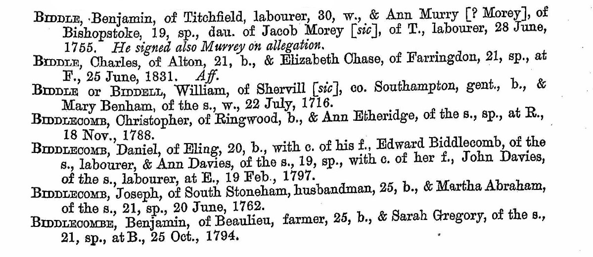
...
A
...
B
...
C
...
Analysis
...
Families
Edward Biddlecomb and Mary Plaskett
Edward Biddlecomb and Mary Plaskett
Another family another article.
Edward Biddlecomb
Edward Biddlecombe
1734–1814
Birth 1734 • Eling, Hampshire, , England
Death 1814 • Landford, Wiltshire, England
Starting relationship;
6th great-granduncle
Starting Ancestry Synopsis;
When Edward Biddlecombe was born in 1734 in Eling, Hampshire, his father, Mr. Biddlecombe, was 49. He married Mary Plasket on 1 June 1759 in his hometown. They had four children during their marriage. He died in 1814 in Landford, Wiltshire, having lived a long life of 80 years, and was buried there.
Do not read below yet! Not completed from copy template
There are three particular peoples trees that I have been interested in as they all have living people with a common ancestor.
???
| Ancestry Member Name | Family Tree | Person at end of my branch |
|---|---|---|
|
|
Jacqueline M Colborne | |
| Nathan Petty | ||
|
|
Susan Jane Sainsbury |
In no way do I intend to be derogatory to any of these people or the work that they have done on their trees.
The above people link through to one of my ancestors;-
???
This will attempt to add some clarity regarding his family. Watch the story develop in 'Discovery'
Help Notes.
The expectation is that people reading this will use it in different ways. Some will just jump to the conclusion, whilst some others will want more information and go to the datasheet. A very few may read cover to cover, which I hope you will find interesting and informative. Especially the surprise revelation in Discovery - Other - The Camp.
| Contents | ||
|---|---|---|
| About the Parish of Eling | Some history, maps, and location information | |
| Discovery Not yet rewritten | Discovery is the research | |
| Data Sheet Not yet rewritten | Data Sheet is a collation of the relevant data | |
Approx ??? words, estimated reading time ?? minutes for the words and ?? minutes for the images.
Charles Penny A
Surname : Penny or Penney
Child's First Name: Charles
Date of Baptism :
Parent(s) :
Parish :
Son / Daughter : Son
Notes : N/A
Potential parents
Introduction - Explanation
Discovery
I have decided to split the information about this person into two main sections. The first is discovery. Generally the first discovery is from Ancestry Trees and Hints. For the avoidance of repetition, I will not repeat that in the Discovery section for each person. Sometimes the lead maybe from MyHeritage, or other similar genealogy sites. Where that is the case, I will state so. Another lead could be DNA, including Ancestry's ThroughLines, again to be stated.
However, the main point of the discovery section is to create something of a story for the person and his or her life. A brief synopsis, sometimes over and above that created by Ancestry's AI.
Data Sheet
The next part is the Data Sheet. Designed to be the collection of all the records, and information found about the person. It can include records already shown in the Discovery Section, for completeness of the Data Sheet. However, although the template is structured for lots of possible information, I am sure that there will be times when there will be many gaps, which will be left so, just in case more information comes to light at a later time.
Structure
The structure of the family website is multifaceted. It depends of where you come into the site as to how transparent this is. The most simple page is that of a single person. More complicated is a single family, where there is a father and the articles within for associated people such as wife and children. The next level is multi-generation built around a hub, Articles within articles, generation after generation. With time it slowly grows. Each person within the growing mass, has a single focused article with a similar structure. This method, I think, gives structure to the reader, and to me.
This itself is a snippet which is frequently repeated, and not therefore specific.
Transcription of records is generally shown in this colour.
About the Parish of Eling
About the Parish of Eling
This was the location for an introduction to the Parish of Eling. I like to have the context of the place that I am researching. However, that would just be a repetition of the Article Biddlecombe families of Eling
More detail about specific family locations may be found in Work and Locations.
Discovery
Discovery
This is the research hub. A record of the information I have found, or sometimes not found, whist digging around in the past to find out about this family.
It could be called Research and Discovery, but the section mainly only records the discoveries made, hence the name.
The first part is very easy, outlining the seed or inspiration for this article, together with using Ancestry to provide some information about the Surname, Biddlecombe. There is also a brief history of why we are lucky enough to have parish records today to delve into.
The next section is also, relatively easy, where I try to establish the initial parameters for the research. Of course, there will be rabbit holes which will need to be jumped in on the way, but that is only natural. Going down the rabbit whole is part of the frustration, and part of the fun.
The parish registers next, the serious, and very time consuming section.
I do a page turn of the Register images looking for any entries with the surname Biddlecombe or Plaskett, as well as variations of those surnames. This is part of the process of trying to establish Edward and Mary Biddlecomb's family.
By seeing families in the Baptism Register can help eliminate alternative options for residents in Eling, Hampshire, but only those of the Church of England. Dissident registers are held elsewhere.
I start with baptisms, but obliviously this method excludes families without children, but we know Edward and Mary had children because of the Ancestry Family tree, we just need to verify that. It also does not take into account other variables such as change of location.
This has only been one pass so I might have missed a Biddlecombe or Plaskett entry.
Although page turning the registry is slow, time consuming laborious work, it can bring forth revelations not possible by just searching the datasets of the transcriptions. In amongst such records, I found a missing baptism, with from what I could decipher was the surname Biddelcomb. The writing of that had a distinctive shape. When again searching for that shape, I found additional records which had been transcribed, and entered into the dataset, but with different surnames. Looking at the information in isolation, I can fully understand the reasons why the transcription was as it was, but by the shapes, they were possibly, probably the same family.
Continue with Marriages, and Burials
The Spelling of Surnames
It is commonly accepted that for the printed word, the spelling system became standardised by the end of the seventeenth century. Powerful influences had been the introduction of the printing press (with spelling conventions set by the printers) and the publication of dictionaries. This standardisation was not echoed in the recording of surnames. Famously, Shakespeare had 5 other variants of his name, in his lifetime. Indeed, standardisation did not arrive until the advent of mass literacy in the twentieth century.
In surname studies, there is a complicated relationship between pronunciation, orthography and, presumably, the influence of the standardisation conventions of printed text.
With more names discovered, search for other sources, such as military and criminal records, wills, and newspapers.
The final part is to copy the relevant findings into the Data Sheet.
Seed
The seed for this research and discovery starts with the core data from Hampshire Genealogical Society (HGS), and his entry on my Family Tree in Ancestry
From the investigation into Biddlecombe families of the Parish of Eling, Hampshire, it is established that Edward Biddlecom maried Mary Plaskett. The task here is to try and resolve the family and find other relatives. and where those fit in the tree.
The search of information may be quite wide, with the result, hopefully, that the research could be useful to other people.
The information will be recorded below, and in Ancestry and my TNG database for this family.
This discovery will explore his parents, siblings, and children, as well as himself and his wife.
Biddlecome Surname
Why do we have Parish Records.
Why do we have Parish Records
Act for the Keeping of Parish Registers 1538
As family historians we own a debt of gratitude to Thomas Cromwell, Lord Privy Seal to Henry VIII and Chief Secretary to the King, for the creation of this act in Henry VIII's 29th year of reign. Without it and the subsequent similar act from Queen Elizabeth in 1558, we would not have such extensive records to assist us in our hobbies or professions.
A good précis of the history is found at Family Search, 'History of Parish Registers in England', reproduced in part below.
Medieval - In medieval times there were no parish registers. For some years before the Reformation, monastic houses (especially the smaller ones) the parish priest had been developing the custom of noting in an album or on the margins of the service books, the births and deaths of the leading local families.
1538 - Through the efforts of Thomas Cromwell a mandate was issued by Henry VIII to keep parish registers. This order that every parson, vicar or curate was to enter in a book every wedding, christening and burial in his parish. The parish was to provide a sure coffer with two locks, the parson having the custody of one key, the wardens the others. The entries were to be made each Sunday after the service in the presence of one of the wardens. The mandate was enforced under a penalty of 3 sols, 4 deniers for the repair' of the church. These entries were made on paper, sometimes upon loose sheets. The bishop in their visitations were to see that the names of sponsors were duly entered in the registers of baptism. The parishioners penalty was divided between the poor box and repairs for the church.
1558 - Queen Elizabeth passed another law that was a duplicate of her father's . Many more registers began at this date. Many of these very early records are hard to read plus being written in Latin and are often very sparse - giving only the fathers name at a Christening and only the persons name in a burial entry. The registers were the property of the incumbent minister and each parish was required to maintain a chest in the parish church for the safe keeping of the same. In time other records were kept in the chest such as poor law records, which were actually the civil parish records. Other records kept in the chest were removal orders, bastardy bonds, overseers of the poor accounts, Tithe award and Maps, Enclosure Awards and Maps, Church Wardens Accounts, etc.
1597 - Registers were to be made of parchment instead of paper, and annual reports of all parish register entries were required to be sent to the appropriate bishop, called Church of England Parish Registers (BT). No doubt the reason we have gaps in some of the early parish registers or they do not exist at all, is that the paper had disintegrated and were not available. In some areas earlier registers were destroyed at this time and some were recopied on parchment.
Some ministers made copies for the Bishop as entries were made in the register, some waited until the end of the year to make these copies. Some entries could have been missed. Most often the original parish entry is more complete.
1598 - The entries that were made on paper, sometimes upon loose sheets, and sixty years later these registers were ordered to be copied upon parchment in books, so that the registers which still survive dating back to 1538-1539 (perhaps about 1400 to 1500 in number). Therefore, any parish which survived this date are rarely the original entries. Some of the earliest paper registers had disappeared even before the transcription was ordered.
1731: 4 George 2 c.26: Proceedings in Courts of Justice Act
1731: 4 George 2 c.26: An act that all proceedings in courts of justice within that part of Great Britain called England, and in the court of exchequer in Scotland, shall be in the English language.
[This extended to Wales by 6 Geo. 2. c.14.]
[After 25 March 1733, all proceedings in courts in England, or exchequer in Scotland, to be in English, and in words at length. 6 Geo. 2. c. 6.]
That from and after the twenty-fifth day of March one thousand seven hundred and thirty-three, all writs, process and returns thereof, and proceedings thereon, and all pleadings, rules, orders, indictments, informations, inquisitions, preferments, verdicts, prohibitions, certificates, and all patents, charters, pardons, commissions, records, judgments, statutes, recognizances, bonds, rolls, entries, fines and recoveries, and all proceedings relating thereunto, and all proceedings of courts leet, courts baron and customary courts, and all copies thereof, and all proceedings whatsoever in any courts of justice within that part of Great Britain called England, and in the court of exchequer in Scotland, and which concern the law and administration of justice, shall be in the English tongue and language only, and not in Latin or French, or any other tongue or language whatsoever, and shall be written in such a common legible hand and character, as the acts of parliament are usually ingrossed in, and the lines and words of the same to be written at least as close as the said acts usually are, and not in any hand commonly called court hand, and in words at length and not abbreviated; any law, custom or usage heretofore to the contrary thereof notwithstanding:
This Act is referred to in S.C. Wilks notes the Nursling Register, but may be incorrectly referenced.
However, English was used in the Parish Registers form this date.
1752 - The Gregorian Calendar was adopted and the first day of the year was changed from March 25th (Ladyday) to January 1st. Up to 1752 use double dating between Jan.1st to Mar. 25th.
1753: 26 George 2 c.33: An Act for the Better Preventing of Clandestine Marriage.
Whereas great Mischiefs and Inconveniencies have arisen from Clandestine Marriages; for preventing thereof for the future, Be it enabled by the King’s most Excellent Majesty, by and with the Advice and Consent of the Lords Spiritual and Temporal, and Commons, in this present Parliament assembled, and by the Authority of the same, That from and after the twenty-fifth Day of March in the Year of our Lord one thousand seven hundred and fifty-four, all Banns of Matrimony shall be published in an audible manner in the Parish Church, or in some publick Chapel, in which publick Chapel Banns of Matrimony have been usually published, of or belonging to such Parish or Chapelry wherein the Persons to be married shall dwell, according to the Form of Words prescribed by the Rubrick prefixed to the Office of Matrimony in the Book of Common Prayer, upon three Sundays preceding the Solemnization of Marriage, during the Time of Morning Service, or of Evening Service (if there be no Morning Service in such Church or Chapel upon any of those Sundays) immediately after the second Lesson: And whensoever it shall happen that the Persons to be married shall dwell in divers Parishes or Chapelries, the Banns shall in like manner be published in the Church or Chapel belonging to such Parish or Chapelry wherein each of the said Persons shall dwell; and where both or either of the Persons to be married shall dwell in any extraparochial Place, (having no Church or Chapel wherein Banns have been usually published) then the Banns shall in like manner be published in the Parish Church or Chapel belonging to some Parish or Chapelry adjoining to such Extraparochial Place: And where Banns shall be published in any Church or Chapel belonging to any Parish adjoining to such Extraparochial Place, the Parson, Vicar, Minister Curate, publishing such Banns shall, in Writing under his Hand, certify the Publication thereof in such manner as if either of the Persons to be married dwelt in such adjoining Parish; and that all other the Rules prescribed by the said Rubrick concerning the Publication of Banns, and the Solemnization of Matrimony, and not hereby altered, shall be duly observed; and that in all Cases where Banns shall have been published, the Marriage shall be solemnized in one of the Parish Churches or Chapels where such Banns have been published, and in no other Place whatsoever.
...
XIV. And for preventing undue Entries and Abuses in Registers of Marriages; Be it enacted by the Authority aforesaid, That on or before the twenty-fifth Day of March in the Year one-thousand seven hundred and fifty-four, and from Time to Time afterwards as there shall be Occasion, the Church-wardens and Chapel-wardens of every Parish or Chapelry shall provide proper Books of Vellum, or good and durable Paper in which all Marriages and Banns of Marriage respectively, there published or solemnized, shall be registered, and every Page thereof shall be marked at the Top, with the Figure of the Number of every such Page, beginning at the second Leaf with Number-one; and every Leaf or Page so numbered, shall be ruled with Lines at proper and equal Distances from each other, or as near as may be; and all Banns and Marriages published or celebrated in any Church or Chapel, or within any such Parish or Chapelry, shall be respectively entered, registered, printed, or written upon or as near as conveniently may be to such ruled Line , and shall be signed by the Parson, Vicar, Minister or Curate, or by some other Person in his Presence and by his Direction; and such Entries shall be made as aforesaid, on or near such Lines in successive Order, where the Paper is not damaged or decayed, by Accident or Length of Time, until a new Book shall be thought proper or necessary to be provided for the same Purposes, and then the Directions aforesaid shall be observed in every such new Book; and all Books provided as aforesaid shall be deemed to belong to every such Parish or Chapel respectively, and shall be carefully kept and preserved for publick Use.
...
XV. And in order to preserve the Evidence of Marriages, and to make the Proof thereof more certain and easy, and for the Direction of Ministers in the Celebration of Marriages and registering thereof, Be it enacted, That from and after the twenty-fifth Day of March in the Year one thousand seven hundred and fifty-four, all Marriages shall be solemnized in the Presence of two or more credible Witnesses, besides the Minister who shall celebrate the same; and that immediately after the Celebration of every Marriage, an Entry thereof shall he made in such Register to be kept as aforesaid ; in which Entry or Register it shall be expressed, That the said Marriage was celebrated by Banns or Licence; and if both or either of the Parties married by Licence, be under Age, with Consent of the Parents or Guardians, as the Case shall be and shall be signed by the Minister with his proper Addition, and also by the Parties married, and attested by such two Witnesses; which Entry shall be made in the Form or to the Effect following; that is to say
A.B. of [the this] Parish
and C.D. of [the this] Parish
were married in this [Church Chapel] by [Banns Licence] with Consent of [Parents Guardians] this Day of in the Year by me J.J. [Rector Vicar Curate]
This Marriage was solemnized between us A.B. C.D. in the Presence of E.F. G.H.
...
etc.
Without these Acts, there would be little to no records upon which to base our research and discovery.
Discovery
Research and discovery starts with trying to establish the parameters for the research.
Extent of Biddlecombe Surname, and variations.
This is part of the process of trying to establish if there are other Biddlecombe families in the area, which could confuse matters, and their distribution. By seeing families in the Baptism Register can help eliminate alternative options for residents in Hampshire, of the Church of England. Obliviously this method excludes families without children. It also does not take into account other variables such as change of location. It is just indicative, but helpful.
Refer to Biddlecombe families of the Parish of Eling, Hampshire
Baptism
Nursling 1617 to 1735
Baptisms in the Nursling Parish Register 1617 to 1735
The first interest in this registry is looking for the Baptism of William Mabey or variations of that spelling. The reason for reviewing these particular years is the Burial record of a William Mayby.
Burials, 1795
April 14 William Mayby aged 63 years
Form his stated age at burial it would suggest a birth of around 1732.
The range of search shown below is 1730 to 1735. Remember that until 1752 the beginning of the New Year was 25 March (Lady Day, the Feast of the Annunciation). This is evident in the pages below.
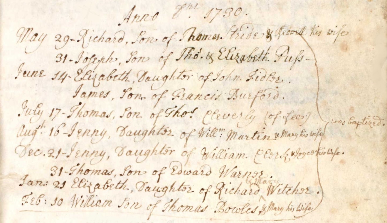
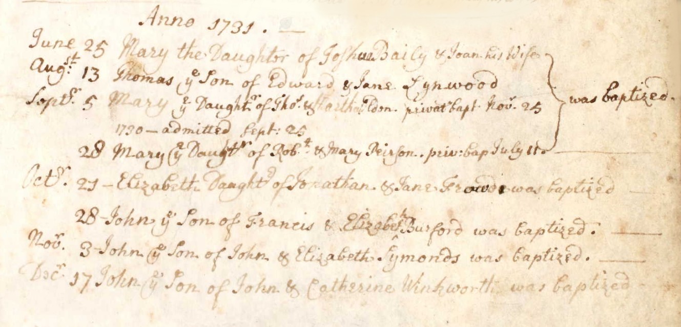
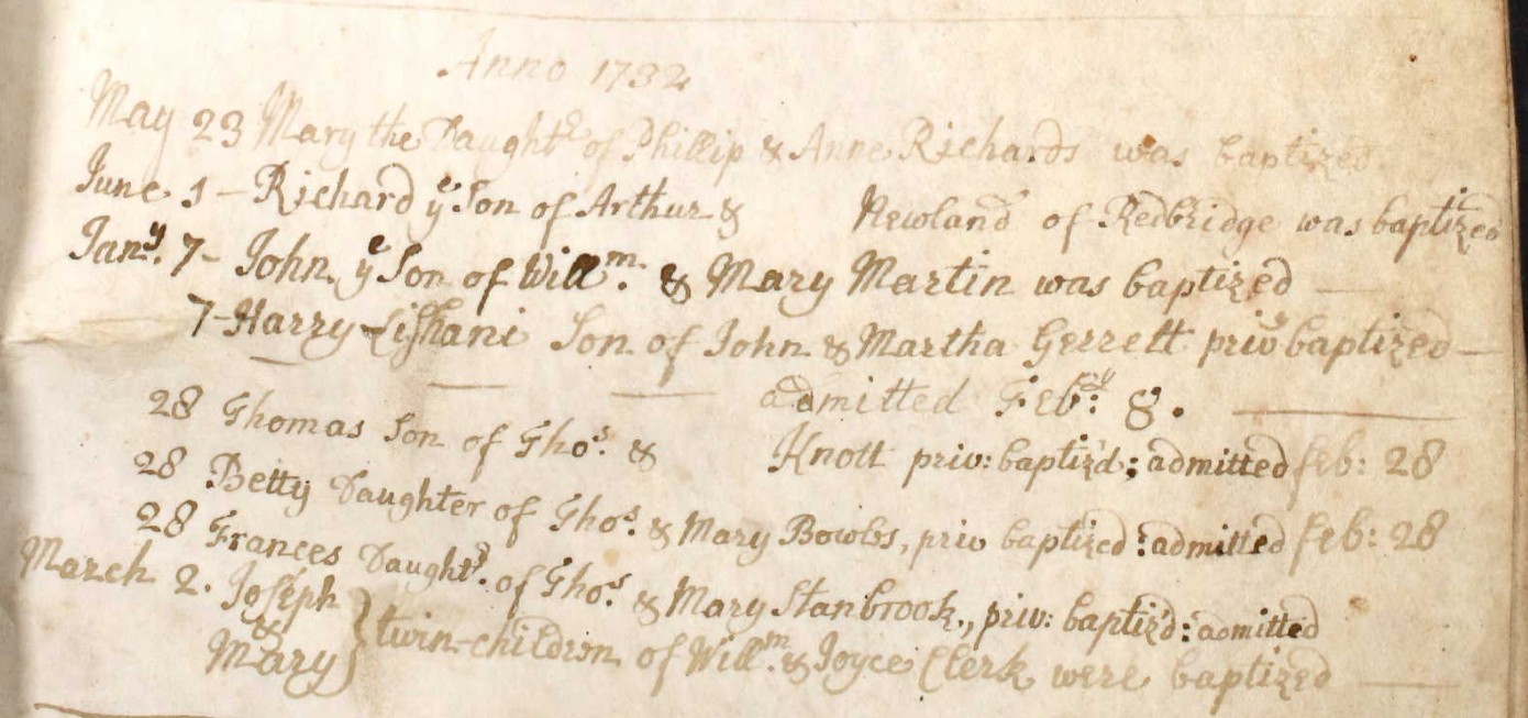
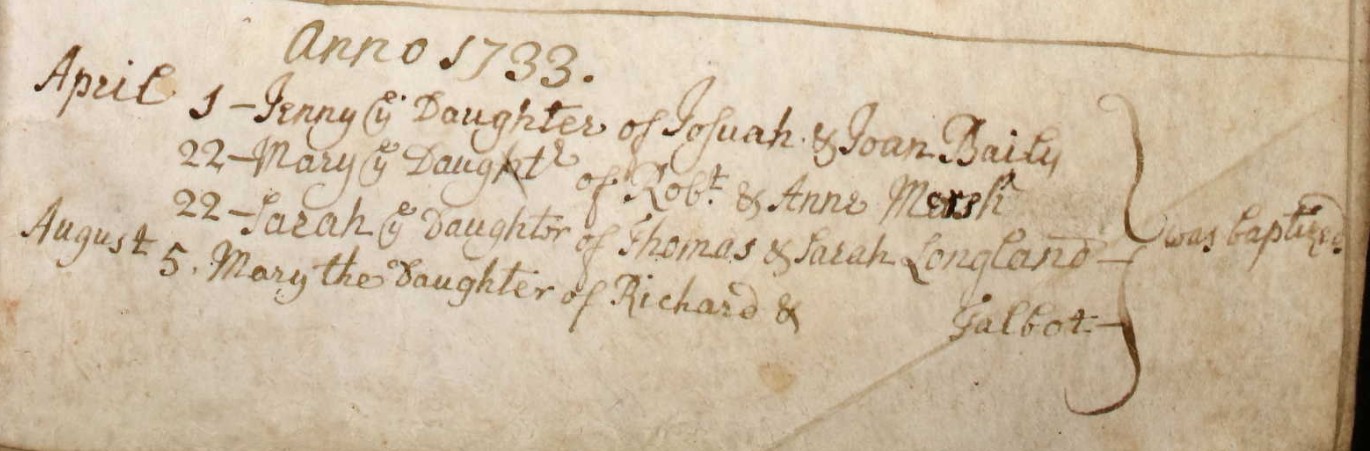
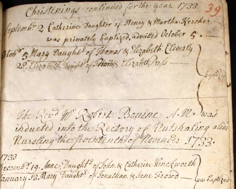
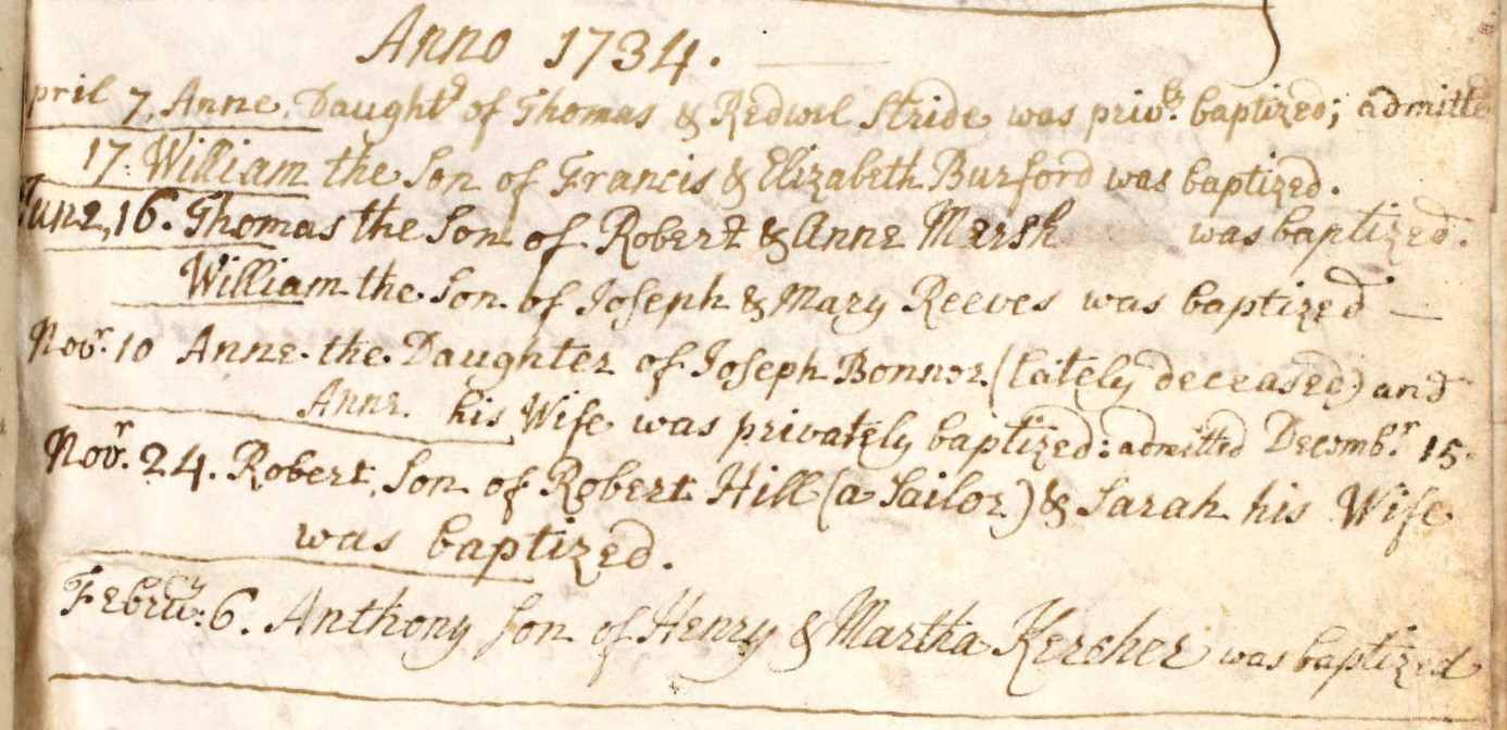
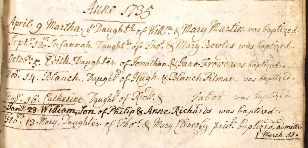
As far as I can see there are only four boys baptised William in the Parish of Nursling between the years 1730 to 1735 inclusive. None of them to a Mabey of similar family.
The search will have to be widened.
Nursling 1736 to 1797
Baptisms in the Nursling Parish Register 1736 to 1797
Baptised at Nursling Parish Church, St Boniface.
Looking in the relevant Parish Registers first, starting with Nursling, Hampshire.
I did a page turn of the Register images looking for any entries with the surname Mabey, aided by the HGS Baptism Index shown above.
Looking through other registers there are a lot of babies privately baptised because they are weak or sick who are taken into the "Congregation of Xt's Flock", "Congregation of Christ's Flock", or "buried on", all in the same entry.
There are a number of recognisable family names within the early pages, which may or may not be related, but it is not until 17?? that I came across the Baptism of a Mabey.
Before listing the finds in the Mabey family, lets look at the Long family.
This is to establish a presence of the Long family in the parish of Nursling, which may help explain the addition of a Mabey family to Nursling parish. Where did William Mabey move from when he married Ann Long in St Boniface Church in Nursling?
Mary, Daughter of Nathaniel & Rebeccah Long
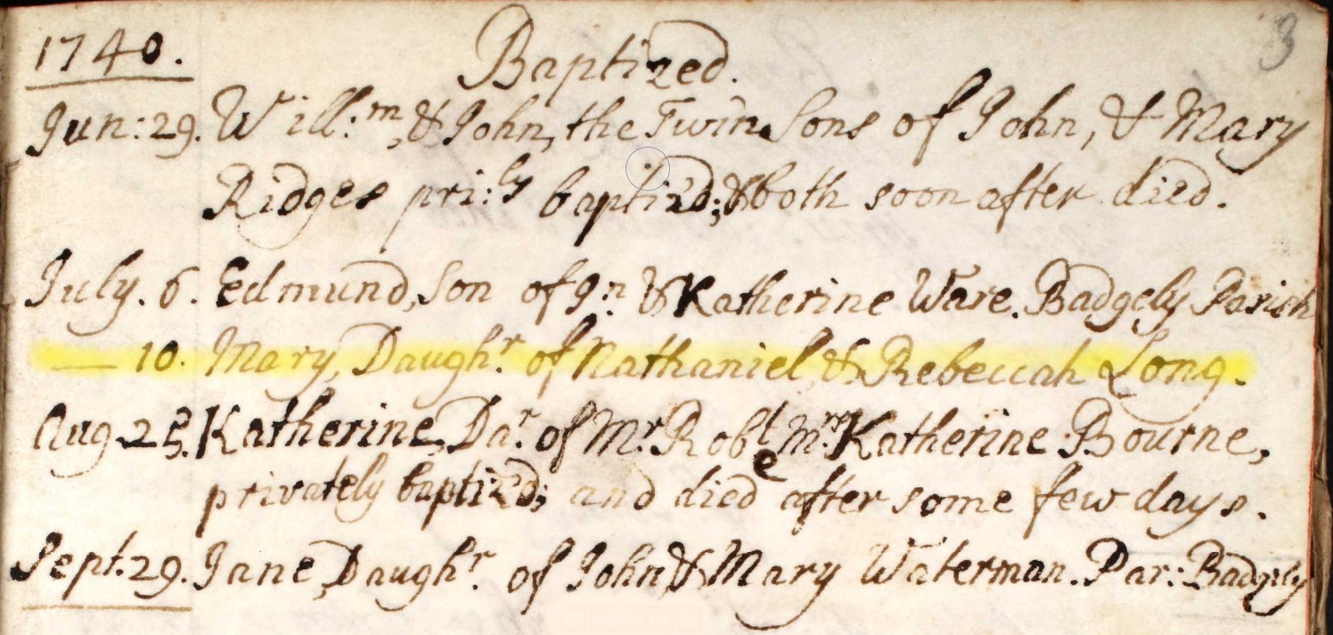
10. Mary, Daughr. of Nathaniel & Rebeccah Long.
July 10, 1740 Mary, Daughter of Nathaniel & Rebeccah Long.
This register only started in 1736 and this is page 3, with the page numbers added later in pencil by S. C. Wilks.
Note two other sad entries on this page, '... privately baptised & both soon after died' and '... privately baptised and died after some few days.' Checks in burials may possibly include the mother. Child birth was a particularly difficult and hazardous event in these times.
Ann, Daughter of Nathaniel & Rebeccah Long

Oct: 9. Ann, Daughr. of Nathaniel & Rebeccah Long.
Oct: 9, 1741. Ann, Daughter of Nathaniel & Rebeccah Long.
Potentially, this Ann Long is the mother of John Mabey. Look to marriages section to find William Mabey married to Ann Long.
Susan, Daughter, of Nathaniel, & Rebeccah Long
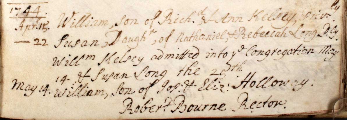
Apr 22 Susan, Daughr, of Nathaniel, & Rebeccah Long P.ly
Willm Kelsey admitted into ye Congregation May 14, & Susan Long the 25th
Apr 22 1744 Susan, Daughter, of Nathaniel, & Rebeccah Long Baptised Privately. William Kelsey admitted into the Congregation May 14, & Susan Long the May 25th
Again, not a Mabey for this baptism record. However, it is another Long, the significance of which will hopefully become apparent later. Also it is an example of Baptised Privately and subsequently admitted into the Congregation / Church.
Nathan, Richard, & Phebe Sons and Daughter of Nathan & Rebecca Long
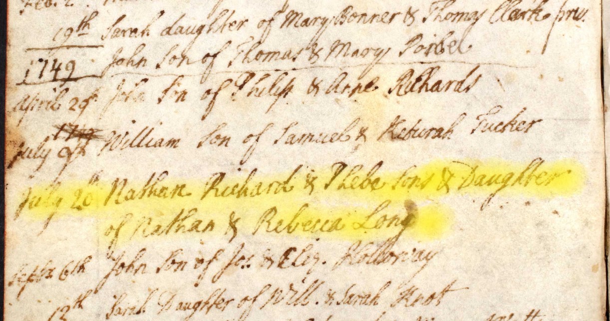
July 20 Nathan Richard & Phebe Sons and Daughter of Nathan & Rebecca Long
July 20 1749 Nathan, Richard, & Phebe Sons and Daughter of Nathan & Rebecca Long
A job lot? Susan Long, above, was Baptised on Apr 22 1744, approximately 5 years before this Baptism. Which is sufficient time for 3 separate pregnancies giving rise to 3 children being baptised at the same time. It could be triplets, or twins and a single, but the is sufficient time interval for it to be three individual births between 1745 and 1749.
John Son of Nathan & Rebecca Long
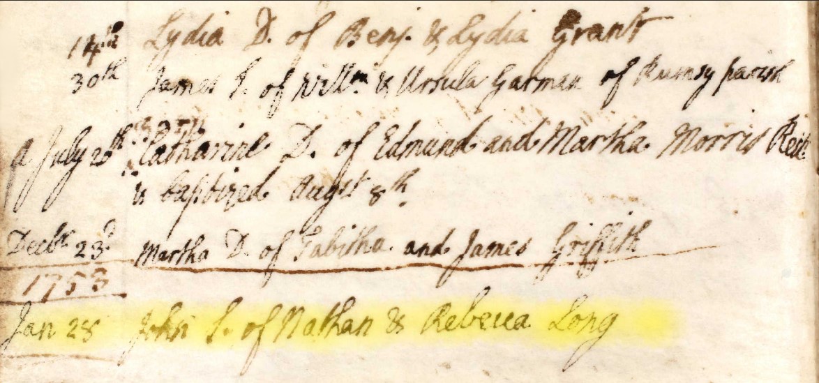
Jan 28 John S. of Nathan & Rebecca Long
Jan 28 1758 John Son of Nathan & Rebecca Long
On this page there is also the baptism of Catharine, daughter of Edmund and Martha Morris, the Rector of this parish, and his wife.
| Baptism date | Child name | S/D | Parents |
|---|---|---|---|
| July 10, 1740 | Mary Long | D | Nathaniel & Rebeccah Long. |
| Oct: 9, 1741 | Ann Long | D | Nathaniel & Rebeccah Long. |
| Apr 22, 1744 | Susan Long | D | Nathaniel, & Rebeccah Long |
| July 20, 1749 | Nathan Long | S | Nathan & Rebecca Long |
| July 20, 1749 | Richard Long | S | Nathan & Rebecca Long |
| July 20, 1749 | Phebe Long | D | Nathan & Rebecca Long |
| Jan 28 1758 | John Long | S | Nathan & Rebecca Long |
Seven children in 18 years, is not implausible, nor is the gaps between them, albeit three baptised at the same time. I have given those three estimated years of birth between 1745 and 1749. However, is this one family or two. Parents are Nathaniel, & Rebeccah Long until 1744 and then at the next baptism, in 1749, they are Nathan & Rebecca Long. Very similar names, but are the people one in the same? On the basis of probability, I will go with the thought that it is all one family, but I accept that is not definitive.
I think there is sufficient evidence to confirm that there is an established presence of a Long family in the Parish of Nursling.
Now on to the Mabey surname.
Martha Daughter of William & Mary Maby
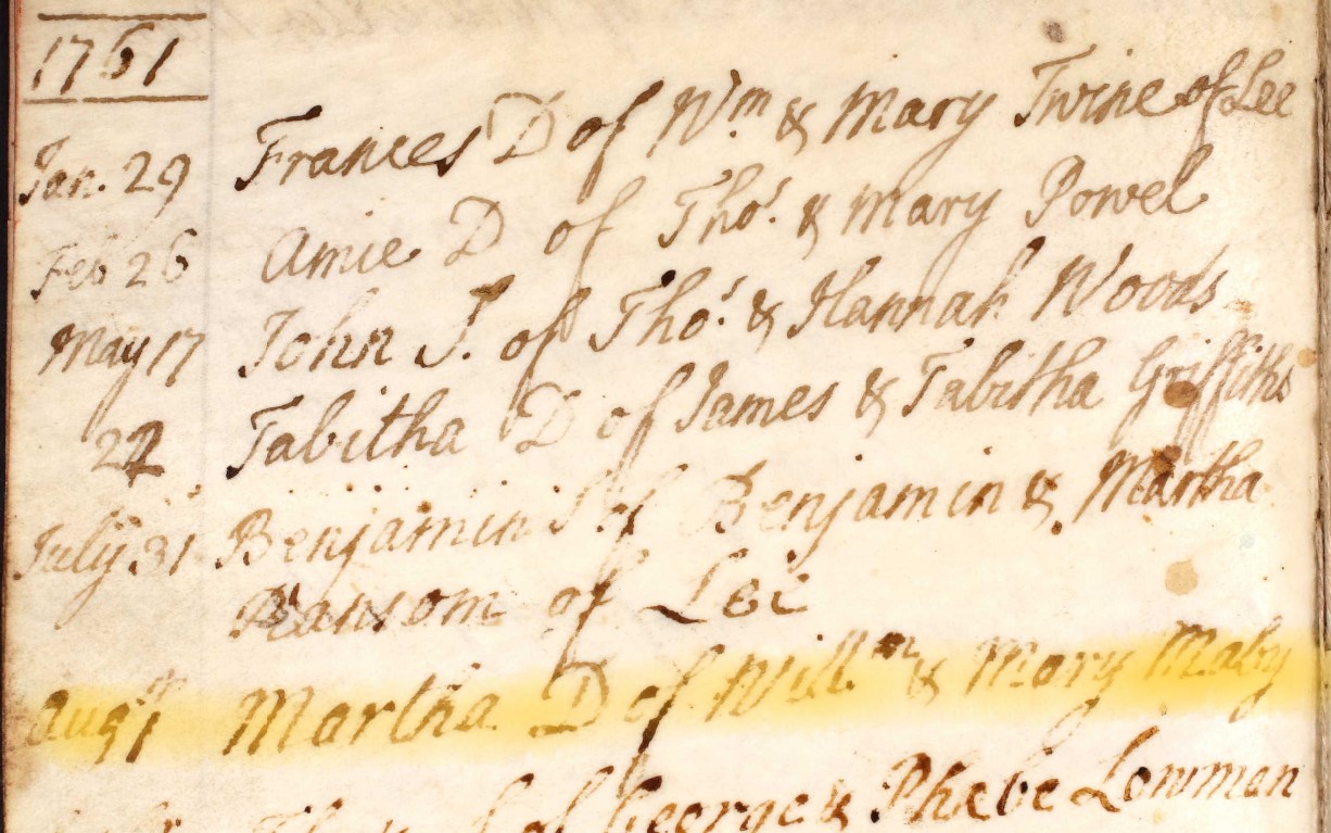
Aug 1 Martha D of Willm & Mary Maby
Aug 1, 1761 Martha Daughter of William & Mary Maby
Maby is not Mabey but is similar.
William Mabey and Ann Long were married at St Boniface Church, Nursling, Hampshire on 29 October 1760. So 1st August 1761 is a respectable date of first born after marriage.
However, who is Mary? William married Ann, not Mary. Is Mary an alternative name for Ann, such as Mary Ann, or Ann Mary. Not according to the baptism record.
Susan Daughter of William & Anne Maby
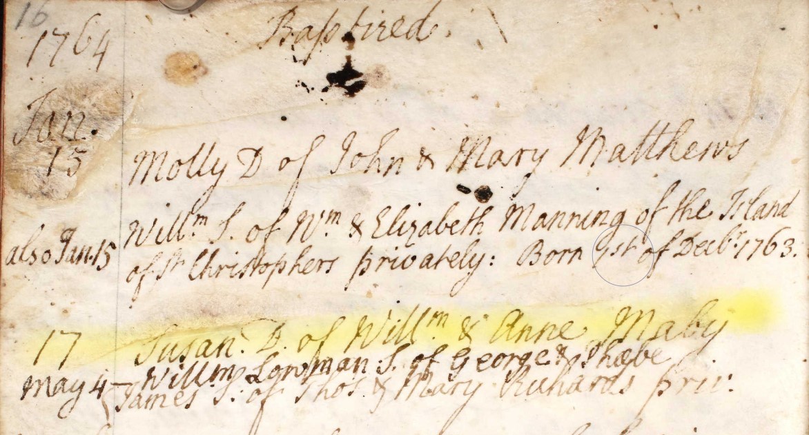
May 4 Susan. D. of Willm & Anne Maby
May 4, 1764 Susan Daughter of William & Anne Maby
Again, Maby is not Mabey but is similar.
At least the parents are the expected William and Ann.
1768
Ann Daughter of James Penny
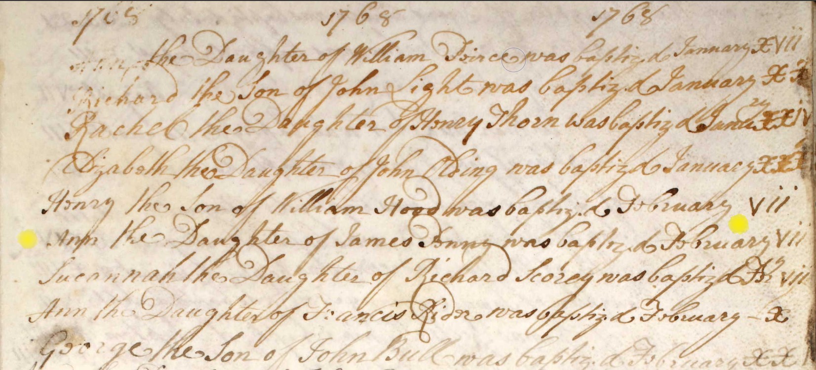
Ann the Daughter of James Penny was baptised February vii - 7th Feb 1768, was baptised at St Boniface Church Nursling.
1768
Joseph Son of William & Anne Mabey
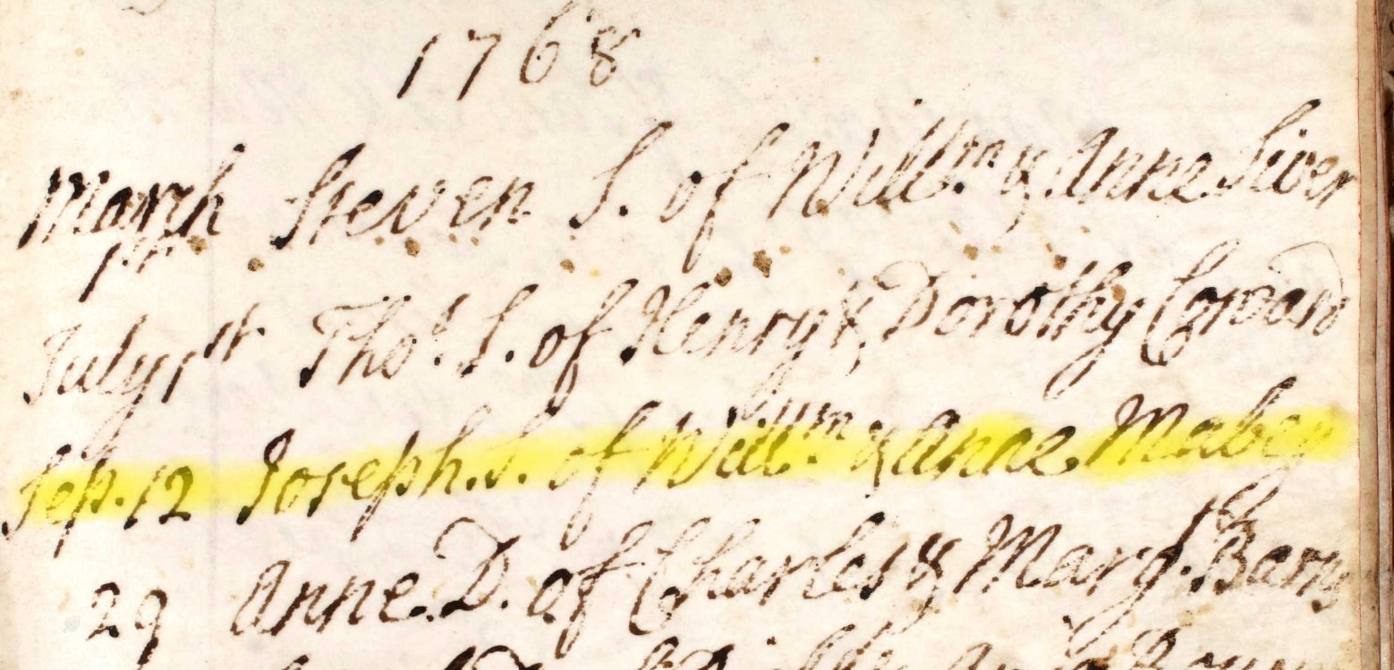
Sep 12 Joseph. S, of Willm. & Anne Mabey
Sep 12, 1768, Joseph Son of William & Anne Mabey.
1771
John Son of William & Anne Mabey
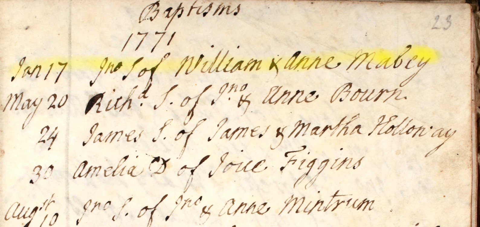
Jan 17 Jno S of William & Anne Mabey
Jan 17, 1771 John Son of William & Anne Mabey
1773
Richard Son of William & Anne Mabey
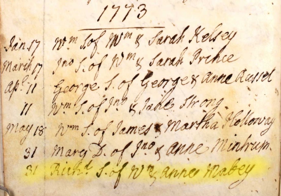 h
h
May 31 Richd S. of Wm & Anne Mabey
May 31, 1773 Richard Son of William & Anne Mabey
1775
John, Son of John & Sarah Penny
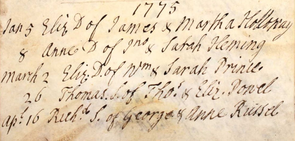
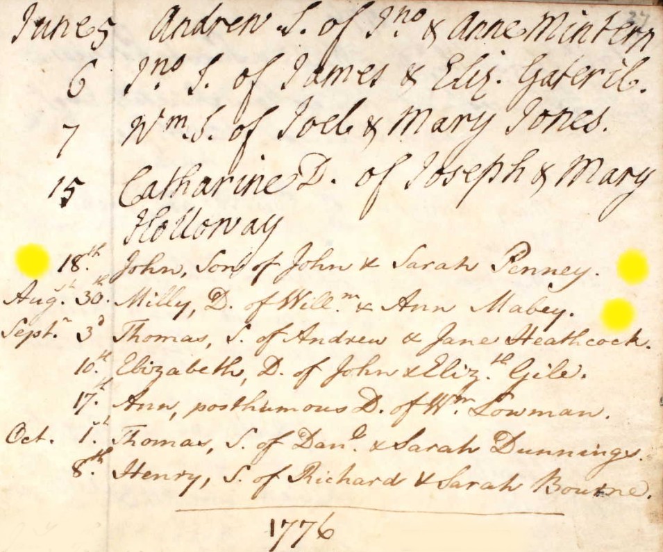
I have copied both pages of the register for 1775 here, looking for John Penny. For the whole year of 1775 there are only two baptisms with male names beginning with J,
June 6 Jno S. of James & Eliz. Gateril
June 18th John, Son of John & Sarah Penny
The next record is Milly, shown below
1775
Milly Daughter of William & Ann Mabey
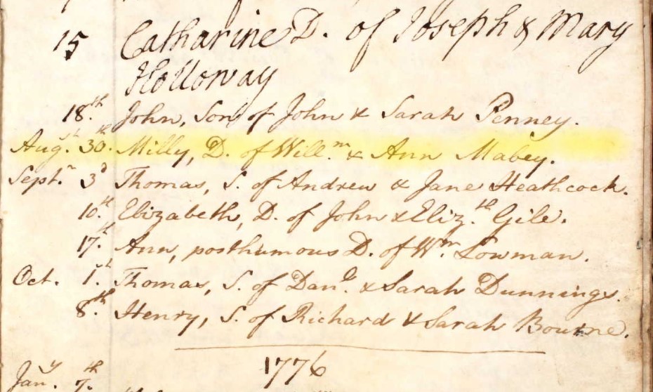
Aug 30 Milly, D. of Willm & Ann Mabey
Aug 30, 1775 Milly Daughter of William & Ann Mabey
1778
Mary Daughter of William and Ann Mabey
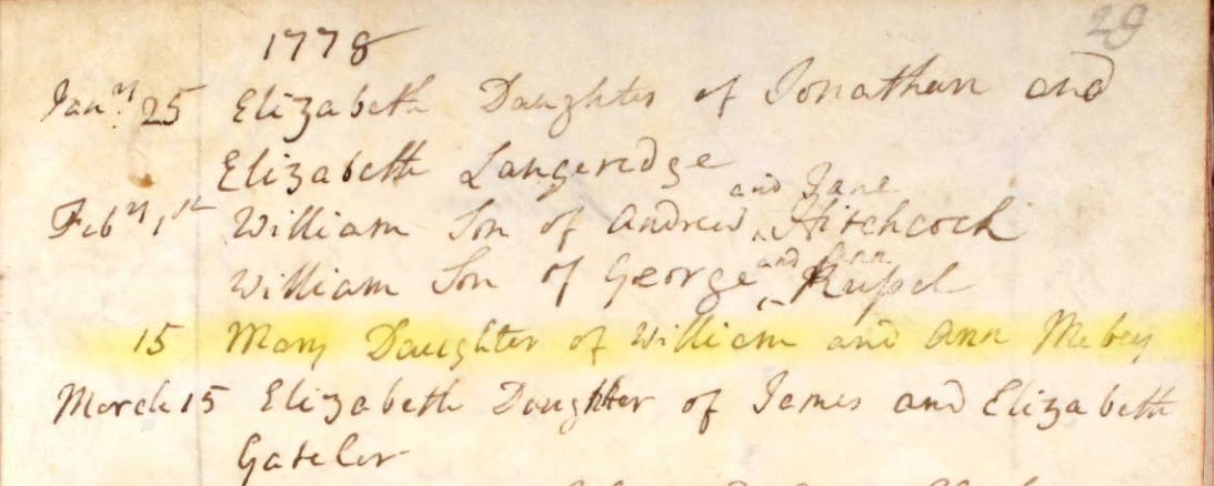
Feb 15 Mary Daughter of William and Ann Mabey
Feb 15, 1778 Mary Daughter of William and Ann Mabey
1780
Susan Daughter of William & Ann Mabey
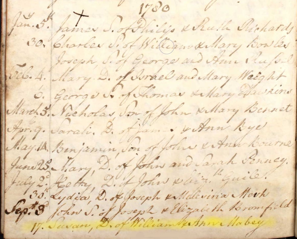
Sep 17 Susan, D. of William & Ann Mabey
Sep 17, 1780 Susan Daughter of William & Ann Mabey
Second use of the name Susan in this family, which implies the first Susan died before this year.
1782
Elizabeth Daughter of William & Anne Maybe
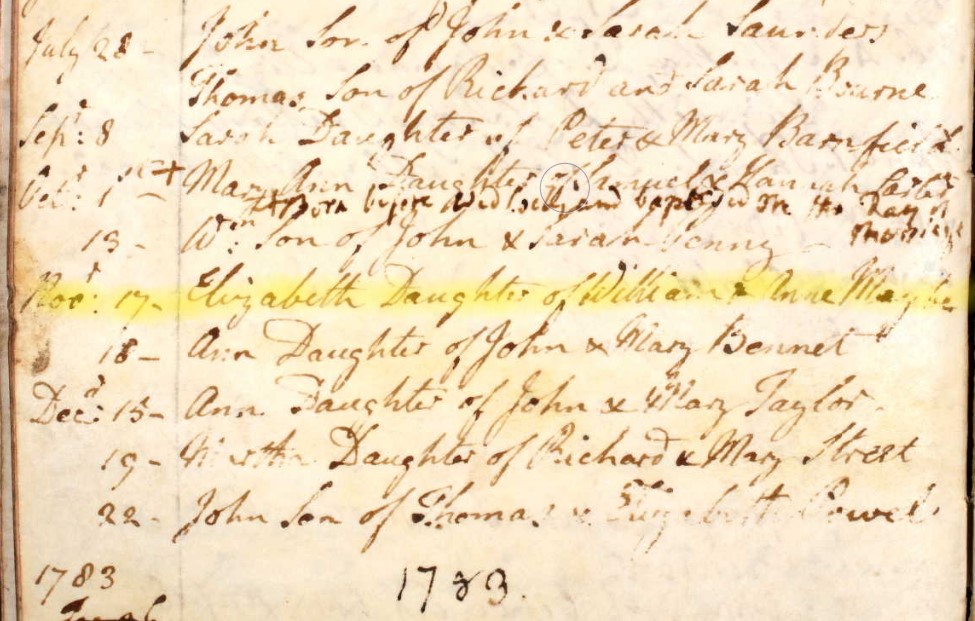
Novr 17. Elizabeth Daughter of William & Anne Maybe
Nov 17, 1782 Elizabeth Daughter of William & Anne Maybe
Note surname written as Maybe not Mabey. Assumed to be the same family.
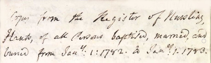
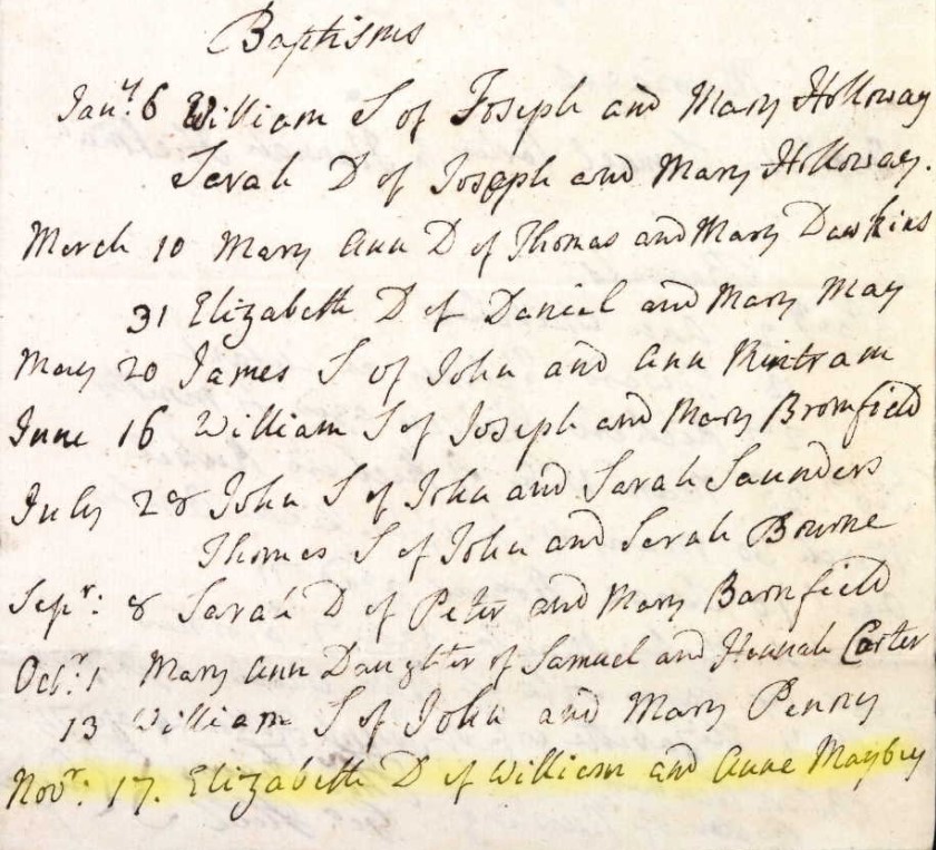
Another copy within the same Register, fortunately with the same information.
Charlotte Mabey
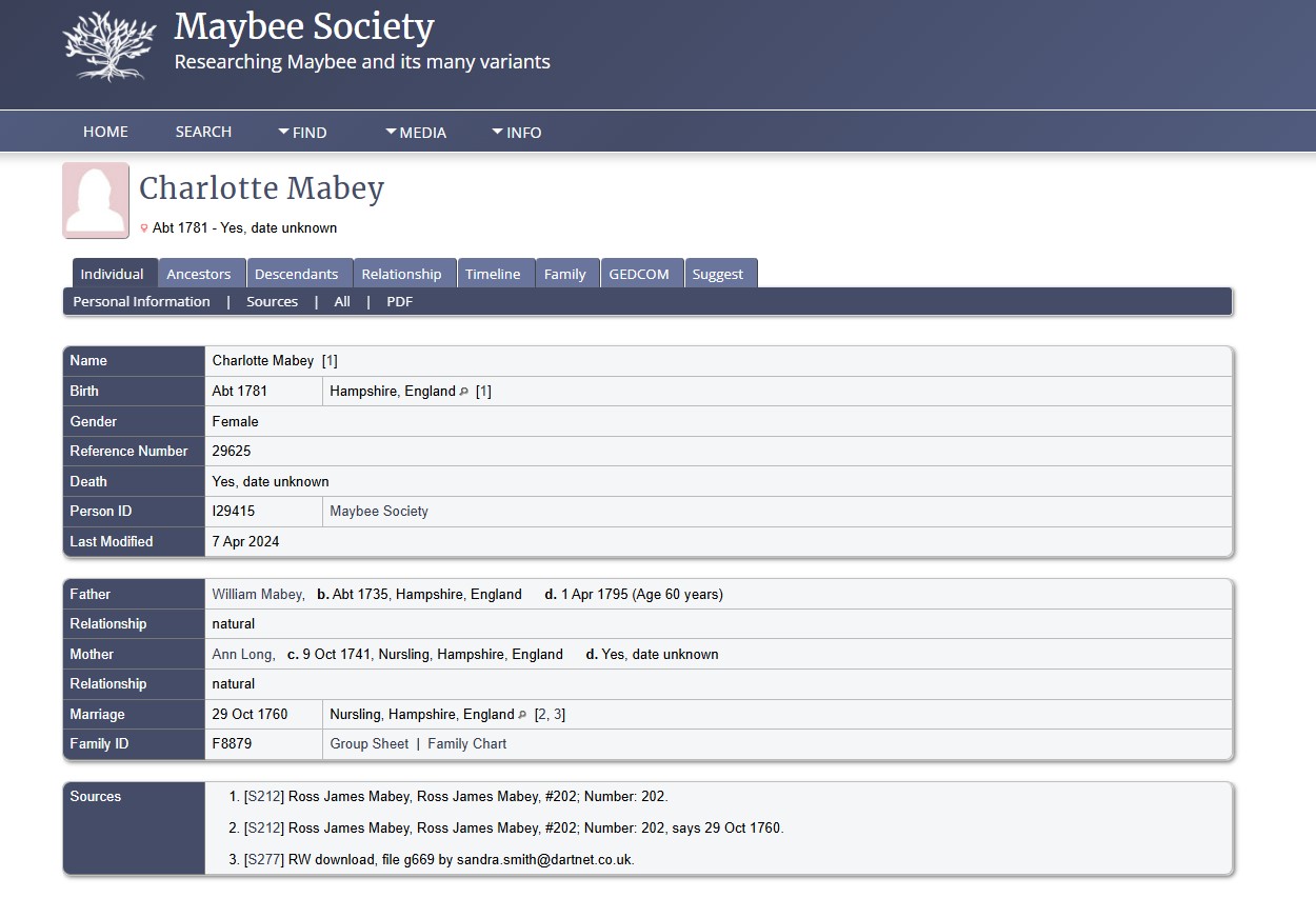
The above is a extract from the Maybee Society regarding Charlotte Mabey b. 1781.
However, so far, I have not found any primary data in respect of Charlotte.
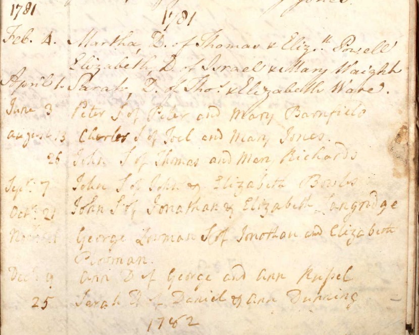
The above is the page for the Parish of Nursling Register in the Baptised section, for 1781. There is no entry for a Charlotte on this page.
The Hampshire Genealogical Society (HGS) Baptism Index 1752 -1812 did not reveal any potential matches, across Hampshire.
The last entry for Baptisms in this section of the Registry is page 36 for the year 1787. No Mabey family found from Elizabeth in 1782 to 1787.
1797
George Son of John & Mary Maybey
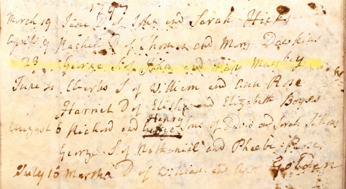
April 23 George S. of John & Mary Maybey
Apr 23, 1797 George Son of John & Mary Maybey
| Baptism date | Child name | S/D | Parents |
|---|---|---|---|
| Aug 1, 1761 | Martha Maby | D | William & Mary Maby |
| Abt. 1762 | William Mabey | S | |
| Abt. 1781 | Charlotte Mabey | D | |
| Apr 23, 1797 | George Maybey | S | John & Mary Maybey |
The three people above are thought to be part of the family according to other Ancestry trees, however, they are not yet proved from the baptism records found so far. The fourth is possibly a grandchild.
| Baptism date | Child name | S/D | Parents |
|---|---|---|---|
| May 4, 1764 | Susan Maby | D | William & Anne Maby |
| Sep 12, 1768 | Joseph Mabey | S | William & Anne Mabey |
| Jan 17 1771 | John Mabey | S | William & Anne Mabey |
| May 31, 1773 | Richard Mabey | S | William & Anne Mabey |
| Aug 30, 1775 | Milly Mabey | D | William & Ann Mabey |
| Feb 15, 1778 | Mary Mabey | D | William and Ann Mabey |
| Sep 17, 1780 | Susan Mabey | D | William & Ann Mabey |
| Nov 17, 1782 | Elizabeth Maybe | D | William & Anne Maybe |
Eight children in 18 years, is not implausible. Even eleven, adding the uncertain children, is still plausible both in terms of elapsed date and separation of dates.
Jump back to top of Parish Records tabs
Nursling 1798 to 1812
Baptisms in the Nursling Parish Register 1798 to 1812
Baptised at Nursling Parish Church, St Boniface.
Jump back to top of Parish Records tabs
Jump back to top of Parish Records tabs
Eling 1672 to 1749
Baptisms in the Eling Parish Register 1672 to 1749
Baptised at Eling Parish Church, St Mary the Virgin, aka St Mary's Church.
Following a similar search in the Nursling Parish Register, without result, it is time to turn attention to the Parish of Eling, Hampshire. General searches of numerous datasets of Parish Records and Bishop's Transcripts have not reveled suitable matches. This could be because of errors in transcription, the variable nature of spelling at the time, or the state of the records, missing or difficult to render a reliable transcription.
The reason for looking in Eling next is some information about his father from Rodney Whale.
Notes: William MABY-245
General: This spelling was as baptised.
Was living in Botley, Hants and moved to Eling. He was examined by the Overseers of the Poor and because he had no settlement certificate he was returned to Botley. However a year later he returned to Eling bearing the certificate and was allowed to settle.
His origins are obscure but he was almost certainly from Dorset. He appears in Swanage for a short while, where his first child was baptised in 1726 and his first wife was buried there in 1731. There is a marriage of a Bernard Mabey in Swanage around this time and he may have been William's brother particularly as William named a son as Bernard.
This information was added to in September 2010 by virtue of his baptism being discovered.
The settlement certificate for Botley is dated 19091738 and one of the Overseers of the poor was Jacob Emery, an ancestor of Beryl Whale nee Sharp.
The Removal Order mentioned was dated 03021737.
The first interest in this Eling registry is looking for the Baptism of William Mabey or variations of that spelling. The reason for reviewing these particular years is the Burial record of a William Mayby.
Burials, 1795
April 14 William Mayby aged 63 years
Form his stated age at burial it would suggest a birth of around 1732.
The range of search shown below is 1730 to 1735. Remember that until 1752 the beginning of the New Year was 25 March (Lady Day, the Feast of the Annunciation). This is evident in the pages below.
1730
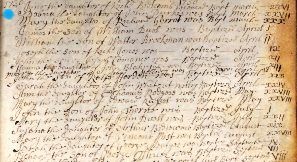
Following the location of three relevant baptisms, I am reviewing these images again looking for the shape of the surname.
The last line but one reveals:-
Sarah the daughter of George Meabyee was Baptised September iv. Baptised 4th September 1730 in St. Mary the Virgin Church, Eling.
However, an alternative direction of travel is a Marriage Certificate for a Sarah Meatyar.
Not here, but on my work in progress tree, I have added George Meabyee, annotated hypothesis, as a brother of William Mabey, b. 1705, the father of William Mabey b. 1734, the person whose Baptism record we are searching for.
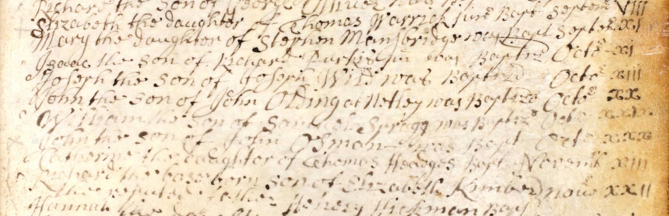
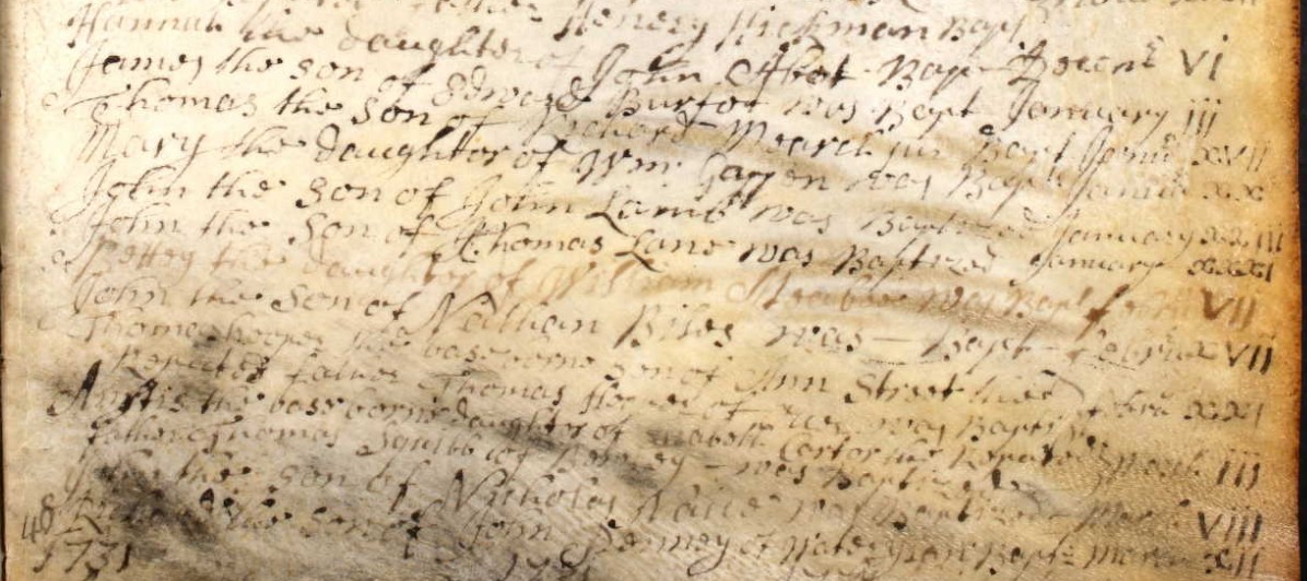
I have split the page into three parts to ensure that the writing is large enough for you to be able to read it, and find something that I have missed. There will therefore be some duplication at the joints.
You can see that there are a lot more baptisms in a year than in Nursling, as to be expected, Eling is larger both by area and population.
As you can see, the page gets very difficult to read towards the bottom. I can fully understand why this was not transcribed, as that would produce unreliable data.
However, I believe I can make out enough to search for a name of William for the baptised person, and an M for the beginning of the father's surname.
Fortunately, Ancestry, as well as some other sites, has the ability to invert the colours of the image, in the tools section. Sometimes this can make the image more legible. Not always sufficient to transcribe though, and I doubt the original transcribers had this technique available to them.
1731
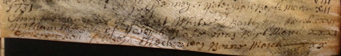
Below, the sixth record from the top reveals:-
Andrew the Son of Joseph Meabyee was Baptised April vii. Baptised 7th April 1731 in St. Mary the Virgin Church, Eling.
However, an alternative direction of travel is a Marriage Certificate for a Sarah Meatyar, but no similar alternative for Andrew.
Not here, but on my work in progress tree, I have added Joseph Meabyee, annotated hypothesis, as a brother of William Mabey, b. 1705, the father of William Mabey b. 1734, the person whose Baptism record we are searching for.
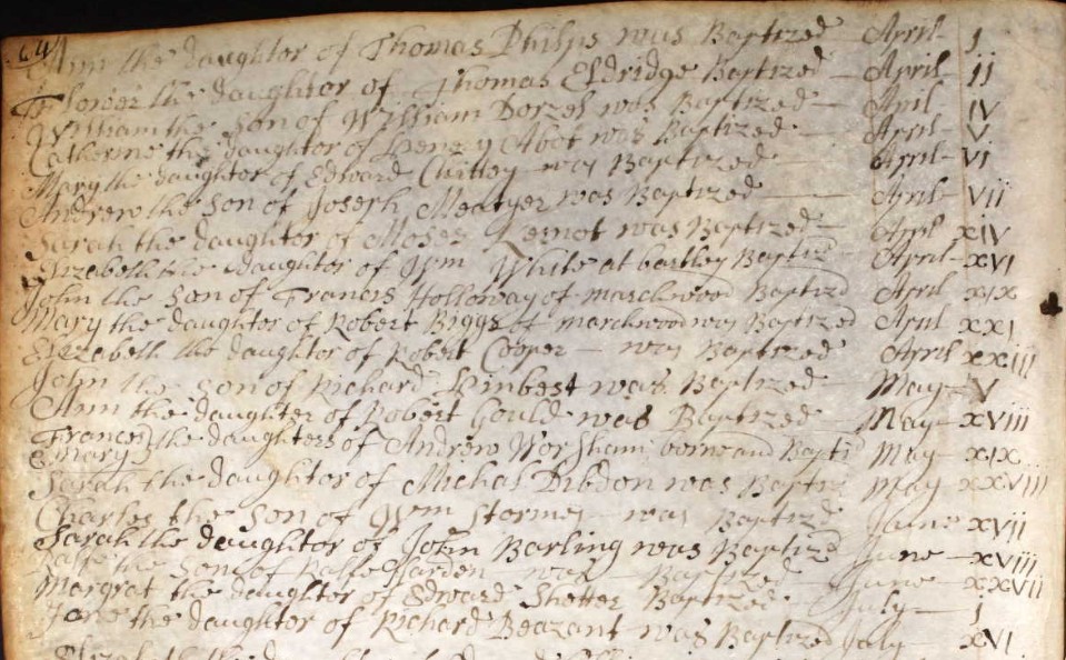
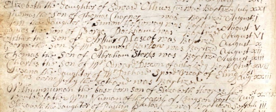
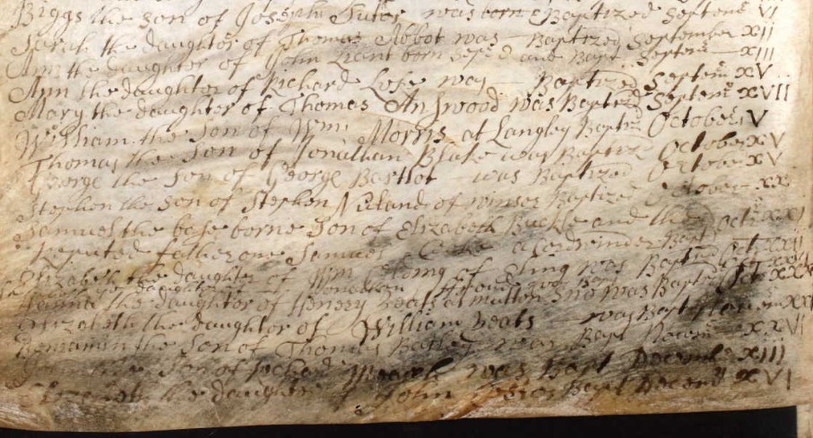
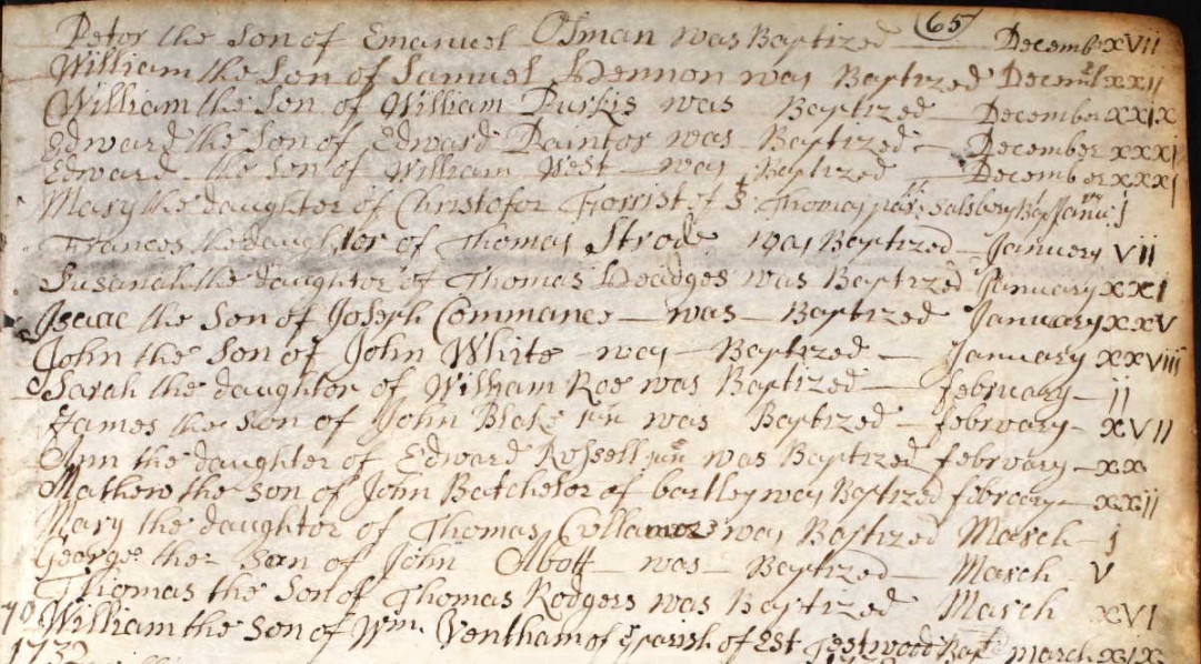
1732
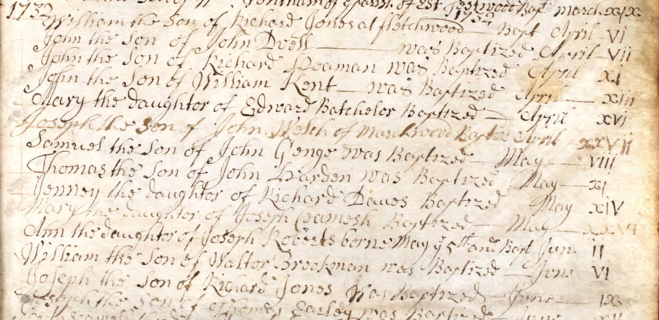
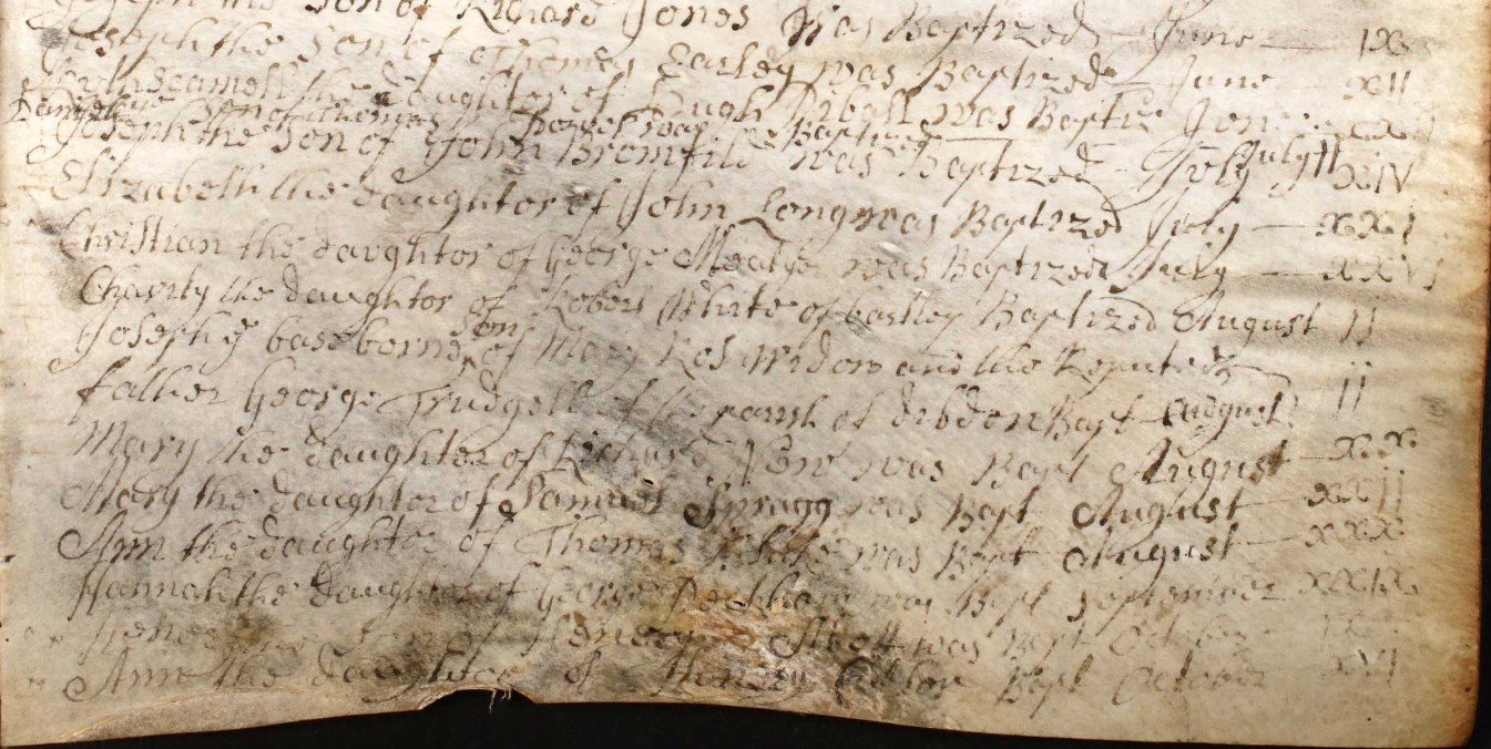
Another possible, four records down from the top of the last section; Christian the daughter of George M???? was baptised July xxvi. July 26th 1732 baptised at St Mary the Virgin Church, Eling. An unusual name for a daughter. Not transcribed in Ancestry.
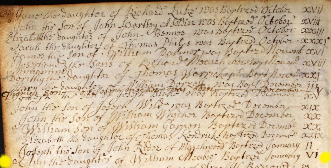
Yellow dots, instead of a light wash to highlight, so as to not obscure the writing on the Registry page. Ann the daughter of William Meabee Baptised January vi. Baptised 6th January 1732 in St. Mary the Virgin Church, Eling.
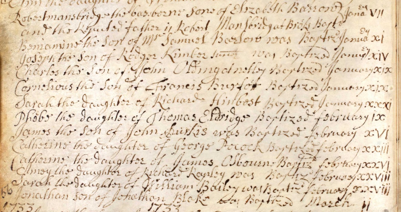
1733
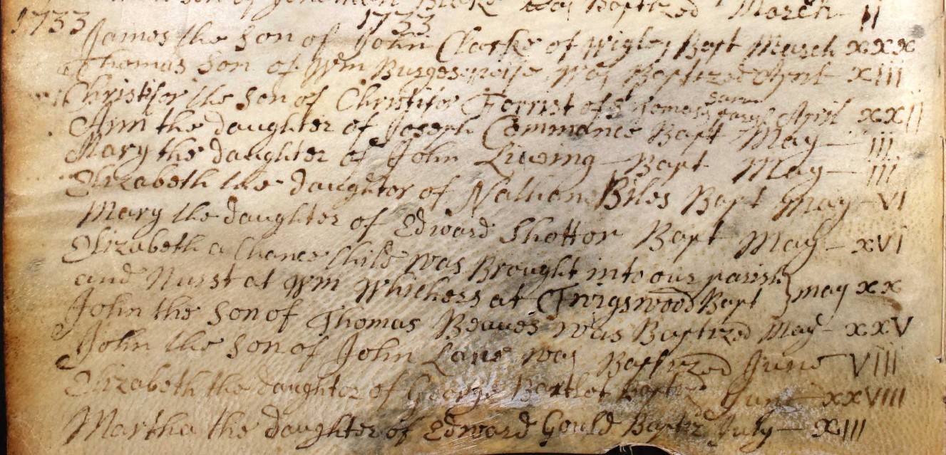
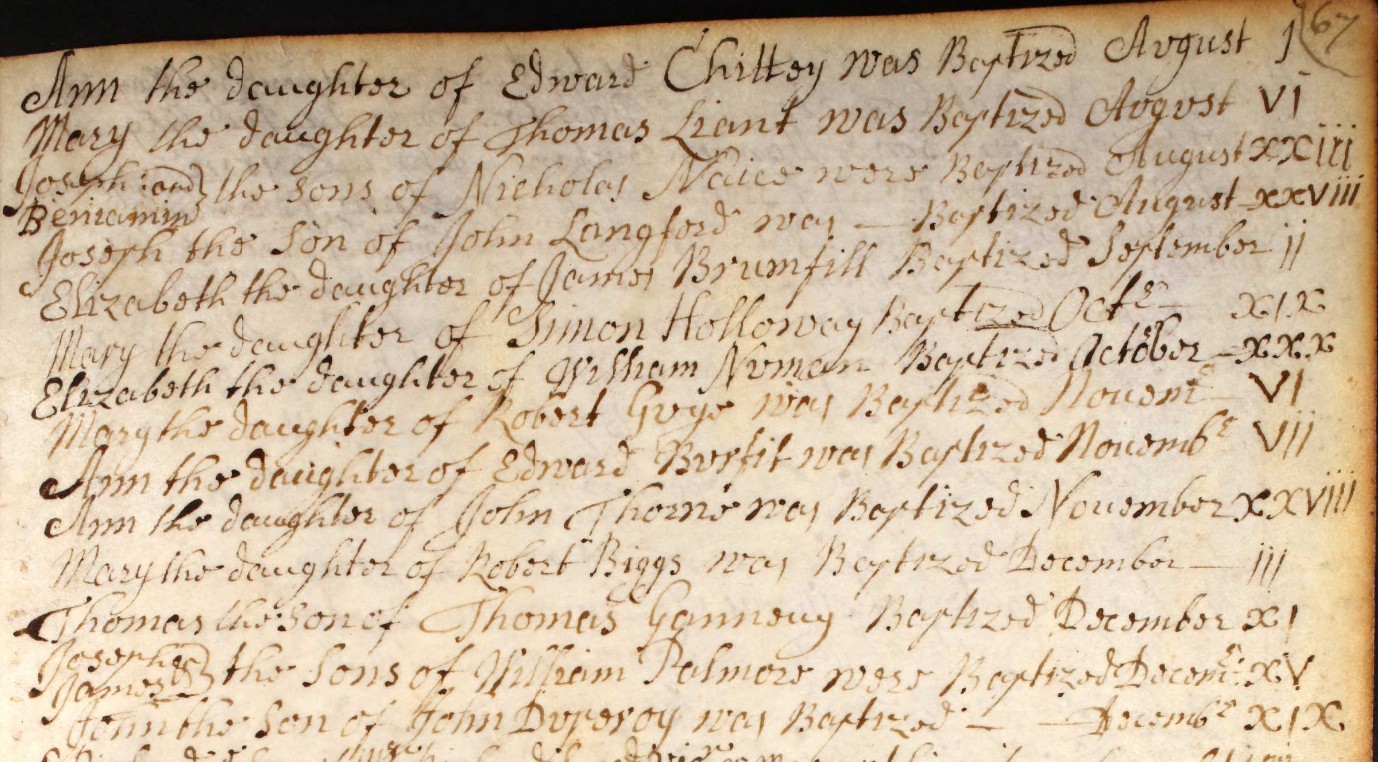
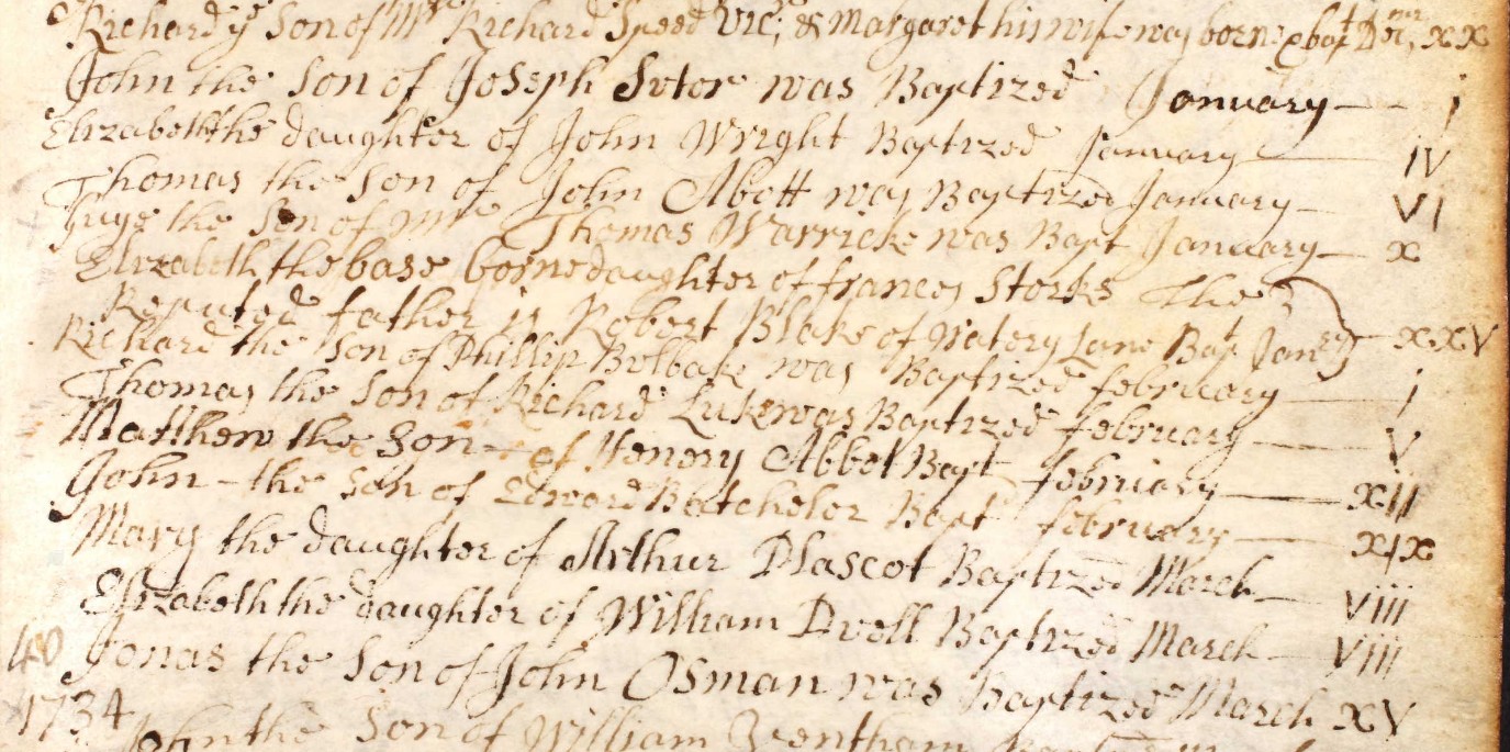
1734
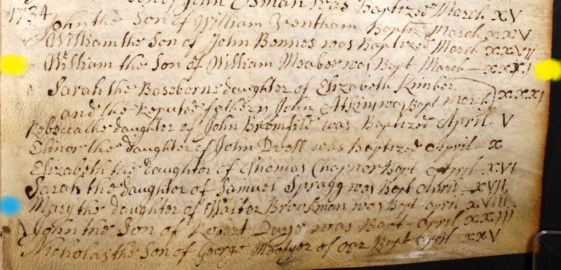
William the Son of William Maebee was Bapt. March xxxi. Baptised 31st March 1734 in St. Mary the Virgin Church, Eling.
The blue dot is just to highlight the use of a capital M, in a word recognisable as Mary, for comparison with Maebee, which is much less certain.
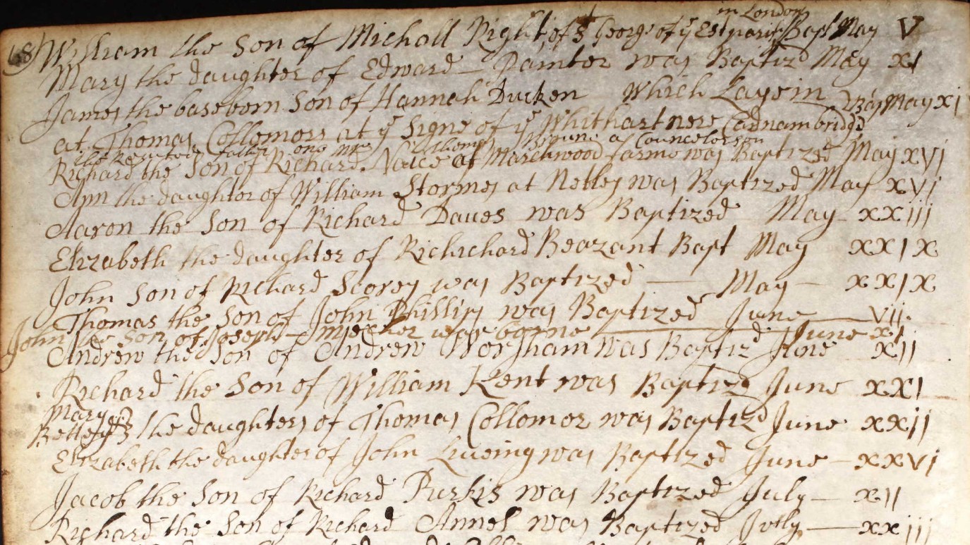
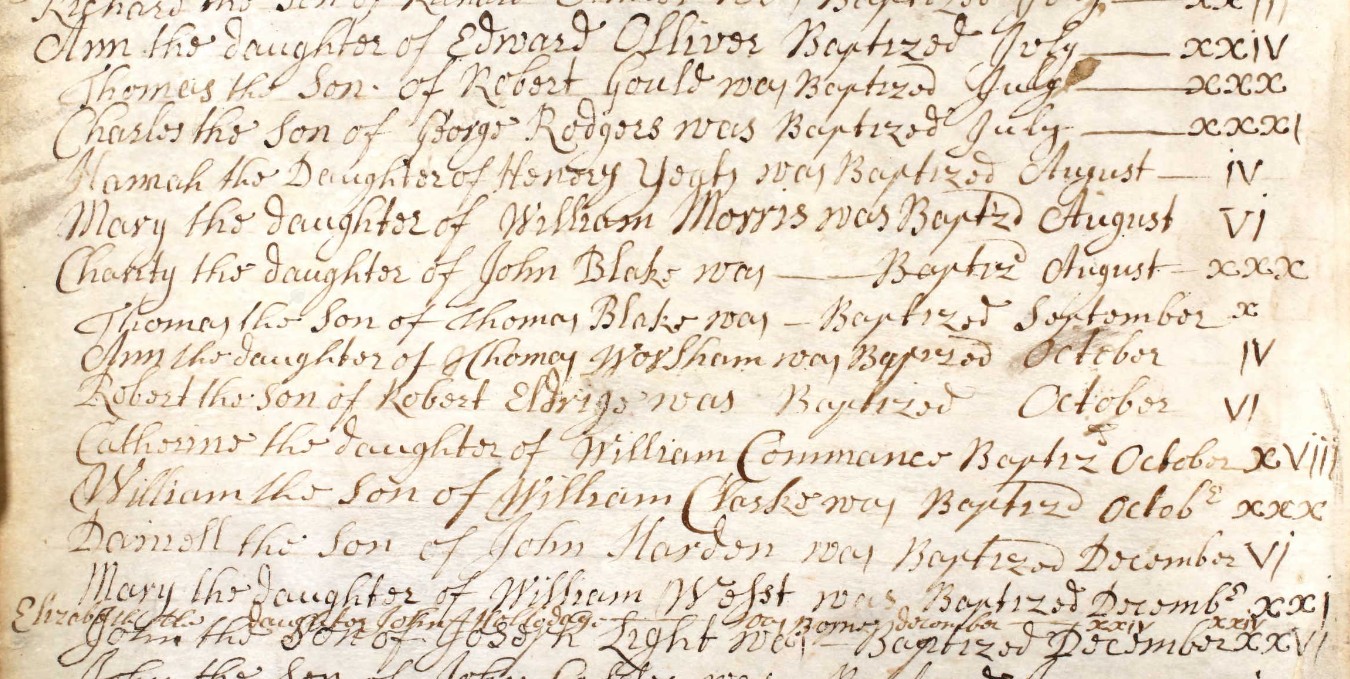
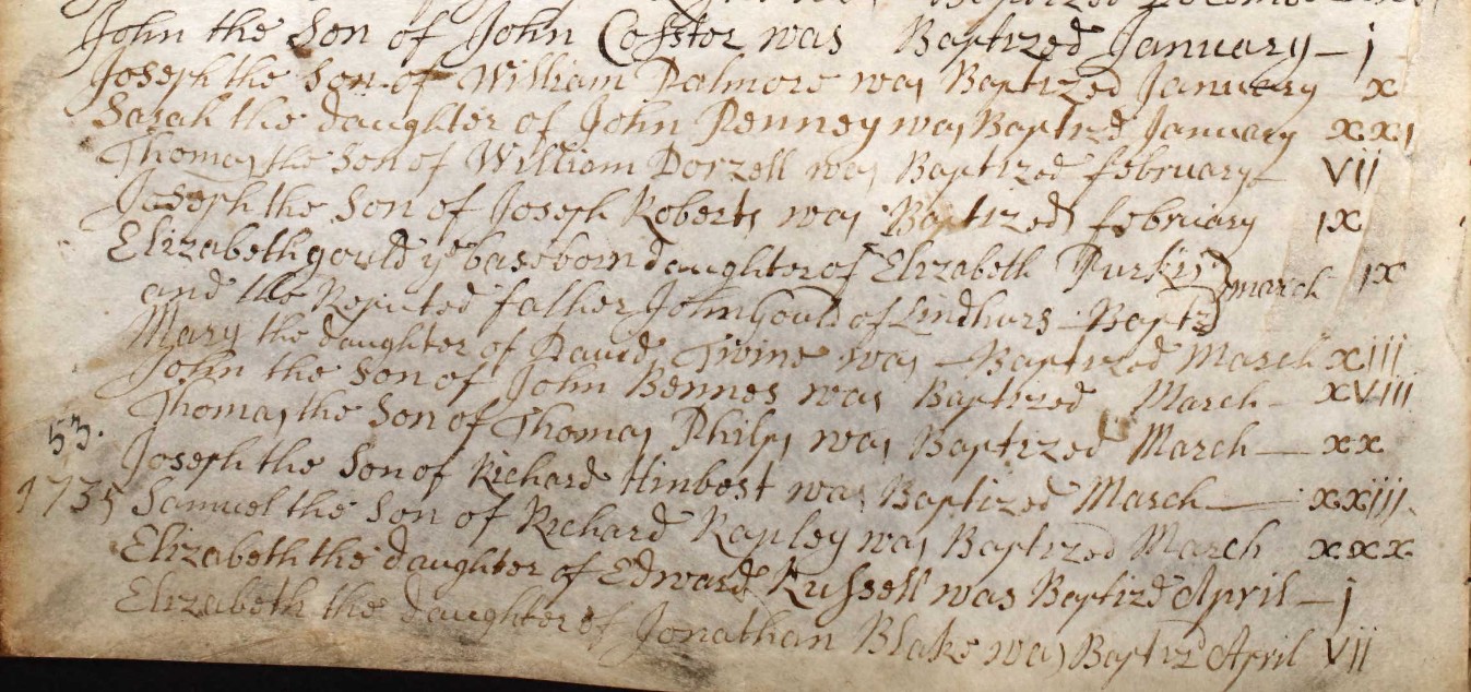
1735
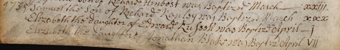
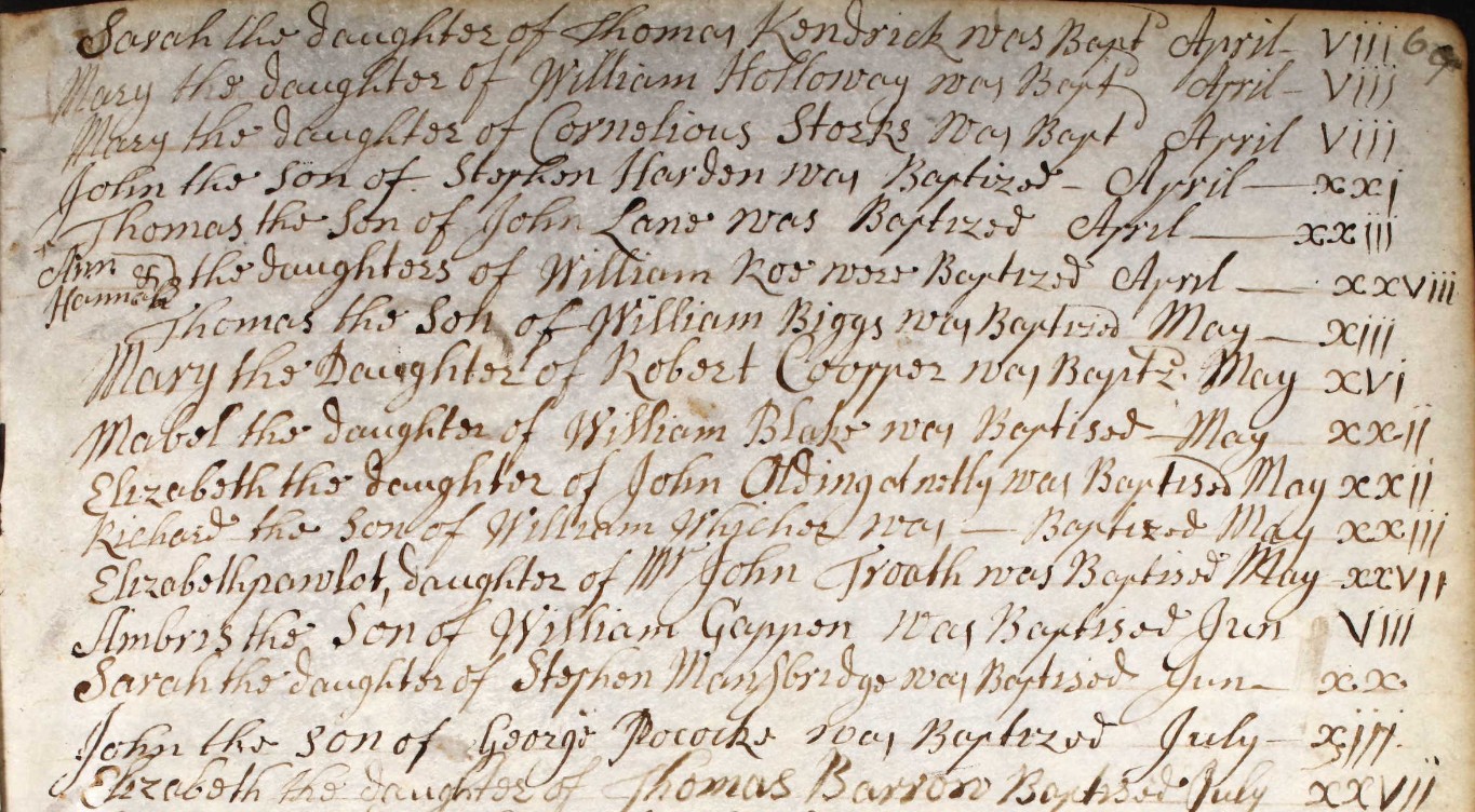
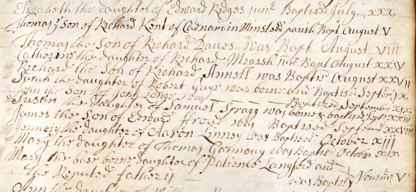
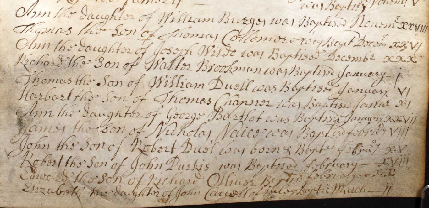
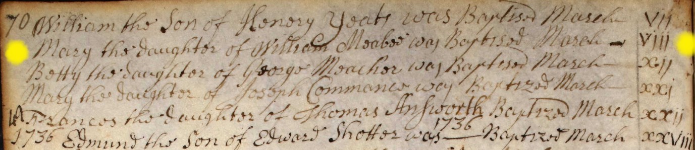
Mary the daughter of William Maebee was Baptised March viii. Baptised 8th March 1735 in St. Mary the Virgin Church, Eling.
1736 Part only
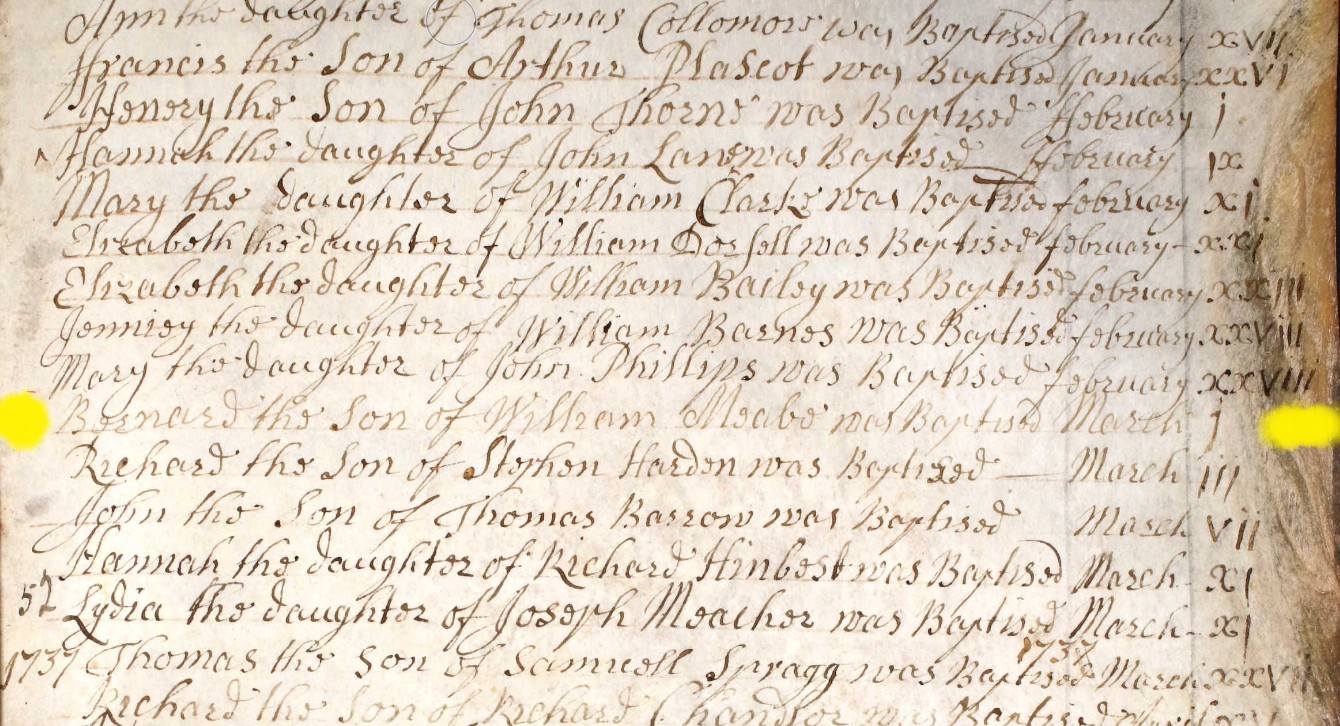
Bernard the Son of William Meabe was Baptised March i. Baptised on 1st March 1736 at St Mary the Virgin Church, Eling, Hampshire.
1738
Ann the Daughter of Robert & Ann Eldridge
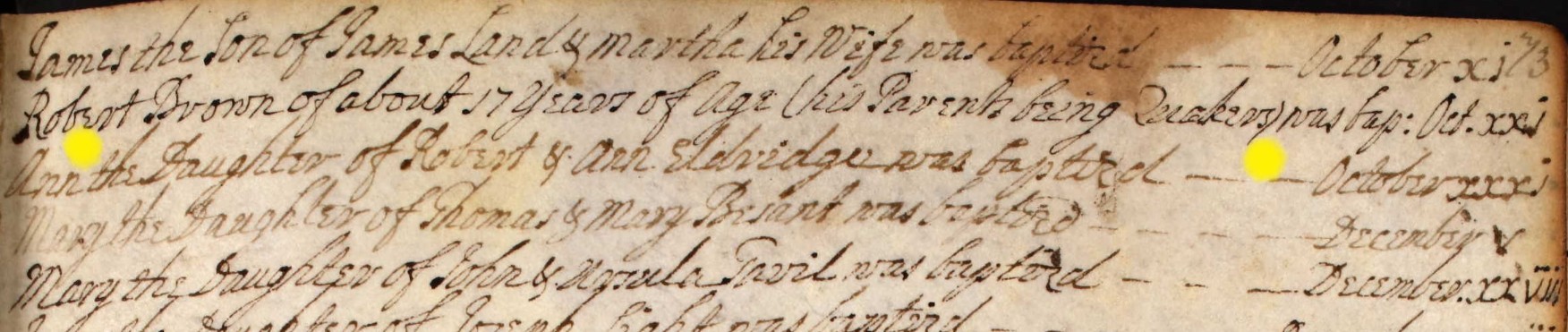
Ann the Daughter of Robert & Ann Eldridge was baptised October xxxi - 31st October 1738, baptised at St Mary the Virgin Church, Eling, Hampshire.
The baptism record above Ann, is also interesting, Robert Brown of about 17 Years of Age (his Parents being Quakers) was bap: Oct. xxi. Further confirms that older children may have their age shown, and sometimes annotated with a reason for late baptism.
Eling 1750 to 1798
Baptisms in the Eling Parish Register 1750 to 1798
Baptised at Eling Parish Church, St Mary the Virgin, aka St Mary's Church.
A reminder that until 1752 the beginning of the New Year was 25 March (Lady Day, the Feast of the Annunciation). This is evident in the pages below.
1750
Thomas the Son of John & Elizabeth Penny
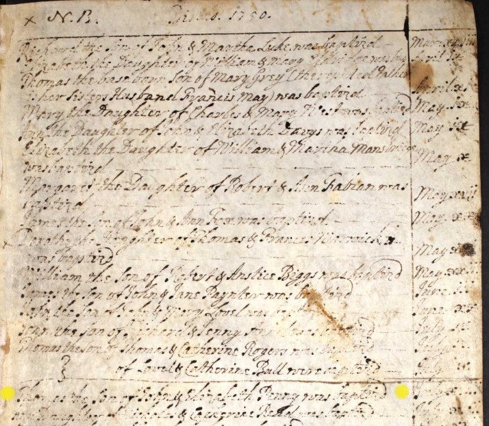
Thomas the Son of John & Elizabeth Penny was baptised July xiii - 13th July 1750, baptised at St Mary the Virgin Church, Eling, Hampshire.
Not particularly relevant, just the same surname.
However, it does provide some evidence of Penny family or families in the Parish of Eling, at least from 1750.
1759
Ann Daughter of William and Mary Eldridge
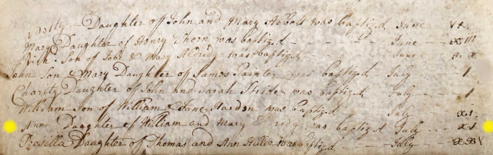
Ann Daughter of William and Mary Eldridge was baptized July xv - 15th July 1759, baptised at St Mary the Virgin Church, Eling, Hampshire.
List of Rectors & Vicars
A spectacular find. Click on image to go to source.
This list is so helpful. In the past I would look through the Parish Register for information to create a list, or go to some of the sources at the top of the image. This is so much easier, just look the parish up, and there is the list. I recognise some of the names from the Marriage Certificates.
Why have I put this here? Well some of the Ancestry Trees have some of the Penny family being born at The Vicarage, Eling Hill, Eling, Hampshire. Which is the correct address for the vicarage of St Mary's, aka St Mary the Virgin Church.
It does not appear that the Penny family are the rector or vicar of the parish, but that does not make the information incorrect. They could be part of the domestic or gardening / farming team.
1772
George the Son of William & Ann Penny
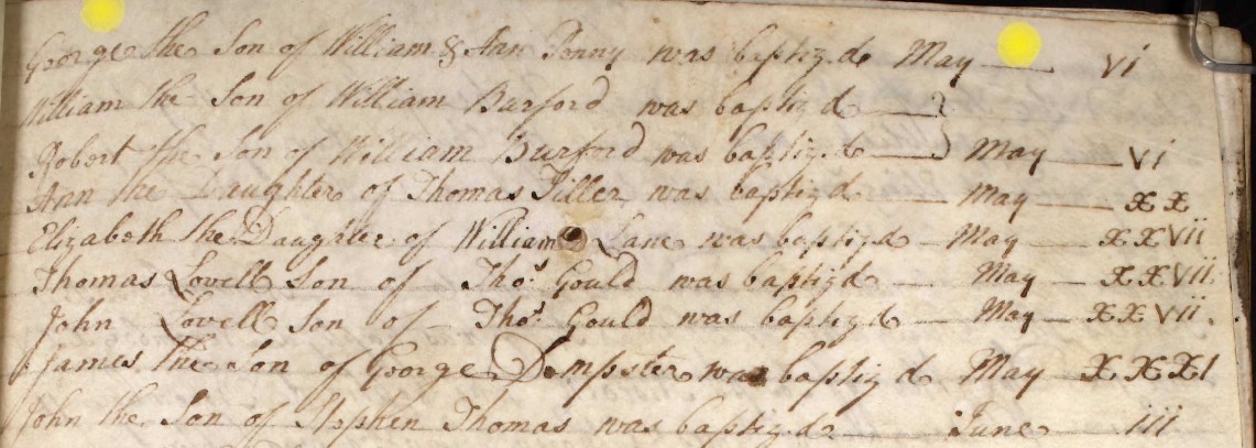
George the Son of William & Ann Penny was baptised May vi. - 6th May 1772 baptised at St Mary the Virgin Church, Eling.
A Penny family found in Eling, just not the one looked for.
1776
Joseph & Mary Son & Daughter of James & Ann Peny
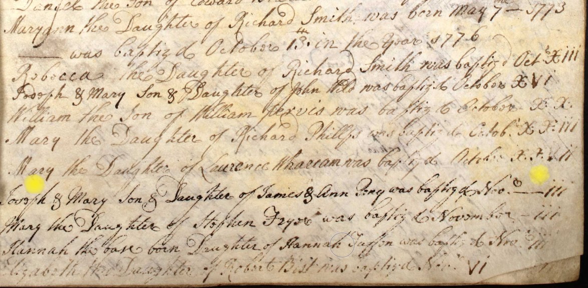
Joseph & Mary Son & Daughter of James & Ann Peny was baptised Novr iii - 3rd November 1776 baptised at St Mary the Virgin Church, Eling.
I believe Mary is the person I was looking for. She becomes John Mabey's wife.
I think Peny and Penny are the same families.
Eling Parish Register
1790
William Son of William and Mary Mabey
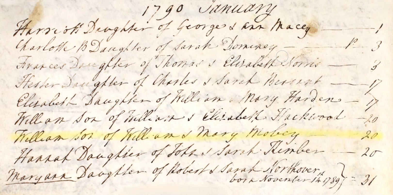
William Son of William & Mary Mabey [or Mobey] 20
20 Jan, 1790 William Son of William & Mary Mabey
Jump back to top of Parish Records tabs
Jump back to top of Parish Records tabs
Marriage
Before we get into the registers ...
Marriage, a snippet of information
In 1780, the minimum legal age for marriage was 12 years for women and 14 years for men. It was also possible for the couple to get engaged at the age of 7, with the right to break off the engagement on reaching the minimum age of consent. However, early marriages were rather rare, and the average age of the newlyweds was about 25 years.
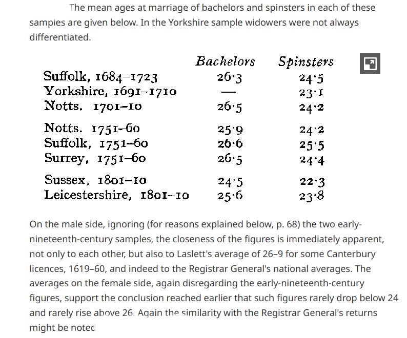
An extract from a Royal Historical Society article.
Nursling 1736 to 1797
Marriages in the Nursling Parish Register 1736 to 1797
William Maby to Anne Long
The marriages in this book from pencil page 42 to pencil page 48 seem to be abridged from the fuller book as ordered by Act of George II . S.C. Wilks Feb. 1854.
1760 Oct 29 William Maby to Ann Long
| 1760 | |||||
| No 9 | |||||
| Banns of Marriage between | William Maby | ||||
| and | Anne Long | ||||
| were published on the three Sundays underwritten: | |||||
| That is to say, | On Sunday, | the 12 | ) | ||
| On Sunday, | the 19 | } | October | by Ed. Morris Rector | |
| On Sunday, | the 26 | ) |
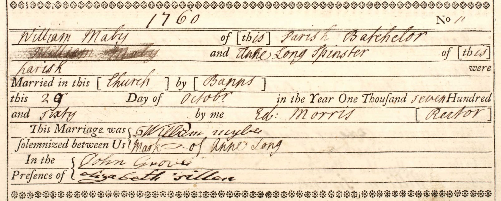
| 1760 | ||||||
| No. 11 | ||||||
| William Maby of this Parish Batchelor | ||||||
| and | ||||||
| Anne Long Spinster of this parish | ||||||
| were Married in this Church by | Banns this | 29 Day of October in the Year One Thousand seven Hundred and Sixty | by me | Ed: Morris | Rector | |
| This Marriage was solemnized between us | William Mybe | |||||
| Mark x of Anne Long | ||||||
| In the Presence of | John Grove | |||||
| Elizabeth Fillere | ||||||
| 29 Oct 1760 |
John Grove is the witness to a number of these marriages which suggests that he may be a clerk or a churchwarden as opposed to a relative.
John Mathews to Mary Long
No entry in the Banns Register between 1762 and 1767 inclusive. Also records no 12 and 13 are blank.
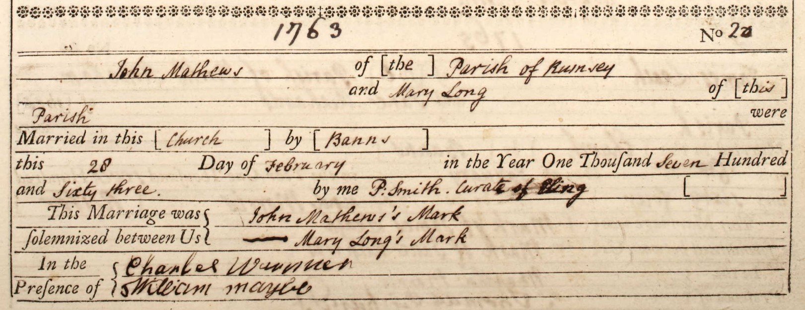
| 1763 | ||||||
| No. 20 | ||||||
| John Mathews of the Parish of Rumsey [Romsey] | ||||||
| and | ||||||
| Mary Long of this parish | ||||||
| were Married in this Church by | Banns this | 28 Day of February in the Year One Thousand Seven Hundred and Sixty three | by me | P. Smith | Curate of Eling. | |
| This Marriage was solemnized between us | John Mathew's Mark ----- | |||||
| Mary Long's Mark | ||||||
| In the Presence of | Charles Waunner | |||||
| William Maybe | ||||||
| 28 Feb 1763 |
Oh, for all writing to be as clear as the Curates! I would still transcribe the data even though it is not necessary to read it, but doing so makes it searchable.
Nathan Long to Mary Powel
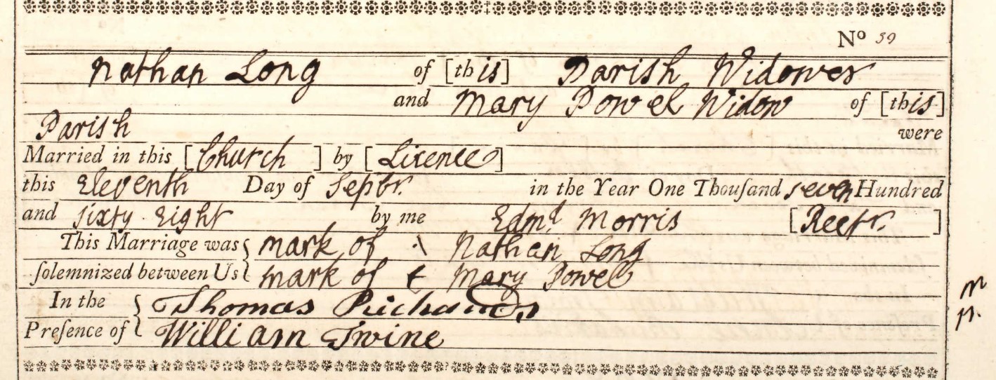
| 1768 | ||||||
| No. 59 | ||||||
| Nathan Long of this Parish Widower | ||||||
| and | ||||||
| Mary Powel Widow | ||||||
| were Married in this Church by | Licence this | Eleventh Day of Sepbr. in the Year One Thousand seven Hundred and Sixty Eight | by me | Edmd Morris | Rector | |
| This Marriage was solemnized between us | Mark of \ Nathan Long | |||||
| Mark of + of Mary Powel | ||||||
| In the Presence of | Thomas Richards | |||||
| William Irvine | ||||||
| 11 Sept 1768 |
John Osman to Sarah Maybey
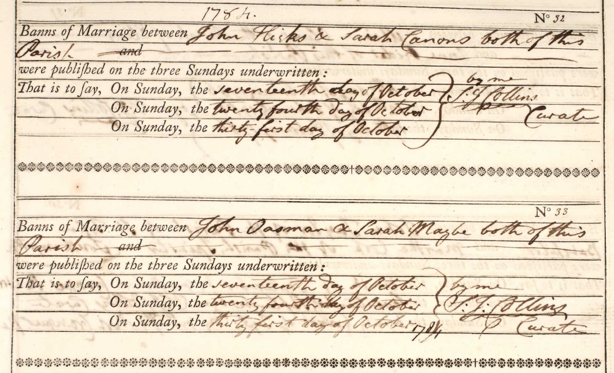
| 1784 | |||||
| No 33 | |||||
| Banns of Marriage between | John Oasman | ||||
| and | Sarah Maybe | both of this parish | |||
| were published on the three Sundays underwritten: | |||||
| That is to say, | On Sunday, | the seventeenth | day of | October | |
| On Sunday, | the twenty fourth | day of | October | by me S. J. Collins | |
| On Sunday, | the thirty first | day of | October 1784 | Curate |
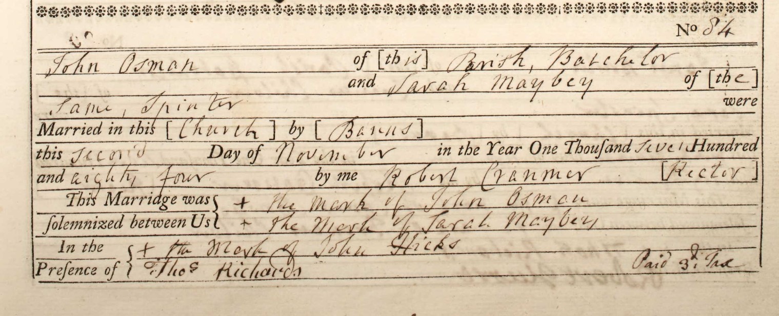
| 1784 | ||||||
| No. 84 | ||||||
| John Osman of this Parish Batchelor | ||||||
| and | ||||||
| Sarah Maybey of the same, Spinster | ||||||
| were Married in this Church by | Banns this | second Day of November in the Year One Thousand seven Hundred and Eighty four | by me | Ed: Morris | Rector | |
| This Marriage was solemnized between us | + the Mark of John Osman | |||||
|
+ the Mark of Sarah Maybey |
||||||
| In the Presence of | + the Mark of John Hicks | |||||
| Thos Richards | ||||||
| 2 Nov 1784 |
John Maybe to Mary Penny
Banns are from Nursling and therefore included here, as well as the Marriage recorded in Eling Parish Register and Bishops Transcripts. All kept together for clarity.
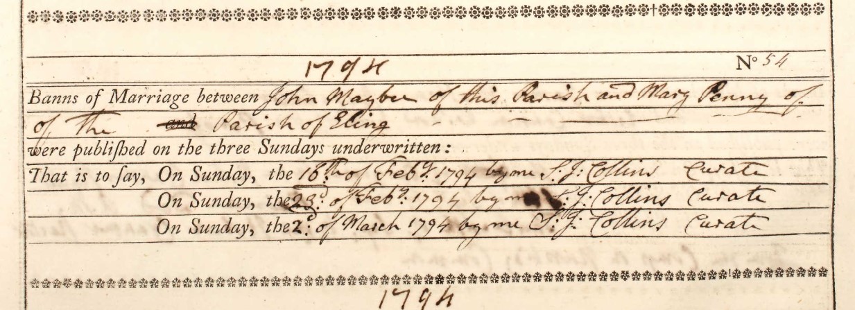
| 1794 | |||||
| No 54 | |||||
| Banns of Marriage between | John Maybe | of this parish | |||
| and | Mary Penny | of the parish of Eling | |||
| were published on the three Sundays underwritten: | |||||
| That is to say, | On Sunday, | the 16th of Feby | 1794 | by me S. J. Collins | Curate |
| On Sunday, | the 23d of Feby | 1794 | by me S. J. Collins | Curate | |
| On Sunday, | the 2d of March | 1794 | by me S. J. Collins | Curate |
The Bride is from the Parish of Eling, so unsurprisingly, the marriage took place in Eling.
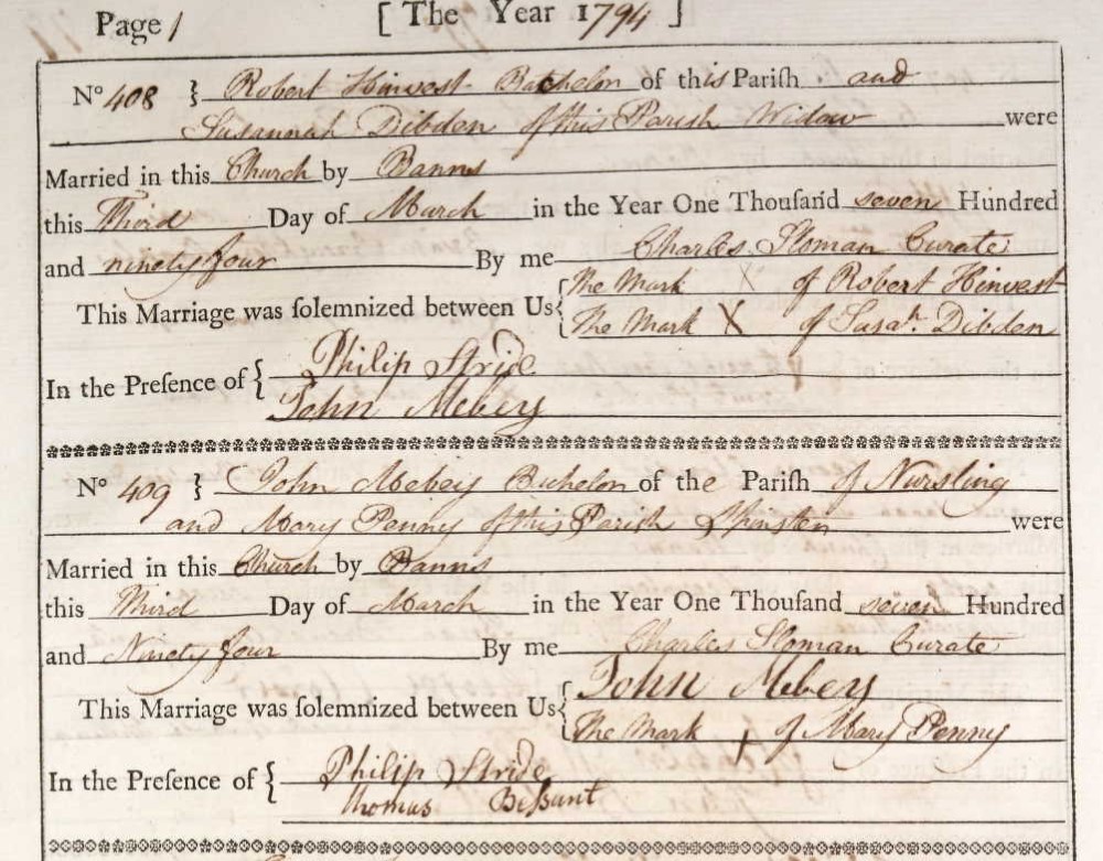
The first entry on this page, no. 408, is copied here just because John Mebey signed as a witness. The signature looks to be the same for his own wedding, so perhaps it has no other significance than he was presence for both weddings, on the third of March and could write.
| 1794 | ||||||
| No. 409 | ||||||
| John Mebey Batchelor of the Parish of Nursling | ||||||
| and | ||||||
| Mary Penny of this parish Spinster | ||||||
| were Married in this Church by | Banns this | Third Day of March in the Year One Thousand seven Hundred and Ninety Four | by me | Charles Sloman | Curate | |
| This Marriage was solemnized between us | John Mebey | |||||
| Mark + of Mary Penny | ||||||
| In the Presence of | Philip Stride | |||||
| Thomas Bessant | ||||||
| 3 Mar 1794 |
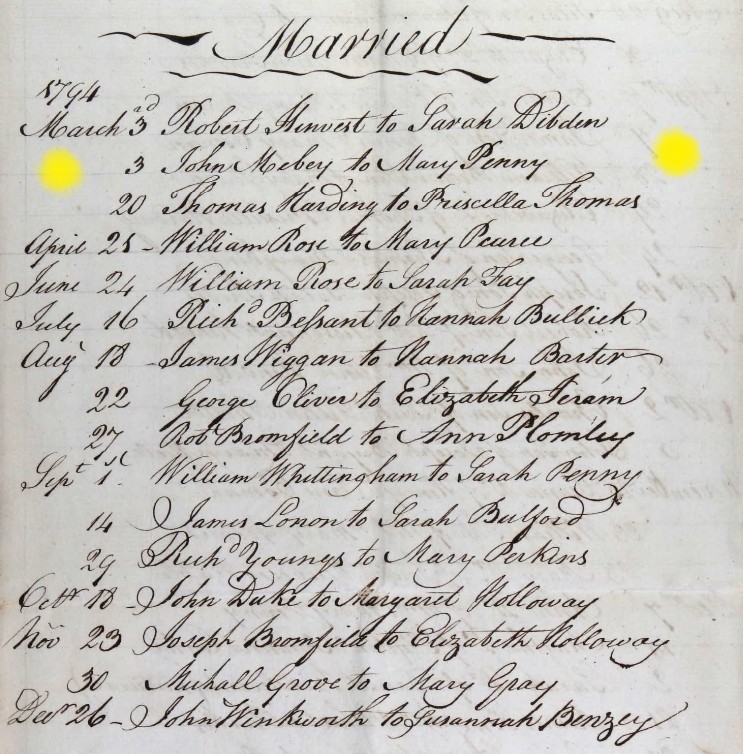
The associated Bishop's Transcripts, also for Eling
John Goff to Mary Maybey
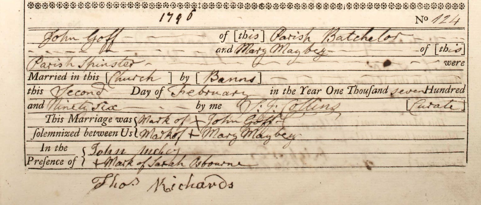
| 1796 | ||||||
| No. 124 | ||||||
| John Goff of this Parish Batchelor | ||||||
| and | ||||||
| Mary Maybey of this parish Spinster | ||||||
| were Married in this Church by | Banns this | Second Day of February in the Year One Thousand seven Hundred and Ninety Six | by me | S. J. Collins | Curate | |
| This Marriage was solemnized between us | Mark x of John Goff | |||||
| Mark x of Mary Maybey | ||||||
| In the Presence of | John Mebey | |||||
| Mark x of Sarah Osbourne | ||||||
| Thoms Richards | ||||||
| 2 Feb 1796 |
John Goff [or is this Goss]
sssssssssssssssssssssssssssssssssssssssssssssssssssssssssssssss
| 1760 | ||||||
| No. 11 | ||||||
| his name of this Parish Batchelor | ||||||
| and | ||||||
| her name Spinster of this parish | ||||||
| were Married in this Church by | Banns this | 29 Day of October in the Year One Thousand seven Hundred and Sixty | by me | Ed: Morris | Rector | |
| This Marriage was solemnized between us | William Mybe | |||||
| Mark x of Anne Long | ||||||
| In the Presence of | John Grove | |||||
| Elizabeth Fillere | ||||||
| 29 Oct 1760 |
xxxxxxxxxxxxxxxxxxxxxxxxxxxxxxxxxxxxxxxxxxxxxxxxxxxxxxxxxxx
Jump back to top of Parish Records tabs
Nursling 1798 to 1812
Marriages in the Nursling Parish Register 1798 to 1812
xxxxxxxxxxxxxxxxxxxxxxxxxxxxxxxxxxxxxxxxxxxxxxxxxxxxxxxxxxxxxxxxxxxxx
EXAMPLE
xxxxxxxxxxxxxxxxxxxxxxxxxxxxxxxxxxxxxxxxxxxxxxxxxxxxxxxxxxxxxxxxxxxxx
| 1760 | |||||
| No 9 | |||||
| Banns of Marriage between | his name | ||||
| and | her name | ||||
| were published on the three Sundays underwritten: | |||||
| That is to say, | On Sunday, | the 12 | ) | ||
| On Sunday, | the 19 | } | October | by Ed. Morris Rector | |
| On Sunday, | the 26 | ) |
sssssssssssssssssssssssssssssssssssssssssssssssssssssssssssssss
| 1760 | ||||||
| No. 11 | ||||||
| his name of this Parish Batchelor | ||||||
| and | ||||||
| her name Spinster of this parish | ||||||
| were Married in this Church by | Banns this | 29 Day of October in the Year One Thousand seven Hundred and Sixty | by me | Ed: Morris | Rector | |
| This Marriage was solemnized between us | William Mybe | |||||
| Mark x of Anne Long | ||||||
| In the Presence of | John Grove | |||||
| Elizabeth Fillere | ||||||
| 29 Oct 1760 |
xxxxxxxxxxxxxxxxxxxxxxxxxxxxxxxxxxxxxxxxxxxxxxxxxxxxxxxxxxx
Eling 1754 to 1783
Marriages in the Eling Parish Register 1754 to 1783
1758
Marriage of James Penny and Ann Eldridge
| 1758 | ||||||
| No. 52 | ||||||
| James Penny of the Parish of Lyndhurst | ||||||
| and | ||||||
| Ann Eldridge of this Parish | ||||||
| were Married in this Church by | Banns this | thirteenth Day of April in the Year One Thousand seven Hundred and fifty eight | by me | Joseph Scott | Curate | |
| This Marriage was solemnized between Us | C the Mark of James Penny | |||||
|
O the Mark of Ann Eldridge |
||||||
| In the Presence of | O the Mark of Joseph Jones | |||||
| O the Mark of James Olding | ||||||
| 13 April 1758 |
Jump back to top of Parish Records tabs
Eling 1784 to 1797
Eling 1798 to 1812
Marriages in the Eling Parish Register 1798 to 1812
xxxxxxxxxxxxxxxxxxxxxxxxxxxxxxxxxxxxxxxxxxxxxxxxxxxxxxxxxxxxxxxxxxxxx
EXAMPLE
xxxxxxxxxxxxxxxxxxxxxxxxxxxxxxxxxxxxxxxxxxxxxxxxxxxxxxxxxxxxxxxxxxxxx
| 1760 | |||||
| No 9 | |||||
| Banns of Marriage between | his name | ||||
| and | her name | ||||
| were published on the three Sundays underwritten: | |||||
| That is to say, | On Sunday, | the 12 | ) | ||
| On Sunday, | the 19 | } | October | by Ed. Morris Rector | |
| On Sunday, | the 26 | ) |
xxxxxxxxxxxxxxxxxxxxxxxxxxxxxxxxxxxxxxxxxxxxxxxxxxxxxxxxxxxxxxxxxxxxx
1792
Richard Penny and Elizabeth Stanswood
| 1792 | ||||||
| No. 382 | ||||||
| Richard Penny of this Parish | ||||||
| and | ||||||
| Elizabeth Stanswood both of this parish | ||||||
| were Married in this Church by | Banns thrice published this | eighth Day of November in the Year One Thousand seven Hundred and Ninety two | by me | H Haivest | Minister | |
| This Marriage was solemnized between us | Richard Penny | |||||
| x the Mark of Elizabeth Stanswooh | ||||||
| In the Presence of | John Pike | |||||
| x the Mark Fanny Veale | ||||||
| 8 Nov 1792 |
Jump back to top of Parish Records tabs
Jump back to top of Parish Records tabs
Burial
The Burying in Woollen Acts
I would note that within some Parish Registers, burials started to be annotated with the affidavit about being buried in wool. Below is an example of same, but for a different parish. There are similar annotations in this parish during the appropriate dates.
The Register of the Parish of the Church of Thorncombe.
One example of many.
The first, well actually the second page of the register is headed;
A Register of those that have been buried in Woollen according to ?? ??? Act of Parliament Thorncombe 1680.
The primary thing to note here is that the book is indeed in relation to Thorncombe and that there is no reference to it being any other form of church, so presumably the Established Church.
The other thing of particular interest was the 'buried in Woollen according to Act of Parliament.' I had not come across this before so had to look it up. Wikipedia quickly provided an answer.
The Burying in Woollen Acts 1666–80 w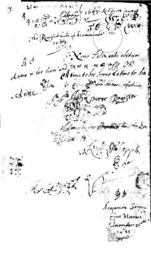 ere Acts of the Parliament of England (Cha. II c. 4 (1666), Cha. II c. 3 (1678) and Cha. II c. 1 (1680) ) which required the dead, except plague victims and the destitute, to be buried in pure English woollen shrouds to the exclusion of any foreign textiles.
Enforcement
It was a requirement that an affidavit be sworn in front of a Justice of the Peace (usually by a relative of the deceased), confirming burial in wool, with the punishment of a £5 fee for noncompliance. Burial entries in parish registers were marked with the word "affidavit" or its equivalent to confirm that affidavit had been sworn; it would be marked "naked" for those too poor to afford the woollen shroud.
The legislation was in force until 1814, but was generally ignored after 1770. The 1666 Act was repealed by the Statute Law Revision Act 1863.
The next interesting title page was at the beginning of the baptisms. It was a very smudged copy so I have tried to clean it up a little, without losing any of the original writing, however it is still difficult to decipher in the whole.
However, again it confirms that the book pertains to Thorncombe and seems to commence in 1663.
'A time to be born and a time to die' is one of the lines on the page.
It is difficult to make things out on the page, but it is nearly 4 centuries old. The Mayflower sailed to America in 1620 and the monarchy had been restored in 1660 with Charles II on the throne.
Turning to the next page of the scan, there are baptisms records, in Latin commencing in 15?? followed by 1552.
Nursling 1736 to 1797
Burials in the Nursling Parish Register 1736 to 1797
Before we get into the subject matter. Above is the record of the Rector of the Parish.
1776
Jany 20th The Revd Edmund Morris, Rector of the Parish, aged 58 years.
Nearly three years later his wife is buried.
Dec 25 Matha Widow of the Rev. Mr Edmund Morris late Rector of this Parish
Dec 25, 1778 Matha Widow of the Rev. Mr Edmund Morris late Rector of this Parish
Also on this page,
Feby 24 William Iwine Clerk of this Parish aged 50 . years
Feb 24, 1779 William Iwine Clerk of this Parish aged 50 . years
I can read this page but it is easier with the Bishops Transcription below.
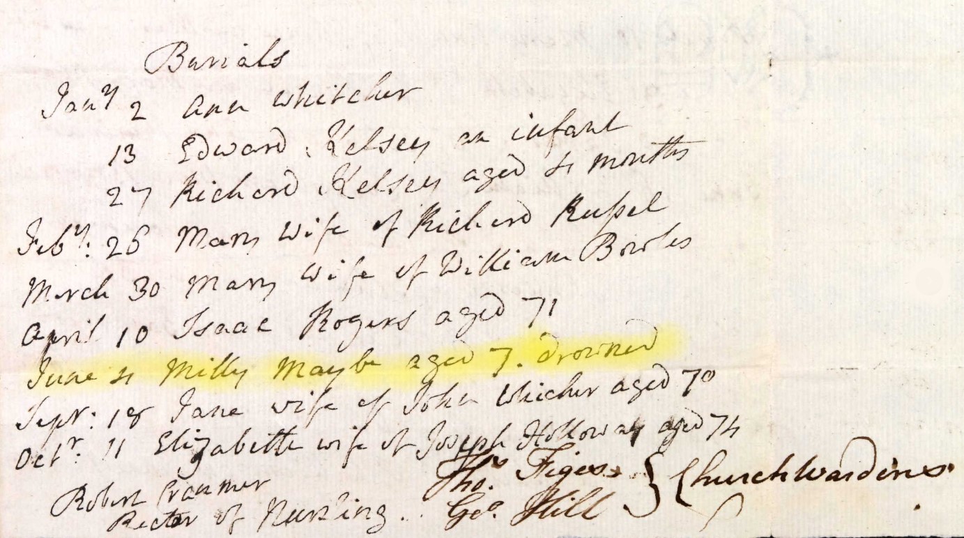
June 4 Milly Maybe aged 7. drowned
4 June, 1782 Milly Maybe aged 7. drowned
Also on page;
Robert Cranmer Rector of Nursling
Thos Figes}
Geo Hill } Churchwardens
The Churchwardens in 1782 were Thomas Figes and George Hill
1795
William Mayby
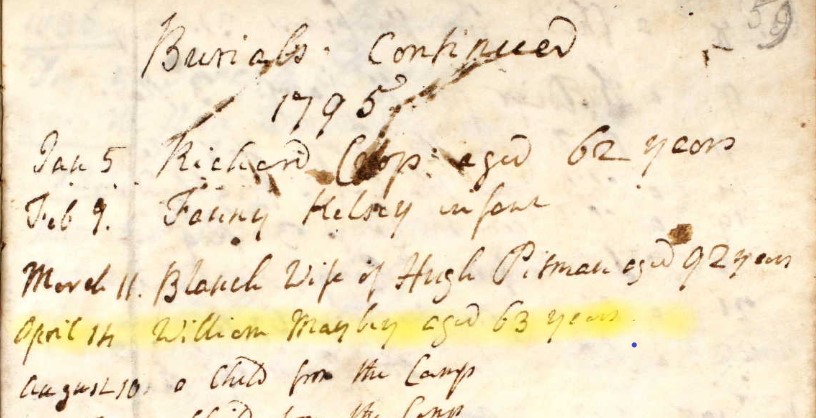
Burials, 1795
April 14 William Mayby aged 63 years
Form his stated age at burial it would suggest a birth of around 1732.
Jump back to top of Parish Records tabs
Nursling 1798 to 1812
Eling A 1798 to 1812
Eling B 1798 to 1812
Wilts West Knoyle 1813 to 1991
1819
Ann Penny
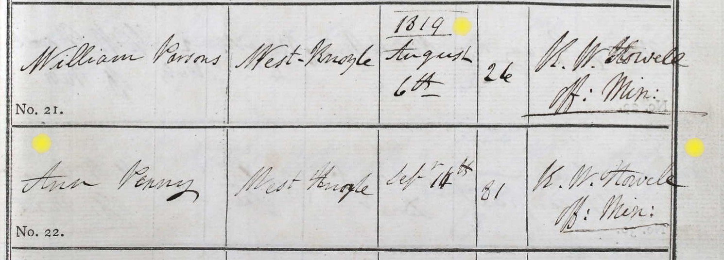
Burials in the Parish of West Knoyle, Wiltshire - Ann Penny Abode, West Knoyle was buried Sepr 14th [1819] aged 81
Jump back to top of Parish Records tabs
Other A 1798 to 1812
Jump back to top of Parish Records tabs
Census
Unlike other tab structures in this article, the Census will be organised by year of Census not by Parish.
1841
1841 Census Sunday 6th June 1841
1851
1851 Census Sunday 30th March 1851
Description of Enumeration District, St Michaels Southampton
6a All that part of the parish of St Michael, Southampton which comprises Butcher Row (otherwise called West Street) Strugnell’s Passage, French Street, Brewhouse Lane, Churcher's Passage, Lenny's Passage, Hampton Court, St Michael's Square, Church Lane, Bugle Street, Vyse Lane and Wickham Court.
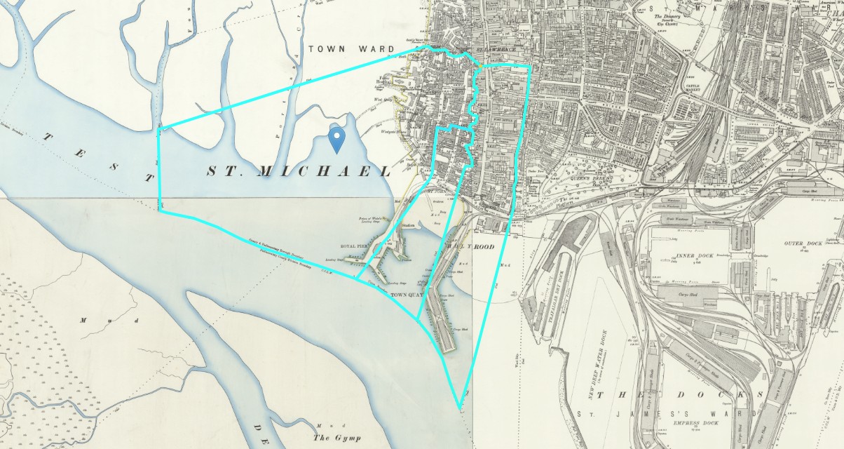
I have tried to play join the dots on the above map. Not entirely successfully as they are very good at hiding in the details of the map. However, even if approximate, it is easier to see the general extent of the parishes, from left to right, across the bottom of Southampton, St Michael or St Michael's, St John, and Holyrood. Boundary, at the time of the drawing of the map, marked in a blue line.
Below in part of the Key associated with this series of maps.
Part of the Key for Ordnance Survey old 25" maps - Boundaries
Charles Penny
| Census year | Place | Parish | Town | House Number | Given Name | Surname | Relationship | Age | Estimated Birth Year | Gender | Birth Place | Occupation | Combined Name |
|---|---|---|---|---|---|---|---|---|---|---|---|---|---|
| 1851 | 13a French Street | St Michaels | Southampton | 35a | Charles | Penny | Head | 28 | 1823 | Male | Somerset, England | Cordwainer | Charles Penny |
| 1851 | 13a French Street | St Michaels | Southampton | 35a | Charlotte | Penny | Wife | 30 | 1821 | Female | Hampshire, England | Charlotte Penny | |
| 1851 | 13a French Street | St Michaels | Southampton | 35a | Harry | Penny | Son | 5 | 1846 | Male | Southampton | Harry Penny | |
| 1851 | 13a French Street | St Michaels | Southampton | 35a | Thomas | Penny | Son | 2 | 1849 | Male | Southampton | Thomas Penny | |
| 1851 | 13a French Street | St Michaels | Southampton | 35a | Mary Ann | Penny | Daughter | 6 Mo | 1850 | Female | Southampton | Mary Ann Penny | |
| 1851 | 13a French Street | St Michaels | Southampton | 35a | Maria | Bovier | 12 | 1839 | Female | Southampton | House Servant | Maria Bovier |
Note Maria Bovier at the end of the list, a twelve year old house servant.
Charles Penny is two years younger than his wife Charlotte Penny. He was born in Somerset and is a cordwainer.
A cordwainer is a shoemaker who makes new shoes from new leather. The cordwainer's trade can be contrasted with the cobbler's trade, according to a tradition in Britain that restricted cobblers to repairing shoes.
Another Charles Penny
Description of Enumeration District, Hamble le Rice, Hampshire
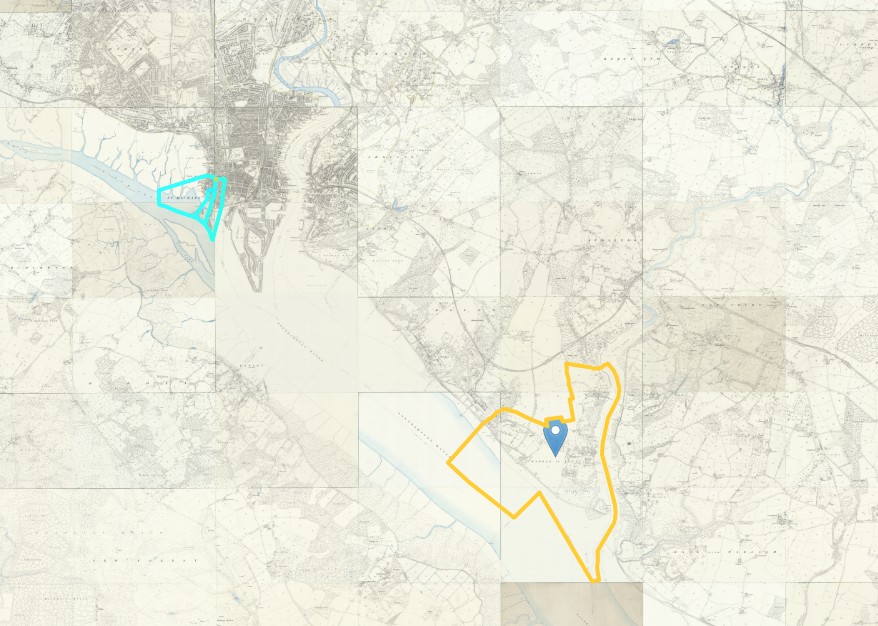
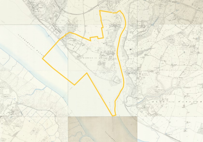
| Census year | Place | Parish | Town | House Number | Given Name | Surname | Relationship | Age | Estimated Birth Year | Gender | Birth Place | Occupation | Combined Name |
|---|---|---|---|---|---|---|---|---|---|---|---|---|---|
| 1851 | Next door to the Bugle Inn | Hamble le Rice | Hamble | 45 | Charles | Penny | Head | 31 | 1820 | Male | Eling, Hampshire, England | Shoe Maker (Master) | Charles Penny |
| 1851 | Next door to the Bugle Inn | Hamble le Rice | Hamble | 45 | Elizabeth | Penny | Wife | 27 | 1824 | Female | Southampton | Elizabeth Penny | |
| 1851 | Next door to the Bugle Inn | Hamble le Rice | Hamble | 45 | Sarah E | Penny | Daughter | 5 | 1846 | Female | Hamble, Hampshire, England | Sarah E Penny | |
| 1851 | Next door to the Bugle Inn | Hamble le Rice | Hamble | 45 | Charles R | Penny | Son | 2 | 1849 | Male | Hamble, Hampshire, England | Charles R Penny | |
| 1851 | Next door to the Bugle Inn | Hamble le Rice | Hamble | 45 | George F | Penny | Son | 1 | 1850 | Male | Hamble, Hampshire, England | George F Penny | |
| 1851 | Next door to the Bugle Inn | Hamble le Rice | Hamble | 45 | Fredrick | Penny | Brother | 18 | 1833 | Male | Eling, Hampshire, England | Fredrick Penny |
1861
1861 Census Sunday 7th April 1861
Description of Enumeration District, St Michaels Southampton
All that remaining part of the Parish of St Michael, Southampton comprising Coocke Lane, Westgate Street, Westgate Terrace, Auspack Place, West Quay, Blue Anchor Lane, Lock's Court, both sides of Simnel Street, Hunts Court, Pepper Alley and Courts, Dean's Court, Castle Court, Spearings Court, Silk Shop Yard, Landsdown Place, Castle Lane, Chesterfield Terrace and Court adjoining.
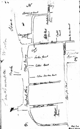
This enumerator, John Fletcher, has been very helpful and left a sketch map of the area he was to cover.
However, I have not yet been able to make out Cooke Lane.
The order given in the notes is not the same as the records, which presumably represent the walking route used by the enumerator.
Starting with Castle Lane.
Then;-
- Landsdown Place
- Castle Lane
- West Quay Tower
- Castle Lane
- Castle Court
- Castle Square
- Chesterfield Terrace
- Simnel Street
- Hunts Court
- Dean's Court
- Simnel Street, Queen Charlotte Inn.
- Simnel Street
- Silk Shop Yard
- Simnel Street
- Taylor's Court
- Simnell Street
- Locks Court
- West Quay
- West Gate House
- West Quay
- Collliers Court
- West Quay
- Blue Anchor Court
- Blue Anchor Lane
- Pepper Alley
- Whites Court
- Pepper Alley
- West Gate Tower
- West Gate Street
- Whites Court
- West Gate Street
- Royal Pier Toll House
- Coocks Lane
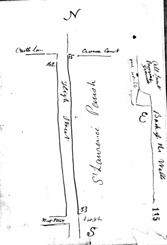
Then, perhaps, back to;-
- Simnel Street
- Pepper Alley
- Castle Court
Ending at Simnel Street.
From the above I would expect to find Coocks or Coocke Lane at the South, near the Royal Pier.
From the foregoing and the NLS Old OS Map 25" I assume that Coocks or Coocke Lane is Cuckoo Lane, which is near the Royal Pier at its southern end.
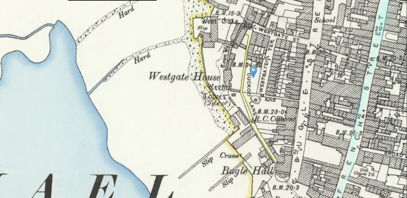
The 1851 Census address was 13a French Street. I have shaded French Street a light blue wash in the above map. I think 13a was about the same extent north as Westgate Street. About 3 minutes walk between French Street and the middle of Cuckoo Lane.
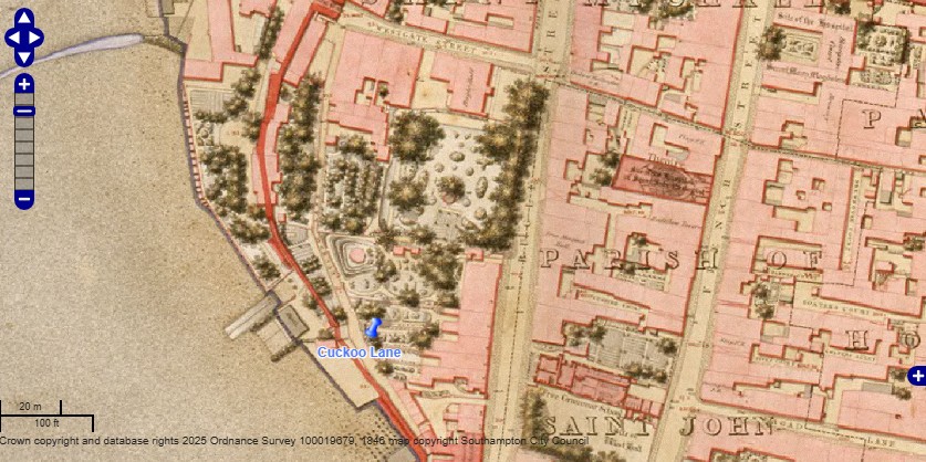
An 1846 OS map found on the City of Southampton's website. With Cuckoo Lane pinpointed.
Charles Penny
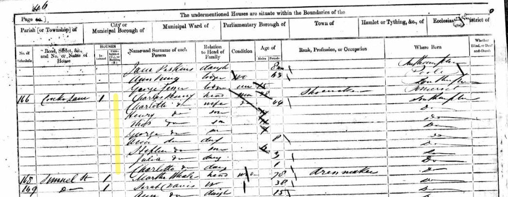
| Census year | Place | Parish | Town | Household schedule number | Name | Gender | Age | Relationship | Est. Birth Year | Where born | Civil parish | Ecclesiastical parish | Town |
|---|---|---|---|---|---|---|---|---|---|---|---|---|---|
| 1861 | Coocks Lane, / Cuckoo Lane |
St Michaels | Southampton | 166 | Charles Penny | Male | 38 | Head | 1823 | Somerset, England | Southampton St Michael | ||
| 1861 | Coocks Lane, / Cuckoo Lane |
St Michaels | Southampton | 166 | Charlotte Penny | Female | 44 | Wife | 1817 | Southampton | Southampton St Michael | ||
| 1861 | >Coocks Lane, / Cuckoo Lane |
St Michaels | Southampton | 166 | Henry Penny | Male | 17 | Son | 1844 | Southampton | Southampton St Michael | ||
| 1861 | Coocks Lane, / Cuckoo Lane |
St Michaels | Southampton | 166 | Thos Penny | Male | 11 | Son | 1850 | Southampton | Southampton St Michael | ||
| 1861 | Coocks Lane, / Cuckoo Lane |
St Michaels | Southampton | 166 | Ann Penny | Female | 8 | Daughter | 1853 | Southampton | Southampton St Michael | ||
| 1861 | Coocks Lane, / Cuckoo Lane |
St Michaels | Southampton | 166 | George Penny | Male | 7 | Son | 1854 | Southampton | Southampton St Michael | ||
| 1861 | Coocks Lane, / Cuckoo Lane |
St Michaels | Southampton | 166 | Stephen Penny | Male | 6 | Son | 1855 | Southampton | Southampton St Michael | ||
| 1861 | Coocks Lane, / Cuckoo Lane |
St Michaels | Southampton | 166 | Julia Penny | Female | 3 | Daughter | 1858 | Southampton | Southampton St Michael | ||
| 1861 | Coocks Lane, / Cuckoo Lane |
St Michaels | Southampton | 166 | Charlotte Penny | Female | 1 | Daughter | 1860 | Southampton | Southampton St Michael | ||
| Name | County/Island | Country | Registration District | Sub-registration district | ED | Occupation | Compare Names | Compare Estimated Birth Year | Compare Where born | Compare Occupation |
|---|---|---|---|---|---|---|---|---|---|---|
| Charles Penny | Hampshire | England | Southampton | Southampton | 47 | Shoemaker | TRUE | TRUE | TRUE | FALSE |
| Charlotte Penny | Hampshire | England | Southampton | Southampton | 47 | TRUE | FALSE | FALSE | ||
| Henry Penny | Hampshire | England | Southampton | Southampton | 47 | FALSE | FALSE | TRUE | ||
| Thos Penny | Hampshire | England | Southampton | Southampton | 47 | FALSE | FALSE | TRUE | ||
| Ann Penny | Hampshire | England | Southampton | Southampton | 47 | |||||
| George Penny | Hampshire | England | Southampton | Southampton | 47 | |||||
| Stephen Penny | Hampshire | England | Southampton | Southampton | 47 | |||||
| Julia Penny | Hampshire | England | Southampton | Southampton | 47 | |||||
| Charlotte Penny | Hampshire | England | Southampton | Southampton | 47 |
Compare with previous Census
There are more 'FALSE' in the compare section than I would normally like.
Charlotte Penny is now six years older than Charles Penny whereas previously it was two years between them.
Harry aged 5 has become Henry aged 17, expected to be 15.
Thomas aged 2 has lost a year, now aged 11, expected to be 12. However, this is an acceptable variation, as is the abbreviation of Thomas to Thos.
Mary Ann, aged 6 months, does not appear here. Perhaps she has died.
Charlotte Penny recorded a place of birth change from Hampshire to Southampton. However, this is just a change in the level of detail.
Occupation from cordwainer the shoemaker is just a change of term for the same thing.
On balance of probability, I think they are the same family, despite the differences from one census, to the next, ten years later.
There is a possibility that Charlotte Penny form 1815 died after having Harry, and Charles Penny re-married, to another Charlotte, on 3 Dec 1849. Some 3 to 5 years after Harry/Henry estimated birth year.
Not Charles Penny but John Penny
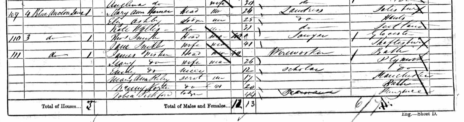
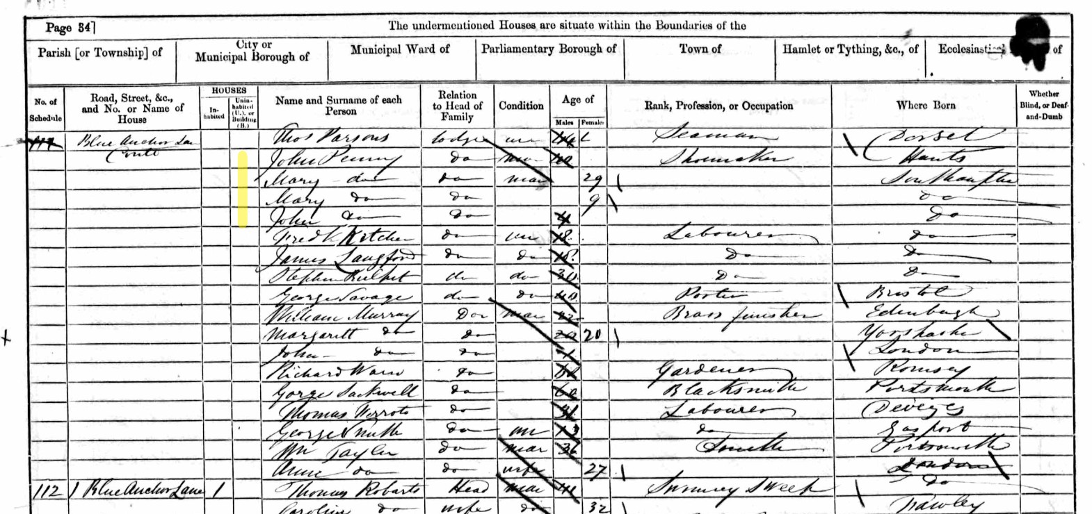
Building 111 spread over two pages.
| Census year | Place | Parish | Town | Household schedule number | Name | Gender | Age | Relationship | Estimated Birth Year | Where born | Civil parish | County/Island | Country | Registration District | Sub-registration district | ED |
|---|---|---|---|---|---|---|---|---|---|---|---|---|---|---|---|---|
| 1861 | Blue Anchor Lane | St Michaels | Southampton | 111 | James Fisher | Male | 40 | Head | 1821 | Bath | Southampton St Michael |
Hampshire | England | Southampton | Southampton | 47 |
| 1861 | Blue Anchor Lane | St Michaels | Southampton | 111 | Mary Fisher | Female | 26 | Wife | 1835 | Plymouth | Southampton St Michael | Hampshire | England | Southampton | Southampton | 47 |
| 1861 | Blue Anchor Lane | St Michaels | Southampton | 111 | Emily Fisher | Female | 12 | Niece | 1849 | Plymouth | Southampton St Michael | Hampshire | England | Southampton | Southampton | 47 |
| 1861 | Blue Anchor Lane | St Michaels | Southampton | 111 | Mary Ann Riley | Female | 17 | Servant | 1844 | Manchester | Southampton St Michael | Hampshire | England | Southampton | Southampton | 47 |
| 1861 | Blue Anchor Lane | St Michaels | Southampton | 111 | Fanny Norte | Female | 20 | Servant | 1841 | Bath | Southampton St Michael | Hampshire | England | Southampton | Southampton | 47 |
| 1861 | Blue Anchor Lane | St Michaels | Southampton | 111 | Tobia Pickford | Female | 44 | Lodger | 1817 | Pangance | Southampton St Michael | Hampshire | England | Southampton | Southampton | 47 |
| 1861 | Blue Anchor Lane | St Michaels | Southampton | 111 | Thos Parsons | Male | 44 | Lodger | 1817 | Dorset, England | Southampton St Michael | Hampshire | England | Southampton | Southampton | 47 |
| 1861 | Blue Anchor Lane | St Michaels | Southampton | 111 | John Penny | Male | 40 | Lodger | 1821 | Hampshire, England | Southampton St Michael | Hampshire | England | Southampton | Southampton | 47 |
| 1861 | Blue Anchor Lane | St Michaels | Southampton | 111 | Mary Penny | Female | 29 | Lodger | 1832 | Southampton | Southampton St Michael | Hampshire | England | Southampton | Southampton | 47 |
| 1861 | Blue Anchor Lane | St Michaels | Southampton | 111 | Mary Penny | Female | 9 | Lodger | 1852 | Southampton | Southampton St Michael | Hampshire | England | Southampton | Southampton | 47 |
| 1861 | Blue Anchor Lane | St Michaels | Southampton | 111 | John Penny | Male | 4 | Lodger | 1857 | Southampton | Southampton St Michael | Hampshire | England | Southampton | Southampton | 47 |
| 1861 | Blue Anchor Lane | St Michaels | Southampton | 111 | Fredk Kotcher | Male | 18 | Lodger | 1843 | Southampton | Southampton St Michael | Hampshire | England | Southampton | Southampton | 47 |
| 1861 | Blue Anchor Lane | St Michaels | Southampton | 111 | James Langford | Male | 18 | Lodger | 1843 | Southampton | Southampton St Michael | Hampshire | England | Southampton | Southampton | 47 |
| 1861 | Blue Anchor Lane | St Michaels | Southampton | 111 | Stephen Rulpit | Male | 30 | Lodger | 1831 | Southampton | Southampton St Michael | Hampshire | England | Southampton | Southampton | 47 |
| 1861 | Blue Anchor Lane | St Michaels | Southampton | 111 | George Savage | Male | 40 | Lodger | 1821 | Bristol | Southampton St Michael | Hampshire | England | Southampton | Southampton | 47 |
Another Penny family, but this time in lodgings with a number of other families. As they are all listed as lodgers, it is not possible to definitively state the relationship within the family, but I assume it is John Penny, aged 40, with his wife Mary, aged 29, together with their two children, a girl and a boy, Mary 9, and John 4. John Penny is about the same age as Charles Penny, and is also a shoemaker.
George Penny

| Census year | Place | Parish | Town | Household schedule number | Name | Gender | Age | Relationship | Estimated Birth Year | Where born | Civil parish | County/Island | Country | Registration District | Sub-registration district | ED, Institution, or Vessel | Occupation |
|---|---|---|---|---|---|---|---|---|---|---|---|---|---|---|---|---|---|
| 1861 | Castle Lane | St Michaels | Southampton | 26 | Gorge Penny | Male | 50 | Head | 1811 | Southampton | Southampton St Michael | Hampshire | England | Southampton | Southampton | 47 | Shoemaker |
| 1861 | Castle Lane | St Michaels | Southampton | 26 | Emma Penny | Female | 48 | Wife | 1813 | Southampton | Southampton St Michael | Hampshire | England | Southampton | Southampton | 47 | |
| 1861 | Castle Lane | St Michaels | Southampton | 26 | Julia Penny | Female | 14 | Daughter | 1847 | Southampton | Southampton St Michael | Hampshire | England | Southampton | Southampton | 47 | |
| 1861 | Castle Lane | St Michaels | Southampton | 26 | George Penny | Male | 4 | Son | 1857 | Southampton | Southampton St Michael | Hampshire | England | Southampton | Southampton | 47 | |
| 1861 | Castle Lane | St Michaels | Southampton | 26 | Thos Penny | Male | 2 | Son | 1859 | Southampton | Southampton St Michael | Hampshire | England | Southampton | Southampton | 47 | |
| 1861 | Castle Lane | St Michaels | Southampton | 26 | Anna Penny | Female | 1 | Daughter | 1860 | Southampton | Southampton St Michael | Hampshire | England | Southampton | Southampton | 47 |
Thomas Penny
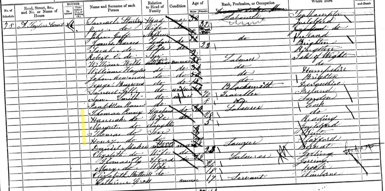
| Parish | Town | Household schedule number | Name | Gender | Age | Relationship | Estimated Birth Year | Where born | Civil parish | County/Island | Country | Registration District | Sub-registration district | ED, Institution, or Vessel | Occupation |
|---|---|---|---|---|---|---|---|---|---|---|---|---|---|---|---|
| St Michaels | Southampton | 78 | Thomas Penny | Male | 30 | Husband | 1831 | Cork, Ireland | Southampton St Michael | Hampshire | England | Southampton | Southampton | 47 | Labourer |
| St Michaels | Southampton | 78 | Hannah Penny | Female | 28 | Wife | 1833 | Cork, Ireland | Southampton St Michael | Hampshire | England | Southampton | Southampton | 47 | |
| St Michaels | Southampton | 78 | Margret Penny | Female | 5 | Daughter | 1856 | Reading | Southampton St Michael | Hampshire | England | Southampton | Southampton | 47 | |
| St Michaels | Southampton | 78 | Thomas Penny | Male | 3 | Son | 1858 | Guildford | Southampton St Michael | Hampshire | England | Southampton | Southampton | 47 | |
| St Michaels | Southampton | 78 | Henry Penny | Male | 7 mths | Son | 1860 | Kent, England | Southampton St Michael | Hampshire | England | Southampton | Southampton | 47 |
I think Thomas Penny is not associated with Charles Penny, as he and his wife were recorded as being born in Cork, Ireland
Rob Penny
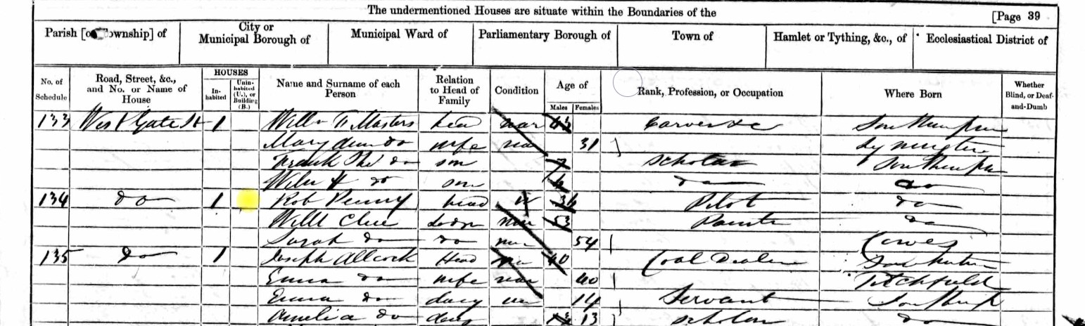
| Census year | Place | Parish | Town | Household schedule number | Name | Gender | Age | Relationship | Estimated Birth Year | Where born | Civil parish | County/Island | Country | Registration District | Sub-registration district | ED, Institution, or Vessel | Occupation |
|---|---|---|---|---|---|---|---|---|---|---|---|---|---|---|---|---|---|
| 1861 | West Gate Street | St Michaels | Southampton | 134 | Rob Penny | Male | 36 | Head | 1825 | Southampton | Southampton St Michael | Hampshire | England | Southampton | Southampton | 47 | Pilot |
| 1861 | West Gate Street | St Michaels | Southampton | 134 | Willl Chee | Male | 53 | Lodger | 1808 | Southampton | Southampton St Michael | Hampshire | England | Southampton | Southampton | 47 | Painter |
| 1861 | West Gate Street | St Michaels | Southampton | 134 | Sarah Chee | Female | 54 | Lodger | 1807 | Cowes | Southampton St Michael | Hampshire | England | Southampton | Southampton | 47 |
Rob Penny is listed as head of the family, but with no other family shown. Will and Sarah Chee are recorded as lodgers. Rob Penny is a Pilot, which considering the date of the Census, is a marine pilot.
James Cheatie, James Cheatie Penny, or James Penny
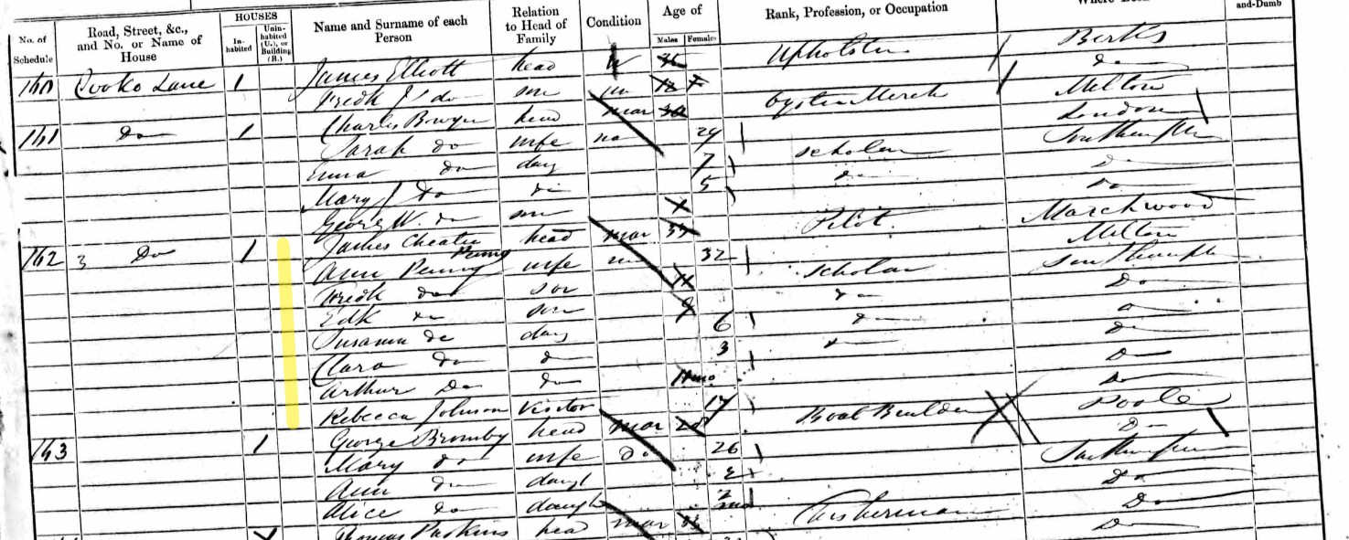
| Census year | Place | Parish | Town | Household schedule number | Name | Gender | Age | Relationship | Estimated Birth Year | Where born | Civil parish | County/Island | Country | Registration District | Sub-registration district | ED, Institution, or Vessel | Occupation |
|---|---|---|---|---|---|---|---|---|---|---|---|---|---|---|---|---|---|
| 1861 | Coocks Lane, / Cuckoo Lane | St Michaels | Southampton | 162 | James Cheatie | Male | 37 | Head | 1824 | Marchwood | Southampton St Michael | Hampshire | England | Southampton | Southampton | 47 | Pilot |
| 1861 | Coocks Lane, / Cuckoo Lane | St Michaels | Southampton | 162 | Ann Penny | Female | 32 | Wife | 1829 | Milton | Southampton St Michael | Hampshire | England | Southampton | Southampton | 47 | |
| 1861 | Coocks Lane, / Cuckoo Lane | St Michaels | Southampton | 162 | Fredk Penny | Male | 11 | Son | 1850 | Southampton | Southampton St Michael | Hampshire | England | Southampton | Southampton | 47 | |
| 1861 | Coocks Lane, / Cuckoo Lane | St Michaels | Southampton | 162 | Edk Penny | Male | 9 | Son | 1852 | Southampton | Southampton St Michael | Hampshire | England | Southampton | Southampton | 47 | |
| 1861 | Coocks Lane, / Cuckoo Lane | St Michaels | Southampton | 162 | Susanna Penny | Female | 6 | Daughter | 1855 | Southampton | Southampton St Michael | Hampshire | England | Southampton | Southampton | 47 | |
| 1861 | Coocks Lane, / Cuckoo Lane | St Michaels | Southampton | 162 | Clara Penny | Female | 3 | Daughter | 1858 | Southampton | Southampton St Michael | Hampshire | England | Southampton | Southampton | 47 | |
| 1861 | Coocks Lane, / Cuckoo Lane | St Michaels | Southampton | 162 | Arthur Penny | Female | 01-Dec | Daughter | 1861 | Southampton | Southampton St Michael | Hampshire | England | Southampton | Southampton | 47 | |
| 1861 | Coocks Lane, / Cuckoo Lane | St Michaels | Southampton | 162 | Rebecca Johnson | Female | 17 | Visitor | 1844 | Southampton | Southampton St Michael | Hampshire | England | Southampton | Southampton | 47 |
James is also a pilot, as was Rob Penny. He lives in Cuckoo Lane, the same road as Charles Penny.
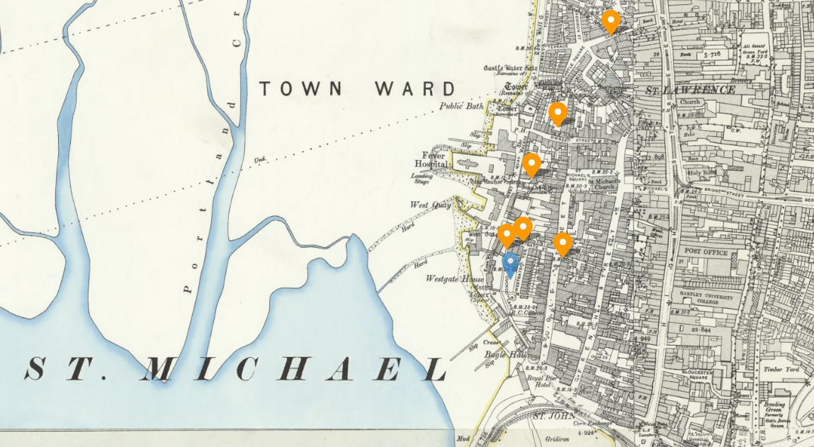
Old OS 25" Map of St Michael Parish with approximate locations of the above Penny families plotted.
It appears as quite a tight cluster of Penny families, some who may be related, or not. Our interest is Charles Penny, whose marker is in blue.
Looking in the Parish of St Mary's, Southampton
Edward Elliot Penny
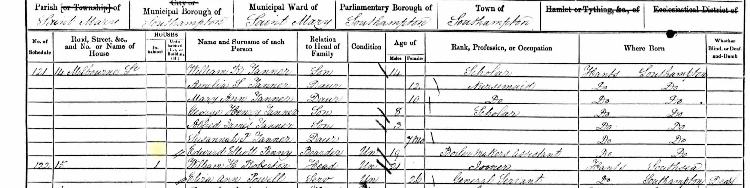
| Census year | Place | Parish | Town | Household schedule number | Name | Gender | Age | Relationship | Estimated Birth Year | Where born | Civil parish | Town | County/Island | Country | Registration District | Sub-registration district | ED, Institution, or Vessel | Occupation |
|---|---|---|---|---|---|---|---|---|---|---|---|---|---|---|---|---|---|---|
| 1861 | 14 Melbourne Street | St Mary's | Southampton | 121 | Edward Elliott Penny | Male | 19 | Boarder | 1842 | Southampton, Hampshire, England | Southampton St Mary | Southampton | Hampshire | England | Southampton | Southampton | 16 | Boiler Makers Assistant |
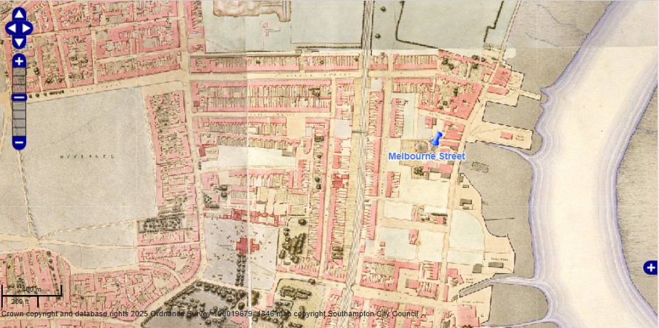
Southampton Workhouse - Mary Penny
Read about the Southampton Workhouse or Poor House at an external site.
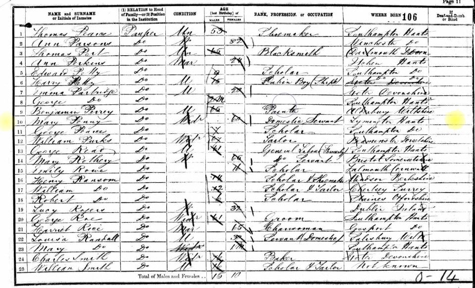
| Census year | Place | Parish | Town | Household schedule number | Name | Gender | Age | Relationship | Estimated Birth Year | Where born | Civil parish | Ecclesiastical parish | County/Island | Country | Registration District | Sub-registration district | ED, Institution, or Vessel | Occupation |
|---|---|---|---|---|---|---|---|---|---|---|---|---|---|---|---|---|---|---|
| 1861 | Workhouse | St Mary's | Southampton | 1 | Mary Penny | Female | 60 | Pauper | 1801 | Lymington, Hampshire, England | Southampton St Mary | St Mary | Hampshire | England | Southampton | Southampton | Southampton Workhouse | Domestic Servant |
1871
1871 Census Sunday 2nd April 1871
Saint Michaels Parish (part of)
All the remaining part of St Michaels parish comprising Cuckoo Lane Westgate Street Westgate Terrace Amspack Place West Quay Blue Anchor Lane Locks Court Collis Court both Sides of Simnel Street Hunts Court Pepper Alley and Court Deers Court Castle Court Silk Shop Yard Landsdown Place Castle Lane Spearings Court, now Castle Buildings Chesterfield Terrace and Court adjoining Castle Gardens.
Now lets put some punctuation in to make it easier to read and understand.
All the remaining part of St Michaels parish comprising Cuckoo Lane, Westgate Street, Westgate Terrace, Amspack Place, West Quay, Blue Anchor Lane, Locks Court, Collis Court, both sides of Simnel Street, Hunts Court, Pepper Alley and Court, Deers Court, Castle Court, Silk Shop Yard, Landsdown Place, Castle Lane, Spearings Court, now Castle Buildings, Chesterfield Terrace, and Court adjoining Castle Gardens.
1881
1881 Census Sunday 3rd April 1881
After his death.
1891
1891 Census Sunday 5th April 1891
After his death.
1901
1901 Census Sunday 31st March 1901
After his death.
1911
1911 Census Sunday 2nd April 1911
After his death.
Jump back to top of Parish Records tabs
Other
Jump back to top of Parish Records tabs
Disbursements
Disbursements by the Parish
At he back of the Parish Register book 1736 to 1797, there are notes about disbursements made by the Parish.
Data Sheet
Data Sheet
Records, data, and general information about Edward and Mary Biddlecomb of Eling and their family
Husband and Wife
Birth
Baptism
Edward Son of ??? & ??? Biddlecomb
Mary Daughter of ??? & ??? Plaskett
Marriage
| 01 Jun 1759 | Eling | Edward Biddlecomb | and | Mary Plaskett |
Banns
Banns not found, Marriage by License.
| 1760 | |||||
| No 9 | |||||
| Banns of Marriage between | |||||
| and | |||||
| were published on the three Sundays underwritten: | |||||
| That is to say, | On Sunday, | the | ) | ||
| On Sunday, | the | } | ??????? | by ??????? Rector | |
| On Sunday, | the | ) |
Extract of the Eling Parish Register
Marriage
| 1759 | ||||||
| No. 64 | ||||||
| Edward Biddlecomb of this Parish Batchelor | ||||||
| and | ||||||
| Mary Plaskett Spinster of this parish | ||||||
| were Married in this Church by | License this | First Day of June in the Year One Thousand seven Hundred and fifty nine | by me | Jos Scott | Curate | |
| This Marriage was solemnized between us | Edward Biddlecomb his Mark | |||||
| x the Mark of Mary Plaskett | ||||||
| In the Presence of | x the Mark of Arthur Plaskett. | |||||
| x the mark of Elizabeth Puskis | ||||||
| 1 Jun 1759 |
This marriage is recorded in my tree, and Edward is my 6th great-granduncle.
John Maybe to Mary Penny
| 1794 | |||||
| No 54 | |||||
| Banns of Marriage between | John Maybe | of this parish | |||
| and | Mary Penny | of the parish of Eling | |||
| were published on the three Sundays underwritten: | |||||
| That is to say, | On Sunday, | the 16th of Feby | 1794 | by me S. J. Collins | Curate |
| On Sunday, | the 23d of Feby | 1794 | by me S. J. Collins | Curate | |
| On Sunday, | the 2d of March | 1794 | by me S. J. Collins | Curate |
The Bride is from the Parish of Eling, so unsurprisingly, the marriage took place in Eling.
The first entry on this page, no. 408, is copied here just because John Mebey signed as a witness. The signature looks to be the same for his own wedding, so perhaps it has no other significance than he was presence for both weddings, on the third of March and could write.
| 1794 | ||||||
| No. 409 | ||||||
| John Mebey Batchelor of the Parish of Nursling | ||||||
| and | ||||||
| Mary Penny of this parish Spinster | ||||||
| were Married in this Church by | Banns this | Third Day of March in the Year One Thousand seven Hundred and Ninety Four | by me | Charles Sloman | Curate | |
| This Marriage was solemnized between us | John Mebey | |||||
| Mark + of Mary Penny | ||||||
| In the Presence of | Philip Stride | |||||
| Thomas Bessant | ||||||
| 3 Mar 1794 |
The associated Bishop's Transcripts, also for Eling.
Death
Burial
Census
Census and Voting Registers
UK Census dates from 1911Census.org;
1841 Census Sunday 6th June 1841
1851 Census Sunday 30th March 1851
1861 Census Sunday 7th April 1861
1871 Census Sunday 2nd April 1871
1881 Census Sunday 3rd April 1881
1891 Census Sunday 5th April 1891
1901 Census Sunday 31st March 1901
1911 Census Sunday 2nd April 1911
1841
1841 Census Sunday 6th June 1841
After his death.
1851
1851 Census Sunday 30th March 1851
After his death.
1861
1861 Census Sunday 7th April 1861
After his death.
1871
1871 Census Sunday 2nd April 1871
After his death.
1881
1881 Census Sunday 3rd April 1881
After his death.
1891
1891 Census Sunday 5th April 1891
After his death.
1901
1901 Census Sunday 31st March 1901
After his death.
1911
1911 Census Sunday 2nd April 1911
After his death.
Parents
Parents
William & Anne Mabey
His Father
William Mabey
Ancestry Synopsis
When William Mabey was born on 31 March 1734 in Eling, Hampshire, his father, William, was 29 and his mother, Elizabeth, was 26. He married Ann Long on 29 October 1760 in Nursling, Hampshire. They had 11 children in 21 years. He died on 14 April 1795 in Nursling, Hampshire, at the age of 61.
Baptism
William the Son of William Meabee
William the Son of William Maebee was Bapt. March xxxi. Baptised 31st March 1734 in St. Mary the Virgin Church, Eling.
The blue dot is just to highlight the use of a capital M, in a word recognisable as Mary, for comparison with Maebee, which is much less certain.
Marriage
William Maby [Mabey] to Anne Long at St Boniface Church, Nursling Hampshire, on 29 October 1760.
One of only two weddings at that church, that year.
Extracts from the Nursling Parish Register.
The marriages in this book from pencil page 42 to pencil page 48 seem to be abridged from the fuller book as ordered by Act of George II . S.C. Wilks Feb. 1854.
1760 Oct 29 William Maby to Ann Long
| 1760 | |||||
| No 9 | |||||
| Banns of Marriage between | William Maby | ||||
| and | Anne Long | ||||
| were published on the three Sundays underwritten: | |||||
| That is to say, | On Sunday, | the 12 | ) | ||
| On Sunday, | the 19 | } | October | by Ed. Morris Rector | |
| On Sunday, | the 26 | ) |
| 1760 | ||||||
| No. 11 | ||||||
| William Maby of this Parish Batchelor | ||||||
| and | ||||||
| Anne Long Spinster of this parish | ||||||
| were Married in this Church by | Banns this | 29 Day of October in the Year One Thousand seven Hundred and Sixty | by me | Ed: Morris | Rector | |
| This Marriage was solemnized between us | William Mybe | |||||
| Mark x of Anne Long | ||||||
| In the Presence of | John Grove | |||||
| Elizabeth Fillere | ||||||
| 29 Oct 1760 |
John Grove is the witness to a number of these marriages which suggests that he may be a clerk or a churchwarden as opposed to a relative.
2nd Marriage
Death
Assumed to be shortly before 14th April 1795.
Burial
Burials, 1795
April 14 William Mayby aged 63 years
His Mother
Anne Long
Ancestry Synopsis;
When Ann Long was born on 9 October 1741 in Nursling, Hampshire, her father, Nathaniel, was 31, and her mother, Rebecca, was 24. She married William Mabey on 29 October 1760 in her hometown. They had 11 children in 21 years. She died on 18 October 1821 in Nursling, Hampshire, having lived a long life of 80 years.
Baptism
Ann, Daughter of Nathaniel & Rebeccah Long
Oct: 9. Ann, Daughr. of Nathaniel & Rebeccah Long.
Oct: 9, 1741. Ann, Daughter of Nathaniel & Rebeccah Long, Baptised at St Boniface Church, Nursling, Hampshire.
Marriage
William Maby [Mabey] to Anne Long at St Boniface Church, Nursling Hampshire, on 29 October 1760.
Extracts from the Nursling Parish Register. (The same as for William Mabey above)
The marriages in this book from pencil page 42 to pencil page 48 seem to be abridged from the fuller book as ordered by Act of George II . S.C. Wilks Feb. 1854.
1760 Oct 29 William Maby to Ann Long
| 1760 | |||||
| No 9 | |||||
| Banns of Marriage between | William Maby | ||||
| and | Anne Long | ||||
| were published on the three Sundays underwritten: | |||||
| That is to say, | On Sunday, | the 12 | ) | ||
| On Sunday, | the 19 | } | October | by Ed. Morris Rector | |
| On Sunday, | the 26 | ) |
| 1760 | ||||||
| No. 11 | ||||||
| William Maby of this Parish Batchelor | ||||||
| and | ||||||
| Anne Long Spinster of this parish | ||||||
| were Married in this Church by | Banns this | 29 Day of October in the Year One Thousand seven Hundred and Sixty | by me | Ed: Morris | Rector | |
| This Marriage was solemnized between us | William Mybe | |||||
| Mark x of Anne Long | ||||||
| In the Presence of | John Grove | |||||
| Elizabeth Fillere | ||||||
| 29 Oct 1760 |
John Grove is the witness to a number of these marriages which suggests that he may be a clerk or a churchwarden as opposed to a relative.
Death
Assumed to be shortly before
Burial
Yet to be found
Her Father
1758
Marriage of James Penny and Ann Eldridge
| 1758 | ||||||
| No. 52 | ||||||
| James Penny of the Parish of Lyndhurst | ||||||
| and | ||||||
| Ann Eldridge of this Parish | ||||||
| were Married in this Church by | Banns this | thirteenth Day of April in the Year One Thousand seven Hundred and fifty eight | by me | Joseph Scott | Curate | |
| This Marriage was solemnized between Us | C the Mark of James Penny | |||||
|
O the Mark of Ann Eldridge |
||||||
| In the Presence of | O the Mark of Joseph Jones | |||||
| O the Mark of James Olding | ||||||
| 13 April 1758 |
Her Mother
Ann Eldridge
1738
Ann the Daughter of Robert & Ann Eldridge
Ann the Daughter of Robert & Ann Eldridge was baptised October xxxi - 31st October 1738, baptised at St Mary the Virgin Church, Eling, Hampshire.
1758
Marriage of James Penny and Ann Eldridge
| 1758 | ||||||
| No. 52 | ||||||
| James Penny of the Parish of Lyndhurst | ||||||
| and | ||||||
| Ann Eldridge of this Parish | ||||||
| were Married in this Church by | Banns this | thirteenth Day of April in the Year One Thousand seven Hundred and fifty eight | by me | Joseph Scott | Curate | |
| This Marriage was solemnized between Us | C the Mark of James Penny | |||||
|
O the Mark of Ann Eldridge |
||||||
| In the Presence of | O the Mark of Joseph Jones | |||||
| O the Mark of James Olding | ||||||
| 13 April 1758 |
1819
Ann Penny
Burials in the Parish of West Knoyle, Wiltshire - Ann Penny Abode, West Knoyle was buried Sepr 14th [1819] aged 81
Given the Baptism date, shown above in this section, of 31st October 1738 and the burial date of 14th September 1819, the duration between those dates is 80 years, 10 months, 14 days excluding the end date, which in the absence of Birth and Death dates, is therefore assumed to be close to an age calculation. About 11/2 months shy of the 81 years shown above. That, in my opinion, is close enough, not to create a red flag.
However, West Knoyle is a long way from Eling. In fact it is about 40 miles, which would be about 41/2 hours walking, from Eling Hill, where the vicarage is. The challenge therefore is to find out why she was there. Are her family still there in the 1841 census, for instance?
Children
Parents Children and Children
His Parents
Ann Mabey nee Long and William Mabey's children's Records.
Scroll left or right along the tabs. There is a tab for each year of child bearing age following their marriage, which helps to indicate years when no children of William and Mary were born, or survived long enough to be baptised, or alternatively, where no record has yet been found. They had 11 children in 21 years.
1760
No record yet found
1761 Martha (Sarah)
From my Ancestry Hurst Family Tree
Martha (Sarah) Mabey
1761–1784
Birth BEF. 1 AUG 1761 • Nursling, Hampshire, England
Death 2 NOV 1784 • Nursling, Hampshire, England
From Discovery above
Birth
Currently assumed to be just before Baptism
Baptism
Martha Daughter of William & Mary Maby
Aug 1 Martha D of Willm & Mary Maby
Aug 1, 1761 Martha Daughter of William & Mary Maby
Maby is not Mabey but is similar.
William Mabey and Ann Long were married at St Boniface Church, Nursling, Hampshire on 29 October 1760. So 1st August 1761 is a respectable date of first born after marriage.
However, who is Mary? William married Ann, not Mary. Is Mary an alternative name for Ann, such as Mary Ann, or Ann Mary. Not according to the baptism record.
The record remains not validated.
Marriage
John Osman to Sarah Maybey
| 1784 | |||||
| No 33 | |||||
| Banns of Marriage between | John Oasman | ||||
| and | Sarah Maybe | both of this parish | |||
| were published on the three Sundays underwritten: | |||||
| That is to say, | On Sunday, | the seventeenth | day of | October | |
| On Sunday, | the twenty fourth | day of | October | by me S. J. Collins | |
| On Sunday, | the thirty first | day of | October 1784 | Curate |
| 1784 | ||||||
| No. 84 | ||||||
| John Osman of this Parish Batchelor | ||||||
| and | ||||||
| Sarah Maybey of the same, Spinster | ||||||
| were Married in this Church by | Banns this | second Day of November in the Year One Thousand seven Hundred and Eighty four | by me | Ed: Morris | Rector | |
| This Marriage was solemnized between us | + the Mark of John Osman | |||||
|
+ the Mark of Sarah Maybey |
||||||
| In the Presence of | + the Mark of John Hicks | |||||
| Thos Richards | ||||||
| 2 Nov 1784 |
Nice marriage details, including Banns, but there is something on a glaring problem here. The bride's name is Sarah Maybey, and it is not the spelling of the surname. On Ancestry, Sarah appears to be associated with Martha as one in the same person. However, I have yet to find definitive evidence as to why this association has been made, let alone that it is correct.
The record remains not validated.
I have started to build the tree branches under this couple in the hope of finding more information, including DNA traces which may prove the link. It may be a case that there are too many generations between any tester and the couple.
Death
Burial
1762 William
From my Ancestry Hurst Family Tree
William Mabey
1762–1856
Birth 1762 • Hampshire, England
Death 29 APR 1856 • Nursling, Hampshire, England
From Discovery above
No Prime data yet found
1763
No record yet found
1764 Susan
From my Ancestry Hurst Family Tree
Susan Mabey
1764–1764
Birth 17 JAN 1764 • Nursling, Hampshire, England
Death 10 MAR 1764 • Nursling, Hampshire, England
From Discovery above
Birth
Currently assumed to be just before Baptism
Baptism
Susan Daughter of William & Anne Maby
May 4 Susan. D. of Willm & Anne Maby
May 4, 1764 Susan Daughter of William & Anne Maby
Again, Maby is not Mabey but is similar.
At least the parents are the expected William and Ann.
1765
1766
No record yet found
1767
No record yet found
1768 Joseph
From my Ancestry Hurst Family Tree
Joseph Mabey
1768–1856
Birth 1768 • Eling, Hampshire, England
Death 1856 • Romsey, Hampshire, England
From Discovery above
Birth
Currently assumed to be just before Baptism
Baptism
Joseph Son of William & Anne Mabey
Sep 12 Joseph. S, of Willm. & Anne Mabey
Sep 12, 1768, Joseph Son of William & Anne Mabey.
1769
No record yet found
1770
No record yet found
1771 John
From my Ancestry Hurst Family Tree
John Mabey
1771–1856
Birth BEF. 17 JAN 1771 • Nursling, Hampshire, England
Death 24 APR 1856 • Nursling, Hampshire, England
From Discovery above
Birth
Currently assumed to be just before Baptism
Baptism
John Son of William & Anne Mabey
Jan 17 Jno S of William & Anne Mabey
Jan 17, 1771 John Son of William & Anne Mabey
1772
No record yet found
1773 Richard
From my Ancestry Hurst Family Tree
Richard Mabey
1773–1835
Birth BEF. 31 MAY 1773 • Nursling, Hampshire, England
Death 28 JAN 1835 • Romsey, Hampshire, England
From Discovery above
Birth
Currently assumed to be just before Baptism
Baptism
Richard Son of William & Anne Mabey
May 31 Richd S. of Wm & Anne Mabey
May 31, 1773 Richard Son of William & Anne Mabey
1774
No record yet found
1775 Milly
From my Ancestry Hurst Family Tree
Milly Mabey
1775–1782
Birth BEF. 30 AUG 1775 • Nursling, Hampshire, England
Death BEF. 4 JUN 1782 • Nursling, Hampshire, England
From Discovery above
Birth
Currently assumed to be just before Baptism
Baptism
Milly Daughter of William & Ann Mabey
Aug 30 Milly, D. of Willm & Ann Mabey
Aug 30, 1775 Milly Daughter of William & Ann Mabey
1776
No record yet found
1777
No record yet found
1778 Mary
From my Ancestry Hurst Family Tree
Mary Mabey
1778–1800
Birth BEF. 15 FEB 1778 • Nursling, Hampshire, England
Death 1800 • Nursling, Hampshire, England
From Discovery above
Birth
Currently assumed to be just before Baptism
Baptism
Mary Daughter of William and Ann Mabey
Feb 15 Mary Daughter of William and Ann Mabey
Feb 15, 1778 Mary Daughter of William and Ann Mabey
1779
No record yet found
1780 Susan
From my Ancestry Hurst Family Tree
Susan Mabey
1780–
Birth BEF. 17 SEP 1780 • Nursling, Hampshire, , England,
Death Unknown
From Discovery above
Birth
Currently assumed to be just before Baptism
Baptism
Susan Daughter of William & Ann Mabey
Sep 17 Susan, D. of William & Ann Mabey
Sep 17, 1780 Susan Daughter of William & Ann Mabey
Second use of the name Susan in this family, which implies the first Susan died before this year.
1781 Charlotte
From my Ancestry Hurst Family Tree
Charlotte Mabey
1781–
Birth 1781 • Hampshire, England
Death Unknown
From Discovery above
No Prime data yet found
1782 Elizabeth
From my Ancestry Hurst Family Tree
Elizabeth Mabey
1782–1843
Birth BEF. 17 NOV 1782 • Nursling, Hampshire, England
Death ABT. 1843
From Discovery above
Birth
Currently assumed to be just before Baptism
Baptism
Elizabeth Daughter of William & Anne Maybe
Novr 17. Elizabeth Daughter of William & Anne Maybe
Nov 17, 1782 Elizabeth Daughter of William & Anne Maybe
Note surname written as Maybe not Mabey. Assumed to be the same family.
Another copy within the same Register, fortunately with the same information.
1783
No record yet found
1784
No record yet found
1785
No record yet found
Her Parents
Ann Penny nee Eldridge and James Penny's children's Records.
Scroll left or right along the tabs. There is a tab for each year of child bearing age following their marriage, which helps to indicate years when no children of William and Mary were born, or survived long enough to be baptised, or alternatively, where no record has yet been found. They had ?????? children in ???????? years.
ggggggggggggggggggggggggggggggggggggggggggggggggggggggggggggggggggggggggggggggggggggggggggggggggggggggg
1758
No record yet found
From my Ancestry Hurst Family Tree
From Discovery above
Birth
Currently assumed to be just before Baptism
Baptism
Marriage
Death
Burial
1759 John
John Penny
No record yet found
From my Ancestry Hurst Family Tree
From Discovery above
Birth
Currently assumed to be just before Baptism
Baptism
Marriage
Death
Burial
1760
No record yet found
From my Ancestry Hurst Family Tree
From Discovery above
Birth
Currently assumed to be just before Baptism
Baptism
Marriage
Death
Burial
1761
No record yet found
From my Ancestry Hurst Family Tree
From Discovery above
Birth
Currently assumed to be just before Baptism
Baptism
Marriage
Death
Burial
1762
From my Ancestry Hurst Family Tree
No record yet found
From my Ancestry Hurst Family Tree
From Discovery above
Birth
Currently assumed to be just before Baptism
Baptism
Marriage
Death
Burial
1763
No record yet found
From my Ancestry Hurst Family Tree
From Discovery above
Birth
Currently assumed to be just before Baptism
Baptism
Marriage
Death
Burial
1764 Richard
Richard Penny
No record yet found
From my Ancestry Hurst Family Tree
From Discovery above
Birth
Currently assumed to be just before Baptism
Baptism
Marriage
Death
Burial
1765
No record yet found
From my Ancestry Hurst Family Tree
From Discovery above
Birth
Currently assumed to be just before Baptism
Baptism
Marriage
Death
Burial
1766
No record yet found
From my Ancestry Hurst Family Tree
From Discovery above
Birth
Currently assumed to be just before Baptism
Baptism
Marriage
Death
Burial
1767
No record yet found
From my Ancestry Hurst Family Tree
From Discovery above
Birth
Currently assumed to be just before Baptism
Baptism
Marriage
Death
Burial
1768 Ann
Ann Penny
No record yet found
From my Ancestry Hurst Family Tree
From Discovery above
Birth
Currently assumed to be just before Baptism
Baptism
Marriage
Death
Burial
1769
No record yet found
From my Ancestry Hurst Family Tree
From Discovery above
Birth
Currently assumed to be just before Baptism
Baptism
Marriage
Death
Burial
1770
No record yet found
From my Ancestry Hurst Family Tree
From Discovery above
Birth
Currently assumed to be just before Baptism
Baptism
Marriage
Death
Burial
1771
No record yet found
From my Ancestry Hurst Family Tree
From Discovery above
Birth
Currently assumed to be just before Baptism
Baptism
Marriage
Death
Burial
1772
No record yet found
From my Ancestry Hurst Family Tree
From Discovery above
Birth
Currently assumed to be just before Baptism
Baptism
Marriage
Death
Burial
1773
No record yet found
From my Ancestry Hurst Family Tree
From Discovery above
Birth
Currently assumed to be just before Baptism
Baptism
Marriage
Death
Burial
1774
No record yet found
From my Ancestry Hurst Family Tree
From Discovery above
Birth
Currently assumed to be just before Baptism
Baptism
Marriage
Death
Burial
1775
No record yet found
From my Ancestry Hurst Family Tree
From Discovery above
Birth
Currently assumed to be just before Baptism
Baptism
Marriage
Death
Burial
1776 Joseph and Mary
Joseph Penny
No record yet found
From my Ancestry Hurst Family Tree
From Discovery above
Birth
Currently assumed to be just before Baptism
Baptism
Marriage
Death
Burial
Mary Penny
No record yet found
From my Ancestry Hurst Family Tree
From Discovery above
Birth
Currently assumed to be just before Baptism
Baptism
Marriage
Death
Burial
1777
No record yet found
From my Ancestry Hurst Family Tree
From Discovery above
Birth
Currently assumed to be just before Baptism
Baptism
Marriage
Death
Burial
1778
No record yet found
From my Ancestry Hurst Family Tree
From Discovery above
Birth
Currently assumed to be just before Baptism
Baptism
Marriage
Death
Burial
1779
No record yet found
From my Ancestry Hurst Family Tree
From Discovery above
Birth
Currently assumed to be just before Baptism
Baptism
Marriage
Death
Burial
1780
No record yet found
From my Ancestry Hurst Family Tree
From Discovery above
Birth
Currently assumed to be just before Baptism
Baptism
Marriage
Death
Burial
1781
No record yet found
From my Ancestry Hurst Family Tree
From Discovery above
Birth
Currently assumed to be just before Baptism
Baptism
Marriage
Death
Burial
1782
From my Ancestry Hurst Family Tree
From Discovery above
Birth
Currently assumed to be just before Baptism
Baptism
1783
No record yet found
From my Ancestry Hurst Family Tree
From Discovery above
Birth
Currently assumed to be just before Baptism
Baptism
Marriage
Death
Burial
1784
No record yet found
From my Ancestry Hurst Family Tree
From Discovery above
Birth
Currently assumed to be just before Baptism
Baptism
Marriage
Death
Burial
1785
No record yet found
From my Ancestry Hurst Family Tree
From Discovery above
Birth
Currently assumed to be just before Baptism
Baptism
Marriage
Death
Burial
Mary Mabey nee Penny and John Mabey children's Baptism Records.
Scroll left or right along the tabs. There is a tab for each year of child bearing age following their marriage, which helps to indicate years when no children of William and Mary were born, or survived long enough to be baptised, or alternatively, where no record has yet been found.
1795 John
No record yet found
From my Ancestry Hurst Family Tree
From Discovery above
Birth
Currently assumed to be just before Baptism
Baptism
Marriage
Death
Burial
1796
No record yet found
From my Ancestry Hurst Family Tree
From Discovery above
Birth
Currently assumed to be just before Baptism
Baptism
Marriage
Death
Burial
1797 George
No record yet found
From my Ancestry Hurst Family Tree
From Discovery above
Birth
Currently assumed to be just before Baptism
Baptism
1797
George Son of John & Mary Maybey
April 23 George S. of John & Mary Maybey
Apr 23, 1797 George Son of John & Mary Maybey
Marriage
Death
Burial
1798
No record yet found
From my Ancestry Hurst Family Tree
From Discovery above
Birth
Currently assumed to be just before Baptism
Baptism
Marriage
Death
Burial
1799 William
No record yet found
From my Ancestry Hurst Family Tree
From Discovery above
Birth
Currently assumed to be just before Baptism
Baptism
Marriage
Death
Burial
1800
No record yet found
From my Ancestry Hurst Family Tree
From Discovery above
Birth
Currently assumed to be just before Baptism
Baptism
Marriage
Death
Burial
1801
No record yet found
From my Ancestry Hurst Family Tree
From Discovery above
Birth
Currently assumed to be just before Baptism
Baptism
Marriage
Death
Burial
1802
No record yet found
From my Ancestry Hurst Family Tree
From Discovery above
Birth
Currently assumed to be just before Baptism
Baptism
Marriage
Death
Burial
1803
No record yet found
From my Ancestry Hurst Family Tree
From Discovery above
Birth
Currently assumed to be just before Baptism
Baptism
Marriage
Death
Burial
1804
No record yet found
From my Ancestry Hurst Family Tree
From Discovery above
Birth
Currently assumed to be just before Baptism
Baptism
Marriage
Death
Burial
1805
No record yet found
From my Ancestry Hurst Family Tree
From Discovery above
Birth
Currently assumed to be just before Baptism
Baptism
Marriage
Death
Burial
1806
No record yet found
From my Ancestry Hurst Family Tree
From Discovery above
Birth
Currently assumed to be just before Baptism
Baptism
Marriage
Death
Burial
1807
No record yet found
From my Ancestry Hurst Family Tree
From Discovery above
Birth
Currently assumed to be just before Baptism
Baptism
Marriage
Death
Burial
1808
No record yet found
From my Ancestry Hurst Family Tree
From Discovery above
Birth
Currently assumed to be just before Baptism
Baptism
Marriage
Death
Burial
1809
No record yet found
From my Ancestry Hurst Family Tree
From Discovery above
Birth
Currently assumed to be just before Baptism
Baptism
Marriage
Death
Burial
1810
No record yet found
From my Ancestry Hurst Family Tree
From Discovery above
Birth
Currently assumed to be just before Baptism
Baptism
Marriage
Death
Burial
1811
No record yet found
From my Ancestry Hurst Family Tree
From Discovery above
Birth
Currently assumed to be just before Baptism
Baptism
Marriage
Death
Burial
1812
No record yet found
From my Ancestry Hurst Family Tree
From Discovery above
Birth
Currently assumed to be just before Baptism
Baptism
Marriage
Death
Burial
1813
No record yet found
From my Ancestry Hurst Family Tree
From Discovery above
Birth
Currently assumed to be just before Baptism
Baptism
Marriage
Death
Burial
1814
No record yet found
From my Ancestry Hurst Family Tree
From Discovery above
Birth
Currently assumed to be just before Baptism
Baptism
Marriage
Death
Burial
1815
No record yet found
From my Ancestry Hurst Family Tree
From Discovery above
Birth
Currently assumed to be just before Baptism
Baptism
Marriage
Death
Burial
1816
No record yet found
From my Ancestry Hurst Family Tree
From Discovery above
Birth
Currently assumed to be just before Baptism
Baptism
Marriage
Death
Burial
Work and locations
Work and locations
ccccccccccccccccccccccccccccccccccccccccccccccccccccccccccccccccccccccccccccccccccccccccccccccccccccccchh
Work
No information about his work yet.
Hampshire
The county of Hampshire, sometimes known as Southamptonshire
County map of Parishes - Hampshire
Extract from Great Britain, Atlas and Index of Parish Registers, from Ancestry
Same map but in more detail
The same map but zoomed in and split into four parts for ease of use.
There is a vertical overlap on each segment to try to avoid the difficulty of interpreting the information, reading at the joints.
At one time this was done with mouse rollover, but that no longer consistently works on all browsers, so back to static.
Somerset
The county of Somerset
Greenwood Atlas Somerset
County map of Parishes - Somerset
Extract from Great Britain, Atlas and Index of Parish Registers, from Ancestry
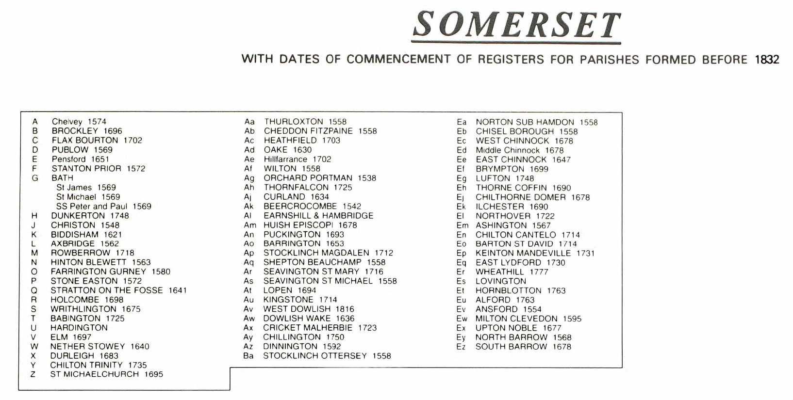
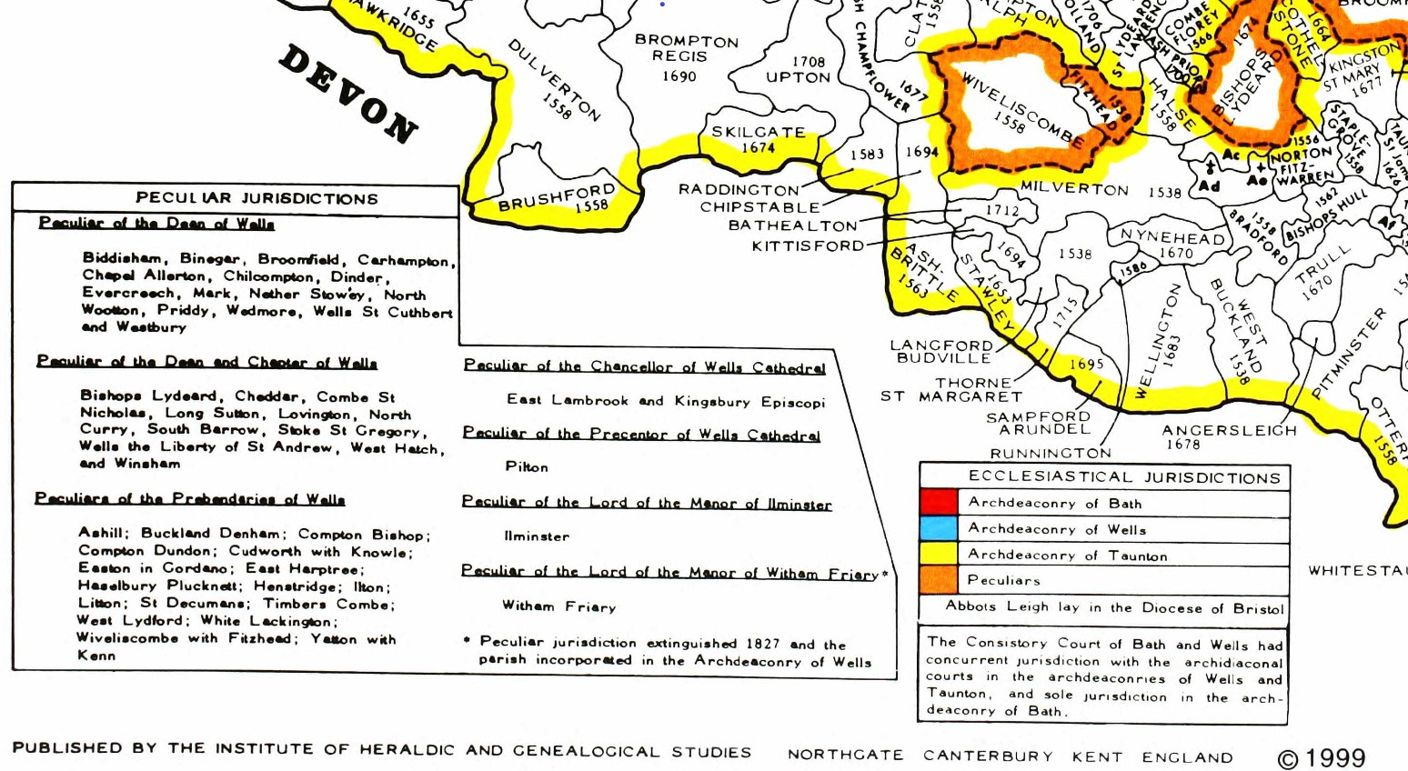
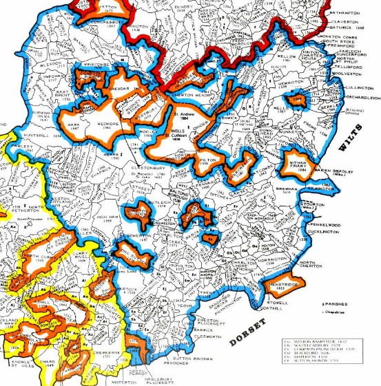
The same map but zoomed in and split into three parts for ease of use.
There is a vertical overlap on each segment to try to avoid the difficulty of interpreting the information, reading at the joints.
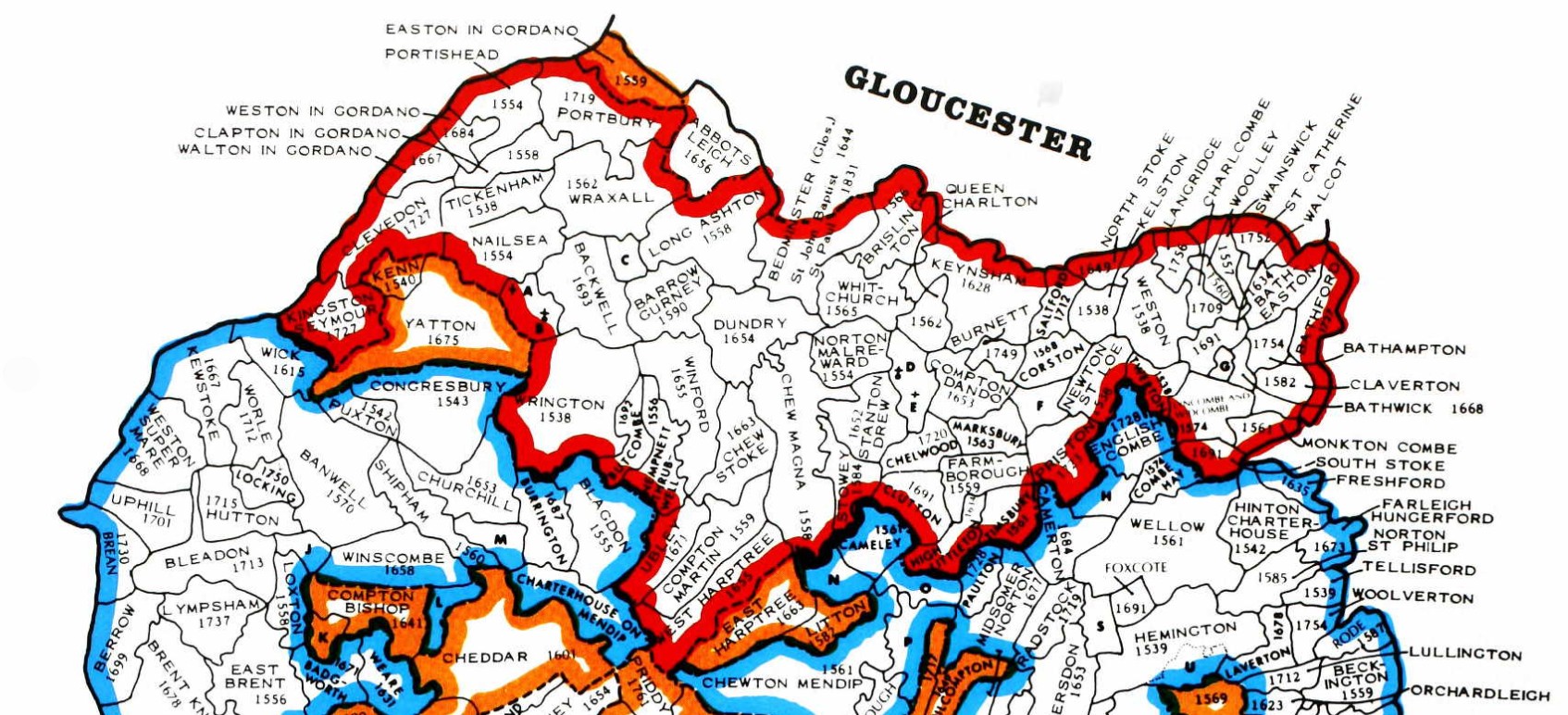
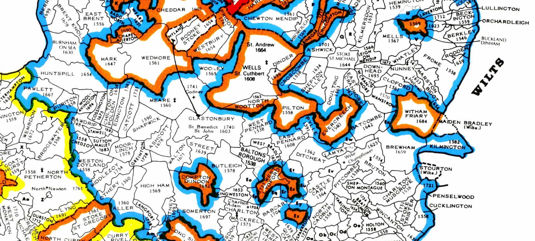
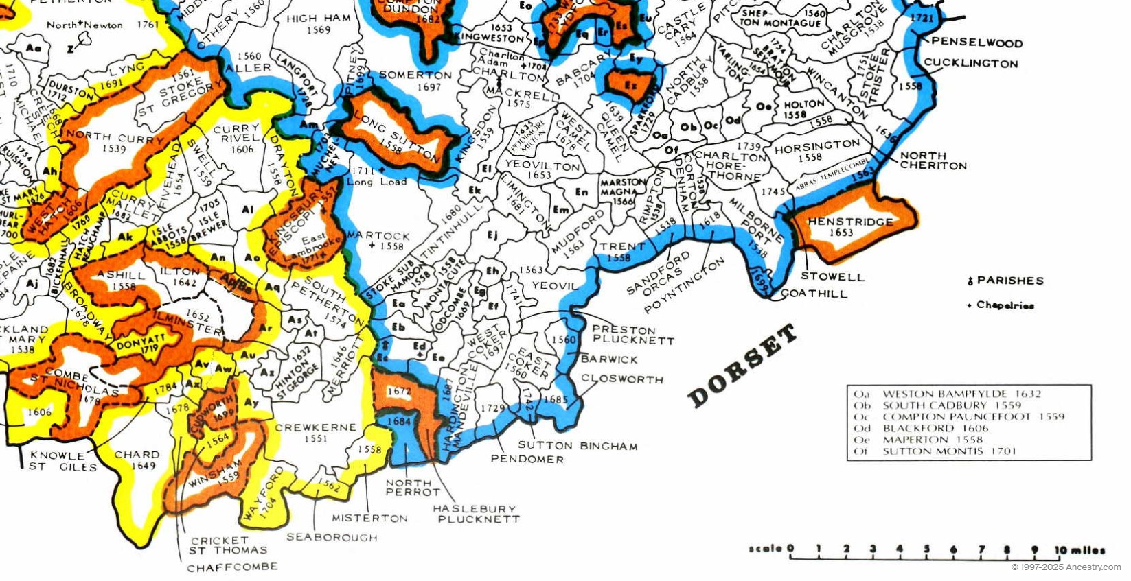
Rockbourne
Parish of Rockbourne Hampshire
Rochesburna (xi cent.); Rechesburna, Rochesburna (xii cent.); Rokeburn (xiii cent.); Rogborne (xvii cent.). Rockbourne contains about 3,923½ acres, of which 2,029 acres are arable land, 1,039½ acres permanent grass and 302¼ acres woods and plantations. (fn. 1) Rockbourne Down, in the north-west of the parish, and Knoll Down, which extends over the borders of Damerham, are in some places over 300 ft. high. The lowest part of the parish is along the banks of the little stream known as Sweatfords Water, which rises in Rockbourne Down and flows straight through the village by the side of the main street. The soil is sand, clay, gravel and chalk on a subsoil of chalk.
 NLS OS 1" Hills Old Map Rockbourne Hampshire
I have added annotation to the map regarding the towns of Salisbury, Winchester, and Southampton, to aid visual location finding.
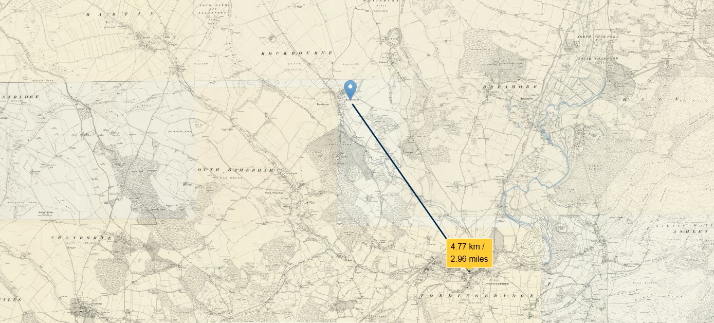
Rockbourne is approximately three miles NNW of Fordingbridge in the New Forest.
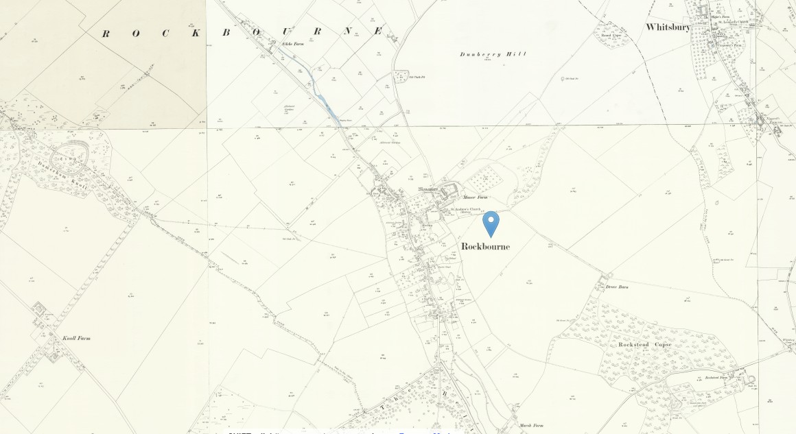 NLS OS 25" Old Map Rockbourne Hampshire - Hampshire and Isle of Wight LIV.10 Revised: 1908, Published: 1909
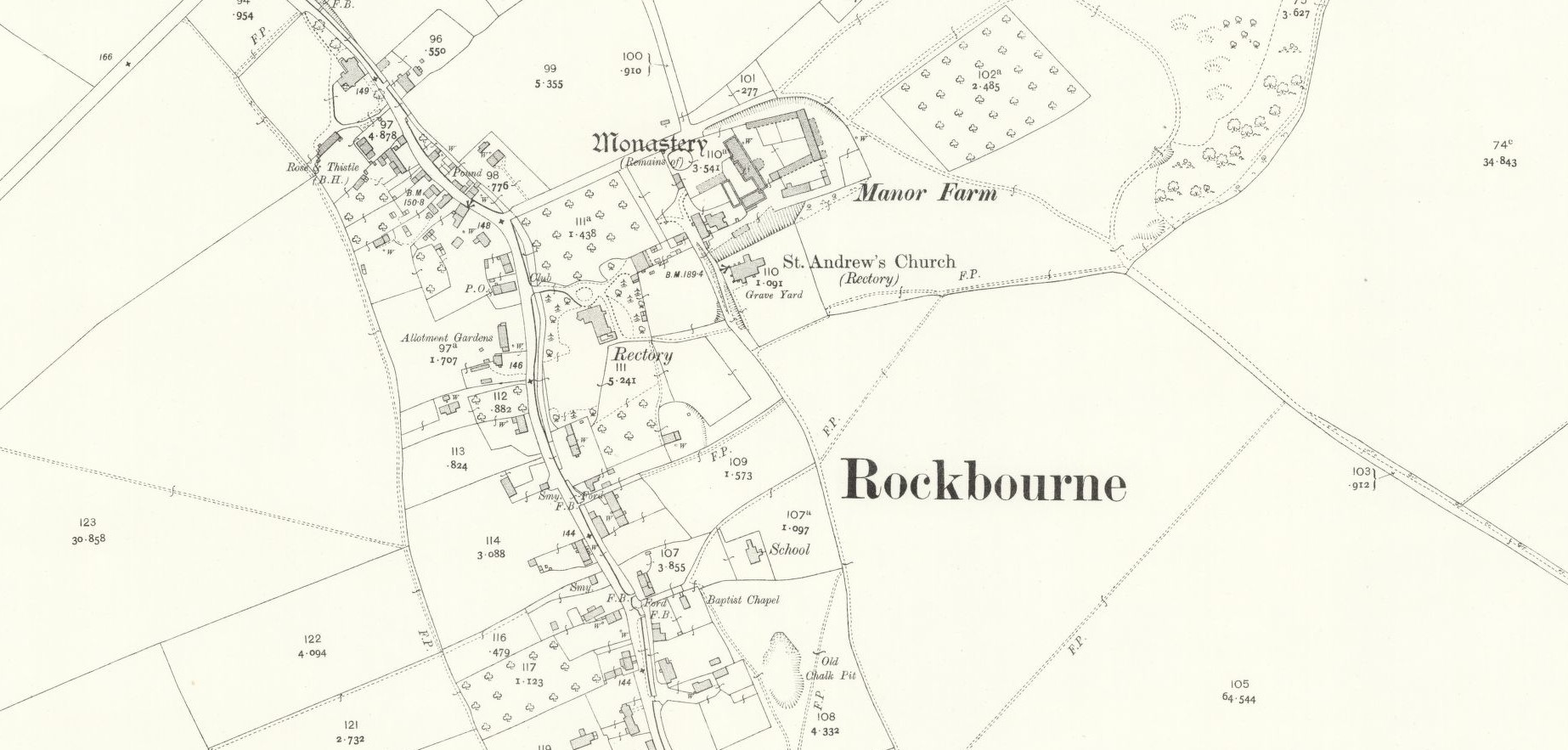 NLS OS 25" Old Map Manor Farm Rockbourne Hampshire - Hampshire and Isle of Wight LIV.10 Revised: 1908, Published: 1909
It appears that there was a Monastery at Rockbourne at one time. The rectory seems to be as big as the St. Andrew's Church, so presumably there was a good living to be had by the Rector in this very rural community.
Sweatfords Water flows through Rockbourne village, broadly in line with the main road. It is a tributary of the River Avon, which it joins at Fordingbridge.
A little South of Rockbourne village lies West Park country house. Unfortunately, the house was demolished in 1948 following damage sustained during WWII. Further information about the estate can be seen on Hampshire County Council site. According to British History Online, West Park was the property of Sir Eyre Coote. The park extends into South Damerham parish.
The village consists chiefly of one street almost half a mile long. The church is in the north-east of the main street Close to the church, adjoining the north side of the churchyard, is a very interesting group of buildings, consisting of a small L-shaped 14th-century house, now used as part of a modern farm-house, the remains of a large Elizabethan or Jacobean house a short distance to the east, a 13th-century chapel near its south-east angle, and a large 15th-century barn running northward from the chapel. The barn has two large waggon-porches, and at the north end has been divided into two stories for use as living rooms; the chapel is now used as a barn, and its most interesting feature is a north doorway with a cinquefoiled head. The buildings are doubtless manorial, the story of the existence of a leper hospital on the site being quite unfounded.
There is evidence of Roman occupation in the area, and Rockbourne was mentioned in the Domesday Book of 1086.
Rockbourne
Land of King William
Households
Households: 4 villagers. 20 smallholders.
Land and resources
Ploughland: 2 lord's plough teams. 3 men's plough teams.
Other resources: Meadow 3 acres.
Owners
Tenant-in-chief in 1086: King William.
Lord in 1086: King William.
Lord in 1066: King Edward.
Eling overview
Eling Overview
Eling Hampshire
Eling a small village and town, as well as a large parish on the banks of the River Test opposite Southampton, and adjacent to the New Forest, in the county of Hampshire, sometimes known as Southamptonshire, or County of Southampton.
Bronze Age 1500BC
A Bronze Age Settlement to the North of the Town was discovered when the Testwood Lakes were excavated. A jetty, bridge and dagger were all found dating from that period.
The town has a history back to before Bronze Age times. It is thought the name Eling probably derives from Edlas’s people, or Edlingas as it appeared in the Domesday Book.
Domesday Book 1066-1086
Eling was a settlement in Domesday Book, in the hundred of Redbridge and the county of Hampshire.
It had a recorded population of 69 households in 1086, putting it in the largest 20% of settlements recorded in Domesday.
![Domesday_-_Eling.jpeg]() Land of King William
Land of King William
Households
- Households: 13 villagers. 43 smallholders. 13 slaves.
Land and resources
- Ploughland: 20 ploughlands. 5 lord's plough teams. 7 men's plough teams.
- Other resources: Meadow 125 acres. Woodland 20 swine render;in Forest. 2 mills, value 1 pound 5 shillings. 1 fishery. 1 salthouse. 1 church. 0.5 church lands.
Valuation
- Annual value to lord: 20 pounds in 1086; 38 pounds 8 shillings and 2 pence when acquired by the 1086 owner; 38 pounds 8 shillings and 2 pence in 1066.
Owners
- Tenant-in-chief in 1086: King William.
- Lord in 1086: King William.
- Lord in 1066: King Edward.
Other information
- Partially waste in 1086.
- Phillimore reference: Hampshire 1,27
Hampshire Parishes - Eling Parish 1537
Original data;
Smith, Cecil R. Humphery. The Phillimore Atlas and Index of Parish Registers. Digitized images. Institute of Heraldic and Genealogical Studies, Canterbury, Kent, England. From Ancestry
County map of Parishes - Hampshire
Extract from Great Britain, Atlas and Index of Parish Registers, from Ancestry
Same map but in more detail
The same map but zoomed in and split into four parts for ease of use.
There is a vertical overlap on each segment to try to avoid the difficulty of interpreting the information, reading at the joints.
At one time this was done with mouse rollover, but that no longer consistently works on all browsers, so back to static.
The above map is an extract of the The Phillimore Atlas and Index of Parish Registers for Hampshire. Of particular interest, the Parishes of Eling - 1537, Southampton, Hound 1660, and South Stonham 1663.
Southampton contains the following parishes;
- All Saints - 1650
- Holy Rood - 1653
- SS, Lawrence and John, sometimes written as St Lawrence and St John - 1754
- St Mary - 1675
- St Mary Extra - 1671 (Other side of the River Itchen)
- St Michael - 1552
- Southampton Common, marked as M, extra-parochial.
The dates are not when the parishes were formed but as it states by the County Title, the dates of the commencement of Registers of Parishes formed before 1832.
I think that may be expanded to dates of registers still in existence.
Old Hampshire Maps
The website for Old Hampshire Maps and Other Historic Resources is a most excellent source of information which I often refer to.
I normally click on the top left icon, Old Hampshire Mapped, but believe that the one next to it on the right is more extensive and gets to the same maps and more.
This section could be called an indulgence to my lifelong fascination with maps and travel. Maps can tell you so much more than just how to get from A to B. Maps over time add to so much more.
Generally, the maps refer to Eling the settlement as opposed to the much larger parish. Something in the history must have given Eling some significance.
Saxton 1575
Saxton's map of Hampshire 1575
Extract from the Old Hampshire Mapped website about Saxton's map.
Map, hand coloured copper plate engraving, Southamtoniae, ie Hampshire, scale about 4 miles to 1 inch, engraved by Leonard Terwoort, Antwerp, Netherlands, published by Christopher Saxton, map maker, London? about 1575.
Published in the Atlas of England and Wales; it was usually issued in hand coloured form; measurements and notes made in the field were worked up later, with the help of earlier manuscript maps if available; Saxton almost certainly used the rudimentary triangulation techniques first described by the cartographer Frisius, Belgium, 1533.
Hills are drawn in profile to provide a general impression of the local topography, while named settlements are shown by a variety of symbols including a church with tower; rivers, coastline, some bridges, deer parks and woods are all included; the most obvious omission on Saxton's maps, to our eyes, are roads, which were not included on general county maps until the 1690s.
The map '... provides us with our first english example of accurate cartography': Colonel Close: 1930:: Hampshire Field Club.
Saxton's county maps were engraved by Ryther, Hogenberg, Reynolds, Terwoort and Scatter.
Direct link to Eling.(Settlement)
The ancient settlement of Eling circled in blue, to help locate it.
Zoomed in some more on the same map. Showing from the New Forest, Eling, Southampton, across to the Hamble.
Norden 1595
Norden's Hampshire 1595
A map of Hampshire, including the Hundreds of the time. Remembering that a Hundred was an administrative area, part of and smaller than a County, and bigger than, and containing multiple Parishes.
The origin of the division of counties into hundreds is described by the Oxford English Dictionary (OED) as "exceedingly obscure". It may once have referred to an area of 100 hides; in early Anglo-Saxon England a hide was the amount of land farmed by and required to support a peasant family, but by the eleventh century in many areas it supported four families. Alternatively the hundred may have been an area originally settled by one "hundred" men at arms, or the area liable to provide one "hundred" men under arms.
Either way, a huge area of land for such a small population.
![Norden s Hampshire 1595 Hundreds and key]() Details
Details
Eling is within the Hundred of Redbridge. Indicated on this map as 21. Fortunately, some of the hundreds have boundaries marked in red on this copy of the map, and 21 is one of them.
From this map it appears that the Hundred of Redbridge, at the time, extended North as far as Romsey, with its town and Abbey, including the Broadlands Estate, and South just past Elinge, on level with Lyndhurst. Note the spelling of Eling with an e at the end.
According to the Key or 'Explanation of the Map' the icon attributed to Elinge appears to be that of a Parish. This map is dated from 1595 and from elsewhere Parish Records commenced in 1537, which obviously predates the map.
Taylor's Hampshire 1759
Taylor's Hampshire 1759 - Section 33.
Circled in green, Grove Place, in Nursling, is not part of this story, but does get a mention elsewhere on this site. Eling, the settlement, circled in blue, is the centre of attention. Eling the parish, takes up a large portion of the map, and the Hundred of Redbridge takes up even more. Extending to Romsey
Copped Thorn Common and Copped Thorn are circled in red, and turn up later in our story, under a slightly changed name.
I will have to look up house 440 at Poltons. It is interesting that Great Testwood carries the same number. Poltons is now known as Paultons Park - Home of Peppa Pig World. How things change.
The estate can be traced back to 1086 where the ‘Paulet’ manor was in the possession of Glastonbury Abbey. The house became derelict and burned down in a great fire on 5 November 1963. Click the link to read about the Estate's History.
The above only looks at Section 33 of Taylor's Map of Hampshire. If you want to look at the whole map, which is very decorated, follow the link to the article Taylor's Map of Hampshire 1759 which opens in a new window.
Eling Parish Split in three 1837-1846
Ancient Parish of Eling
The Parish of Eling was divided, which is understandable, as it was a huge area, and would have had a growing population. Initially into, South to North, Marchwood, (1846), Ealing (Ancient) and North Eling (1837), .
The maps are from FamilySearch.
North Eling, blue wash, Eling, mouve, Marchwood, yellow.
Eling - re-sized
First the map with the revised size Eling parish as 1 and the newly formed North Eling as 2. Marchwood is also formed from the Ancient Parish of Ealing.
Eling is an Ancient Parish in the county of Hampshire
Other places include: Wigley, Wade, Testwood, Tatchbury, South Eling, Rumbridge, Ower, Lopperwood, Langley, Lamb's Corner, Ironshill Walk, Ipley Farm, Durley, Denny Lodge Walk, Colebury, Castle Malwood Walk, Beechwood, Bauldoxfee, Bistern and Bartley, Bartley Regis, Ashurst Walk, and Ashurst Lodge and Grounds.
Parish records begin in 1537 and Bishops Transcripts 1701.
Non-Church of England denominations identified in Eling include: Independent/Congregational and Wesleyan Methodist.
I have transcribed the image, which is clearly legible sat here, mainly to provide searchable text, but hopefully also to provide the information irrespective of the devise used to view this article.
North Eling
North Eling is an Ecclesiastical Parish in the county of Hampshire, created in 1837 from Eling Ancient Parish.
Parish records begin in 1834 and Bishops Transcripts 1838. Interesting that the Parish records commence before the creation of the parish. No non-Church of England denominations have been identified for North Eling.
Jurisdictions;
- Place; North Eling
- County; Hampshire
- Civil Registration District; New Forest
- Probate Court; Courts of the Bishop (Episcopal Consistory) and Archdeaconry of Winchester.
- Diocese; Winchester
- Rural Deanery; Southampton
- Poor Law Union; New Forest
- Hundred; Redbridge
- Province; Canterbury
All the Jurisdictions apart from the place are the same for all three parishes.
Marchwood
Nine years after the division of the Ancient Parish of Eling to create North Eling, a further split to create the Parish of Marchwood.
Marchwood is an Ecclesiastical Parish in the county of Hampshire, created in 1846 from chapelry in Ealing Ancient Parish.
Other places in the parish include: Decoy Pond.
Parish records begin in 1843 and Bishops Transcripts 1843. Interesting that the Parish records commence before the creation of the parish.
Independent/Congregational is the only identified non-Church of England denomination in Marchwood.
ArcGIS Church of England Parishes Map
An extract of ArcGIS Church of England Parishes Map focused on the parish of Eling
Ordnance Survey
OS 25 Old Map Eling village - Hampshire and Isle of Wight LXIV.12 Revised: 1895, Published: 1897
OS 25 Old Map Eling and Totton - Hampshire and Isle of Wight LXIV.8 Revised: 1896, Published: 1897
OS 6 Old Map Ancient Eling 4 parish boundaries plus Eling mark - Hampshire & Isle of Wight Sheet LXIV.NE Revised: 1895 to 1896, Published: 1897
For this rendition of the 6" version of the same Ordnance Survey Map I have slowly traced the boundary makers shown on the map to more easily see the ancient parish of Eling, as well as the now four resultant parishes.
First it was one parish, then three, then four at the time of this map, 1895.
It is made up of several map sheets, one of which is Hampshire & Isle of Wight Sheet LXIV.SE
Revised: 1895, Published: 1898.
The village of Eling is shown by the blue marker.
The 1895 Eling Parish boundary is shown with the orange line.
The Parish of Copythorne has a yellow outer boundary.
The Parish of Netley Marsh has a green outer boundary.
The Parish of Colbury has a red outer boundary.
The Parish of Marchwood has a light blue outer boundary.
With inner boundaries sharing adjacent parishes colours.
I have saved the lines, but unfortunately they will not show when you follow the link, click the map, to the source information.
The following maps are zoomed in to each parish.
The 1895 Eling Parish boundary is shown with the orange line.
The 1895 Parish of Copythorne has a yellow outer boundary.
The 1895 Parish of Netley Marsh has a green outer boundary.
The 1895 Parish of Colbury has a red outer boundary.
The 1895 Parish of Marchwood has a light blue outer boundary.
The Vicarage Eling
The Vicarage, Eling Hill, Eling, Hampshire, England.
The vicarage, Eling Hill is a recuring address for some Penny and Eldridge families, according to some other peoples Trees.
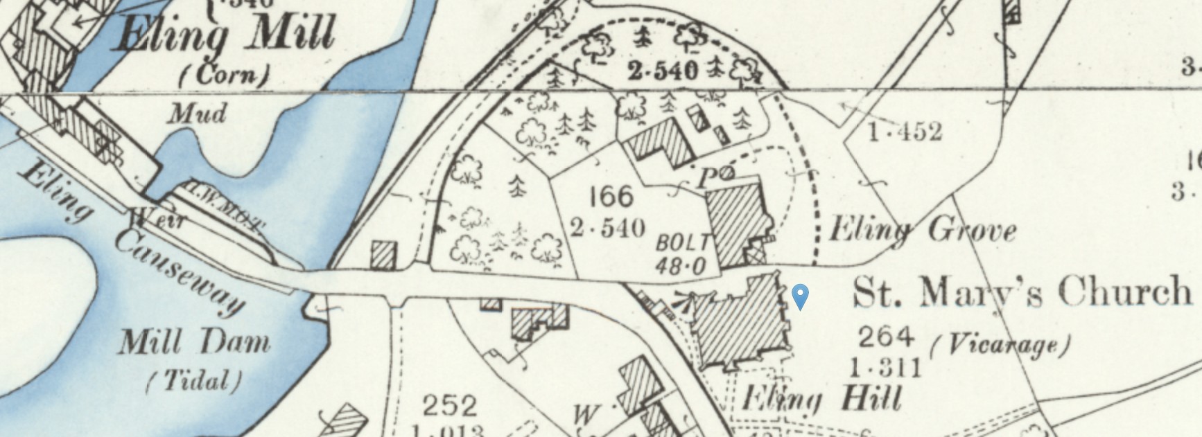
The vicarage of St Mary's aka St Mary the Virgin church is adjacent to the marker on the above map.
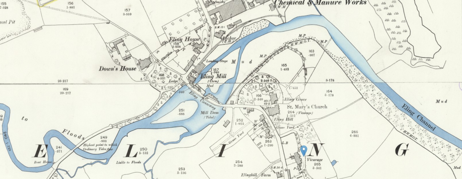
Although, on these OS 25" Maps, there is another Vicarage slightly further along Eling Hill, opposite Elinghill Farm.
Andover - old
Andover
Andover is an Ancient Parish and a market town in the county of Hampshire. Foxcott is a chapelry of Andover.
Other places in the parish include: King’s Enham, Hatherden, Enham Kings, Charlton, Woodhouse, Wildhern, Swanhill, Smannell, and Little London.
Alternative names: Andover With Foxcott
Parish church:
Parish registers begin:
Parish registers: 1587
Bishop’s Transcripts: 1703
Nonconformists include: Baptist, Church of Jesus Christ of Latter-day Saints, Independent/Congregational, Particular Baptist, Primitive Methodist, Society of Friends/Quaker, and Wesleyan Methodist.
Jumping back in time to closer to that of Abraham Hurst, Taylor's Map of Hampshire 1759.
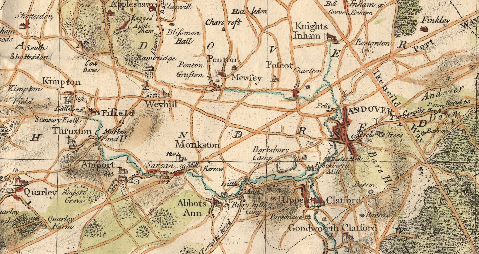
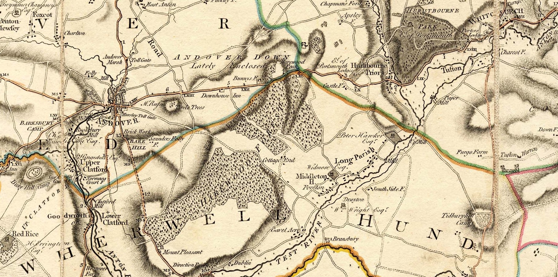
Milne's Map of Hampshire 1791, Andover and surrounding area.
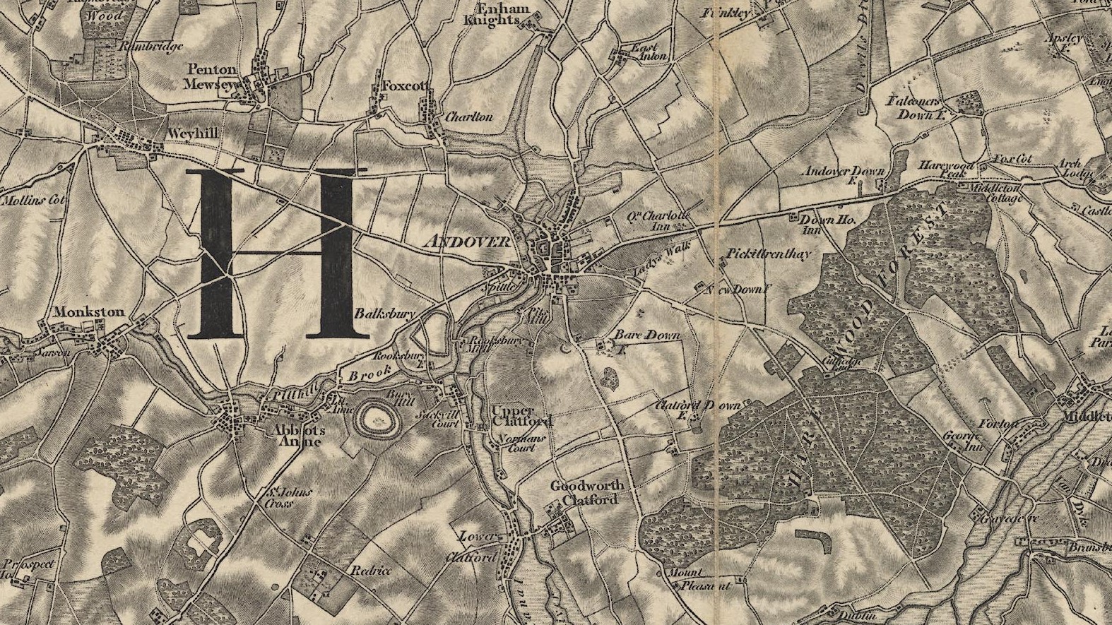
Jumping forward out of the period of Abraham Hurst, which ended in 1777, above is an OS Original Series Map at about 1817. A little more detail, but not a huge change in the size of Andover.
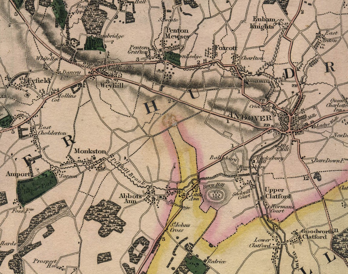
The Greenwood 1826 Map of Hampshire, Andover and area, included here just to complete the set of Old Maps of Hampshire with a scale of approximately one Inch. Perhaps a little clearer as it is in colour.
Click on any of the above maps to view them at source, Old Hampshire Mapped. There are a lot more maps to see there.
Broughton and Houghton
Broughton is 10 to 11 miles, about 4hrs walking, away from Andover depending on which route taken, and is less than 3 miles from Houghton, only 1 hour walking. Unfortunately Google Maps does not yet have an option for riding a horse or horse and carriage, but somewhat quicker that walking
Houghton is around 10 miles, slightly less than 4hrs walking, away from Andover depending on which route taken.
The Parishes of Broughton and Houghton are both small and adjacent to one another.
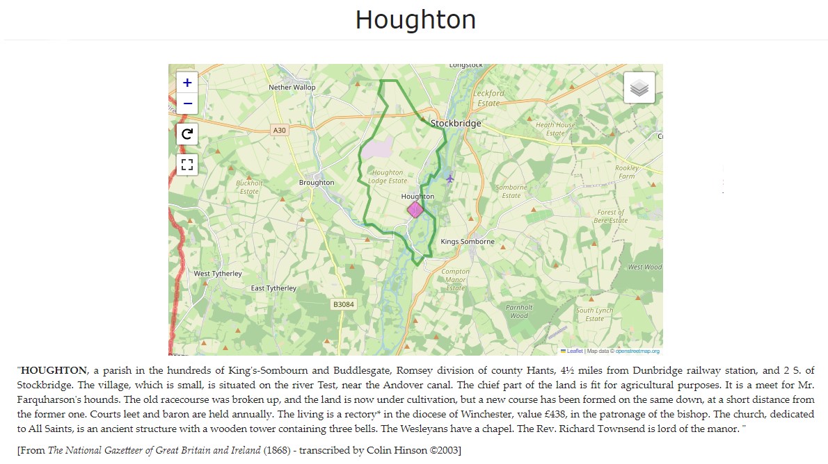
The above is a screenshot of the current ESRI Church of England (CoE) Parish Map, centred on Broughton. On the live map there is a lot of statistical information about the Parish in the current time. Click on the image to go to the live map. The web address is to this image,but it may automatically redirect you London. If this is the case search for Broughton, Test Valley, Hampshire, England, GBR or Houghton, Test Valley, Hampshire, England, GBR
Not very relevant to the issue at hand, in the mid 1700's but interesting.
Still not the 1700's but a very much closer representation in Old OS maps.
A National Library of Scotland Georeferenced tiled Map with both Broughton and Houghton, both circled in blue, showing their relative positions. Just two miles as the crow flies. That is just the villages though as the parishes abut residences on either side of the parish boundary could be even closer.
An image of an Old OS Sheet map showing the village of Broughton, beside Wallop Brook, a tributary of the River Test.
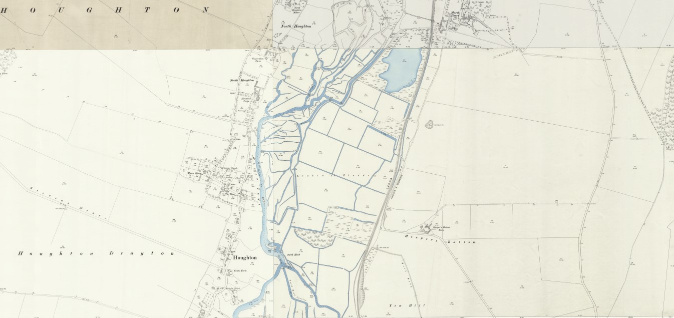
An image of an Old OS map showing the village of Houghton and the River Test, on its way to Romsey, Millbrook, and Southampton.
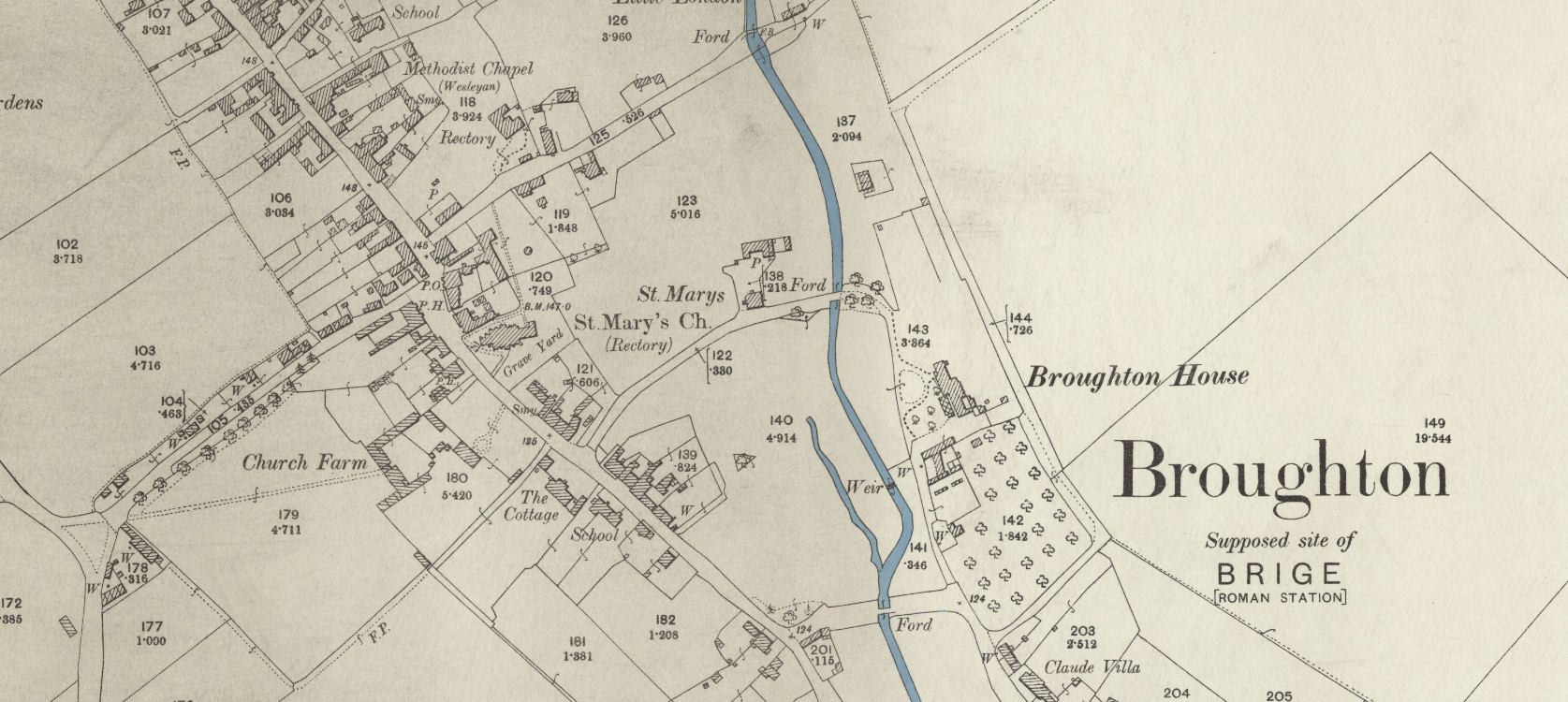
An image of an Old OS map showing a closer view of the centre of the village of Broughton and the Parish Church of St. Mary's.
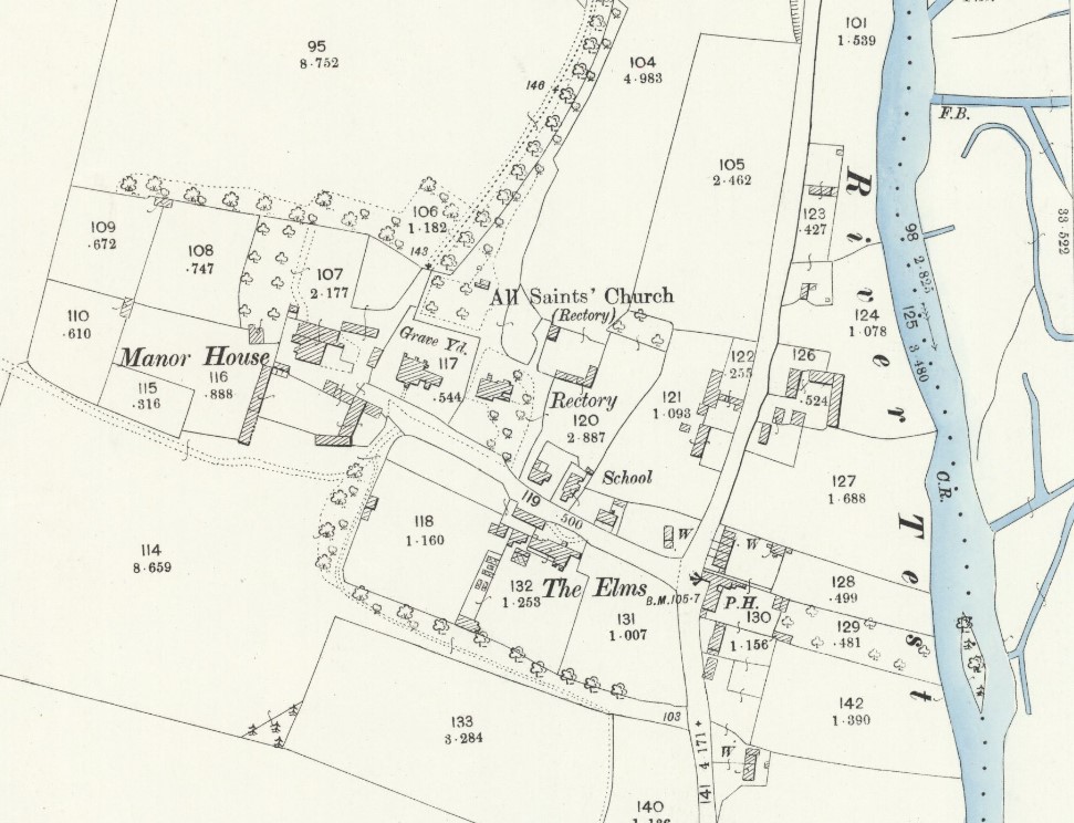
An image of an Old OS Sheet map showing a closer view of the centre of the village of Houghton and the Parish Church of All Saints'
Pittleworth, Bossington
Pittleworth is a farm and manor in a Parish South of Houghton called Bossington
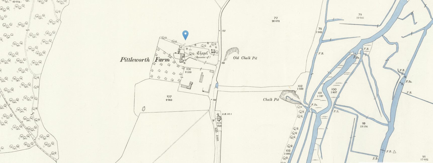
Buckholt, Broughton
Buckholt Farm and Buckholt, Broughton, Hampshire
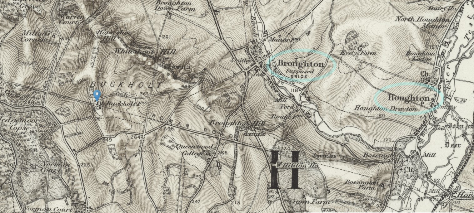
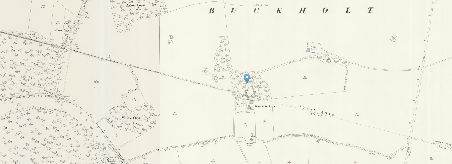
The entry for the baptism of Sarah Hurst 1781 referred to Abraham and Sarah Hurst of Buckholt. Sometimes that would refer to a place and other-times a Farm. There are not a lot of building in the area of Buckholt and no apparent hamlet or village so it could easily be referring to Buckholt Farm.
Conclusion
Conclusion
Key data about John Mabey and his family.
Dates
Key Dates
| Name | Birth | Baptism | Marriage | Death | Interval between children | Mothers age at birth |
| John Mabey | 17th January 1771 | 3rd March 1794 | (Marriage 25 y, 1 m, 29 d) | |||
| Mary Penny | 3rd March 1794 | |||||
| (Marriage 2 y, 7 m, 28 d) | 27 years, 9 months, 26 days | |||||
| 1 year, 1 month, 7 days | 28 years, 11 months, 1 day | |||||
Data Sources / Evidence
Key Data Sources / Evidence
| Baptism | Census | ||||||||||||
| Name | Birth | Record |
Parish Image |
1841 |
1851 |
1861 |
1871 |
1881 |
1891 |
1901 |
1911 |
Death | |
| John Mabey | X | Charwoman | |||||||||||
| Mary Penny | X | -- | -- | -- | Carman | ||||||||
| X | X | X | -- | -- | |||||||||
| -- | -- | Greengrocer assistant, Dock labourer | |||||||||||
| -- | -- | Farrier, Fish Monger | |||||||||||
| -- | -- | Seaman, Dock labourer | |||||||||||
| -- | -- | Charwoman | |||||||||||
| -- | -- | ||||||||||||
| -- | -- | ||||||||||||
| -- | -- | ||||||||||||
Places of Interest
Places of Interest
| Place | Event | Date | Note |
| Birth | |||
| Baptism | |||
| . | Census 1841 | ||
| Christ Church With St Mary and St Stephen, Spitalfields, Tower Hamlets, Middlesex | Marriage | ||
| Marriage | |||
| Baptism of | |||
| Census 1851 | |||
| Baptism of | |||
| Baptism of | |||
| Baptism of | |||
| Baptism of | |||
| Census 1861 | |||
| Baptism of | |||
| Baptism of | |||
| Baptism of | 13th February 1870 | ||
| Census 1871 | |||
| Census 1881 | |||
| Census 1891 | |||
| Death |
Tree
| William Mabey | Anne Long | James Penny | Ann Eldridge | |||||||
| 1761 Martha (Sarah) |
1762 William |
1764 Susan |
1768 Joseph |
1771 John |
child 1 | child 2 | child 3 | child 4 | child 5 | |
| 1773 Richard |
1775 Milly |
1778 Mary |
1780 Susan |
1781 Charlotte |
child 6 | child 7 | child 8 | child 9 | child 10 | |
| 1782 Elizabeth |
child 12 | child 13 | child 14 | child 15 | child 11 | child 12 | child 13 | child 14 | child 15 | |
| John Mabey | Mary Penny | |||||||||
| child 1 | child 2 | child 3 | child 4 | child 5 | child 6 | child 7 | child 8 | child 9 | child 10 | |
| next ancestor | or next ancestor | |||||||||
| child 1 | child 2 | child 3 | child 4 | child 5 | child 6 | child 7 | child 8 | child 9 | child 10 | |
xxxxxxxxxxxxxxxx
Family 02
Family 03
Family 04
Family 05
Family 06
...