Lily Minnie Carr
Born 19 Nov 1883
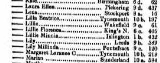
Register of Births Q4 1883. Carr, Lillie Minnie, Islington 1 b. 432
Slight variance of name between registration and baptism. Lillie v. Lily.
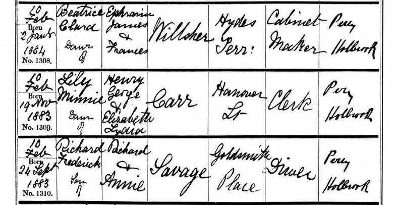
Baptised at St Mary, Islington: Upper Street, Islington, on 10 Feb 1884, having been born on 19 Nov 1883, Lily Minnie, daughter of Henry George & Elizabeth Lydia Car of Hannover Street, the father's occupation, a Clerk.
 OS 25 Old Map Islington St Marys Church - London (Edition of 1894-96) XXXIX Revised: 1894, Published: 1897
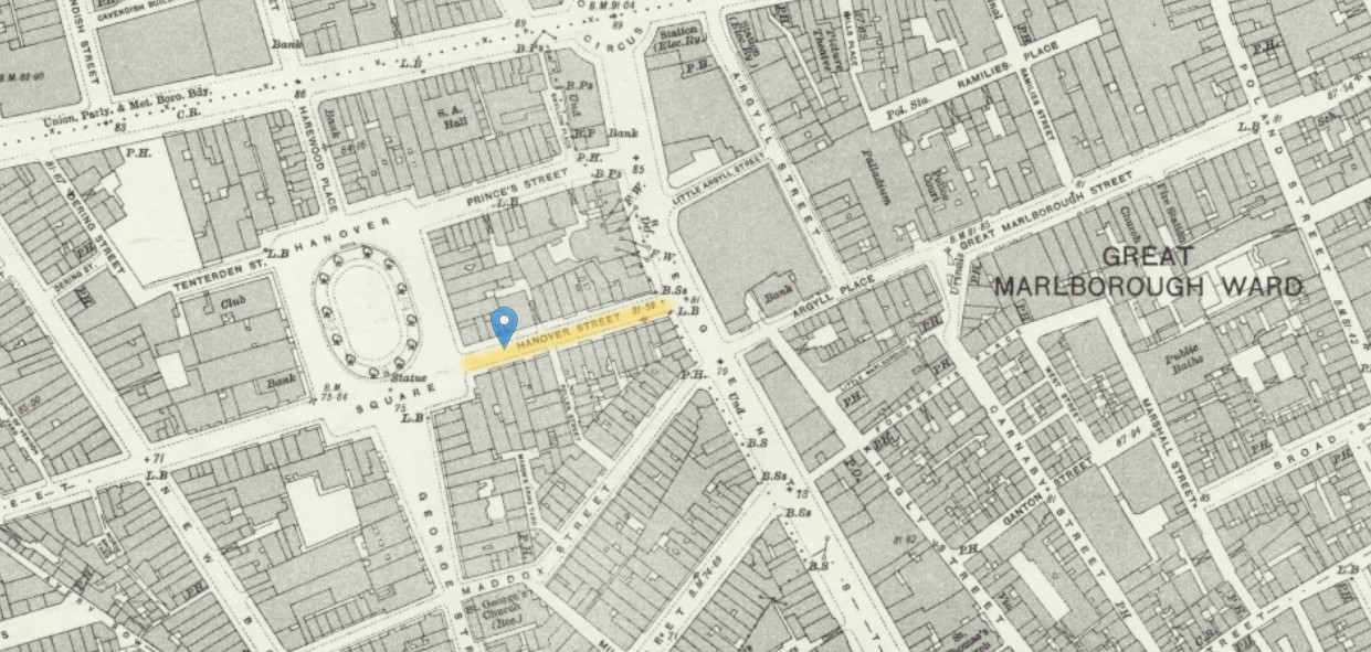 OS 25 Old Map Hanover Street St George Hanover Square - London (1915- Numbered sheets) V.9 Revised: 1914, Published: 1934
It is interesting to note that the Baptism Record has a abode of Hanover Street, without annotation that it is a different parish, and that the Hanover Street near Hanover Square is about 3 miles, just over an hour walk, to the church chosen for the baptism of Lily Minnie Carr.
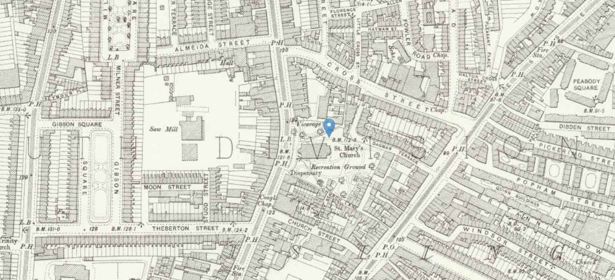
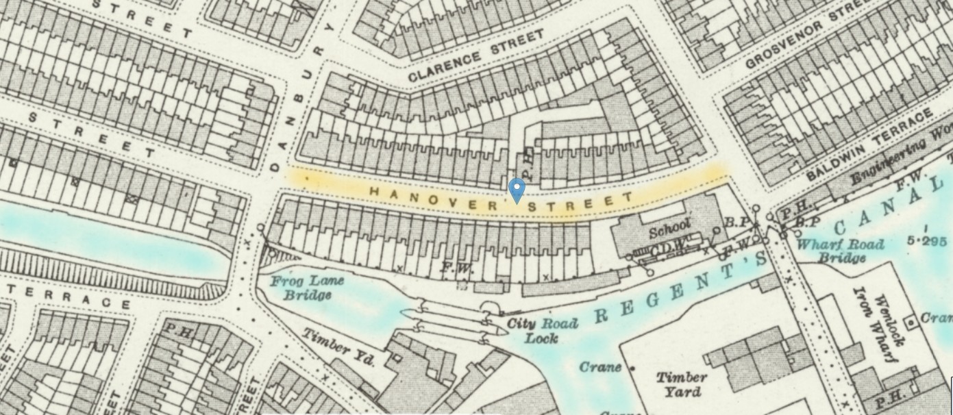 OS 25 Old Map Hanover Street Islington - London (1915- Numbered sheets) V.6 Revised: 1913, Published: 1916
A much more likely Hanover Street. Now known as Noel Road, probably as a result of the exercise to remove duplicate street names. The distance to St Mary's church from hear is only half a mile, a 12 minute walk.
Census 1891
Census of England and Wales 1891
Islington - Highbury
Enumeration District No. 37
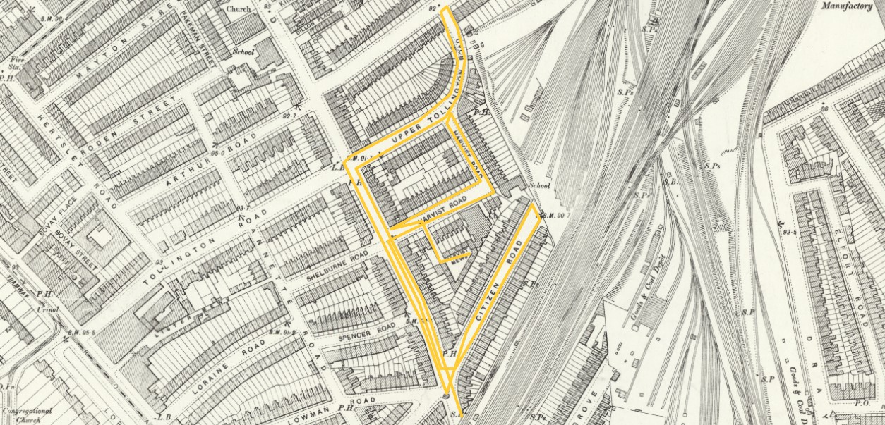
Sometimes, in Census records there is very little information about the individual roads or places. Fortunately, on this occasion both the roads are recorded as well as the house numbers. However, the street names are not written clearly enough to be able to find then on a map by searching. Perhaps City something. Is that City Road, City Garden Row, or something different. Flip pages to find adjacent roads. That sometimes resolves the location. Other times it can be necessary to go to the front of the district census record to the notes and the enumerator's route description. That is exactly what I have done this time.
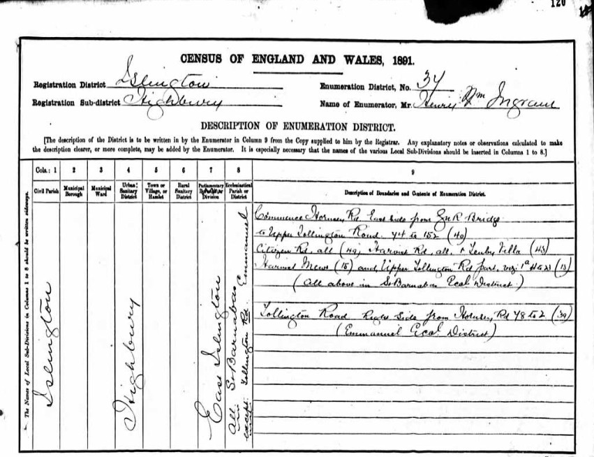
Commence Hornsey Road East Side from GNR Bridge to Upper Tollington Roud 44 to 152 (40) Citizen Rd all (49) Harvist Rd, all, & Tenby Villa (48) Harvist Mews (15) and Upper Tollington Rd Part ?? 1a HG ?? (13)
(All above in St Barnabas Ecal District)
Tollington Road Right Side from Hornsey Rd 78 to 2 (39) (Emmanuel Ecal District).
Islington, St Barnabas, Harvist Road, Hornsey Road (Harvist Estate is now off Citizen Road)[1866] closed 1947, demolished 1966. 1945 Parish united to Emmanuel. 1953 parish divided, part to Emmanuel, part to St. Mary Magdalene.
SAINT BARNABAS, HORNSEY ROAD, HORNSEY ROAD, ISLINGTON. in LMA database
Parish is no. 14 on outline map, at grid reference TQ311860
Islington, Emmanuel, Hornsey Road [1886] still open, part of the Tollington Team Ministry.
EMMANUEL, HORNSEY ROAD, HORNSEY ROAD, ISLINGTON in LMA database
Parish is no. 13 on outline map, at grid reference TQ308861
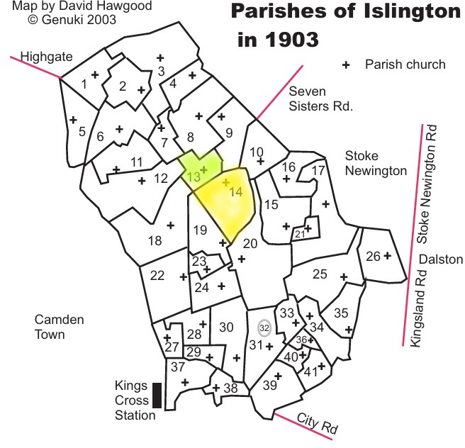
I have not yet located Tenby Villa. With 48 homes it is likely to be a block of flats / tenements called Tenby Villas, as opposed to a street name.

An 1860 map of the area shows how rural the place was, mainly fields.
Zoom in to the area just north west of our census area. You can see the profile use of Villas and Terraces in the area of Tollington Place.
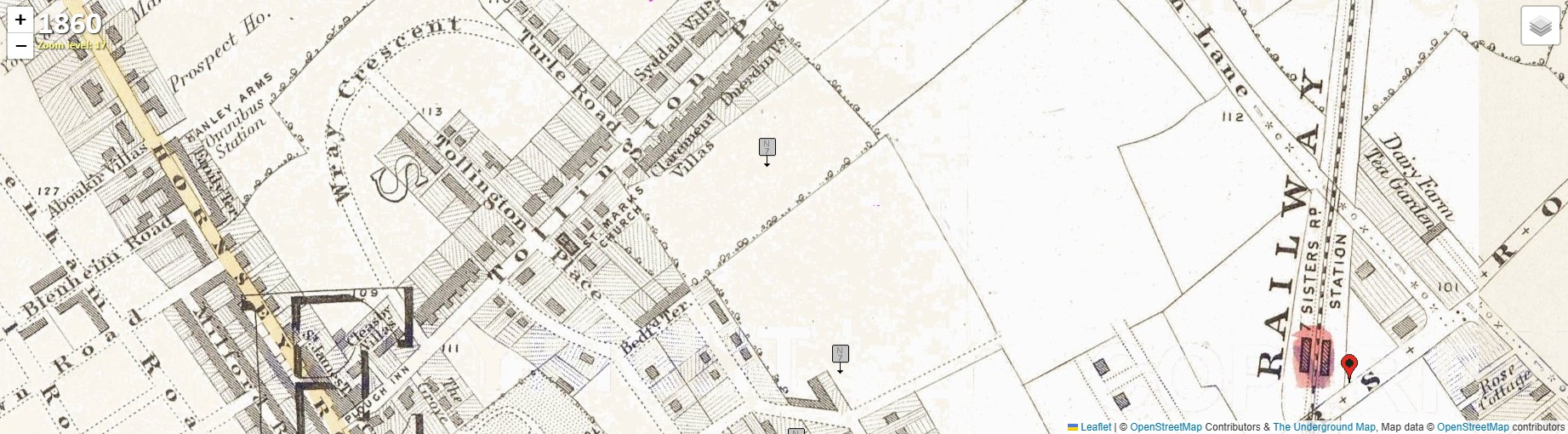
An approximation of the area of the District 37 1891 Census with the yellow box. Not the actual boundary, just a placeholder. In 1860, almost all fields.
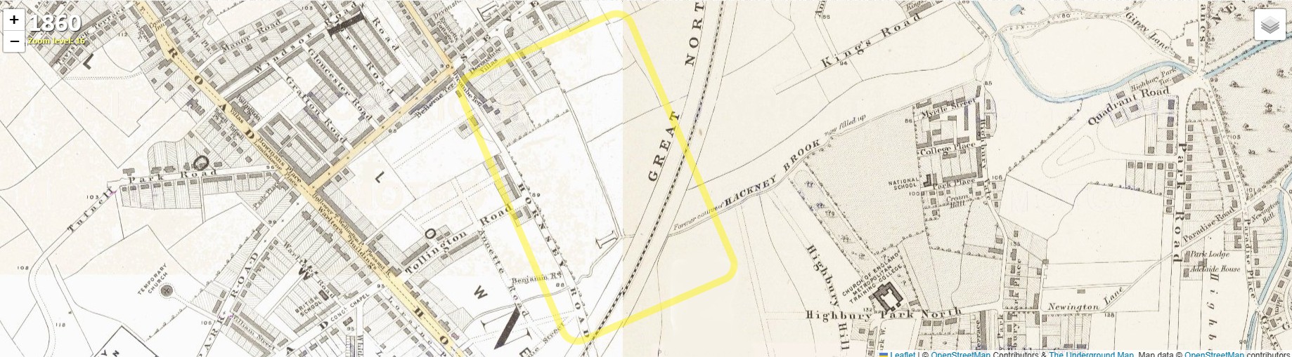
Move forward a mere twenty years and the area is entirely developed. The fields have gone. The area now shown as a yellow triangle.
There is a 1890 version of the mapping, to nearly match the Census year of 1891, but it is less clear but with similar information, so I have chosen not to use it.
You may have noticed that clicking each map takes you to the same article on their website. You then have to navigate to the area, near the Emirates Stadium using the 2025 mapping, before choosing which year, using the stack of paper icon on the top right corner.
Back to the OS 25" Mapping.
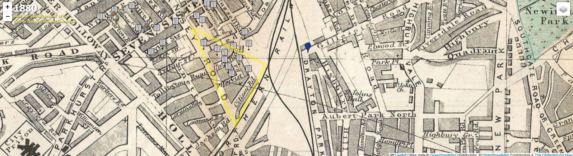
 OS 25 Old Map Islington District 37 Enumerators route - London (Edition of 1894-96) XXIX Revised: 1893 to 1894, Published: 1897
This is an approximation of the Enumerators Route for District 37 of the 1891 Census. It is not comprehensive, but it is sufficient to give an idea of the area, and most importantly to confirm the street names within the Census. Including Citizen Road, the address of our family in question.
The map was revised in 1893 to 1894, so is probably quite similar to the layout of the 1891 Census.
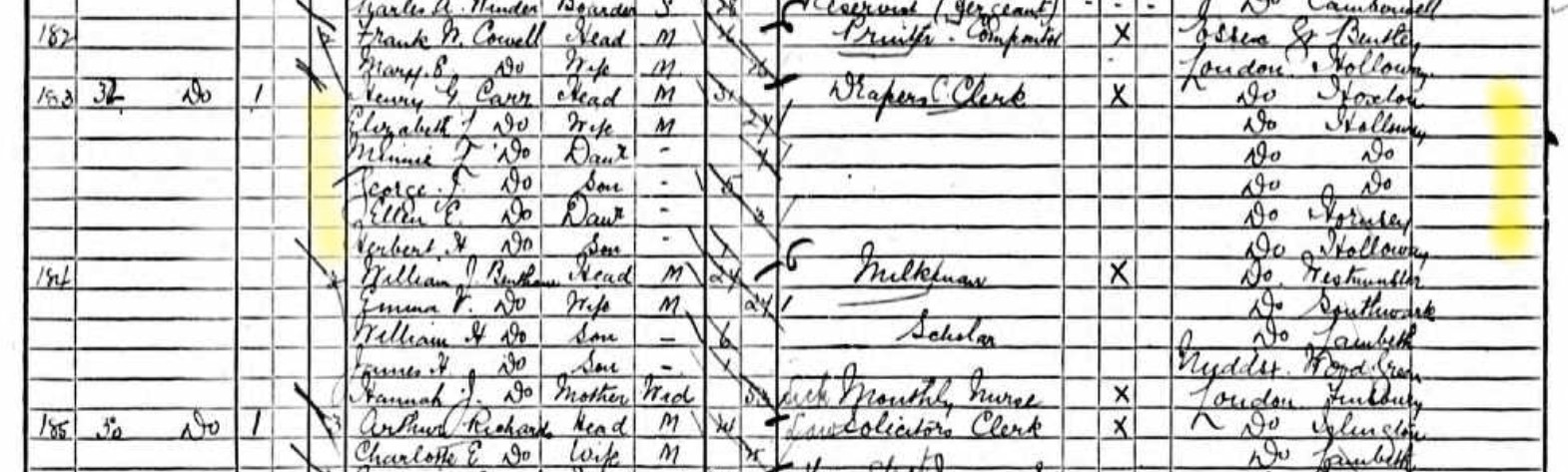
Extract of Highbury Islington Census, for 32 Citizen Road.
| Name | Relation to Head |
Condition | Age (M) |
Age (F) |
Occupation | Employer | Employed | ? | Where Born | Disability |
| Henry G Carr | Head | M | 31 | Drapers Clerk | X | London Hoxton | ||||
| Elizabeth L Carr | Wife | M | 27 | London Holloway | ||||||
| Minnie L Carr | Daur | 7 | London Holloway | |||||||
| George J Carr | Son | 5 | London Holloway | |||||||
| Ellen E Carr | Daur | 3 | London Hornsey | |||||||
| Herbert H Carr | Son | 1 | London Holloway |
The family lived in a multi-occupancy building, as were the neighbouring houses.
Some Ancestry Trees record a marriage to Lillie Minne Carr on 18 Nov 1928 in Fulham, London.
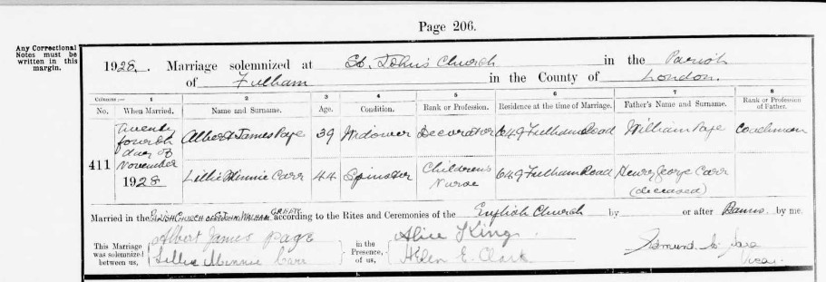
There is a problem here. Albert James Page did indeed marry Lillie Minnie Carr. He was a 39 year old Widower, and she a 44 year old Spinster. That would make their years of birth approximately 1889 and 1884 respectively.
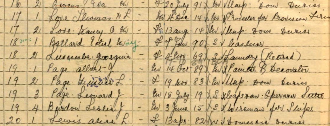
Part of the 1939 Register, for 31 Ravenscourt Road Hammersmith. Page Albert J born either 14 Oct 1889 or 19 10 1889. This matches The marriage record.