We waved to the Trans Kalahari Inn as we drove past to start the day again. We didn't see the troop of Baboons on the road from the airport today. However, we soon came upon a big hangar type structure straddling the road, but without doors at either end.
The structure is there just to provide shade for the police whilst they check your papers, search your car or truck, or, as happened to us, just wave you through with the merest wave or nod, provided you stop at the stop sign.
Windhoek
Just a few more miles and we were driving through Windhoek. The capital city with a population of less than 500,000, but with all the normal accoutrements of speed cameras, speed humps, policemen, traffic lights, roundabouts, and of course, traffic. Through into the mix, four way stops and three way stops, very rare in the UK. We are not disciplined enough to make those work. Straight into the centre of the capital heading for the B1 and the road south. Shops, pedestrians, traffic, and taxis everywhere. We made a wrong turn with signs often worn out and right at the junction, too late for a change of lane. No matter, a quick turn arround had us back on route. Not really very difficult, in on the B6, Sam Nujoma Drive, out on the B1, or Mandume Ndemufayo Avenue. The satnav was on but had yet to find our next location. So we set it to Rehoboth to get us in the right direction. Not so much as to tell us the way to go, as there is not a lot of choise outside the capital, but to record where we were going and at what time. We could then link the photo time to the position of the GPS satnav to geolocate the photos.
placeholder for gopro of windhoek
We soon left the urban sprawl of Windhoek and were on the open road south, a good blacktop road. This lasted for about 100km
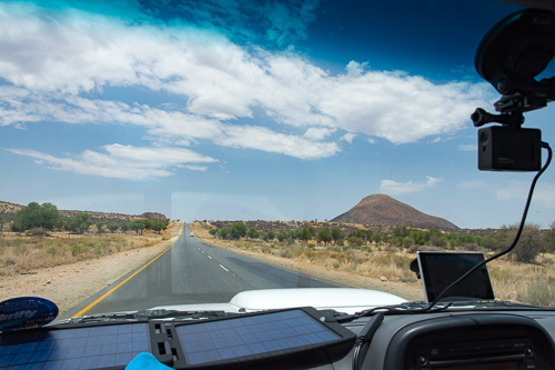
The photo of the open road through the windscreen, with only a slight reflection shows how we were kitted out for the journey. A GoPro recording the trip. Well, in fact two alternating, with plenty of batteries. Even so, the GPS was turned off to get the most out of the batteries. A Garmin SatNav with Southern Africa mapping, powered from the cigarette lighter socket. We did have a duel socket, but it kept falling out on the corrugations, so only one source of 12v power. The solar panels on the dashboard either directly charged the GoPro battery, or fed a power pack, which in turn charged the batteries for the GoPro. Location tracking was provided by the SatNav and David's Garmin watch which had GPS.
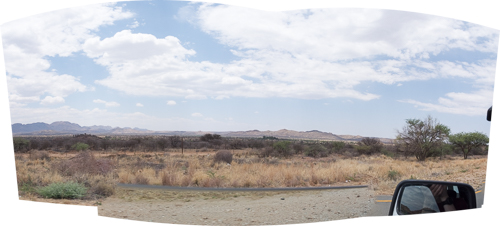
Again ignoring the rules against taking photos through more glass than contained in the lens, this is a panorama of six photos taken throught the side window whilst on the move, at 76km/h.
All set for our adventure.
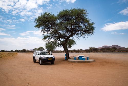
Another new road sign to learn. A tree with a picnic bench, and lo and behold, it means what it shows. Unfortunately, some of the time the tree is missing, but the thought is there, somewhere to rest under shade, or perhaps wait for that elusive ride, or bus.
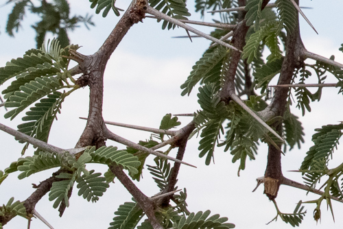
The tree does provide the required shade but it does also have a sharp side. Look at those thorns! Even so there does appear to be some damage to the tree, as if something has been eating it.
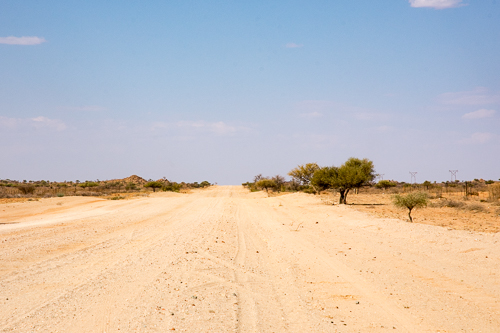
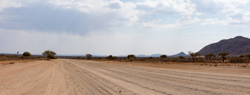
The beginning of the gravel / dirt roads
The the tar road soon petered out as we turned onto the C24, to give way to the more normal, corrugated gravel road. No photo of the change as there were people at the junction looking for rides, and it would have been cruel to stop, but not give anyone a ride. It seemed to be quite normal for people to either hitch a ride, or to walk vast distances, in searing heat. Whist the photo gives an idea out of the windscreen, I will describe some of the clutter on the back seat, which was full, thereby preventing us giving lifts. There were two camera bags, a video camera, binoculars, tripod, photo beanbags, and various other paraphernalia, which seemed to grow as the trip progressed. The head photo for this article shows the beginning of the gravel road, but a short way along, away from hoping eyes. From the same place, but without the dust cloud obsuring the sign.
Now we could settle into a normal routine of bounding alone on the top of the corrugations, absorbing the vibration, and creating our own little dust cloud. There was very little other traffic and generally it could be seen coming for some time, if not the car, then the dust cloud.
We quickly learnt to close the car doors when taking photos, not only for the benefit of the aircon, but to avoid dust coming in should a car pass as we were stopped. Cars tend to travel at the same pace on corrugated gravel roads, which emphasizes the emptiness, and means that someone stops, generally for a photo, for other cars to appear going in the same direction. Normally, they were also tourist cars.
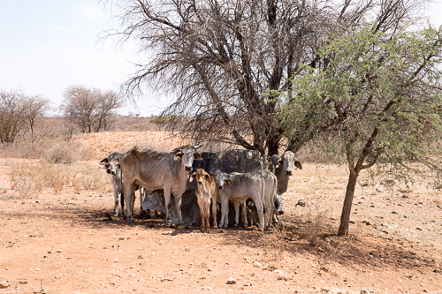
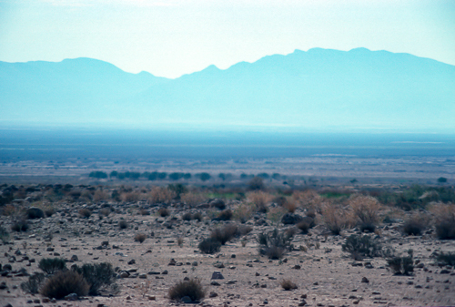
Life is difficult even at the edges of the desert. Survival techniques vary between different animals but a shared practice is to find whatever shade there is, especially in the middle of the day, where temperatures can exceed 30C, creeping up to 40C. Today, the maximum temperature at the regional town of Rehoboth was 34C.
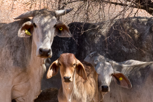
We were close to the cattle and they were obviously concerned and watchful but very reluctant to move out of the little shade offered by the acacia tree. Young and old, large and small, all closely knitted together. Cool being the main objective.
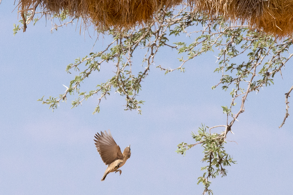
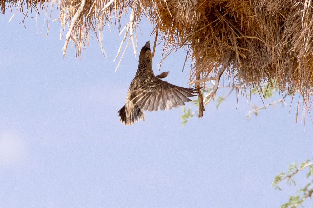
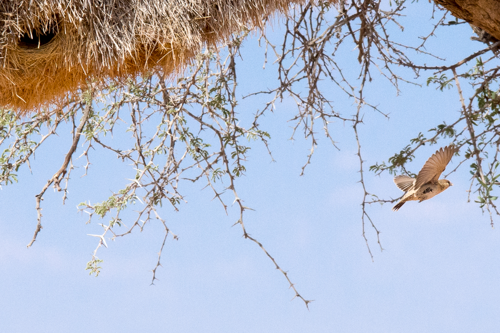
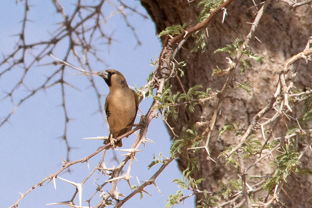
A Sociable Weaver nest

We could have driven straight past this Sociable Weaver nest built in a lonely Acacia tree, seen here with a bird flying into the nest. The satnav told us that there was a photo opportunity in the vicinity and there it was. Who knew satnav could be so useful. There were two such nests in this part of the desert. Worth looking out for. Click on image above for popup video clip of the nest.
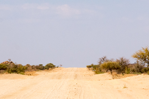
Wilderness
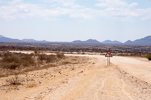
Back to our dirt road in the wilderness, with nothing separated by more nothing. How can we describe an endless desert with scrub and the occasional tree, backdropped by mountains and rock outcrops, as nothing. Dips in the road which potentially hid the rare car coming in the opposite direction, formed by dry riverbeds, as nothing. The riverbeds have a higher concentration of scrub and trees, suggesting that there may be water somewhere. But this is fenced land suggesting that it is farmed. It is enough to imagine anything living here let alone thriving. What can they be farming here and what is the sustainable density? There is the very occasional gate, in the otherwise continuous fence. Satellite views of the area show how desolate the area is. But there is an occasional dwelling of sorts.
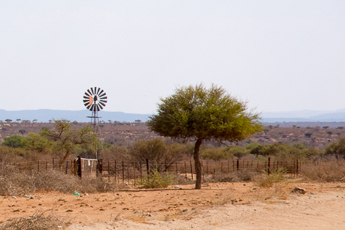
Occasionally, the wilderness gives way to an isolated community.
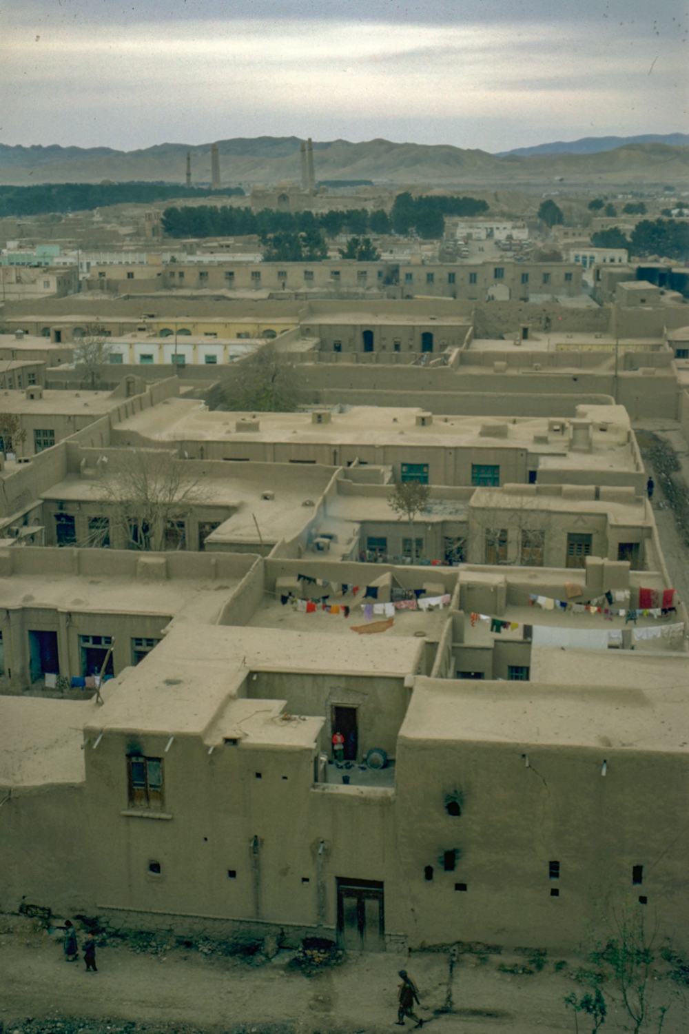
Klein Aub
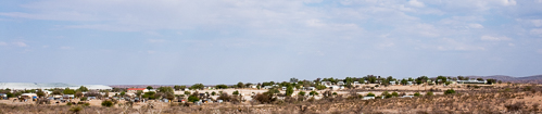
This is the village of Klein Aub, apparently containing a store and two schools. The adjacent Copper Mine closed in 1987, before Namibian independence in 1990.
Space is not a problem, so even low population villages are physically large. It took me a long time scrutinising this photo for evidence of continued occupation, but there is washing on the line and two people to be found.
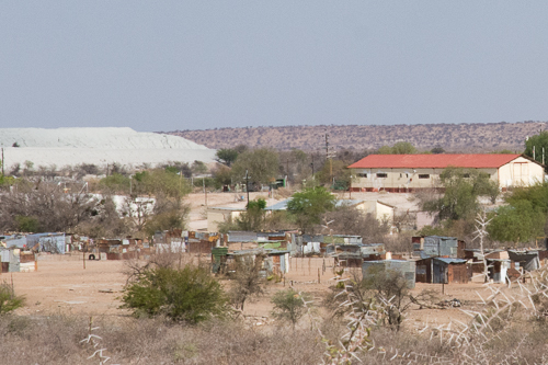
Presumably the whitish hill on the left is the arisings from the closed copper mine.
The shed like buildings in the foreground are not part of a field of allotments. They are dwellings. With luck, they a no longer used. However, we did see other locations with the same sort of structures forming the main community.
Hopefully, the current, post mining, and post independence community is in this newer part of town. I suspect the one store supplies not only the village but the huge surrounding rural community.
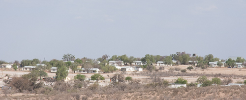
It was a surprise to bump into this village, in the middle of nowhere, about half way between Rehoboth and Tsauchab River Camp.
Ant
Whilst stopped to take photos of Klein Aub David noticed something at his feet. We generally get out of the car to take photos. It is good to move around and you are more able to compose your photos with a degree of freedom of movement. (Memo to self, revise advice when taking photos of lions). You also appreciate the difference between the warm outside and the air conditioned interior of the car.
On this occasion there was a hole in the gravel verge. A home to something, but what? The diameter was about 30-40mm.
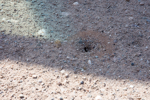
Lets take a closer look at the tunnel entrance. Same photo, just croped in.
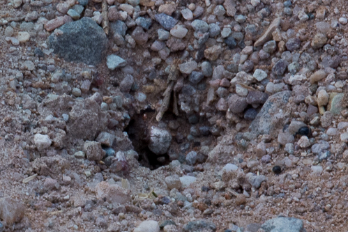
Still can't see it? Even with the extra lighting in the deep tunnel mouth? There is an ant in the entrance. Not as sharp as we would have wanted, but it captured the moment.
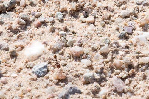
This is one of the owners of the hole and the tunnels beneath the gravel verge. The ant is less than one metre away from the hole and it is travelling towards the bottom of the photo.
See if you can identify which family it is, perhaps using this e-guide.
The next article in the series is Tsauchab River Camp