Is Tassili N'Ajjer National Park on this planet?
Algeria 20 Feb 1979 to 9 Mar 1979
25 - 28 February 1979
Apparently yes. It may have spacemen on the walls but it is still here, in the Sahara.
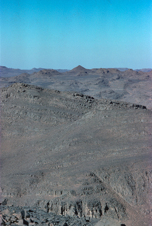
We joined the channel of a glacial meltwater stream, which had grown to a river and eroded the bedrock. Numerous channels incise the bedrock and whilst once filled with flowing gurgling water, are now full of sand. The literal English translation of Tassili n'Ajjer is 'Plateau of the rivers'.
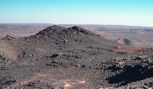
We slowly climbed to 1500m, about 5000 ft, on the high plateau. To put that into some form of context, Ben Nevis is the highest mountain in the British Isles, located in Scotland, and has an elevation of 1,345 metres. The plateau floor eventually reaches 800ft above Ben Nevis with the columns and stacks above that.
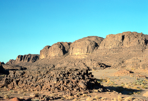
Out of the sand and onto a flat area of the plateau. Sandstone is the rock, but they are all black! How is this the case? Well, these chunks of broken rock have not used their factor 50 sunscreen. Pick one up, carefully now, sometimes there are there are things that move underneath. Not all of them friendly. On the one side the stones have a very severe case of sunburn, and on the other they are normal sandstone colour. Well, who knew? Rocks burn! Carefully put back in place, black side up, left for another few thousand years.
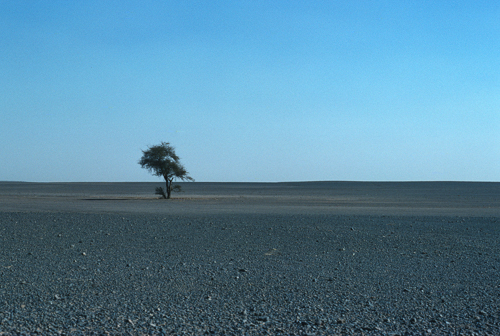
Then in a sea of black stones there stands a lonely solitary tree. Is it an Acacia laeta (Senegalia laeta), a sand acacia tree, or the vary rare Saharan cypress (Cupressus dupreziana). It is not the The Ténéré Tree which was further south, in Niger, and in any case was knocked down in 1973. The roots may descend over a hundred feet to get to a water table, and the tree may be hundreds of years old. It really was the only tree not just a case of how the photo was taken. Is it still there? I'm inclined to think it is some form of acacia left behind from a previous age where water and trees were more plentiful.
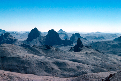
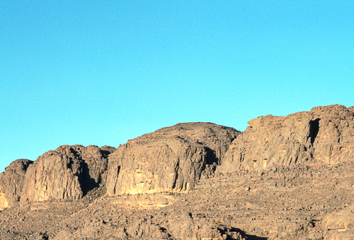
The landscape changed again. The flatness gone to be replaced by a more normal mountain range vista, looking across the high plateau.
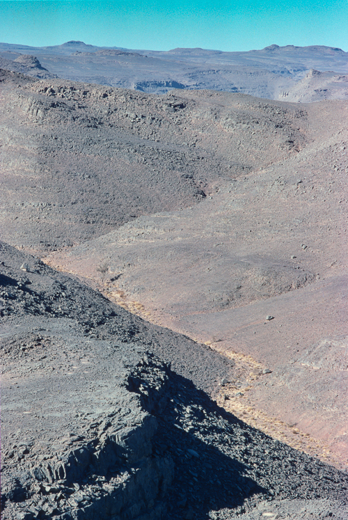
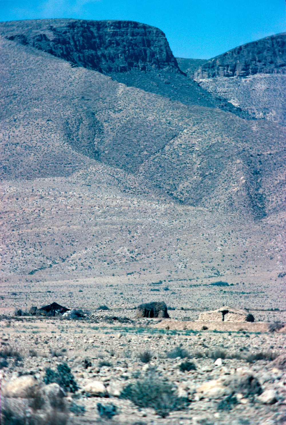
Dropped in a winding valley back to 1100m. Only to find a junction with another track, piste Aïne Tihoubar heads off along the route of an old riverbank. Tempted, maybe not. However, after a further 65km another left turn would have taken us on a 25km each way detour to the village of Iherir in a river valley (wadi) named Oued Iherir. Apparently the area has been populated since Neolithic times. Unlike most of the other river beds in the area which are totally dry, there is a small constantly wet pool in the village. We did not know about it and therefore were not tempted. Our loss.
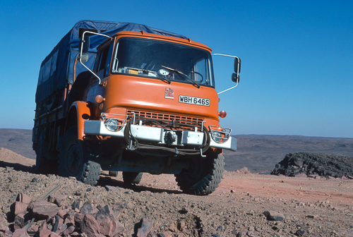
Another climb, back up to 1500m, then just topping 1600m. Pulled off to the side of the, well the next word was going to be road, 'but not as we know it' then comes to mind. Shall we say pulled off to the side of the track to take of photo of the truck against a backdrop of the Tassili n'Ajjer massif. Not quite sure why we pulled to the side as we were the only traffic seen so far today. Yes, that is still the main route between the North and South sides of the Tassili n'Ajjer massif.
A little history
The Tamrit plateau east of Djanet was designated a National Park in 1972.
In 1979, furher areas were designated Historical Monuments and Sites, probably after our visit, but not because of.
Seven years later in 1986, the Park was extended to 7,200,000 ha, all to be subject to National Park conservation legislation which protected the cultural but not the natural resources.
Then again in 1986 The Tassili Plateau, which includes the Tamrit plateau and the rock paintings, was designated a UNESCO Biosphere Reserve;
In 1987 the nearby Ahaggar Mountains declared a National Park (of 450,000 sq.km.) and in 2001/3: Oued Iherir and the Afilal pools designated Ramsar Wetland sites. Wetland sites in the Sahara!
The park is predominantly the Tassili n'Ajjer massif above the 1000m contour. It is part of the West Saharan montane xeric woodlands is an ecoregion that extends across several highland regions in the Sahara. Surrounded at lower elevations by the largely barren Sahara
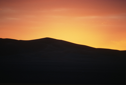
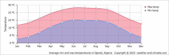
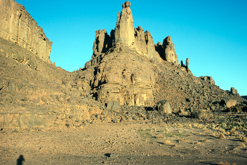
Down another escarpment, hanging on to the side of the mountain, round a pimple and flattish again, but with sides. And now to the main event. Spectacular rock formations. Lengthening shadows means the end of the day is approaching. Camped out in this lunar landscape with nothing else around. Cold, but superb. D'janet average climate for Mid February is 25C day and 10C night, or maximum and minimum. The plateau is a least 500m higher than D'janet's altitude of 1035m, which would reduce that by a further 5C. No moisture to form a frost but a little chilly.
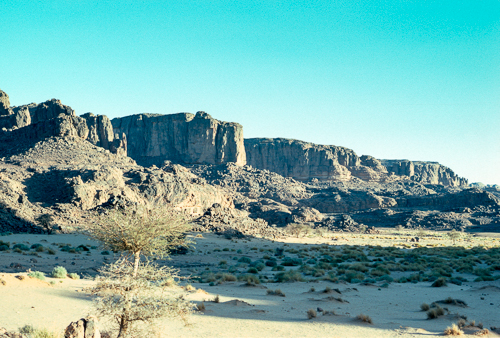
The road is on the wide flat valley floor with ample scrub and the occasional tree. The towering cliffs on either side change colour dependant on the lighting.
Weather worn sandstone with deep gullies indicating the past presence of tumbling streams. Read more about desert landforms, click here to open a new page.
There must be more photos of this spectacular sandstone stack on the internet. That is me in shadow form at the bottom left.
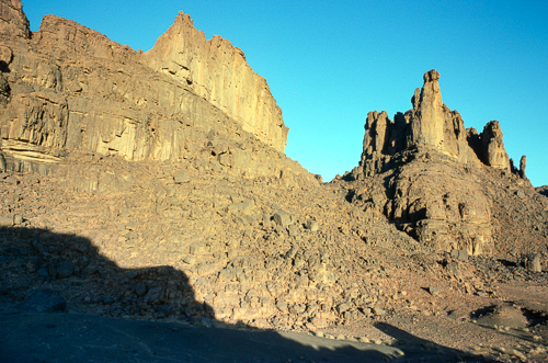
Slightly further away, and the full shape of the cliffs to the left appear, together with the deep shadow of the other side of the valley.
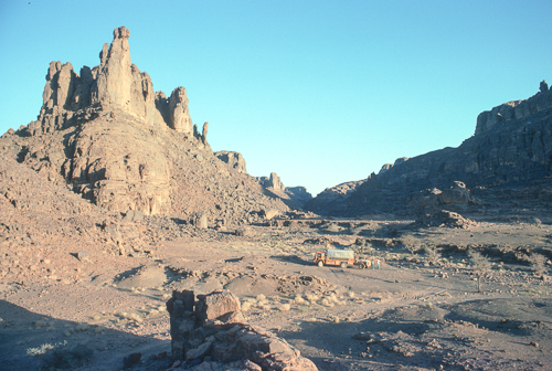
Now the same stack with some scale. Perhaps 15 times the height of the Bedford cab of about 2.5m. Nearly 40m of free standing sandstone stack. I'm on the other side of the valley floor stood on another outcrop, partially seen in the forground. Just beyond that is the main road between D'janet and Tamanrasset. You can see the tyre tracks of the truck as it turned off from the road, which continues in front of the tree, exiting the photo on the right.
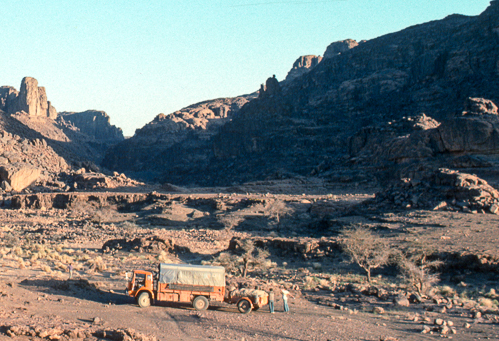
Shall we camp here? A valley floor and a dry river bed. The river bank can be seen behind the two small trees. The vegetation shows the probable route of the river, of years or decades ago. Or perhaps, hundreds of years. The slope in front of the truck should be OK. There are three people in this photo, can you find them all?
Bordj El Haouas marks another change, well just before, we exit the park and return to the sand. Bordj El Haouas is on the banks of a wide river. Not that there is any water in the river, not on the surface at least.
Map of North Africa with approximate route zoomed in to the Tassili N'Ajjer National Park. Zoom in further to see more detail.
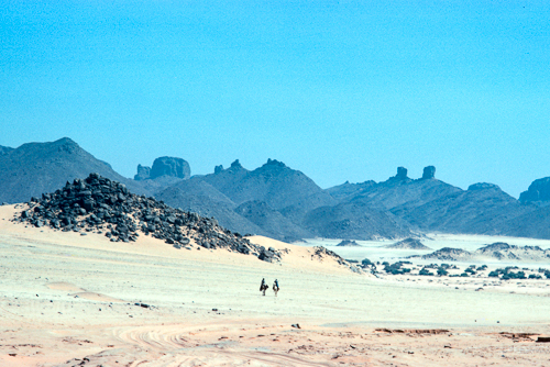
On the way to Bordj El Haouas we see two riders in the distance. As far as I can recall these are the first people outside the truck since entering the Tassili N'Ajjer National Park. Perhaps this is one of those fingers, or incised channels which has filled with sand over time. The camels can travel over the soft sand, whilst we follow the tracks in the sand left by previous vechiles. At the risk of labouring the point, in the forground of the photo, those tracks in the sand constitute the main road across Tassili N'Ajjer National Park.
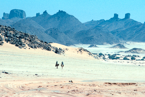
Getting closer. Racing camels are fast but these pair are just walking slowly, in the heat of the day.
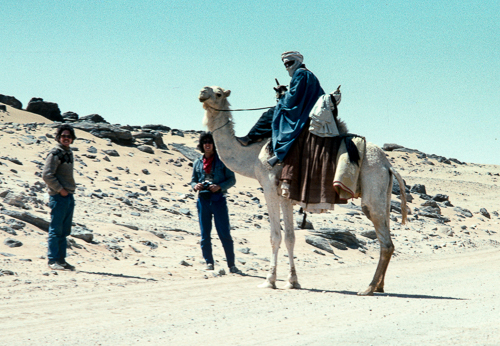
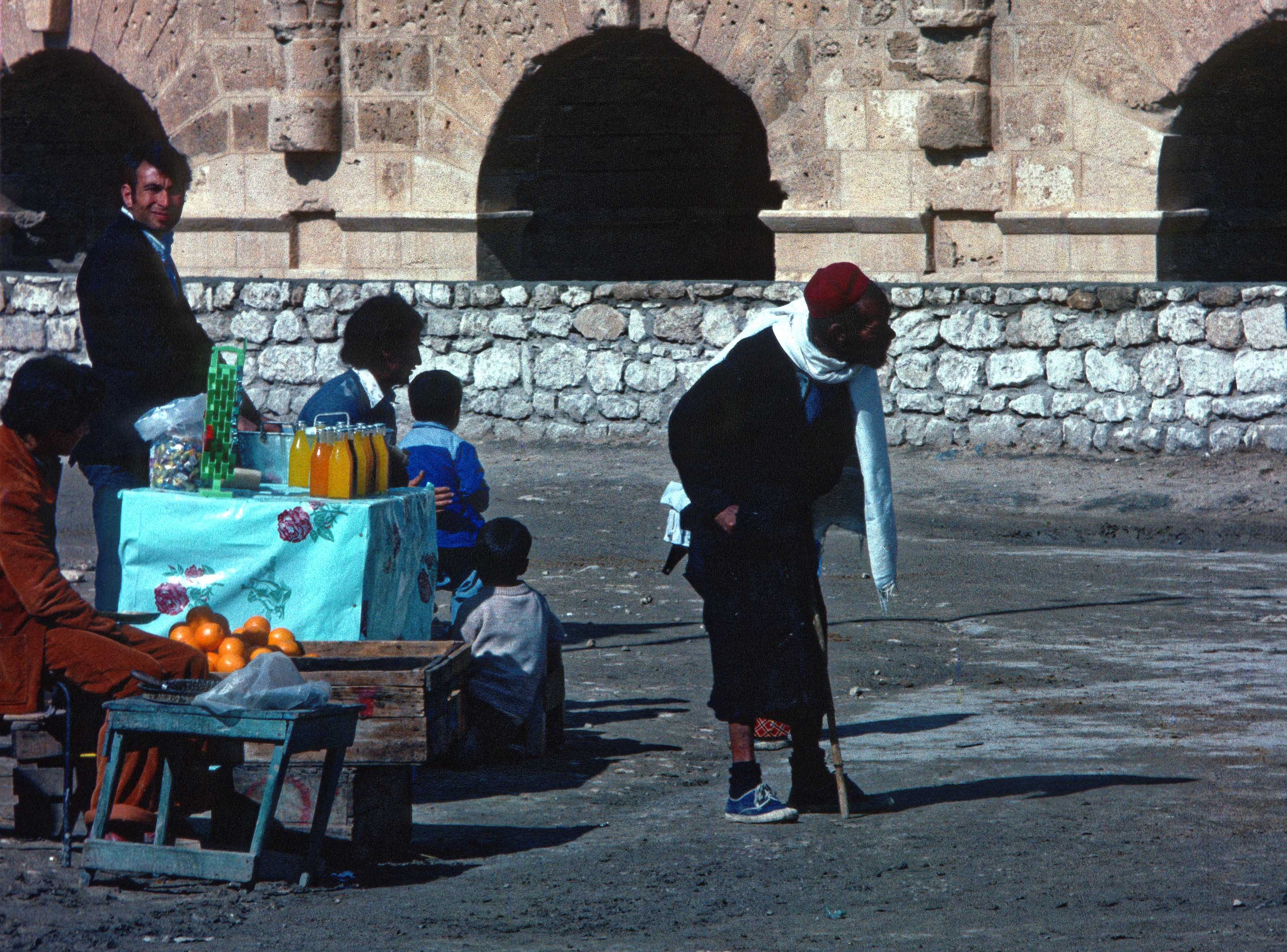
Some of the EMs chat to the riders, presumably Tuareg.
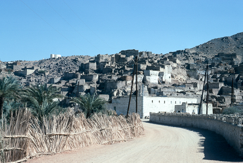
We arrive at D'Janet, half way up another one of those fingers of sand. Only 400km from Illizi, the last settlement, across the plateau and mountains with some splendid scenery. A proper road, with surfacing and edges. The white building on the horizon might be the Ksar el mihane. The caption on the photo in the link is 'The view from the Imam's balcony in Ksar El Mihane is mesmerizing' and may be approximatly the reverse image.
As an aside, click this link to see a flooded Djanet at a different time
At the top of the article, 'It may have spacemen on the walls but it is still here, in the Sahara.' So, yes, it is in the Sahara, but where are the spacemen? They make their appearance in the follow on article, called 'Djanet and rock paintings', were we return to the Tassili N'Ajjer National Park from the town of D'Janet.
Photo galleries powered by SmugMug
To see the photos of this article in HD follow this link to my photo gallery site. Click here.
Back to Contents and navigation