Striding for the unknown, after the snow
Tunisia 13/ Feb/1979 to 20/ Feb /1979 and Algeria 20/ Feb/1979 to 9/ Mar /1979
February 1979
I was very conflicted about writing up our story, following our visit to Matmata Tunisia. Memory and information did not seem to agree.
Memory took me to the bottom corner of Southern Tunisia right next to the Libyan border for our crossing into Algeria. Our Michelin Map of North Africa indicated a road there but that does not preclude politics disrupting our ambitions of exploring a new route for Encounter Overland. At this time I was accompanied by a very experienced EO Leader Driver Alan Dougle. Having two of us perhaps allowed us to be more adventurous.
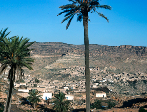
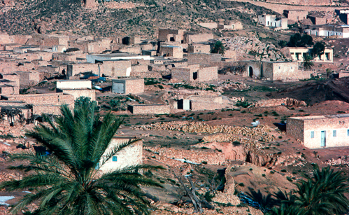
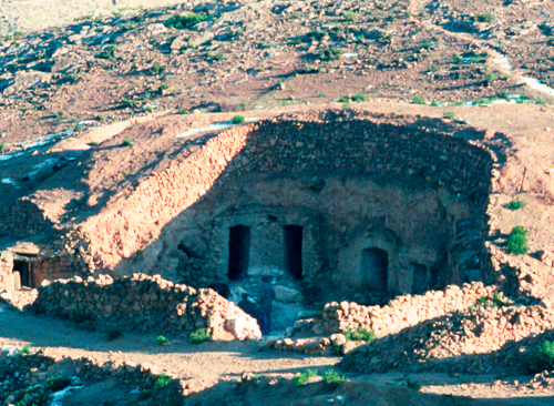
I have found an Enflash, our drivers newsletter, with our report for that leg which clears up most of the confusion. However, it also creates some alternative confusion. The night of the snow we stayed in a traditional Berber troglodyte underground building. The date of the snow is well recorded as it is so so very rare in the Sahara, 18th February 1979 and then again nearly 40 years latter, on 19th December 2016. It would seem from Enflash that we stayed the night in Toujane, but searching the internet for photos of the area and looking at Google Maps and Bing Maps, does not seem to confirm this. My photos look more like Matmata. I suspect this dilemma will never be resolved unless somebody recognizes the place in my photo. Even going there today would not necessarily resolve it as the places will have changed a lot in the intervening 40 years or so.
Back to this story. We left El Jem and travelled south. Either via or avoiding Sfax.
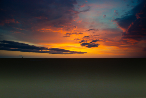
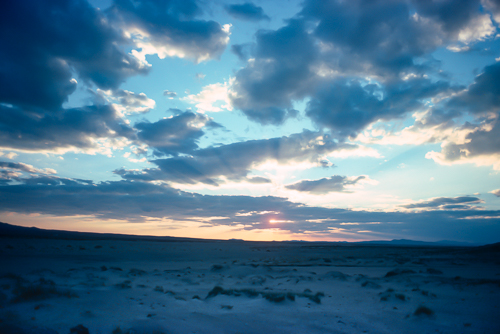
Camped out in the wilderness and could not resist taking a few photos of this splendid sunset. Below, a few minutes later.
Tourist brochures picked up in Tunis 'persuaded us to detour via Matamata and Toujane (near Gabes)'. We have established that we were there on the 18th February 1979. 'The same glossy literature prompted us to investigate the possibility of following the Libyan border track to enter Algeria near Ghadames (Libya).' Or is it Gadamis. Extracts from Enflash. This would be an exciting deviation from the normal routes. The intention was not to pass into Libya but only to skirt along the border. So far the brochures were correct, with the traditional Berber troglodyte homes we had come across and the welcoming friendly people, plus the sunset, it was a pleasant diversion. I should explain, that one of the differentiators of Encounter Overland was the ability to deviate from the script. Not all overland companies had that luxury at the time. As you will see elsewhere there is always the potential to upset plans, including wars, coups, civil disturbances, political instability, floods, pestilence and plague, well Mother Nature. Of course, there is also mechanical failure, particularly our breakdown in Eastern Turkey.
There are dots that have to be visited, at or around an expected date. Poste restante in various cities being a very special dot on the map. In some locations there was physically only one available or practicable route to take. Other places, where it was safe and appropriate to do so, it was upto the Leader/driver how to join the dots. Sometimes the EMs would contribute to the decision, and other times not.
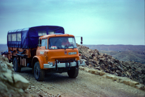
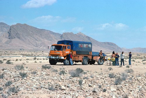
Note the quality of the road surface and the stone edging. I know that sounds sarcastic, but it is a lot better than many other places.
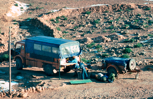
The long shadows confirm the lateness of the day. An eventful and pleasant day in the mountains. Time to hunker down for the evening.
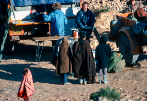
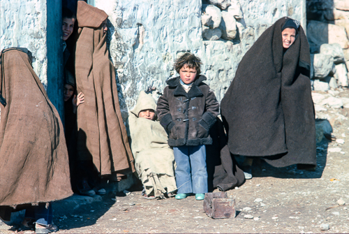
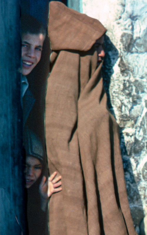
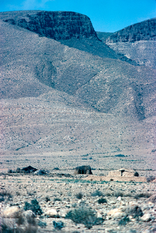
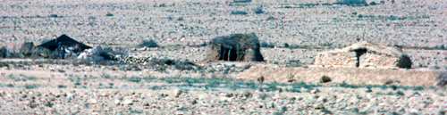
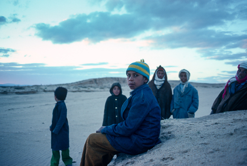
Soon after our arrival, despite the cold, local kids came out to watch our preparations. We were the entertainment for the evening. Sometimes a gathering crowd is a potential problem, but in this instance we felt comfortable with our audience. The adults were also friendly and invited some of us to stay in the troglodyte homes. Star Wars film crew may have been here a few years before but I got the impression that we were the new novelty, not seen before.
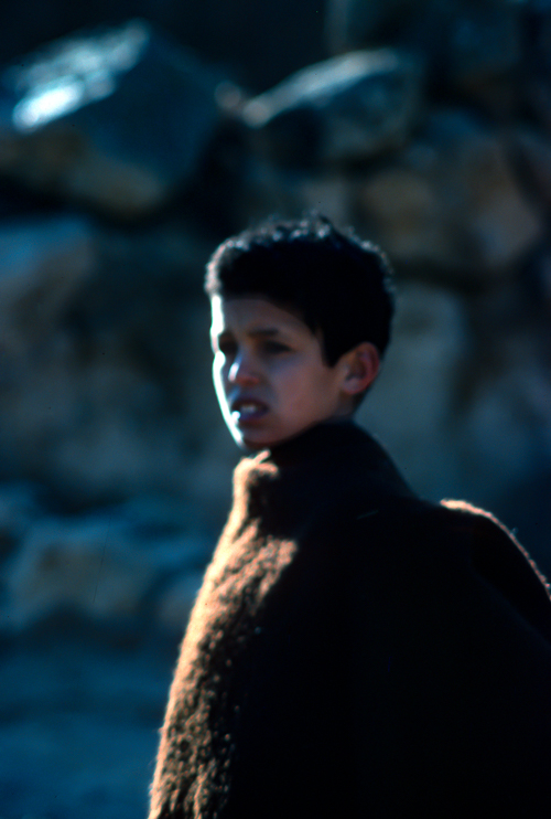
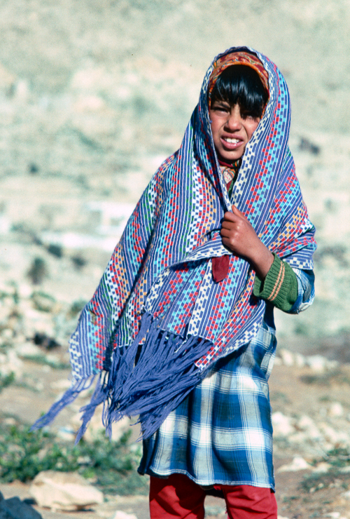
A girl watching as we left in the morning, towards Tataouine. Seeing Berber and or Bedouin camps and people on the way. If Bedouin it would probably be either Banu Hilal or Banu Sulaym tribe. Heading South West "...to boldly go where no (EO) man has gone before." Oops, wrong Star ... Star Trek not Star Wars.
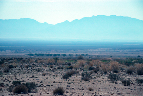
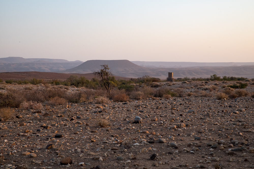
A long flat plain with some scrub with mountains in the distance obscured by heat haze. Wilderness, but with life out there somewhere.
What happened next?
Now for some conjecture. No story is complete without some conjecture.
We left Matmata or Matmatat-Al-Qadimal in the morning heading towards Foum Tatahouine, now known as Tataouine. Looking at the photos we took the mountain route. We probably bought some fresh food at the souk in Tataouine. We had joined the main road in Tataouine which was blacktop and in good condition, probably quite new. We set off again towards the border with Algeria at Borj El Khadra. Borj El Khadra was not only the border with Algeria but it was also very close to the border with Libya, less than 20km from Ghadames, Ghadamis, or Gadamis, in Libya. Libya was not a place we intended to visit at this time. We would be travelling on roads designated (at time of writing) as P19, a main national road, then joining C211, another minor dirt road. We knew we would be going close to Libya from the Michelin Map of North Africa we had. Yes, a paper map. Albeit plastic coated to make it more robust.
What we did not know was that we were also heading towards the Al-Burmah (El-Borma) oil field. Everwhere seems to have more than one name for the same place. Oil had been discovered here in 1964 but as this was not part of the normal Encounter Overland route we had no pre-knowledge of the oil field.
Continuing with the conjecture, we had lunch somewhere South West of Foum Tatahouine, now known as Tataouine. Note the different rock formations in the mountains, folds pushed up out of the ground. That is a steep angle of dangle, a geological term. Also note the blacktop road. After lunch we continued on towards Borj El Khadra at a good pace given the well surfaced road. At some point we arrived at a police checkpoint. We were entering a restricted area. Was that because of the oil field? Without the correct piece of paper we could go no further on this route. Return to Medinine to get permission to travel to Borj El Khadra. To give some idea of scale, is over 400km and to go back even from Tataouine to Medinine is over 50km. in this conjecture I am not putting the police checkpoint between Tataouine and Medinine because of the increased traffic there would have been between the two towns. It would appear more logical to start a restricted zone away from the busy town of Tataouine.
Returning to facts, we were turned back somewhere near Foum Tatahouine to get authorisation at Medinine, which was not forthcoming, so we headed North again, on a 1800 km, over a 1000 miles diversion, about four or five days. To approximately the same latitude as El Jem. We crossed into Algeria at Bou Chebka or Bouchebka. Then headed towards In Amenas, Algeria to rejoin the route we were trying to take form Matmata. That route is 1000km, over 600 miles more than the Southern Tunisia route we were exploring. The result was probably that no other Encounter Overland truck visited Matamata and Foum Tatahouine.
The photos below are probably taken on the route somewhere past the Algrian border at Bouchebka which we crossed on 20 Feb 1979. It was not wise to take photos at border crossings and without date stamps and GPS, locating photos and identifying separate counties was a challenge.
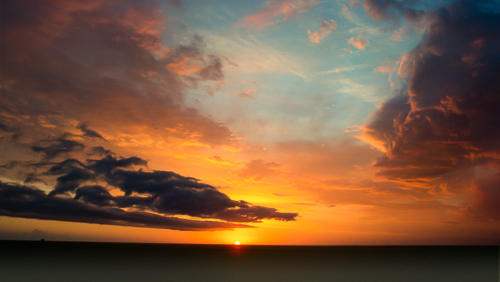
Another day done. Another brilliant sunset.
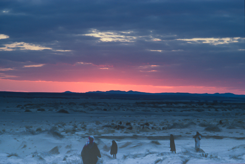
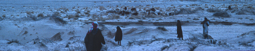
Another sunset, and yet another day gone, this time while shepherds watched their flocks at night, in the middle of nowhere.
Map of North Africa approximate route zoomed in to the Matmata and Tataouina area. Zoom out to get some idea of the distance traveled and the route taken. Added information about the Al-Burmah oil field.
Each and every Encounter Overland expedition was unique.
Photo galleries powered by SmugMug
To see the photos of this article in HD follow this link to my photo gallery site. Click here.
Back to Contents and navigation